Category:Hydrographic maps of Tavers (Loiret)
Jump to navigation
Jump to search
Media in category "Hydrographic maps of Tavers (Loiret)"
The following 2 files are in this category, out of 2 total.
-
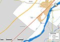 45317-Tavers-Cours eau.jpg 3,507 × 2,480; 438 KB
-
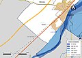 45317-Tavers-Zone inondable.jpg 3,507 × 2,480; 538 KB

