Category:Hydrogeological diagrams
Jump to navigation
Jump to search
Subcategories
This category has the following 4 subcategories, out of 4 total.
Media in category "Hydrogeological diagrams"
The following 174 files are in this category, out of 174 total.
-
 Altezza capillare.svg 636 × 483; 21 KB
-
 Alur-penyusunan-pengujian-metode-baru.jpg 1,280 × 882; 130 KB
-
 AnisotropicSoil.jpg 667 × 413; 35 KB
-
 Aquifer arabic.png 413 × 425; 31 KB
-
 Aquifer microbiology.jpg 1,101 × 510; 995 KB
-
 Aquifer-ar.jpg 413 × 425; 26 KB
-
 Aquiferos.PNG 494 × 258; 6 KB
-
 Aquifère Darcy perméabilité.jpg 978 × 401; 53 KB
-
 Aquifère Darcy échanges flux.jpg 1,131 × 1,524; 165 KB
-
 Aquifère Darcy échanges nappe.jpg 1,366 × 768; 148 KB
-
 Aquifère Darcy échanges variant sédiment.jpg 1,366 × 1,568; 182 KB
-
 Aquifère Darcy échanges.jpg 1,366 × 1,568; 170 KB
-
 Aquifère Dupuit-Darcy drainage 2D.jpg 1,118 × 643; 170 KB
-
 Benzene Transport to Groundwater from Oil Spill.pdf 1,500 × 1,125; 166 KB
-
 Bioclogging.jpg 1,590 × 768; 1.73 MB
-
 Biogeochemical cycle turn over.jpg 1,133 × 918; 952 KB
-
 Bodenwasser.png 300 × 200; 5 KB
-
 Bodenwasser2.png 1,058 × 794; 49 KB
-

-
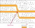 Clay Smear.png 3,950 × 3,185; 304 KB
-
 Coastal Hydrogeology.png 1,292 × 648; 164 KB
-
 Coastal Zone cross section.png 1,200 × 784; 207 KB
-
 CSEM OFG.png 770 × 632; 475 KB
-
 CSMain.png 1,223 × 1,235; 81 KB
-
 Dippmannsdorf Paradies1.JPG 756 × 427; 75 KB
-
 Disegno falda-freatica.svg 748 × 608; 117 KB
-
 Drooglegging en ontwateringsdiepte.jpg 961 × 396; 40 KB
-
 Endrain.png 640 × 480; 6 KB
-
 Erscheinungsformen des unterirdischen Wassers.svg 550 × 450; 84 KB
-
 Es water cont.png 450 × 228; 183 KB
-
 Es water flow.png 450 × 242; 233 KB
-
 Etapes analyses CFC.jpg 720 × 227; 25 KB
-
 EvolCFC.jpg 253 × 249; 9 KB
-
 Evolution of groundwater chemistry.jpg 1,706 × 990; 1.11 MB
-

-
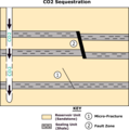
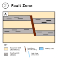
 Fault Zone Architecture.png 794 × 1,123; 86 KB
-
 Faultzonegif.gif 480 × 480; 95 KB
-
 FEMP 03 101 (27837861552).jpg 3,183 × 2,184; 552 KB
-
-
 Figure3.Hydrodynamic sketch.jpg 1,157 × 875; 111 KB
-
 Figure6.Phreatic level and average monthly rainfall.jpg 1,133 × 625; 101 KB
-
 Figurepiston copie.jpg 402 × 500; 37 KB
-
 File-Saltmod8 (2).JPG 1,530 × 1,646; 241 KB
-
 Fluassauenzuordnung.png 1,280 × 720; 84 KB
-
 Fluassauenzuordnung.svg 512 × 289; 15 KB
-
 Forze adesione-coesione.svg 638 × 696; 27 KB
-
 Freq.gif 640 × 480; 8 KB
-
 Funnel and Gate, Prinzip, Draufsicht.jpg 4,448 × 3,643; 460 KB
-
 Garmsar.gif 640 × 480; 10 KB
-
 GarmsarAquifer.JPG 541 × 331; 23 KB
-
 GarmsarWatBal.JPG 564 × 325; 24 KB
-
 GeneralideaofFZH .gif 480 × 240; 112 KB
-
 GeneralideaofFZH.gif 480 × 240; 109 KB
-
 Geometrické a energet charakteristiky zvodně.png 1,907 × 1,479; 666 KB
-
 Gohana2.jpg 605 × 437; 25 KB
-
 GOHANAFREQ.jpg 623 × 441; 29 KB
-
 Groundwater Freeze and Cherry 1979 Table 2-2.png 663 × 727; 66 KB
-
 Groundwater he.png 552 × 600; 73 KB
-
 Groundwater useage in Japan J.PNG 760 × 760; 117 KB
-
 Groundwater.png 1,286 × 1,397; 251 KB
-
 Groundwaterimage.jpg 660 × 427; 51 KB
-
 Grundvattenbåge.svg 623 × 209; 21 KB
-
 Hooghoudt.jpg 935 × 399; 34 KB
-
 Hydraulic head of salt flow.png 832 × 860; 158 KB
-
 Hydraulické parametry tabulka 2.png 2,225 × 1,806; 570 KB
-
 Hydraulické parametry tabulka.png 2,225 × 1,806; 570 KB
-
 Hydrogeology, Clays, Soils and Alterations.png 1,562 × 1,126; 368 KB
-
 Hydrologisches Dreieck.png 1,884 × 1,425; 33 KB
-
 HydrologischesDreieck.svg 927 × 765; 46 KB
-
 Hydrothermal system.png 1,804 × 1,076; 140 KB
-
 Infiltration.jpg 550 × 418; 166 KB
-
 Infiltrazione.PNG 550 × 418; 131 KB
-
 Interacstudy.gif 640 × 480; 9 KB
-
 Kappa-Phi.jpg 900 × 500; 60 KB
-
 Karst Hydrogeologie Schema1.jpg 1,800 × 1,200; 979 KB
-
 Karst Hydrogeologie Schema2.jpg 1,800 × 1,200; 1.12 MB
-
 Karst-model.png 5,195 × 2,801; 802 KB
-
 Karstaquifer Schwankungen.jpg 1,800 × 883; 963 KB
-
 Landsat-2000 Submarine-springs Argolis-Gulf Greece.jpg 800 × 1,200; 1.52 MB
-
 Liquido bagnante-non.svg 722 × 552; 83 KB
-
 Local meteoric water line.tif 3,216 × 2,461; 77 KB
-
 Microfacture.gif 478 × 478; 137 KB
-
 Microfaultgif2.gif 480 × 480; 134 KB
-
 MODFLOW 3D grid.png 950 × 674; 16 KB
-
 Mpbas.gif 640 × 480; 8 KB
-
 NAPLs.jpg 1,527 × 906; 1.32 MB
-
 OFG cartoon marcan.jpg 1,228 × 1,752; 189 KB
-
 Panaz.gif 640 × 480; 21 KB
-
 Perm-rel.jpg 650 × 390; 39 KB
-
 Posrednie zasilanie wod szczelinowych.svg 800 × 470; 698 KB
-
 Prameny.png 1,554 × 2,400; 1.42 MB
-
 Průnik znečištění.png 1,893 × 1,865; 1.24 MB
-
 Pórovitosti.png 1,857 × 2,008; 249 KB
-
 Přírodní zásoby.png 2,214 × 1,117; 440 KB
-
 Raney studna.png 2,082 × 1,671; 2.36 MB
-
 ReversingFallsLevels.PNG 801 × 426; 19 KB
-
 Riset-kolaborasi-urban-hydrogeology-surabaya-2021-pdf.pdf 2,962 × 1,666; 265 KB
-
 Riset-kolaborasi-urban-hydrogeology-surabaya-2021-png.png 1,422 × 800; 223 KB
-
 Salinization4.gif 733 × 454; 8 KB
-
 Salt water intrusion wikipedia2.png 9,983 × 6,249; 13.69 MB
-
 Saltwater Intrusion Cause and Impact.jpg 8,243 × 5,934; 9.62 MB
-
 Saltwater intrusion en.svg 512 × 213; 17 KB
-
 Saltwater intrusion fa.svg 512 × 512; 3 KB
-
 Saltwater Intrusion.gif 633 × 260; 13 KB
-
 Schema aquifere socle.jpg 701 × 398; 41 KB
-
 Seawater intrusion.png 713 × 499; 64 KB
-
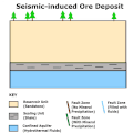 Seismic-induced Ore Deposit.gif 480 × 480; 121 KB
-
 SoilLeaching.jpg 599 × 364; 16 KB
-
 Strefa kapilarna.jpg 412 × 414; 16 KB
-
 Strefy-wody-podziemne.png 1,896 × 1,047; 172 KB
-
 StripCropping.jpg 1,103 × 620; 52 KB
-
 SVE (Soil Vapor Extraction), Anwendungsprinzip, Einfluss von Belüftung.jpg 2,246 × 731; 103 KB
-
 SVE (Soil Vapor Extraction), Funktionsprinzip, Seitenansicht mit Belüftungsbrunnen.jpg 1,850 × 1,141; 161 KB
-
 Tabla de agua.PNG 532 × 302; 9 KB
-
 Tableau parametres influents.jpg 612 × 543; 65 KB
-
 Trac mode interpretation fenetre graphique.png 798 × 834; 1.91 MB
-
 Trac mode interpretation fenetre principale.png 528 × 850; 1.29 MB
-
 Trac mode simulation fenetre graphique.png 798 × 834; 1.91 MB
-
 Trac mode simulation fenetre principale.png 528 × 850; 1.29 MB
-
 Trac splash screen trac 1.6.5.png 500 × 526; 772 KB
-
 Transmissivita.png 2,157 × 2,810; 3.73 MB
-
 Typy hg izolátorů.png 1,359 × 997; 733 KB
-
 Typy hladin podz vody.png 1,573 × 1,096; 1.67 MB
-
 Verwerfungsquelle.png 1,072 × 957; 93 KB
-
 Verzouting1.jpg 759 × 525; 40 KB
-
 Verzouting2.jpg 811 × 445; 41 KB
-
 Verzouting3.jpg 526 × 391; 24 KB
-
 Vrt.png 1,083 × 1,182; 1.62 MB
-
 Výstroj vrtu.png 1,432 × 2,117; 3.39 MB
-
 Wasserperm.png 624 × 439; 20 KB
-
 WatBalan.JPG 896 × 589; 43 KB
-
 Water table id.svg 350 × 180; 8 KB
-
 Water table-fr.svg 350 × 180; 8 KB
-
 Water table-season fluctuation.svg 350 × 180; 6 KB
-
 Water table.svg 350 × 180; 7 KB
-
 Well arrangement.png 331 × 334; 4 KB
-
 Well arrangement.svg 512 × 512; 2 KB
-
 Well&Karez.JPG 576 × 296; 26 KB
-
 WellDrain.gif 552 × 511; 8 KB
-
 WellDrain.png 528 × 388; 27 KB
-
 WellDrain2.png 552 × 497; 15 KB
-
 WellHead.gif 640 × 480; 5 KB
-
 Woda-blonkowata-woda-higroskopowa.png 1,109 × 938; 213 KB
-
 Woda-wolna-zawieszona.png 1,839 × 798; 198 KB
-
 Wody przypowierzchniowe.png 1,572 × 958; 168 KB
-
 Wody-kapilarne.png 1,839 × 798; 205 KB
-
 Wody-podziemne-rodzaje.png 1,572 × 1,135; 252 KB
-
 Wody-podziemne-strefy.png 1,268 × 963; 158 KB
-
 Wody-podziemne-szczelinowe-krasowe-warstwowe.png 1,184 × 780; 177 KB
-
 Wody-strefa-aeracji.png 1,109 × 938; 174 KB
-
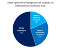 Wody-ze-wzgledu-na-intensywnosc-wymiany.png 996 × 840; 67 KB
-
 WTFluctuations.gif 370 × 230; 7 KB
-
 Zasilanie1.png 1,294 × 868; 170 KB
-
 Zasilanie2.png 1,296 × 801; 164 KB
-
 Zasilanie3.png 1,296 × 805; 167 KB
-
 Zasilanie4.png 1,296 × 801; 167 KB
-
 Zasilanie5.png 1,295 × 800; 168 KB
-
 Zasilanie6.png 1,358 × 788; 170 KB
-
 Zasilanie7.png 1,588 × 892; 225 KB
-
 Zasilanie8.png 1,502 × 885; 153 KB
-
 Zony.png 1,270 × 1,059; 991 KB
-
 Zvodeň artézská.png 737 × 444; 321 KB
-
 Zvodeň freatická.png 768 × 630; 491 KB
-
 Zvodeň napjatá.png 742 × 837; 727 KB
-
 Zvodeň nenapjatá.png 742 × 887; 886 KB
-
 Zvodeň visutá.png 426 × 561; 391 KB
-
 Zvodeň zavěšená.png 426 × 635; 415 KB
-
 Zwierciadla-oznaczenia.png 565 × 296; 8 KB
-
 Zwierciadla-w-wodach-naporowych.png 1,757 × 848; 217 KB
-
 Zwierciadlo-napiete.png 745 × 1,059; 117 KB
-
 Zwierciadlo-swobodne.png 744 × 1,063; 110 KB
-
 Zwierciadlo-wod-podziemnych.png 1,553 × 1,063; 222 KB
-
 Zásoby celkově.png 1,109 × 1,145; 195 KB
-
 Гідрогеологічний розріз заплави Бистриці-Надвірнянської біля Станіславова.png 3,157 × 1,354; 203 KB


_Hydrogeol_J.jpg)


_Environ_Res_Lett_14_063002_Fig_1.svg)


.jpg)


.JPG)


,_Funktionsprinzip,_Seitenansicht_mit_Bel%C3%BCftungsbrunnen.jpg)


,_Anwendungsprinzip,_Einfluss_von_Bel%C3%BCftung.jpg)