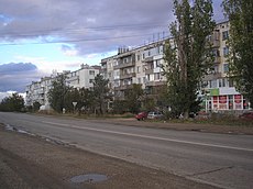
Category:Hvardiiske, Simferopol Raion
Jump to navigation
Jump to search
| Object location | | View all coordinates using: OpenStreetMap |
|---|
العربية: ar:هفاردييسكي
Qırımtatarca: crh:Sarabuz
Esperanto: eo:Gvardejsko (Simferopola distrikto)
English: en:Hvardeyskoe, Simferopol Raion
Українська: uk:Гвардійське (Сімферопольський район)
Français : fr:Hvardiïske (Crimée)
urban type settlement in the Simferopolsky District of the Autonomous Republic of Crimea, Ukraine | |||||
| Upload media | |||||
| Instance of | |||||
|---|---|---|---|---|---|
| Location | Q4134431, Simferopol Raion, Autonomous Republic of Crimea, Ukraine | ||||
| Population |
| ||||
| Elevation above sea level |
| ||||
| Different from | |||||
 | |||||
Subcategories
This category has the following 3 subcategories, out of 3 total.
G
O
Media in category "Hvardiiske, Simferopol Raion"
The following 11 files are in this category, out of 11 total.
-
PO-16 pict main.jpg 1,600 × 1,200; 297 KB
-
Spat 1.jpg 2,816 × 2,112; 1.1 MB
-
Spat 3.jpg 2,816 × 2,112; 1,008 KB
-
Spat 4.jpg 2,816 × 2,112; 1.16 MB
-
Spat 5.jpg 2,816 × 2,112; 1.73 MB
-
Spat 6.jpg 2,816 × 2,112; 1.14 MB
-
Детсад ТеремокГв.jpg 4,160 × 3,120; 1.37 MB
-
Мельница Спат.jpg 1,920 × 1,155; 1.06 MB
-
ПрудГвар 1.jpg 1,600 × 1,200; 315 KB
-
ПрудГвар 1913.jpg 702 × 494; 107 KB
-
Чугунно-Литейный Завод.jpg 900 × 470; 121 KB


