Category:Hutton Hang
Jump to navigation
Jump to search
village in the United Kingdom | |||||
| Upload media | |||||
| Instance of | |||||
|---|---|---|---|---|---|
| Location | Richmondshire, North Yorkshire, Yorkshire and the Humber, England | ||||
| Population |
| ||||
 | |||||
Media in category "Hutton Hang"
The following 42 files are in this category, out of 42 total.
-
 'Littlecroft', North Lane - geograph.org.uk - 5309377.jpg 1,024 × 683; 181 KB
-

-
 Cereal crop, Hutton Hang - geograph.org.uk - 6698252.jpg 1,024 × 705; 176 KB
-
 Cereal crop, Low Hutton - geograph.org.uk - 6698303.jpg 1,024 × 768; 271 KB
-
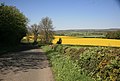
 Country lane. Hutton Hang - geograph.org.uk - 2589172.jpg 3,264 × 2,448; 1.92 MB
-

-
 Dolly Bog Wood - geograph.org.uk - 4556089.jpg 4,000 × 2,659; 3.42 MB
-
 Elizabeth II postbox on West Moor Lane, Hutton Hill - geograph.org.uk - 6698529.jpg 1,164 × 1,600; 593 KB
-
 Farm Buildings at Hutton Hang - geograph.org.uk - 3101455.jpg 800 × 600; 65 KB
-
 Farm buildings at Hutton Hang - geograph.org.uk - 5311303.jpg 1,024 × 683; 126 KB
-
 Farm buildings, Hutton Hang - geograph.org.uk - 6698259.jpg 1,024 × 637; 129 KB
-
 Farm road and footpath to Scrogg Farm - geograph.org.uk - 6423485.jpg 5,050 × 3,500; 2.71 MB
-

-
 Field near Hutton Hang, Constable Burton - geograph.org.uk - 139371.jpg 640 × 480; 126 KB
-
 Gallops climbing up Hutton Hill - geograph.org.uk - 6093214.jpg 1,600 × 1,200; 464 KB
-

-
 Hedged fields, near Scrogg House Farm - geograph.org.uk - 6093233.jpg 1,600 × 1,200; 434 KB
-
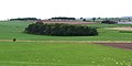
 Hilltop copse - geograph.org.uk - 2587980.jpg 2,591 × 1,632; 734 KB
-
 Hutton Hang - geograph.org.uk - 4556069.jpg 4,000 × 2,660; 2.57 MB
-
 Hutton Hang - geograph.org.uk - 6486293.jpg 5,184 × 3,456; 7.26 MB
-
 Hutton Hang Cottage - geograph.org.uk - 6377189.jpg 1,600 × 1,043; 346 KB
-
 Hutton Hill - geograph.org.uk - 4487223.jpg 4,000 × 2,660; 2.66 MB
-
 Lane towards Hutton Hang - geograph.org.uk - 6698253.jpg 1,024 × 768; 197 KB
-
 Lone tree on Buck Bank - geograph.org.uk - 6093247.jpg 1,523 × 1,142; 442 KB
-
 Looking west on West Moor Lane - geograph.org.uk - 6093240.jpg 1,600 × 1,200; 364 KB
-
 Low Hutton - geograph.org.uk - 4556064.jpg 4,000 × 2,660; 2.92 MB
-
 Maize crop north of West Moor Lane - geograph.org.uk - 6698267.jpg 1,024 × 768; 196 KB
-
 National Cycle Route 71, Hutton Hill - geograph.org.uk - 6698265.jpg 640 × 480; 74 KB
-
 National Cycle Route 71, Low Hutton - geograph.org.uk - 6698304.jpg 1,024 × 768; 244 KB
-

-
 North Moor Lane At West Moor Lane - geograph.org.uk - 3101447.jpg 800 × 600; 90 KB
-
 Road junction at Hutton Hang - geograph.org.uk - 6377154.jpg 1,600 × 1,200; 333 KB
-
 Road junction on West Moor Lane, Hutton Hill - geograph.org.uk - 6698532.jpg 1,600 × 1,188; 264 KB
-

-
 Rural view from near Hutton Hill - geograph.org.uk - 2389330.jpg 640 × 433; 96 KB
-
 Scrog Wood - geograph.org.uk - 4487225.jpg 4,000 × 2,660; 3.23 MB
-
 Sheep grazing, Hutton Hill - geograph.org.uk - 6698261.jpg 1,024 × 768; 199 KB
-
 Sixpenny Wood - geograph.org.uk - 2587894.jpg 3,238 × 1,632; 846 KB
-
 Strip of Woodland near Hutton Hang - geograph.org.uk - 6486270.jpg 5,184 × 3,456; 7.53 MB
-
 Tree on the south side of West Moor Lane - geograph.org.uk - 6093277.jpg 1,600 × 1,200; 340 KB
-
 West Moor Lane - geograph.org.uk - 6698269.jpg 800 × 600; 115 KB
-
 Woodland at the eastern end of Buck Bank - geograph.org.uk - 6093250.jpg 1,600 × 1,200; 431 KB


