Category:Hutton, Essex
Jump to navigation
Jump to search
suburb in Brentwood, Essex, England, UK  | |||||
| Upload media | |||||
| Instance of |
| ||||
|---|---|---|---|---|---|
| Location | Brentwood, Essex, East of England, England | ||||
 | |||||
English: Hutton is a village in south Essex. It is situated to the east of Brentwood and to the west of Billericay. The village is close to Shenfield being largely built-up but with a substantial rural element as well.
Norsk bokmål: Hutton er en landsby i Essex i England. Den ligger øst for Brentwood og vest for Billericay, like ved Shenfield.
Subcategories
This category has the following 2 subcategories, out of 2 total.
A
H
- Hutton Country Park (1 F)
Media in category "Hutton, Essex"
The following 50 files are in this category, out of 50 total.
-

-
 Arnolds Avenue, Hutton - geograph.org.uk - 4514250.jpg 640 × 480; 89 KB
-

-
 Bayleys Mead, Hutton - geograph.org.uk - 1396619.jpg 3,072 × 2,304; 1.49 MB
-
 Brindles Close sign - geograph.org.uk - 4684949.jpg 3,072 × 2,304; 1.88 MB
-
 Brindles Close, Hutton - geograph.org.uk - 1396638.jpg 3,072 × 2,304; 1.51 MB
-
 Brindles Close, Hutton - geograph.org.uk - 4684946.jpg 3,072 × 2,304; 1.79 MB
-
 Brindles Close, Hutton - geograph.org.uk - 4685072.jpg 3,072 × 2,304; 1.79 MB
-
 Claughton Way Sign - geograph.org.uk - 2825513.jpg 3,072 × 2,304; 1.42 MB
-

-
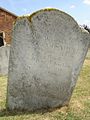
 Gravestone for James Falconer 1813 - geograph.org.uk - 359055.jpg 495 × 640; 133 KB
-

-
-
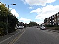
 Hanging Hill Lane, Hutton - geograph.org.uk - 1396628.jpg 3,072 × 2,304; 1.64 MB
-
 Hanging Hill Lane, Hutton - geograph.org.uk - 1396634.jpg 3,072 × 2,304; 1.43 MB
-
 Hanging Hill Lane, Hutton - geograph.org.uk - 2867372.jpg 640 × 428; 91 KB
-
 Hanging Hill Lane, Hutton - geograph.org.uk - 4685067.jpg 3,072 × 2,304; 1.85 MB
-
 Harrison Close Hutton - geograph.org.uk - 4465288.jpg 640 × 424; 55 KB
-
 Houses off Hanging Hill Lane - geograph.org.uk - 4685729.jpg 3,072 × 2,304; 1.77 MB
-
 Hutton Drive sign - geograph.org.uk - 4685563.jpg 3,072 × 2,304; 1.95 MB
-
 Hutton Drive sign - geograph.org.uk - 4685915.jpg 3,072 × 2,304; 1.91 MB
-
 Hutton Drive, Hutton - geograph.org.uk - 4685561.jpg 3,072 × 2,304; 1.99 MB
-
 Hutton Drive, Hutton - geograph.org.uk - 4685710.jpg 3,072 × 2,304; 1.86 MB
-
 Hutton Drive, Hutton - geograph.org.uk - 4685718.jpg 3,072 × 2,304; 1.84 MB
-
 Hutton Drive, Hutton - geograph.org.uk - 4685830.jpg 3,072 × 2,304; 1.85 MB
-
 Hutton Drive, Hutton - geograph.org.uk - 4685907.jpg 3,072 × 2,304; 1.83 MB
-
 Hutton Drive, Hutton - geograph.org.uk - 4685910.jpg 3,072 × 2,304; 1.7 MB
-
 Hutton parade, Essex.jpg 1,600 × 2,133; 487 KB
-
 Hutton Parish Hall, Rayleigh Road - geograph.org.uk - 1365535.jpg 640 × 427; 85 KB
-
 Local Shops in Rayleigh Road, Hutton - geograph.org.uk - 1365522.jpg 640 × 427; 78 KB
-
 Long Ridings Avenue, Hutton - geograph.org.uk - 4514255.jpg 640 × 480; 74 KB
-
 Princes Way sign - geograph.org.uk - 4684884.jpg 3,072 × 2,304; 1.86 MB
-
 Princes Way, Hutton - geograph.org.uk - 4684952.jpg 2,304 × 3,072; 2.02 MB
-
 Prospect Way, Hutton - geograph.org.uk - 4514268.jpg 640 × 480; 70 KB
-
 Springfield Avenue sign - geograph.org.uk - 4685826.jpg 3,033 × 2,272; 3.23 MB
-
 Springfield Avenue, Hutton - geograph.org.uk - 4685816.jpg 3,072 × 2,304; 1.66 MB
-
 Springfield Avenue, Hutton - geograph.org.uk - 4685904.jpg 3,072 × 2,304; 1.68 MB
-
 Spurgate sign - geograph.org.uk - 4684886.jpg 2,912 × 2,181; 2.53 MB
-
 Spurgate, Hutton - geograph.org.uk - 4684883.jpg 3,072 × 2,304; 1.83 MB
-
 Tallon Road, Hutton - geograph.org.uk - 4687558.jpg 3,072 × 2,304; 1.82 MB
-
 Tallon Road, Hutton - geograph.org.uk - 4687646.jpg 3,072 × 2,304; 1.83 MB
-

-
 The Co-operative, Hutton.jpg 3,072 × 2,304; 1.36 MB
-

-
 Bushwood Farm, Havering's Grove, Essex - geograph.org.uk - 59101.jpg 640 × 480; 125 KB
-
 Hall Green Lane, Hutton, Essex - geograph.org.uk - 22887.jpg 640 × 480; 91 KB
-
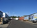 Hutton Trading Estate, Hutton, Essex - geograph.org.uk - 59106.jpg 640 × 480; 65 KB
-
 Lawness Barns - geograph.org.uk - 48334.jpg 640 × 439; 98 KB
-

-


