Category:Hut circles in Scotland
Jump to navigation
Jump to search
Subcategories
This category has only the following subcategory.
Media in category "Hut circles in Scotland"
The following 75 files are in this category, out of 75 total.
-
 4 views of hut-circles at Valtos, Uig, Lewis, Broch Age. Wellcome M0015349.jpg 4,002 × 2,645; 3.1 MB
-
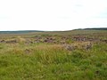
 A Hut circle on the hill - geograph.org.uk - 48936.jpg 640 × 480; 162 KB
-
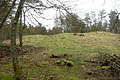
 Ancient and Modern - geograph.org.uk - 974565.jpg 640 × 480; 86 KB
-
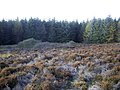
 Another Hut Circle^ - geograph.org.uk - 956087.jpg 640 × 427; 261 KB
-
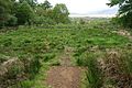
 Broch or Hut Circle - geograph.org.uk - 1102675.jpg 640 × 427; 80 KB
-

-
 Carman Hill-fort, site of hut-circle - geograph.org.uk - 1348692.jpg 640 × 480; 93 KB
-

-
 Hut circle - geograph.org.uk - 1154147.jpg 640 × 480; 73 KB
-
 Hut Circle - geograph.org.uk - 1286795.jpg 640 × 480; 108 KB
-
 Hut Circle - geograph.org.uk - 1306469.jpg 640 × 480; 97 KB
-
 Hut Circle - geograph.org.uk - 1351717.jpg 640 × 480; 99 KB
-
 Hut Circle - geograph.org.uk - 1353022.jpg 640 × 480; 87 KB
-
 Hut circle - geograph.org.uk - 1545763.jpg 640 × 480; 126 KB
-
 Hut circle - geograph.org.uk - 167224.jpg 640 × 480; 149 KB
-
 Hut circle - geograph.org.uk - 584610.jpg 640 × 480; 141 KB
-
 Hut circle - geograph.org.uk - 798314.jpg 640 × 480; 98 KB
-
 Hut Circle - geograph.org.uk - 935308.jpg 640 × 480; 52 KB
-
 Hut Circle - geograph.org.uk - 935316.jpg 640 × 480; 72 KB
-
 Hut Circle - geograph.org.uk - 956077.jpg 640 × 427; 246 KB
-
 Hut circle above Badyo - geograph.org.uk - 1008443.jpg 640 × 395; 76 KB
-
 Hut Circle and Field System at Astle - geograph.org.uk - 1257784.jpg 640 × 447; 80 KB
-
 Hut Circle at Rimsdale - geograph.org.uk - 1404700.jpg 640 × 480; 78 KB
-
 Hut Circle below Mast - geograph.org.uk - 1168166.jpg 640 × 480; 77 KB
-
 Hut Circle in Field beside Achvaich - geograph.org.uk - 1201484.jpg 640 × 480; 83 KB
-
 Hut circle in the forest - geograph.org.uk - 1545818.jpg 640 × 480; 118 KB
-
 Hut circle near An Dubh Loch - geograph.org.uk - 1135950.jpg 640 × 480; 195 KB
-
 Hut Circle near Carn nam Muc - geograph.org.uk - 1360695.jpg 640 × 480; 60 KB
-
 Hut Circle near the Achuvoldrach Burn - geograph.org.uk - 956144.jpg 640 × 480; 95 KB
-
 Hut Circle near the Armadale Burn - geograph.org.uk - 1351844.jpg 640 × 480; 115 KB
-
 Hut circle on Carman Muir - geograph.org.uk - 1379995.jpg 640 × 267; 53 KB
-
 Hut circle on Faire na Paitig - geograph.org.uk - 1273822.jpg 640 × 537; 80 KB
-
 Hut Circle on North Berwick Law - geograph.org.uk - 905433.jpg 640 × 480; 106 KB
-
 Hut circle on the slopes of Carn Mor - geograph.org.uk - 645010.jpg 640 × 426; 68 KB
-
 Hut circle or small forest - geograph.org.uk - 1773112.jpg 1,500 × 1,125; 935 KB
-
 Hut circle overlooking Lochbroom Burn - geograph.org.uk - 981642.jpg 640 × 480; 113 KB
-
 Hut Circle, Dunnet Forest - geograph.org.uk - 376009.jpg 640 × 427; 132 KB
-
 Hut circle, Machrie Forest - geograph.org.uk - 589937.jpg 640 × 480; 91 KB
-
 Hut Circle, Na Leacan, Islay - geograph.org.uk - 1750014.jpg 567 × 378; 248 KB
-
 Hut circle, Torr Righ.jpg 3,888 × 2,592; 4.58 MB
-
 Hut circles - geograph.org.uk - 1334213.jpg 640 × 480; 122 KB
-
 Hut circles and field systems - geograph.org.uk - 889505.jpg 640 × 480; 114 KB
-
 Hut circles at Borichill Mor - geograph.org.uk - 164633.jpg 640 × 480; 187 KB
-
 Hut Circles in the ancient Field System. - geograph.org.uk - 370188.jpg 640 × 426; 102 KB
-
 Hut Circles near summit of Creach Bheinn - geograph.org.uk - 1134598.jpg 640 × 415; 137 KB
-
 Hut Circles on Green Knowe - geograph.org.uk - 1590662.jpg 640 × 480; 58 KB
-
 Hut Circles on White Meldon - geograph.org.uk - 1590667.jpg 640 × 480; 67 KB
-
 Hut Circles,Green Knowe - geograph.org.uk - 1590657.jpg 640 × 480; 58 KB
-
 Iron age hut circle on Forvie Moor - geograph.org.uk - 604412.jpg 640 × 374; 166 KB
-
 More hut circles on Carn Mor - geograph.org.uk - 645084.jpg 640 × 426; 56 KB
-
 Port Bun Aibhne - geograph.org.uk - 15338.jpg 640 × 480; 124 KB
-

-
 Remains of hut circles and field system - geograph.org.uk - 777596.jpg 640 × 480; 108 KB
-
 Stones from the hut circles - geograph.org.uk - 1100673.jpg 480 × 640; 119 KB
-

-
 Two hut circles - geograph.org.uk - 1545781.jpg 640 × 480; 105 KB
-

-
 Ancient 'Hut Circle' by the B976 - geograph.org.uk - 443036.jpg 640 × 480; 129 KB
-
 Greenbrough Hill - geograph.org.uk - 1423966.jpg 640 × 360; 108 KB
-
 Hut circle - geograph.org.uk - 324464.jpg 640 × 480; 70 KB
-
 Hut circle - geograph.org.uk - 41516.jpg 640 × 480; 133 KB
-
 Hut Circle - geograph.org.uk - 435378.jpg 640 × 369; 90 KB
-
 Hut Circle above Holm - geograph.org.uk - 170703.jpg 640 × 480; 125 KB
-
 Hut Circle in Suardal - geograph.org.uk - 164044.jpg 640 × 480; 128 KB
-

-
 Hut circle near Leacnasaide - geograph.org.uk - 401798.jpg 640 × 480; 164 KB
-
 Hut circle near Loch Fuar - geograph.org.uk - 401844.jpg 640 × 480; 128 KB
-
 Hut circle on Leathad Mor hillside - geograph.org.uk - 54744.jpg 640 × 480; 111 KB
-
 Hut circle on the hill above the A897 - geograph.org.uk - 594170.jpg 640 × 399; 106 KB
-
 Hut circle on The Strome - geograph.org.uk - 443039.jpg 640 × 480; 141 KB
-
 Hut Circle, River Sand - geograph.org.uk - 548727.jpg 640 × 427; 84 KB
-
 Hut circles - geograph.org.uk - 140647.jpg 640 × 480; 107 KB
-
 Hut circles at the head of Glen Suardal - geograph.org.uk - 652607.jpg 640 × 480; 150 KB
-
 Possible Hut circle - geograph.org.uk - 212027.jpg 640 × 480; 121 KB
-
 Remains of hut circles - geograph.org.uk - 594167.jpg 640 × 426; 100 KB


