Category:Hurvat Ga'aton
Jump to navigation
Jump to search
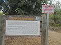
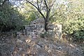
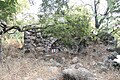
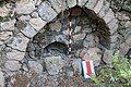
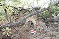
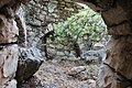
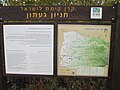
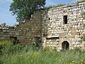
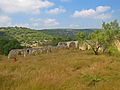
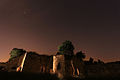
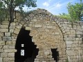
historical agricultural farm from 10 century BC in the Gaaton river | |||||
| Upload media | |||||
| Location | Mateh Asher Regional Council, Acre Subdistrict, Northern District, Israel | ||||
|---|---|---|---|---|---|
| Heritage designation | |||||
 | |||||
Media in category "Hurvat Ga'aton"
The following 79 files are in this category, out of 79 total.
-
 (النبعة ( شمال فلسطين.jpg 2,736 × 3,648; 12.55 MB
-
 Gaaton ruins a secret garden.jpg 7,360 × 4,912; 25.55 MB
-
 Gaaton ruins a tooth.jpg 7,360 × 4,912; 24.72 MB
-
 Gaaton ruins a touch of light.jpg 7,360 × 4,912; 10.93 MB
-
 Gaaton ruins an Arch.jpg 7,360 × 4,912; 25.52 MB
-
 Gaaton ruins Arches.jpg 7,360 × 4,912; 26.31 MB
-
 Gaaton ruins Roots.jpg 7,079 × 4,704; 20.67 MB
-
 Gaaton ruins.jpg 7,182 × 4,747; 18.34 MB
-
 Hurvat Ga'aton.JPG 4,608 × 3,456; 4.72 MB
-
 Hussein sheikh, Jaitun 01.jpg 4,272 × 2,848; 8.8 MB
-
 Hussein sheikh, Jaitun 02.jpg 4,272 × 2,848; 8.21 MB
-
 Hussein sheikh, Jaitun 03.jpg 4,272 × 2,848; 4.77 MB
-
 Hussein sheikh, Jaitun 04.jpg 4,272 × 2,848; 6.99 MB
-
 Hussein sheikh, Jaitun 06.jpg 4,272 × 2,848; 5.02 MB
-
 IHM חורבת געתון 1.jpeg 1,600 × 1,067; 817 KB
-
 IHM חורבת געתון 2.jpeg 1,600 × 1,067; 812 KB
-
 IHM חורבת געתון 3.jpeg 1,067 × 1,600; 985 KB
-
 IHM חורבת געתון 4.jpeg 1,067 × 1,600; 447 KB
-
 IHM חורבת געתון.jpeg 1,600 × 1,067; 705 KB
-
 PikiWiki Israel 40579 Hurvat Gaaton.JPG 4,608 × 3,456; 5.17 MB
-
 PikiWiki Israel 40580 Hurvat Gaaton.JPG 4,608 × 3,456; 5.35 MB
-
 PikiWiki Israel 40581 Hurvat Gaaton.JPG 4,608 × 3,456; 4.51 MB
-
 PikiWiki Israel 40582 Hurvat Gaaton.JPG 4,608 × 3,456; 4.09 MB
-
 PikiWiki Israel 40583 Hurvat Gaaton.JPG 4,608 × 3,456; 3.5 MB
-
 PikiWiki Israel 47470 Geography of Israel.jpg 2,988 × 5,312; 1.64 MB
-
 Sursuk.JPG 2,048 × 1,536; 711 KB
-
 אחד הקירות הפנימיים של המנזר בחורבת געתון.JPG 3,648 × 2,736; 6.15 MB
-
 געתון - panoramio (1).jpg 4,288 × 2,864; 3.32 MB
-
 געתון - panoramio (2).jpg 4,288 × 2,864; 3.56 MB
-
 געתון - panoramio (3).jpg 4,288 × 2,864; 2.71 MB
-
 געתון - panoramio.jpg 4,288 × 2,864; 2.53 MB
-
 המנזר בחורבת געתון - מבט מבפנים.JPG 3,648 × 2,736; 4.95 MB
-
 הקיר החיצוני של המנזר בחורבת געתון.JPG 3,648 × 2,736; 5.4 MB
-
 זריחה בחאן סורסוק 01.jpg 5,477 × 3,651; 18.28 MB
-
 זריחה בחאן סורסוק 02.jpg 5,472 × 3,648; 3.43 MB
-
 זריחה בחאן סורסוק 03.jpg 5,472 × 3,648; 3.01 MB
-
 זריחה בחאן סורסוק 04.jpg 5,472 × 3,648; 3.33 MB
-
 זריחה בחאן סורסוק 05.jpg 5,472 × 3,648; 1.6 MB
-
 חאן געתון, המבנה המערבי והחצר.jpg 5,184 × 3,456; 4.43 MB
-
 חאן געתון, חצר ומבנה מערבי.jpg 4,661 × 3,107; 3.75 MB
-
 חאן געתון, מבט מהקומה השניה אל החצר מעל המדרגות.jpg 3,456 × 5,184; 5.17 MB
-
 חאן געתון, מבט מהקומה השנייה במבנה הדרומי אל החצר.jpg 3,456 × 5,184; 4.98 MB
-
 חאן געתון, מבט מכיוון צפון אל הפינה הצפון מערבית.jpg 3,456 × 5,184; 3.14 MB
-
 חאן געתון, מבנה דרומי ומדרגות.jpg 3,297 × 4,948; 3.98 MB
-
 חאן געתון, קשתות במבנה המזרחי 2.jpg 3,086 × 4,631; 3.76 MB
-
 חאן געתון, קשתות במבנה המזרחי 3.jpg 5,184 × 3,456; 4.77 MB
-
 חאן געתון, קשתות במבנה המזרחי.jpg 3,456 × 5,184; 4.84 MB
-
 חאן געתון, קשתות במנה המזרחי.jpg 5,184 × 3,456; 4.64 MB
-
 חאן געתון.jpg 4,896 × 3,264; 8.05 MB
-
 חאן סורסוק.jpg 6,000 × 4,500; 14.43 MB
-
 חורבת געתון חצר 1.jpg 4,845 × 3,230; 7.99 MB
-
 חורבת געתון חצר 2.jpg 5,184 × 3,456; 9.31 MB
-
 חורבת געתון מבנה 1.jpg 4,766 × 3,177; 7.73 MB
-
 חורבת געתון מבנה 2 פנים 1.jpg 3,456 × 5,184; 9.1 MB
-
 חורבת געתון מבנה 2 פנים 2.jpg 5,049 × 3,366; 8.61 MB
-
 חורבת געתון מבנה 2 פנים 3.jpg 5,184 × 3,456; 9.15 MB
-
 חורבת געתון מבנה 2.jpg 5,145 × 3,430; 7.76 MB
-
 חורבת געתון.jpg 3,264 × 2,448; 1.87 MB
-
 חירבת געתון.JPG 4,272 × 2,848; 5.48 MB
-
 חירבת געתון1.JPG 4,272 × 2,848; 6.8 MB
-
 חירבת געתון2.JPG 4,272 × 2,848; 6.12 MB
-
 חירבת געתון3.JPG 4,272 × 2,848; 3.98 MB
-
 חירבת געתון4.JPG 4,272 × 2,848; 7.3 MB
-
 חירבת געתון5.JPG 4,272 × 2,848; 6.54 MB
-
 לילה בחאן געתון.jpg 5,472 × 3,648; 7.9 MB
-
 מבט מתוך המנזר ההרוס לעבר החלונות.JPG 3,648 × 2,736; 2.42 MB
-
 פנים המנזר ההרוס בחורבת געתון.JPG 3,648 × 2,736; 5.09 MB
-
 קשת מהחצר החיצונית של המנזר בחורבת געתון.JPG 3,648 × 2,736; 4.75 MB
-
 קשתות בחאן געתון.jpg 5,472 × 3,648; 8.48 MB
-
 רצף קשתות מהחצר בחרבת געתון 2.JPG 3,648 × 2,736; 5.26 MB
-
 רצף קשתות מהחצר בחרבת געתון וקיר הבית החיצון.JPG 3,648 × 2,736; 4.91 MB
-
 רצף קשתות מהחצר בחרבת געתון.JPG 3,648 × 2,736; 4.81 MB
-
 النبعة - شمال فلسطين.jpg 3,648 × 2,736; 5.31 MB
-
 النبعة في شمال فلسطين.jpg 3,648 × 2,736; 17.97 MB
-
 بقايا منزل عربي فلسطيني قديم ومهجر - النبعة - شمال فلسطين.jpg 3,648 × 2,736; 14.29 MB
-
 بيت قديم مهجر- النبعة شمال فلسطين.jpg 3,648 × 2,736; 14.63 MB
-
 منزل في قرية عمقة (النبعة) فلسطين.jpg 3,648 × 2,736; 10.03 MB
-
 منزل في قرية عمقة - (النبعة) فلسطين.jpg 2,736 × 3,648; 13.39 MB
-
 منزل قديم مهجر في النبعة.jpg 3,648 × 2,736; 16.57 MB


.jpg)
.jpg)
.jpg)


_%D9%81%D9%84%D8%B3%D8%B7%D9%8A%D9%86.jpg)
_%D9%81%D9%84%D8%B3%D8%B7%D9%8A%D9%86.jpg)
