Category:Hursley
Jump to navigation
Jump to search

village and civil parish in Hampshire, UK  | |||||
| Upload media | |||||
| Instance of | |||||
|---|---|---|---|---|---|
| Location | City of Winchester, Hampshire, South East England, England | ||||
 | |||||
English: Hursley is a village and civil parish on the A3090 road in Hampshire, England, between Romsey Winchester. The parish includes the hamlets of Standon and Pitt.
Subcategories
This category has the following 11 subcategories, out of 11 total.
A
D
- The Dolphin, Hursley (6 F)
F
H
- Hursley House (21 F)
I
K
- Kings Head, Hursley (8 F)
P
- Pitt, Hampshire (7 F)
S
- Standon, Hampshire (12 F)
W
Media in category "Hursley"
The following 200 files are in this category, out of 415 total.
(previous page) (next page)-
 Neale(1818) p2.078 - Hursley Lodge, Hampshire.jpg 1,808 × 1,222; 564 KB
-

-

-
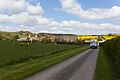
 33KV Pylon west of Farley Mount Road - geograph.org.uk - 3941053.jpg 640 × 427; 93 KB
-
 A gully like track - geograph.org.uk - 3861116.jpg 2,432 × 4,320; 2.66 MB
-
 A permissive path from Ladywell - geograph.org.uk - 3878652.jpg 4,320 × 2,432; 3.98 MB
-
 A private track in Ampfield wood - geograph.org.uk - 3857524.jpg 4,320 × 2,432; 4.38 MB
-
 A View from Lanham Lane - geograph.org.uk - 1869248.jpg 2,816 × 2,112; 1.9 MB
-
 A3090 looking northeast - geograph.org.uk - 2855874.jpg 640 × 447; 125 KB
-
 A3090 looking northeast - geograph.org.uk - 2855878.jpg 640 × 449; 116 KB
-
 A3090 north of Juniper Bank - geograph.org.uk - 3657011.jpg 3,648 × 2,736; 1.23 MB
-
 All Saints Church at Hursley - geograph.org.uk - 5294889.jpg 4,000 × 3,000; 3.37 MB
-
 All Saints' Church, Hursley - geograph.org.uk - 5613369.jpg 3,264 × 2,448; 3.38 MB
-
 All Saints, Hursley, churchyard - geograph.org.uk - 6218216.jpg 640 × 480; 132 KB
-

-
 All Saints, Hursley, Keble's grave - geograph.org.uk - 6218230.jpg 640 × 480; 108 KB
-
-

-
 All Saints, Hursley, Pitt board (1) - geograph.org.uk - 6218236.jpg 640 × 377; 51 KB
-
 All Saints, Hursley, Pitt board (2) - geograph.org.uk - 6218239.jpg 374 × 640; 56 KB
-
 All Saints, Hursley, reredos - geograph.org.uk - 6218254.jpg 640 × 480; 90 KB
-
 All Saints, Hursley, tower - geograph.org.uk - 6218213.jpg 480 × 640; 80 KB
-
 All Saints, Hursley, VC memorial (I) - geograph.org.uk - 6218247.jpg 640 × 480; 65 KB
-

-

-
 Along the Clarendon Way in West Wood - geograph.org.uk - 2073052.jpg 800 × 600; 174 KB
-
 Alongside Crabwood Farm - geograph.org.uk - 1884600.jpg 4,000 × 3,000; 2.86 MB
-
 An old Roman route - geograph.org.uk - 5281744.jpg 640 × 480; 228 KB
-
 Animal pen on Dores Lane - geograph.org.uk - 3940910.jpg 640 × 427; 156 KB
-
 Anmery Cottage - geograph.org.uk - 3940945.jpg 640 × 427; 174 KB
-
 Anmery Lodge - geograph.org.uk - 3940952.jpg 640 × 427; 156 KB
-
 Autumn afternoon in Parnholt Wood - geograph.org.uk - 5603613.jpg 640 × 427; 136 KB
-
 Avenue of trees, Monarch's Way - geograph.org.uk - 2855897.jpg 640 × 480; 127 KB
-
 Avenue of trees, Monarch's Way - geograph.org.uk - 2855912.jpg 640 × 480; 106 KB
-
 Avenue of trees, Monarch's Way - geograph.org.uk - 2855915.jpg 640 × 480; 113 KB
-
 Baddesley Common - geograph.org.uk - 17797.jpg 640 × 480; 38 KB
-
 Beech tree at crossing - geograph.org.uk - 1884577.jpg 4,000 × 3,000; 2.88 MB
-
 Beechcroft Farm - geograph.org.uk - 2319751.jpg 640 × 405; 195 KB
-
 Bells Ground Farm - geograph.org.uk - 2322847.jpg 640 × 363; 169 KB
-
 Bend in Sparsholt Road - geograph.org.uk - 5121670.jpg 640 × 427; 84 KB
-
 Berrydown Farm - geograph.org.uk - 3940713.jpg 640 × 427; 144 KB
-
 Berrydown Farm - geograph.org.uk - 3940724.jpg 640 × 427; 108 KB
-
 Blue, green and gold - geograph.org.uk - 3594168.jpg 640 × 427; 107 KB
-
 Boosey Hanging on Violet Hill - geograph.org.uk - 3940643.jpg 640 × 427; 149 KB
-
 Boosey Hanging on Violet Hill - geograph.org.uk - 3940645.jpg 640 × 427; 161 KB
-
 Boundary of Hursley estate - geograph.org.uk - 2322677.jpg 640 × 361; 209 KB
-
 Bridleway towards Ampfield Wood - geograph.org.uk - 2322879.jpg 521 × 640; 291 KB
-
 Brooks Way Track Ladywell - geograph.org.uk - 3878642.jpg 4,320 × 2,432; 4.19 MB
-
 Buildings at Home Farm - geograph.org.uk - 3940947.jpg 640 × 427; 120 KB
-

-
 Bunstead Lane - geograph.org.uk - 5281503.jpg 640 × 480; 206 KB
-
 Bunstead Lane - geograph.org.uk - 5875550.jpg 640 × 480; 109 KB
-
 Bunstead Lane - geograph.org.uk - 5875552.jpg 640 × 480; 128 KB
-
 Bus Shelter and signs of the times - geograph.org.uk - 956429.jpg 640 × 427; 158 KB
-
 Bus Shelter Reference Marker - geograph.org.uk - 956444.jpg 427 × 640; 102 KB
-
 Butchers and Post Office, Hursley - geograph.org.uk - 3182275.jpg 1,024 × 768; 169 KB
-
 Cattle, Farley Mount Country Park - geograph.org.uk - 5281704.jpg 640 × 480; 125 KB
-
 Catways, Port Lane - geograph.org.uk - 956400.jpg 640 × 427; 161 KB
-
 Clarendon Way at crossroads on edge of Winchester - geograph.org.uk - 1884624.jpg 4,000 × 3,000; 2.9 MB
-
 Clarendon Way beside Beaconhill Plantation - geograph.org.uk - 1866740.jpg 2,816 × 2,112; 2.37 MB
-
 Collins Lane - geograph.org.uk - 5875555.jpg 640 × 480; 105 KB
-
 Copse on Farley Down - geograph.org.uk - 3940690.jpg 640 × 427; 165 KB
-
 Corus Hotel, near Ampfield - geograph.org.uk - 124180.jpg 640 × 480; 327 KB
-
 Cottage roof in Hursley - geograph.org.uk - 3182283.jpg 1,024 × 768; 252 KB
-
 Cottages at South Lynch - geograph.org.uk - 3941019.jpg 640 × 427; 119 KB
-
 Cottages in Hursley - geograph.org.uk - 3182294.jpg 1,280 × 960; 1.14 MB
-
 Cottages, Main Street, Hursley - geograph.org.uk - 5613379.jpg 3,264 × 2,448; 4.32 MB
-
 Cows grazing near Pitt Down - geograph.org.uk - 2596177.jpg 640 × 480; 64 KB
-
 Crossroads at Crabwood - geograph.org.uk - 2319762.jpg 640 × 398; 192 KB
-
 Crossroads at Teg Down - geograph.org.uk - 2319704.jpg 640 × 371; 194 KB
-

-
-
 Decorative chimneys, Hursley - geograph.org.uk - 5613382.jpg 3,264 × 2,448; 3.14 MB
-
 Detail of Hursley Newsbox and Post Office - geograph.org.uk - 956734.jpg 640 × 461; 173 KB
-
 Detail of Keble Cottage - geograph.org.uk - 956462.jpg 401 × 640; 84 KB
-
 Detail of The Old Saddlery - geograph.org.uk - 956460.jpg 427 × 640; 112 KB
-

-
 Dores Copse, near Lower Slackstead - geograph.org.uk - 145119.jpg 640 × 480; 298 KB
-
 Dores Lane - geograph.org.uk - 3940906.jpg 640 × 427; 131 KB
-
 Edge of woods near Farley Farm - geograph.org.uk - 2596219.jpg 640 × 480; 102 KB
-
 Edge of woods on Beacon Hill - geograph.org.uk - 2596217.jpg 640 × 480; 87 KB
-
 Enmill Lane - geograph.org.uk - 3078916.jpg 3,872 × 2,592; 4.78 MB
-
 Enmill Lane - geograph.org.uk - 5281643.jpg 640 × 480; 139 KB
-
 Enmill Lane meets the A3090 - geograph.org.uk - 5281640.jpg 640 × 480; 198 KB
-
 Entering Hursley along Port Lane - geograph.org.uk - 956398.jpg 640 × 427; 183 KB
-
 Entering Hursley on the A3090 - geograph.org.uk - 5456305.jpg 2,048 × 1,536; 1.42 MB
-
 Entrance to Merdon Manor Farm - geograph.org.uk - 2322711.jpg 640 × 427; 218 KB
-
 Entrance to West Wood - geograph.org.uk - 2073047.jpg 800 × 600; 152 KB
-
 Entrance to West Wood from the south - geograph.org.uk - 2073064.jpg 800 × 600; 182 KB
-
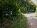
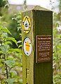 Explanatory sign for The Monarch's Way - geograph.org.uk - 955951.jpg 467 × 640; 119 KB
-
 Farley Chamberlayne - geograph.org.uk - 6255430.jpg 683 × 1,024; 191 KB
-
 Farley Chamberlayne - St John's Church - geograph.org.uk - 5611979.jpg 5,184 × 2,920; 5.56 MB
-
 Farley Chamberlayne War Memorial - geograph.org.uk - 6257389.jpg 683 × 1,024; 208 KB
-
 Farley Farm - geograph.org.uk - 3940702.jpg 640 × 427; 91 KB
-
 Farley Mount Country Park near Winchester - geograph.org.uk - 5611964.jpg 5,184 × 2,920; 5.76 MB
-
 Farley Mount Monument near Winchester - geograph.org.uk - 5611967.jpg 5,184 × 2,920; 4.87 MB
-
 Farley Mount Road - geograph.org.uk - 3941026.jpg 640 × 427; 121 KB
-
 Farley Mount Road - geograph.org.uk - 3941061.jpg 640 × 427; 168 KB
-
 Farley Mount Road - geograph.org.uk - 5281684.jpg 640 × 480; 143 KB
-
 Farm buildings at South Lynch - geograph.org.uk - 3941057.jpg 640 × 427; 139 KB
-
 Farmland at Crabwood - geograph.org.uk - 2319718.jpg 640 × 418; 210 KB
-
 Farmland off Sparsholt Road - geograph.org.uk - 2319870.jpg 640 × 428; 192 KB
-
 Farmland off Sparsholt Road - geograph.org.uk - 2319879.jpg 640 × 427; 183 KB
-
 Farmland off Sparsholt Road - geograph.org.uk - 2319893.jpg 640 × 425; 203 KB
-
 Farmland seen from Sparsholt Road - geograph.org.uk - 3078988.jpg 3,872 × 2,592; 4.06 MB
-
 Farmland west of A3090 - geograph.org.uk - 2864998.jpg 640 × 402; 45 KB
-
 Field and barn on Pitt Down - geograph.org.uk - 3941047.jpg 640 × 427; 129 KB
-

-

-

-

-
 Field east of Port Lane - geograph.org.uk - 5281589.jpg 640 × 480; 136 KB
-
 Field edge beside A3090 - geograph.org.uk - 5117124.jpg 640 × 427; 88 KB
-
 Field edge on Southlynch Estate - geograph.org.uk - 3594175.jpg 640 × 427; 66 KB
-
 Field House, Ladwell - geograph.org.uk - 139601.jpg 640 × 426; 99 KB
-
 Field north-east of Hursley - geograph.org.uk - 5281508.jpg 640 × 480; 105 KB
-
 Field of sheep, looking south - geograph.org.uk - 70503.jpg 640 × 480; 141 KB
-

-
 Field west of Merdon Castle - geograph.org.uk - 3940957.jpg 640 × 427; 126 KB
-
 Fields and hedge beside Enmill Lane - geograph.org.uk - 5121664.jpg 640 × 427; 84 KB
-
 Fields at Merdon Manor Farm - geograph.org.uk - 2322717.jpg 640 × 427; 187 KB
-
 Fields at Merdon Manor Farm - geograph.org.uk - 2322730.jpg 640 × 427; 173 KB
-

-
 Fields east of Berrydown Farm - geograph.org.uk - 2641498.jpg 640 × 427; 113 KB
-

-
 Flooded field just off footpath to Lower Slackstead - geograph.org.uk - 3857514.jpg 4,320 × 2,432; 2.14 MB
-
 Footbridge along the Monarchs Way - geograph.org.uk - 3861013.jpg 4,320 × 2,432; 3.2 MB
-
 Footbridge, Monarch's Way - geograph.org.uk - 2855903.jpg 640 × 480; 119 KB
-
 Footpath alongside Folly in Cranberry Park - geograph.org.uk - 3878791.jpg 4,320 × 2,432; 2.57 MB
-
 Footpath completely blocked by fallen trees - geograph.org.uk - 3878749.jpg 4,320 × 2,432; 3.29 MB
-
 Footpath through Cranberry Park Estate - geograph.org.uk - 3878780.jpg 2,432 × 4,320; 4.61 MB
-
 Foxgloves in clearing, Ampfield Copse - geograph.org.uk - 2993793.jpg 640 × 482; 117 KB
-

-
 Gateway to West Wood - geograph.org.uk - 2073032.jpg 800 × 600; 204 KB
-
 Grass air strip on Farley Down, Farley Chamberlayne - geograph.org.uk - 5611971.jpg 5,184 × 2,920; 5.21 MB
-
 Green Acres - geograph.org.uk - 139855.jpg 640 × 426; 146 KB
-
 Green on the Royal Winchester Golf Course - geograph.org.uk - 1869255.jpg 2,816 × 2,112; 1.63 MB
-
 Halfway down Enmill Lane - geograph.org.uk - 3078957.jpg 3,872 × 2,592; 4.36 MB
-

-
 Harvested field and a fine sky - geograph.org.uk - 3182214.jpg 1,280 × 1,707; 1.8 MB
-
 Hedgerow by the A3090 before Hursley - geograph.org.uk - 6290638.jpg 1,892 × 1,236; 1.94 MB
-
 Hedgerow by the A3090 before Hursley - geograph.org.uk - 6290641.jpg 1,920 × 1,280; 1.83 MB
-
 Hocombe Bridge - geograph.org.uk - 2960881.jpg 640 × 482; 152 KB
-

-
 Home Farm in the distance - geograph.org.uk - 377826.jpg 640 × 480; 67 KB
-
 Hookwood Lane - geograph.org.uk - 139793.jpg 426 × 640; 142 KB
-
 House and chimney in Hursley - geograph.org.uk - 5460254.jpg 2,048 × 1,536; 1 MB
-
 House at Lower Slackstead - geograph.org.uk - 2322850.jpg 640 × 415; 218 KB
-
 House at Lower Slackstead - geograph.org.uk - 2322853.jpg 640 × 427; 207 KB
-
 House at Standon Farm - geograph.org.uk - 3941008.jpg 640 × 427; 158 KB
-
 House in Farley Lane - geograph.org.uk - 2510261.jpg 640 × 480; 114 KB
-
 House on edge of recreation ground - geograph.org.uk - 960413.jpg 640 × 414; 146 KB
-
 House with interesting chimneys - geograph.org.uk - 956482.jpg 497 × 640; 166 KB
-
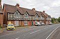
 Houses along A3090 at Hursley - geograph.org.uk - 959413.jpg 640 × 427; 137 KB
-
 Houses along the A3090 - geograph.org.uk - 959373.jpg 640 × 427; 138 KB
-
 Housing south of Collins Lane - geograph.org.uk - 956032.jpg 640 × 427; 111 KB
-
 Hursley "Morris Men" - geograph.org.uk - 1540958.jpg 640 × 480; 102 KB
-
 Hursley church - geograph.org.uk - 5281521.jpg 640 × 480; 145 KB
-
 Hursley Garage - geograph.org.uk - 956414.jpg 640 × 427; 109 KB
-
 Hursley Park Cricket Club - geograph.org.uk - 956768.jpg 640 × 427; 119 KB
-
 Hursley Post Office - geograph.org.uk - 5613375.jpg 3,264 × 2,448; 3.94 MB
-
 Hursley Telephone Exchange - geograph.org.uk - 955940.jpg 640 × 427; 144 KB
-
 Hursley village on A3090 - geograph.org.uk - 3428248.jpg 640 × 473; 76 KB
-
 HursleyCottages.jpg 3,648 × 2,736; 3.97 MB
-
 In Ashmore Hill Copse - geograph.org.uk - 1866886.jpg 2,816 × 2,112; 3.2 MB
-
 In Farley Mount Country Park - geograph.org.uk - 1866836.jpg 2,816 × 2,112; 2.4 MB
-

-
 Junction of lanes - geograph.org.uk - 2510270.jpg 640 × 480; 111 KB
-
 Junction of lanes at Silkstead - geograph.org.uk - 3737208.jpg 640 × 427; 97 KB
-
 Juniper Bank - geograph.org.uk - 2319972.jpg 640 × 427; 231 KB
-
 Juniper Bank - geograph.org.uk - 2319974.jpg 640 × 428; 220 KB
-
 Juniper bank from the A3090 - geograph.org.uk - 3020869.jpg 1,600 × 1,200; 511 KB
-
 Keble Close - geograph.org.uk - 956396.jpg 640 × 449; 147 KB
-
 Keeper's Lodge, Hursley - geograph.org.uk - 2855909.jpg 640 × 480; 103 KB
-
 Lamppost in Hursley Churchyard - geograph.org.uk - 2416858.jpg 480 × 640; 111 KB
-
 Land off Dores Lane - geograph.org.uk - 2322734.jpg 640 × 428; 231 KB
-
 Land off Dores Lane - geograph.org.uk - 2322743.jpg 640 × 427; 189 KB
-
 Lanham Lane in Crab Wood - geograph.org.uk - 1869234.jpg 2,816 × 2,112; 2.67 MB
-
 Large trees by the A3090, Hursley - geograph.org.uk - 5456308.jpg 2,004 × 1,474; 1.35 MB
-
 Layby on the A3090 before Hursley - geograph.org.uk - 6290643.jpg 1,920 × 1,280; 1.23 MB
-
 Layby on the A3090, Hursley - geograph.org.uk - 3020859.jpg 1,600 × 1,200; 590 KB
-
 Leafy crossroads - geograph.org.uk - 4257915.jpg 640 × 360; 78 KB
-
 Little Pittdown Plantation - geograph.org.uk - 4414853.jpg 640 × 427; 104 KB
-
-
 Looking into Hursley estate - geograph.org.uk - 2322705.jpg 640 × 439; 224 KB
-

-
 Looking South over Mount Down - geograph.org.uk - 1866754.jpg 2,816 × 2,112; 1.53 MB
-

-
 Lychgate Cottage - geograph.org.uk - 955926.jpg 640 × 432; 130 KB
-
 M3 approaches Junction 12 - geograph.org.uk - 2608694.jpg 3,015 × 1,937; 928 KB
-
 M3 north of Junction 12 - geograph.org.uk - 2960911.jpg 640 × 482; 78 KB
-
 Main Road at the junction of Poles Lane, Hursley - geograph.org.uk - 3020787.jpg 1,600 × 1,200; 620 KB
-
 Main Road at the junction of Poles Lane, Hursley - geograph.org.uk - 3020857.jpg 1,600 × 1,200; 511 KB
-
 Memorial bench on crossroads at Hursley - geograph.org.uk - 3245999.jpg 427 × 640; 128 KB
-
 Merdon Castle - geograph.org.uk - 2322699.jpg 640 × 427; 193 KB
-
 Merdon Castle - geograph.org.uk - 3940967.jpg 640 × 427; 225 KB
-
 Merdon Cottages and farm buildings - geograph.org.uk - 3940961.jpg 640 × 427; 88 KB
-
 Merdon Manor - geograph.org.uk - 3940932.jpg 640 × 427; 130 KB
-
 Meredon Close - geograph.org.uk - 955862.jpg 640 × 427; 121 KB
-
 Meredun Close - geograph.org.uk - 959453.jpg 541 × 640; 142 KB
_p2.078_-_Hursley_Lodge,_Hampshire.jpg)


_-_geograph.org.uk_-_6218236.jpg)
_-_geograph.org.uk_-_6218239.jpg)


_-_geograph.org.uk_-_6218247.jpg)
_-_geograph.org.uk_-_6218252.jpg)


