Category:Huron-Manistee National Forests
Jump to navigation
Jump to search
English: en:Huron-Manistee National Forests
العربية: جنگل ملی هیوران-منستی
national forest in Michigan, United States  | |||||
| Upload media | |||||
| Instance of | |||||
|---|---|---|---|---|---|
| Location | Michigan | ||||
| IUCN protected areas category | |||||
| official website | |||||
| |||||
Subcategories
This category has the following 8 subcategories, out of 8 total.
Media in category "Huron-Manistee National Forests"
The following 135 files are in this category, out of 135 total.
-
 Au sable river Bluffs near Iargo Springs.jpg 4,032 × 3,024; 4.79 MB
-
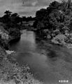
 Au sable river near Iargo Springs.jpg 4,032 × 3,024; 4.04 MB
-
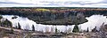 Au Sable River.jpg 6,000 × 2,172; 9.23 MB
-
 Better hide the picnic baskets! (5797288198) (cropped).jpg 1,456 × 2,045; 1.24 MB
-
 Briar HIll (Michigan)-3.jpg 4,598 × 1,641; 5.39 MB
-
 Briar HIll (Michigan).jpg 3,992 × 2,992; 8.19 MB
-
 Characteristics of family campers using the Huron-Manistee National Forests (IA characteristicso19king).pdf 1,083 × 1,489, 22 pages; 1.09 MB
-

-
 Fire in Huron-Manistee National Forest.jpg 1,024 × 767; 470 KB
-
 The forest resources of the Huron-Manistee national forests, 1993 (microform) (IA forestresourceso181haug).pdf 1,108 × 1,558, 50 pages; 2.63 MB
-

-
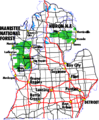 Huron Manistee USFS map.png 450 × 546; 18 KB
-
 Huron National Forest Overlook.jpg 4,000 × 2,667; 11.86 MB
-
 Huron-Manistee National Forests bear crossing road sign.jpg 3,872 × 2,592; 4 MB
-
 Lake Scenes - Michigan - DPLA - 59be0ce43844b89db0957e28a5a22df7.jpg 4,734 × 3,839; 2.59 MB
-
 Lumbermans Monument Overview.JPG 2,848 × 2,136; 1.47 MB
-
 M-37 Michigan HIghway.jpg 1,156 × 1,732; 1.49 MB
-
 Manistee National Forest Scenic Overlook.jpg 3,998 × 2,669; 5.17 MB
-
 Manistee National Forest Timber.jpg 3,830 × 2,871; 7.28 MB
-
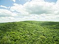
 Manistee National Forest.jpg 6,000 × 2,435; 14.99 MB
-
 ManisteeRiverTrailBridge2013.jpg 4,608 × 3,456; 5.34 MB
-
 MichiganNationalForests-zh.svg 549 × 606; 102 KB
-
 MichiganNationalForests.svg 549 × 606; 102 KB
-

-
 NCT Huron-Manistee 1.jpg 3,456 × 4,608; 4.96 MB
-
 NCT Huron-Manistee 2.jpg 2,736 × 3,648; 8.57 MB
-
 NCT Huron-Manistee 3.jpg 2,560 × 1,920; 1.11 MB
-
 North Country Trail Manistee Forest.jpg 2,736 × 1,998; 5.6 MB
-
 Pere Marquette River in Autumn Manistee National Forest.JPG 1,567 × 1,150; 235 KB
-
 Pere Marquette River in Fall Manistee National Forest.JPG 1,600 × 1,200; 234 KB
-

-

-
 Photograph of a 40 Year-Old Stand of Jack Pine - NARA - 2128445.jpg 1,223 × 1,944; 1.89 MB
-
 Photograph of a 40 Year-Old Stand of Jack Pine - NARA - 2128445.tif 1,223 × 1,944; 2.27 MB
-
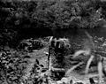
 Photograph of a Completed Stream Improvement Structure - NARA - 2128093.jpg 1,265 × 927; 761 KB
-
 Photograph of a Completed Stream Improvement Structure - NARA - 2128093.tif 1,265 × 927; 1.12 MB
-
 Photograph of a Fire Tower in Lower Michigan - NARA - 2127383.jpg 1,323 × 1,035; 937 KB
-
 Photograph of a Fire Tower in Lower Michigan - NARA - 2127383.tif 1,323 × 1,035; 1.31 MB
-
 Photograph of a Forest Fire - NARA - 2128138.jpg 1,289 × 945; 686 KB
-
 Photograph of a Forest Fire - NARA - 2128138.tif 1,289 × 945; 1.17 MB
-
 Photograph of a Group of Skaters - NARA - 2128510.jpg 946 × 675; 323 KB
-

-
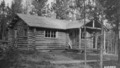
 Photograph of a New Dwelling at Silver Creek Ranger Station - NARA - 2127622.jpg 1,254 × 808; 753 KB
-

-
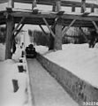 Photograph of a Toboggan - NARA - 2128532.jpg 936 × 1,011; 477 KB
-
 Photograph of an Old Burn on the Mio District - NARA - 2127406.jpg 1,624 × 1,120; 1.31 MB
-
 Photograph of Arboretum Stock - NARA - 2128952.jpg 1,094 × 861; 689 KB
-
 Photograph of Blue Heron in Swamp on Lake Mitchell - NARA - 2127857.jpg 654 × 915; 340 KB
-
 Photograph of Buck Creek Plantation - NARA - 2128932.jpg 1,167 × 863; 695 KB
-
 Photograph of Burned over Area - NARA - 2127544.jpg 1,154 × 761; 672 KB
-

-
 Photograph of Caberfae Block - NARA - 2128948.jpg 1,115 × 852; 647 KB
-
 Photograph of Caberfae Block - NARA - 2128949.jpg 1,086 × 834; 598 KB
-
 Photograph of Caberfae Block - NARA - 2128950.jpg 1,097 × 858; 670 KB
-

-
-
 Photograph of Children Playing in Sand - NARA - 2128706.jpg 1,113 × 870; 505 KB
-

-
-
 Photograph of Corsair Campground Shelter - NARA - 2128350.jpg 1,230 × 726; 711 KB
-

-

-
 Photograph of Denuded Forest Lands Not Restocking - NARA - 2128089.jpg 1,254 × 899; 773 KB
-
 Photograph of Directing Fire Suppression by Radio - NARA - 2128097.jpg 1,278 × 917; 748 KB
-
 Photograph of Directing Fire Suppression by Radio - NARA - 2128097.tif 1,278 × 917; 1.12 MB
-
 Photograph of District Ranger Chase - NARA - 2128379.jpg 903 × 1,281; 1,009 KB
-
 Photograph of District Ranger Chase - NARA - 2128379.tif 903 × 1,281; 1.11 MB
-
 Photograph of Emery Lumber Company Sawmill - NARA - 2129609.jpg 1,965 × 1,374; 1.6 MB
-
 Photograph of Erosion Control to Prevent Gullying - NARA - 2128105.jpg 1,298 × 934; 1,019 KB
-
 Photograph of Fire Bug Float - NARA - 2127731.jpg 1,132 × 771; 650 KB
-
 Photograph of Fire on Manistee National Forest - NARA - 2128348.jpg 696 × 1,158; 514 KB
-
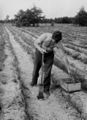
 Photograph of First Crop on a Submarginal Farm - NARA - 2128092.jpg 1,271 × 921; 843 KB
-

-
 Photograph of Forest Entrance Portal on N-55 West of Cadillac - NARA - 2128112.tif 1,280 × 948; 1.16 MB
-

-
-
 Photograph of Jean and Charlotte Gibson Picking Blueberries - NARA - 2128395.jpg 1,238 × 920; 699 KB
-
 Photograph of Jean Gibson Pouring Blueberries - NARA - 2128396.jpg 915 × 1,273; 827 KB
-
 Photograph of Largemouth Bass Caught in Tawas River - NARA - 2129014.jpg 2,044 × 1,455; 1.98 MB
-
 Photograph of Lewiston, Michigan - NARA - 2127524.jpg 1,888 × 1,203; 1.49 MB
-
 Photograph of Long Lake Ranger District Station Dwelling - NARA - 2127468.jpg 1,728 × 1,159; 1.15 MB
-
 Photograph of Long Lake Ranger District Station Dwelling - NARA - 2127468.tif 1,728 × 1,159; 1.91 MB
-
 Photograph of Mess Hall at Camp Manikiwa - NARA - 2129616.jpg 1,902 × 1,299; 1.33 MB
-
 Photograph of Michigan Sand Thrower - NARA - 2129612.jpg 1,281 × 932; 840 KB
-
 Photograph of Michigan's Largest Sand Blow - NARA - 2128347.jpg 1,245 × 717; 546 KB
-
 Photograph of Modern Equipment for Maple Sap Production - NARA - 2127819.jpg 1,034 × 614; 562 KB
-
 Photograph of Modern Equipment for Maple Sap Production - NARA - 2127820.jpg 1,073 × 616; 599 KB
-
 Photograph of Modern Equipment for Maple Sap Production - NARA - 2127821.jpg 1,083 × 633; 556 KB
-
 Photograph of Modern Equipment for Maple Sap Production - NARA - 2127822.jpg 1,070 × 609; 413 KB
-
 Photograph of Modern Equipment for Maple Sap Production - NARA - 2127823.jpg 620 × 1,098; 557 KB
-
 Photograph of Modern Equipment for Maple Sap Production - NARA - 2127824.jpg 1,075 × 632; 561 KB
-
 Photograph of Mueller Cabin Near Cook Dam - NARA - 2127659.jpg 831 × 472; 329 KB
-
 Photograph of Office at Baldwin Ranger Station - NARA - 2128080.jpg 1,294 × 908; 733 KB
-
 Photograph of Office at Baldwin Ranger Station - NARA - 2128080.tif 1,294 × 908; 1.12 MB
-
 Photograph of Old Tower Block - NARA - 2128960.jpg 915 × 1,284; 695 KB
-
 Photograph of Old Tower Block - NARA - 2128961.jpg 1,241 × 942; 793 KB
-
 Photograph of Partridge Nest - NARA - 2129614.jpg 936 × 1,341; 775 KB
-
 Photograph of Radio Mast at Baldwin Ranger Station - NARA - 2129500.jpg 891 × 1,555; 749 KB
-
 Photograph of Radio Mast at Baldwin Ranger Station - NARA - 2129500.tif 891 × 1,555; 1.32 MB
-
 Photograph of Ranger Strate in a Jack Pine Plantation - NARA - 2129501.jpg 699 × 1,268; 614 KB
-
 Photograph of Red Pine Planted in Scalps in Fall 1937 - NARA - 2129613.jpg 1,284 × 942; 852 KB
-
 Photograph of Rollways Ranger Station and Lookout Tower - NARA - 2127426.jpg 1,748 × 1,128; 1.17 MB
-
 Photograph of Rollways Ranger Station and Lookout Tower - NARA - 2127426.tif 1,748 × 1,128; 1.88 MB
-
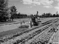 Photograph of Rototiller in Operation - NARA - 2128384.jpg 1,278 × 945; 891 KB
-
 Photograph of Senior Ski Hill at Silver Valley - NARA - 2128975.jpg 873 × 729; 436 KB
-
 Photograph of Silver Creek Lookout Tower - NARA - 2127427.jpg 1,112 × 1,744; 1.11 MB
-
 Photograph of Silver Creek Tower - NARA - 2128661.jpg 852 × 1,166; 759 KB
-
 Photograph of Silver Valley View of Tin Pan Slide - NARA - 2128974.jpg 867 × 1,146; 588 KB
-
 Photograph of Sudan Grass - NARA - 2128702.jpg 1,142 × 876; 722 KB
-
 Photograph of Summer Home on Pere Marquette River - NARA - 2128087.jpg 1,259 × 924; 768 KB
-

-

-
 Photograph of the Only Building Left in McKinley, Michigan - NARA - 2127425.jpg 1,720 × 1,120; 1.17 MB
-
 Photograph of Toboggan Return to Toboggan Tow - NARA - 2129276.jpg 1,311 × 1,008; 830 KB
-

-

-
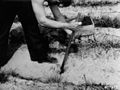
 Photograph of Tree Planting with Michigan Planting Bar - NARA - 2128999.jpg 1,284 × 942; 812 KB
-
 Photograph of Tree Planting with Michigan Planting Bar - NARA - 2129000.jpg 1,269 × 945; 671 KB
-
 Photograph of Tree Planting with Michigan Planting Bar - NARA - 2129001.jpg 1,260 × 945; 800 KB
-
 Photograph of Tree Planting with Michigan Planting Bar - NARA - 2129002.jpg 915 × 1,260; 698 KB
-
 Photograph of Tree Planting with Michigan Planting Bar - NARA - 2129003.jpg 933 × 1,245; 765 KB
-
 Photograph of View from Dock - NARA - 2129573.jpg 2,286 × 1,424; 1.78 MB
-
 Photograph of Visitors at Council Ring - NARA - 2128708.jpg 1,122 × 824; 671 KB
-
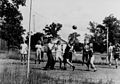 Photograph of Volley Ball Court - NARA - 2129617.jpg 1,926 × 1,347; 1.37 MB
-
 Photograph of Warehouses and Shop at Baldwin Ranger Station - NARA - 2128083.jpg 1,280 × 903; 773 KB
-
 Photograph of Warehouses and Shop at Baldwin Ranger Station - NARA - 2128083.tif 1,280 × 903; 1.11 MB
-
-
 Photograph of White River Stream Improvement - NARA - 2128871.jpg 1,347 × 1,068; 1.14 MB
-
 Photograph of White River Stream Improvement - NARA - 2128872.jpg 921 × 1,074; 754 KB
-
 Recreation Improvements - Michigan - DPLA - 3e14820034c86286e92a051a364a86b0.jpg 4,788 × 3,798; 1.42 MB
-
 Red Pines in the Manistee National Forest.jpg 6,000 × 4,000; 22.37 MB
-
 River Scenes - Michigan - DPLA - 5fe0eade35876e873dd95155682b9e46.jpg 4,878 × 3,761; 2.47 MB
-
 Tent Caterpillars - All States - DPLA - 06a8b846a5b23f8b9b85154ad3689915.jpg 4,801 × 3,845; 2.45 MB
-
 The dunes, Nordhouse Dunes.jpg 720 × 540; 35 KB
-
 Watershed Management - General - DPLA - 00326d9ac37aa94a1ff19faecdfd2f76.jpg 2,868 × 4,039; 1.04 MB


_(cropped).jpg)
.jpg)
_growing_in_a_pollinator_garden_on_the_Huron_Manistee_National_Forest_in_Michigan_-_20210714-FS-JF-01.jpg)

_and_little_blue_stem_coated_in_fall_dew_-_20221004-FS-JF-01.jpg)


_growing_on_the_Huron_Manistee_National_Forest_in_Michigan_along_the_Au_Sable_River_-_20210624-FS-JF-01.jpg)


-3.jpg)
Categories:
- National Forests of Michigan
- Geography of Lake County, Michigan
- Newaygo County, Michigan
- Wexford County, Michigan
- Geography of Manistee County, Michigan
- Mason County, Michigan
- Geography of Oceana County, Michigan
- Geography of Muskegon County, Michigan
- Geography of Mecosta County, Michigan
- Geography of Montcalm County, Michigan
- Oscoda County, Michigan
- Alcona County, Michigan
- Iosco County, Michigan
- Crawford County, Michigan
- Ogemaw County, Michigan
- National Forests of the United States by name
- Western Great Lakes forests