Category:Hurleston
Jump to navigation
Jump to search
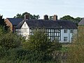
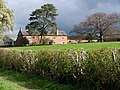
English: Hurleston is a former civil parish in the unitary authority area of Cheshire East and the ceremonial county of Cheshire, England, which lies to the north west of Nantwich. The parish was predominantly rural with scattered farms and buildings and no settlements. Nearby villages include Barbridge, Burland, Radmore Green, Rease Heath and Stoke Bank.
former civil parish in Cheshire East, England, UK  | |||||
| Upload media | |||||
| Instance of |
| ||||
|---|---|---|---|---|---|
| Location |
| ||||
| Population |
| ||||
 | |||||
Subcategories
This category has the following 2 subcategories, out of 2 total.
H
S
Media in category "Hurleston"
The following 73 files are in this category, out of 73 total.
-
 Approaching Hurleston Top Lock, Cheshire - geograph.org.uk - 3216781.jpg 1,024 × 695; 420 KB
-
 Autumn at Bank Farm near Burland, Cheshire - geograph.org.uk - 3216365.jpg 1,024 × 656; 382 KB
-
 Autumn trees near Burland, Cheshire - geograph.org.uk - 3216359.jpg 1,024 × 768; 540 KB
-
 Bache House Farmhouse 01.jpg 4,000 × 3,000; 5.08 MB
-
 Bache House Farmhouse 02.jpg 4,000 × 3,000; 4.96 MB
-
 Bank Farm, near Burland - geograph.org.uk - 2897276.jpg 640 × 480; 116 KB
-
 Barn at Bache House Farm.jpg 4,000 × 3,000; 5.2 MB
-

-
 Buildings by Hurleston Top Lock - geograph.org.uk - 853552.jpg 640 × 465; 133 KB
-
 Cornes Bridge just around the corner - geograph.org.uk - 4597737.jpg 640 × 427; 79 KB
-
 Cottage near Burford Roundabout - geograph.org.uk - 3868932.jpg 1,920 × 1,937; 1.64 MB
-
 Cows at Park Farm - geograph.org.uk - 2720956.jpg 1,500 × 914; 199 KB
-

-
 Dredger at Hurleston Junction - geograph.org.uk - 4753068.jpg 640 × 356; 33 KB
-
 Drifter at Hurleston Junction - geograph.org.uk - 4753069.jpg 640 × 491; 71 KB
-
 Farmland north of Burland, Cheshire - geograph.org.uk - 3216765.jpg 1,024 × 751; 397 KB
-
 Farmland north of Burland, Cheshire - geograph.org.uk - 3216766.jpg 1,024 × 726; 410 KB
-
 Farmland north of Burland, Cheshire - geograph.org.uk - 3216768.jpg 1,024 × 743; 438 KB
-
 Feed to Hurleston Reservoir, view NNW - geograph.org.uk - 853167.jpg 453 × 640; 168 KB
-
 Feed to Hurleston Reservoir, view SE - geograph.org.uk - 853578.jpg 488 × 640; 191 KB
-
 Garden by Hurleston Reservoir - geograph.org.uk - 4753070.jpg 640 × 511; 60 KB
-

-
 Grass fields near Burland, Cheshire - geograph.org.uk - 3197540.jpg 1,024 × 754; 465 KB
-
 Green fields near Burford - geograph.org.uk - 2170209.jpg 1,500 × 1,000; 166 KB
-
 Henhullbridge Farm - geograph.org.uk - 2749343.jpg 1,600 × 1,271; 614 KB
-
 Houses by Hurleston Reservoir - geograph.org.uk - 4753072.jpg 640 × 488; 38 KB
-
 Houses by Hurleston Reservoir - geograph.org.uk - 4753073.jpg 640 × 396; 35 KB
-
 Hurleston Reservoir - geograph.org.uk - 5852706.jpg 1,280 × 851; 425 KB
-
 Hurleston Reservoir - geograph.org.uk - 853528.jpg 640 × 427; 117 KB
-
 Hurleston Reservoir building - geograph.org.uk - 4753078.jpg 640 × 386; 28 KB
-
 Hurleston Reservoir building - geograph.org.uk - 4753079.jpg 640 × 526; 45 KB
-
 Hurleston Reservoir embankment - geograph.org.uk - 4753080.jpg 640 × 433; 32 KB
-
 Hurleston Reservoir Feeder - geograph.org.uk - 5852707.jpg 1,280 × 851; 630 KB
-
 Hurleston Reservoir, Cheshire - geograph.org.uk - 3198530.jpg 800 × 800; 437 KB
-
 Hurleston Reservoir, Cheshire - geograph.org.uk - 3198544.jpg 1,024 × 672; 386 KB
-
 Hurleston Reservoir, Cheshire - geograph.org.uk - 3198548.jpg 768 × 1,024; 401 KB
-
 Hurleston Reservoir, Cheshire - geograph.org.uk - 3198558.jpg 1,024 × 768; 385 KB
-
 Layby on the A51 - geograph.org.uk - 3867364.jpg 3,047 × 2,492; 3.17 MB
-
 Llangollen Canal north of Burland, Cheshire - geograph.org.uk - 3198485.jpg 1,024 × 632; 381 KB
-

-
 Llangollen Canal, Hurleston - geograph.org.uk - 5852710.jpg 1,280 × 851; 439 KB
-

-

-

-
 Narrow boat moored West of Hurleston Bridge - geograph.org.uk - 6013007.jpg 5,184 × 3,888; 4.19 MB
-

-

-

-
 Narrowboat detail near Hurleston - geograph.org.uk - 4597745.jpg 640 × 427; 66 KB
-

-
 Narrowboats moored above Hurleston Bridge - geograph.org.uk - 6272706.jpg 1,024 × 683; 207 KB
-

-
 New Farm, at Burland - geograph.org.uk - 3679809.jpg 3,264 × 2,448; 4.7 MB
-
 Pasture near Burland, Cheshire - geograph.org.uk - 3197114.jpg 1,024 × 750; 485 KB
-
 Pasture near Burland, Cheshire - geograph.org.uk - 3197523.jpg 1,024 × 768; 517 KB
-
 Pasture near Burland, Cheshire - geograph.org.uk - 3197553.jpg 1,024 × 660; 412 KB
-
 Pasture near Lee's Bridge - geograph.org.uk - 1199527.jpg 640 × 427; 152 KB
-
 Pasture north of the A534 - geograph.org.uk - 1198362.jpg 640 × 435; 114 KB
-

-

-

-

-
 Shropshire Union nr Henhullbridge Fm.jpg 1,200 × 886; 896 KB
-
 Signpost for the Llangollen canal - geograph.org.uk - 3212058.jpg 2,048 × 1,362; 1.39 MB
-

-
 Slurry tank by Bank Farm near Burland, Cheshire - geograph.org.uk - 3216390.jpg 1,024 × 725; 404 KB
-
 Small mere near the canal - geograph.org.uk - 1199477.jpg 640 × 427; 126 KB
-
 Snugburys straw sculpture - 2016 (2017 rebuild) - geograph.org.uk - 5880628.jpg 1,600 × 1,067; 602 KB
-
 Stormy but sunny near Burland, Cheshire - geograph.org.uk - 3197547.jpg 1,024 × 730; 384 KB
-
 Stormy but sunny pasture near Burland, Cheshire - geograph.org.uk - 3197558.jpg 1,024 × 626; 357 KB
-
 The A51 to Nantwich - geograph.org.uk - 2169963.jpg 1,500 × 1,000; 135 KB
-

-
 Water treatment works - geograph.org.uk - 4753100.jpg 640 × 398; 38 KB


_-_geograph.org.uk_-_5880628.jpg)


