Category:Huntingtower
Jump to navigation
Jump to search
English: Huntingtower is a village in Perthshire, Scotland, south of the Almond. Lies close to Ruthvenfield. More info.
| Upload media | |||||
| |||||
Subcategories
This category has the following 2 subcategories, out of 2 total.
H
- Huntingtower Castle (27 F)
- Huntingtower Hotel (10 F)
Media in category "Huntingtower"
The following 21 files are in this category, out of 21 total.
-
 A building with Clock Tower, Huntingtowerfield - geograph.org.uk - 4004662.jpg 4,608 × 3,456; 3.71 MB
-
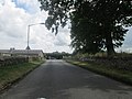
 A85, Huntingtower - geograph.org.uk - 2673816.jpg 640 × 480; 187 KB
-
 A85, Huntingtower - geograph.org.uk - 3654922.jpg 640 × 480; 232 KB
-
 Bleachers Way, Huntingtowerfield - geograph.org.uk - 4004641.jpg 4,608 × 3,456; 3 MB
-
 BS Huntigtower Gask Ridge.png 961 × 1,402; 57 KB
-
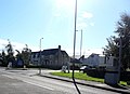 Glover Arms, Huntingtower - geograph.org.uk - 2684280.jpg 1,600 × 1,165; 420 KB
-
 Huntingtower clock tower.jpg 480 × 640; 99 KB
-
 Huntingtower Lodges - geograph.org.uk - 4819655.jpg 3,504 × 2,336; 3.73 MB
-
 Huntingtower Lodges - geograph.org.uk - 5892877.jpg 640 × 480; 354 KB
-
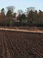
 Huntingtowerfield - geograph.org.uk - 2513780.jpg 640 × 480; 248 KB
-
 Innkeeper's Lodge, Huntingtower - geograph.org.uk - 1638823.jpg 640 × 480; 50 KB
-
 Leaving Huntingtower Castle - geograph.org.uk - 3573214.jpg 640 × 480; 70 KB
-

-
 Mains of Huntingtower - geograph.org.uk - 1153175.jpg 640 × 427; 183 KB
-
 Mains of Huntingtower - geograph.org.uk - 3388857.jpg 640 × 480; 55 KB
-
 Mains of Huntingtower - geograph.org.uk - 5288945.jpg 1,600 × 996; 466 KB
-
 Mains of Huntingtower - geograph.org.uk - 5288984.jpg 1,600 × 1,067; 298 KB
-
 Riverside path, Huntingtower - geograph.org.uk - 5228008.jpg 531 × 800; 233 KB
-
 View SW from Huntingtower Castle - geograph.org.uk - 2658349.jpg 800 × 533; 222 KB
-
 Waterside Cottages, Huntingtowerfield - geograph.org.uk - 5288594.jpg 1,600 × 1,067; 423 KB
-
 Huntingtower car-park - geograph.org.uk - 776462.jpg 640 × 480; 49 KB


