Category:Huntington, Cheshire
Jump to navigation
Jump to search
English: Huntington is a civil parish on the southern outskirts of Chester in the the unitary authority of Cheshire West and Chester and the ceremonial county of Cheshire, England. At the 2001 Census, the population of the entire civil parish was 1,961.
village and civil parish in Cheshire West and Chester, UK  | |||||
| Upload media | |||||
| Instance of | |||||
|---|---|---|---|---|---|
| Location | Cheshire West and Chester, Cheshire, North West England, England | ||||
| Population |
| ||||
 | |||||
Media in category "Huntington, Cheshire"
The following 101 files are in this category, out of 101 total.
-
 A55 about to pass under the B5130 - geograph.org.uk - 2357611.jpg 640 × 480; 39 KB
-
 A55 and Saighton Camp - geograph.org.uk - 2213009.jpg 640 × 480; 217 KB
-
 A55 road at Huntington, Cheshire.JPG 4,608 × 3,456; 3.4 MB
-
 A55 westbound crossing the River Dee - geograph.org.uk - 2360684.jpg 640 × 481; 35 KB
-
 A55, Chester ring road - geograph.org.uk - 5191222.jpg 640 × 480; 58 KB
-
 B5130 bridge over Chester bypass - geograph.org.uk - 4488592.jpg 1,600 × 1,065; 1.25 MB
-
 Barn, Meadowhouse Farm.jpg 640 × 480; 78 KB
-

-
 Butterbache Road, Huntington - geograph.org.uk - 5191214.jpg 640 × 480; 58 KB
-
 Cheaveley Hall Farmhouse 01.jpg 4,000 × 3,000; 5.02 MB
-
 Cheaveley Hall Farmhouse 02.jpg 4,000 × 3,000; 4.88 MB
-

-

-
 Chester bypass at the waterworks - geograph.org.uk - 2875093.jpg 637 × 449; 109 KB
-
 Chester bypass on the River Dee bridge - geograph.org.uk - 2875090.jpg 639 × 453; 103 KB
-
 Chester Road (B5130) - geograph.org.uk - 5191210.jpg 640 × 480; 93 KB
-
 Chester Road Bridge - geograph.org.uk - 2159001.jpg 640 × 384; 121 KB
-
 Chester Road bridge, Huntington.JPG 4,608 × 3,456; 3.38 MB
-
 Chester Road, Huntington - geograph.org.uk - 5191220.jpg 640 × 480; 75 KB
-
 Citroën car dealer, Huntington, Cheshire.JPG 4,320 × 3,240; 3.02 MB
-

-
 Construction site compound, off Sandy Lane - geograph.org.uk - 4316839.jpg 1,024 × 614; 124 KB
-
 Eccleston Ferry Farmhouse, Eccleston - geograph.org.uk - 6675576.jpg 1,024 × 768; 565 KB
-

-
 Elizabeth II postbox on Sandy Lane, Huntington - geograph.org.uk - 5193291.jpg 2,136 × 2,848; 1.23 MB
-
 Entrance to Chester Driving Test Centre - geograph.org.uk - 3060117.jpg 4,000 × 3,000; 2.67 MB
-
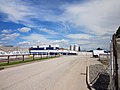
 Entrance to Huntington water treatment plant, Cheshire (1).JPG 4,320 × 3,240; 3.28 MB
-
 Entrance to Huntington water treatment plant, Cheshire (2).JPG 4,320 × 3,240; 3.43 MB
-
 Entrance to The Grange - geograph.org.uk - 3060037.jpg 4,000 × 3,000; 2.47 MB
-
 Farm building at Cheaveley Hall Farm, Aldford.jpg 4,000 × 3,000; 1.21 MB
-
 Field entrance off Sandy Lane - geograph.org.uk - 5191231.jpg 640 × 480; 84 KB
-
 Footpath and Stile at Huntington, Cheshire.jpg 4,000 × 3,000; 3.7 MB
-
 Footpath off Chester Road (B5130) - geograph.org.uk - 5191197.jpg 640 × 480; 146 KB
-
 Footpath to Christleton - geograph.org.uk - 4123229.jpg 4,000 × 3,000; 2.53 MB
-
 Footpath to Christleton - geograph.org.uk - 4123404.jpg 4,000 × 3,000; 4.83 MB
-
 Footpath to Huntington - geograph.org.uk - 4123353.jpg 4,000 × 3,000; 2.31 MB
-
 Footpath to Huntington - geograph.org.uk - 4123366.jpg 4,000 × 3,000; 2.56 MB
-
 Former bandstand at Eccleston Ferry.jpg 4,000 × 3,000; 4.91 MB
-

-
 Green Howards Road, Huntington - geograph.org.uk - 3998183.jpg 4,000 × 3,000; 2.34 MB
-
 Green Howards Road, Huntington - geograph.org.uk - 3998193.jpg 4,000 × 3,000; 2.25 MB
-
 Highlander Road in the snow - geograph.org.uk - 4316835.jpg 1,024 × 768; 136 KB
-
 Highlander Way, Huntington - geograph.org.uk - 3998126.jpg 4,000 × 3,000; 2.16 MB
-
 Highlander Way, Huntington - geograph.org.uk - 3998140.jpg 4,000 × 3,000; 2.22 MB
-
 Houses on Chester Road, Huntington - geograph.org.uk - 5191218.jpg 640 × 411; 52 KB
-
 St Luke's, Huntington.JPG 4,320 × 3,240; 2.8 MB
-
 Huntington - Churton Heyes Farm - geograph.org.uk - 974951.jpg 640 × 480; 291 KB
-
 Huntington - Huntington Hall Farm - geograph.org.uk - 974941.jpg 640 × 480; 240 KB
-
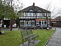
 Huntington - Rake and Pikel pub - geograph.org.uk - 974969.jpg 639 × 480; 262 KB
-
 Huntington bus terminus.JPG 4,608 × 3,456; 3.41 MB
-
 Huntington planter (2).JPG 4,320 × 3,240; 4.71 MB
-
 Huntington planter.JPG 4,608 × 3,456; 3.6 MB
-
 Huntington sign, Cheshire.JPG 3,240 × 4,320; 3.02 MB
-
 Huntington village centre.jpg 640 × 480; 127 KB
-
 Huntington, Cheshire (1).JPG 4,608 × 3,456; 3.45 MB
-
 Huntington, Cheshire (10).JPG 4,320 × 3,240; 4.24 MB
-
 Huntington, Cheshire (11).JPG 4,320 × 3,240; 5.01 MB
-
 Huntington, Cheshire (2).JPG 4,608 × 3,456; 3.43 MB
-
 Huntington, Cheshire (3).JPG 4,608 × 3,456; 3.39 MB
-
 Huntington, Cheshire (4).JPG 4,608 × 3,456; 3.42 MB
-
 Huntington, Cheshire (5).JPG 4,608 × 3,456; 3.44 MB
-
 Huntington, Cheshire (6).JPG 4,608 × 3,456; 3.44 MB
-
 Huntington, Cheshire (7).JPG 4,320 × 3,240; 4.47 MB
-
 Huntington, Cheshire (8).JPG 4,320 × 3,240; 4.45 MB
-
 Huntington, Cheshire (9).JPG 4,320 × 3,240; 5.12 MB
-
 Lodgehouse at the side of The Dee - geograph.org.uk - 1842953.jpg 1,024 × 768; 316 KB
-
 Meadow Farm - geograph.org.uk - 3527381.jpg 640 × 480; 88 KB
-
 Meadowhouse Farmhouse.jpg 640 × 480; 114 KB
-
 Milepost, Huntington, Cheshire.JPG 3,240 × 4,320; 3.67 MB
-
 Millennium Project time capsule, Huntington, Cheshire.JPG 4,608 × 3,456; 3.4 MB
-
 New Housing Estate, Huntington - geograph.org.uk - 3998155.jpg 4,000 × 3,000; 2.23 MB
-
 New Housing Estate, Huntington - geograph.org.uk - 3998204.jpg 4,000 × 3,000; 2.28 MB
-
 Pond at Huntington - geograph.org.uk - 4123380.jpg 4,000 × 3,000; 2.89 MB
-
 Public footpath to the B5130 - geograph.org.uk - 4316864.jpg 1,024 × 768; 199 KB
-
 Rake & Pikel, Huntington (2).JPG 4,320 × 3,240; 3.43 MB
-
 Rake & Pikel, Huntington, Cheshire.JPG 4,608 × 3,456; 3.59 MB
-
 River Dee - Eccleston - geograph.org.uk - 2396615.jpg 792 × 926; 514 KB
-
 River Dee from A55 westbound - geograph.org.uk - 2422947.jpg 640 × 480; 60 KB
-
 Sandy Lane - geograph.org.uk - 5191229.jpg 640 × 480; 99 KB
-
 Sandy Lane, Huntington - geograph.org.uk - 5193293.jpg 2,567 × 1,720; 981 KB
-

-
 Shops on Chester Road, Huntington - geograph.org.uk - 5191216.jpg 640 × 480; 110 KB
-
 Sign for Chester on Chester bypass - geograph.org.uk - 4488609.jpg 1,600 × 1,200; 1.23 MB
-

-
 Snowy hedges, west of Sandy Lane - geograph.org.uk - 4316854.jpg 1,024 × 768; 208 KB
-
 Snowy Sandy Lane, looking north-west - geograph.org.uk - 4316829.jpg 1,024 × 768; 140 KB
-
 The A55(T) at Huntington - geograph.org.uk - 3060097.jpg 4,000 × 3,000; 2.88 MB
-
 The B5130 near Aldford - geograph.org.uk - 3059956.jpg 4,000 × 3,000; 3.83 MB
-
 The B5130 near Aldford - geograph.org.uk - 3059965.jpg 4,000 × 3,000; 3.62 MB
-
 The B5130 near Huntington - geograph.org.uk - 3060051.jpg 4,000 × 3,000; 3.1 MB
-
 The B5130 near Huntington - geograph.org.uk - 3060062.jpg 4,000 × 3,000; 2.75 MB
-
 The B5130 near Huntington Hall - geograph.org.uk - 3059993.jpg 4,000 × 3,000; 3.07 MB
-
 The Rake ^ Pikel Inn, Huntington - geograph.org.uk - 5191224.jpg 640 × 480; 76 KB
-
 The Rake ^ Pikel, Huntington - geograph.org.uk - 3060082.jpg 4,000 × 3,000; 1.79 MB
-
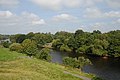 The River Dee - geograph.org.uk - 2089610.jpg 1,200 × 803; 257 KB
-
 The River Dee - geograph.org.uk - 2089617.jpg 1,200 × 803; 270 KB
-

-
 Trees near the Rake & Pikel, Huntington.JPG 4,608 × 3,456; 3.35 MB
-
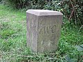 War Department Boundary Stone at Huntington - geograph.org.uk - 4123285.jpg 4,000 × 3,000; 4.5 MB
-
 Winter tree on Sandy Lane - geograph.org.uk - 4316877.jpg 768 × 960; 590 KB
-
 Huntington, Chester - geograph.org.uk - 10782.jpg 640 × 480; 91 KB


_-_geograph.org.uk_-_5191210.jpg)


.JPG)
.JPG)


_-_geograph.org.uk_-_5191197.jpg)


.JPG)


.JPG)
.JPG)
.JPG)
.JPG)
.JPG)
.JPG)
.JPG)
.JPG)
.JPG)
.JPG)
.JPG)


.JPG)


_at_Huntington_-_geograph.org.uk_-_3060097.jpg)


