Category:Hunstanworth
Jump to navigation
Jump to search
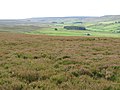
English: Hunstanworth is a small village in County Durham, in England. It is situated approximately 10 miles to the west of Consett, south-east of the village of Blanchland.
village and civil parish in County Durham, United Kingdom _-_geograph.org.uk_-_3473684.jpg) | |||||
| Upload media | |||||
| Instance of | |||||
|---|---|---|---|---|---|
| Location | County Durham, North East England, England | ||||
| Population |
| ||||
 | |||||
Subcategories
This category has the following 5 subcategories, out of 5 total.
Media in category "Hunstanworth"
The following 200 files are in this category, out of 840 total.
(previous page) (next page)-

-

-

-

-

-

-
 Access road into Deborah Plantation - geograph.org.uk - 6503032.jpg 2,000 × 1,500; 3.53 MB
-
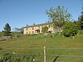
 Alanshields Farmhouse - geograph.org.uk - 182771.jpg 640 × 480; 70 KB
-
 Allenshields - geograph.org.uk - 4209567.jpg 1,024 × 768; 276 KB
-
 Allenshields and Buckshott Moor (2) - geograph.org.uk - 2863971.jpg 640 × 480; 103 KB
-
 Allenshields and Buckshott Moor - geograph.org.uk - 2863964.jpg 640 × 480; 89 KB
-
 Allenshields Farm - geograph.org.uk - 1210944.jpg 640 × 480; 63 KB
-
 Allenshields Farm - geograph.org.uk - 907347.jpg 640 × 480; 103 KB
-
 Arriving in Blanchland - geograph.org.uk - 6493119.jpg 640 × 480; 90 KB
-
 B6306 beside East Plantation - geograph.org.uk - 4893144.jpg 640 × 480; 61 KB
-
 Balehill House - geograph.org.uk - 1191770.jpg 640 × 426; 82 KB
-
 Balehill House Farm - geograph.org.uk - 907218.jpg 640 × 480; 89 KB
-
 Balehill Plantation - geograph.org.uk - 907216.jpg 640 × 480; 120 KB
-
 Barn at Riddlehamhope (2) - geograph.org.uk - 685010.jpg 640 × 480; 94 KB
-
 Barn at Riddlehamhope - geograph.org.uk - 685006.jpg 640 × 480; 93 KB
-
 Barn at Rope Barn - geograph.org.uk - 4209491.jpg 1,024 × 768; 213 KB
-
 Base of chimney, Taylor's Shaft - geograph.org.uk - 4209878.jpg 1,024 × 768; 377 KB
-
 Baxtonlaw Plantation - geograph.org.uk - 3513276.jpg 1,500 × 1,125; 1.99 MB
-
 Bay Bridge - geograph.org.uk - 3333856.jpg 4,000 × 3,000; 2.72 MB
-
 Bay Bridge - geograph.org.uk - 5648573.jpg 1,024 × 768; 301 KB
-
 Baybridge picnic site - geograph.org.uk - 2684343.jpg 640 × 480; 108 KB
-

-
 Beldon Burn at Gibraltar Banks - geograph.org.uk - 5222201.jpg 5,312 × 2,988; 6.68 MB
-
 Beldon Burn by Gibraltar Banks - geograph.org.uk - 3478408.jpg 640 × 480; 149 KB
-

-

-
 Beldon Side - geograph.org.uk - 3814625.jpg 640 × 480; 73 KB
-
 Bend in fence on Nookton Edge - geograph.org.uk - 4247666.jpg 1,024 × 768; 233 KB
-
 Birkside Fell (2) - geograph.org.uk - 511782.jpg 640 × 480; 95 KB
-
 Birkside Fell (3) - geograph.org.uk - 510802.jpg 640 × 480; 80 KB
-
 Birkside Fell (3) - geograph.org.uk - 511792.jpg 640 × 480; 94 KB
-
 Birkside Fell (4) - geograph.org.uk - 511804.jpg 640 × 480; 90 KB
-
 Birkside Fell - geograph.org.uk - 505298.jpg 640 × 480; 97 KB
-
 Black Haggs - geograph.org.uk - 1730736.jpg 640 × 480; 69 KB
-
 Blanchland bridge - geograph.org.uk - 4764126.jpg 2,760 × 1,797; 2.04 MB
-
 Blanchland Bridge - geograph.org.uk - 5177231.jpg 4,000 × 3,000; 3.9 MB
-
 Blanchland from Derwent Bridge - geograph.org.uk - 4209453.jpg 1,024 × 768; 195 KB
-
 Bloomery overlooking Beldon Burn - geograph.org.uk - 4232707.jpg 853 × 640; 650 KB
-
 Bolt's Burn - geograph.org.uk - 1118634.jpg 640 × 480; 120 KB
-
 Bolt's Burn just north of Ramshaw - geograph.org.uk - 2697775.jpg 640 × 480; 104 KB
-
 Bolt's Law (2) - geograph.org.uk - 1607582.jpg 640 × 480; 72 KB
-
 Bolt's Law (3) - geograph.org.uk - 1607584.jpg 640 × 480; 108 KB
-
 Bolt's Law - geograph.org.uk - 1607578.jpg 640 × 480; 98 KB
-
 Bolt's Law - geograph.org.uk - 6518172.jpg 2,000 × 1,500; 2.44 MB
-
 Boltshope from north-west - geograph.org.uk - 4247280.jpg 1,024 × 768; 210 KB
-
 Boltslaw Flat (2) - geograph.org.uk - 1606175.jpg 640 × 480; 89 KB
-
 Boltslaw Flat (3) - geograph.org.uk - 1606177.jpg 640 × 480; 76 KB
-
 Boltslaw Flat (4) - geograph.org.uk - 1606178.jpg 640 × 480; 79 KB
-
 Boltslaw Flat (5) - geograph.org.uk - 1606180.jpg 640 × 480; 80 KB
-
 Boltslaw Flat (6) - geograph.org.uk - 1607590.jpg 640 × 480; 76 KB
-
 Boltslaw Flat (7) - geograph.org.uk - 1607609.jpg 640 × 480; 80 KB
-
 Boltslaw Flat (8) - geograph.org.uk - 1607616.jpg 640 × 480; 76 KB
-
 Boltslaw Flat (9) - geograph.org.uk - 1607617.jpg 640 × 480; 83 KB
-
 Boltslaw Flat - geograph.org.uk - 1606174.jpg 640 × 480; 87 KB
-
 Boltslaw Flat - geograph.org.uk - 6337756.jpg 1,024 × 768; 208 KB
-
 Boltslaw Flat and Burnhead Dam (2) - geograph.org.uk - 1607581.jpg 640 × 480; 72 KB
-
 Boltslaw Flat and Burnhead Dam (3) - geograph.org.uk - 1607586.jpg 640 × 480; 70 KB
-
 Boltslaw Flat and Burnhead Dam (4) - geograph.org.uk - 1607603.jpg 640 × 480; 84 KB
-
 Boltslaw Flat and Burnhead Dam - geograph.org.uk - 1607576.jpg 640 × 480; 61 KB
-

-

-
 Boltslaw West - geograph.org.uk - 6337751.jpg 1,024 × 768; 267 KB
-
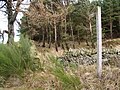
 Boundary Fence near Hackford's Dam - geograph.org.uk - 2124552.jpg 2,048 × 1,536; 1.61 MB
-
 Boundary north-east of Redburn Edge - geograph.org.uk - 4247597.jpg 1,024 × 768; 277 KB
-
 Boundary stone near Chop Hardy - geograph.org.uk - 2679180.jpg 480 × 640; 131 KB
-
 Boundary stone north of Sandyford - geograph.org.uk - 2679103.jpg 640 × 480; 90 KB
-
 Boundary Stone, Nookton Edge (east side) - geograph.org.uk - 4247652.jpg 1,024 × 768; 273 KB
-
 Boundary Stone, Nookton Edge (west side) - geograph.org.uk - 4247662.jpg 1,024 × 768; 310 KB
-
 Bridge at Far Sandyford - geograph.org.uk - 5881426.jpg 1,024 × 768; 162 KB
-
 Bridge End, Blanchland - geograph.org.uk - 4209458.jpg 1,024 × 768; 377 KB
-
 Bridge over the River Derwent - geograph.org.uk - 5780233.jpg 2,592 × 1,944; 2.35 MB
-
 Bridleway Blanchland Moor - geograph.org.uk - 171430.jpg 640 × 480; 63 KB
-
 Bridleway descending towards Blanchland - geograph.org.uk - 3036044.jpg 1,500 × 843; 1 MB
-
 Bridleway on Buchshott Fell - geograph.org.uk - 4209580.jpg 1,024 × 768; 283 KB
-
 Bridleway on Buckshot Fell - geograph.org.uk - 1210950.jpg 640 × 480; 72 KB
-
 Bridleway to Buchshott Fell - geograph.org.uk - 4209539.jpg 1,024 × 768; 289 KB
-
 Bridleway towards Edmondbyers - geograph.org.uk - 5108836.jpg 1,066 × 800; 271 KB
-
 Buckshot Fell (2) - geograph.org.uk - 2679129.jpg 640 × 480; 78 KB
-
 Buckshot Fell (3) - geograph.org.uk - 2679130.jpg 640 × 480; 80 KB
-
 Buckshot Fell - geograph.org.uk - 2679610.jpg 640 × 480; 84 KB
-

-
 Buckshott - geograph.org.uk - 3035961.jpg 1,500 × 843; 1.01 MB
-
 Buckshott Fell - geograph.org.uk - 2460534.jpg 640 × 480; 77 KB
-
 Buckshott Fell - geograph.org.uk - 907344.jpg 640 × 480; 78 KB
-
 Burnhead Dam - geograph.org.uk - 4212619.jpg 1,024 × 768; 262 KB
-
 Burnhead Dam from cairn on Bolt's Law - geograph.org.uk - 2254324.jpg 2,000 × 1,298; 2.4 MB
-
 Burnhope Burn valley - geograph.org.uk - 3379370.jpg 1,600 × 1,200; 844 KB
-
 Burnhope Dam - geograph.org.uk - 6275476.jpg 1,600 × 1,200; 643 KB
-

-
 Cairn on Bolt's Law - geograph.org.uk - 6005442.jpg 4,608 × 3,456; 4.89 MB
-
 Cairn, Bolt's Law - geograph.org.uk - 4210638.jpg 1,024 × 768; 284 KB
-
 Car park at Baybridge - geograph.org.uk - 5297905.jpg 1,499 × 781; 1.13 MB
-
 Carrier's Way on Bulbeck Common - geograph.org.uk - 171461.jpg 640 × 480; 66 KB
-
 Castleberry Sike - geograph.org.uk - 2683681.jpg 640 × 480; 109 KB
-
 Castleberry Sike - geograph.org.uk - 5214359.jpg 5,312 × 2,988; 6.49 MB
-
 Cattle grid - geograph.org.uk - 1191756.jpg 640 × 426; 111 KB
-
 Cattle grid at Packlet's Gate - geograph.org.uk - 4212598.jpg 1,024 × 768; 197 KB
-
 Cattle in Field Near Gibraltar - geograph.org.uk - 1933304.jpg 1,499 × 842; 1.27 MB
-
 Chimney at Sikehead - geograph.org.uk - 1191743.jpg 640 × 426; 90 KB
-
 Chimney at Sikehead Mine - geograph.org.uk - 5759393.jpg 2,000 × 1,264; 1.87 MB
-
 Chimney at the Sikehead lead mine - geograph.org.uk - 2603516.jpg 480 × 640; 64 KB
-
 Chimney beside Sikehead Dam - geograph.org.uk - 6503378.jpg 2,000 × 1,079; 1.48 MB
-
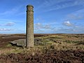 Chimney, Sikehead Lead Mine - geograph.org.uk - 4210241.jpg 1,024 × 768; 220 KB
-
 Chop Hardy (2) - geograph.org.uk - 2679615.jpg 640 × 480; 71 KB
-
 Chop Hardy (3) - geograph.org.uk - 2679622.jpg 640 × 480; 68 KB
-
 Chop Hardy - geograph.org.uk - 2679176.jpg 640 × 480; 83 KB
-
 Church of St James, Hunstanworth - geograph.org.uk - 5474232.jpg 640 × 480; 119 KB
-

-
 Collapsed flue ^ chimney east of Sikehead Dam - geograph.org.uk - 4210202.jpg 1,024 × 768; 214 KB
-
-
 Coppy Wreath (2) - geograph.org.uk - 1803701.jpg 640 × 480; 77 KB
-

-
 Corrugated metal building at Bridge End - geograph.org.uk - 6504251.jpg 1,999 × 1,257; 3.2 MB
-
 Country Road - geograph.org.uk - 168632.jpg 640 × 480; 89 KB
-
 County Durham road sign - geograph.org.uk - 6503331.jpg 2,000 × 1,139; 3.37 MB
-

-
 Crag Hill - geograph.org.uk - 5572853.jpg 640 × 480; 130 KB
-
 Culvert on the Bolt's Burn - geograph.org.uk - 2524223.jpg 640 × 480; 159 KB
-
 Curlew Sike, Boltshope Park - geograph.org.uk - 950530.jpg 640 × 480; 82 KB
-
 Currick in gathering ground of Nookton Burn - geograph.org.uk - 3219650.jpg 1,500 × 798; 941 KB
-
 Cuthbert's Currick - geograph.org.uk - 2460576.jpg 640 × 480; 116 KB
-
 Cuthbert's Hill - geograph.org.uk - 3154268.jpg 3,413 × 1,763; 826 KB
-
 Cuthbert's Hill with fence junction - geograph.org.uk - 6518189.jpg 2,000 × 1,500; 2.63 MB
-
 Dead Friars - geograph.org.uk - 1747832.jpg 2,848 × 2,136; 1.64 MB
-
 Dead Friars - geograph.org.uk - 1968326.jpg 3,888 × 2,267; 733 KB
-
 Derwent Head - geograph.org.uk - 3477307.jpg 640 × 480; 125 KB
-
 Derwent Reservoir from road south of Rope Farm - geograph.org.uk - 4209522.jpg 1,024 × 766; 250 KB
-
 Disused flue of lead smelter - geograph.org.uk - 4210057.jpg 1,024 × 768; 339 KB
-
 Disused flue of lead smelter - geograph.org.uk - 4210164.jpg 1,024 × 767; 396 KB
-

-

-

-

-

-

-

-

-
 Disused quarries at Abbey Weathers - geograph.org.uk - 4209918.jpg 1,024 × 768; 309 KB
-

-
 Disused quarry, Allenshields ^ Buckshott Moor - geograph.org.uk - 4210190.jpg 1,024 × 768; 301 KB
-

-
 Dry Rigg (3) - geograph.org.uk - 1730713.jpg 640 × 479; 80 KB
-
 Dry Rigg (4) - geograph.org.uk - 1730727.jpg 640 × 480; 88 KB
-
 Dry Rigg - geograph.org.uk - 2753173.jpg 1,500 × 843; 1.21 MB
-
 East dam at Sikehead Dams - geograph.org.uk - 4210214.jpg 1,024 × 768; 294 KB
-
 Edmondbyers Common - geograph.org.uk - 2679097.jpg 640 × 480; 61 KB
-

-

-

-
 Ellen Shaft, Sikehead Lead Mine - geograph.org.uk - 4210237.jpg 768 × 1,024; 238 KB
-
 Entrance to Dead Friars Quarry - geograph.org.uk - 1747817.jpg 2,848 × 2,136; 1.64 MB
-
 Estate road on Nookton Fell - geograph.org.uk - 3798818.jpg 1,500 × 1,125; 1.22 MB
-
 Estate road reaching Taylor's Shaft - geograph.org.uk - 3035649.jpg 1,500 × 843; 1.1 MB
-

-

-
 Farmland around Stony Burn - geograph.org.uk - 3289838.jpg 640 × 480; 83 KB
-
 Fence crossing heather moor south-west of Cuthbert's Hill - geograph.org.uk - 2255530.jpg 2,000 × 1,500; 2.68 MB
-
 Fence crossing moorland replacing a wall along Nookton Edge - geograph.org.uk - 5343490.jpg 1,500 × 1,001; 1.45 MB
-
 Fence junction along county boundary line - geograph.org.uk - 5343424.jpg 1,500 × 760; 904 KB
-
 Fence junction at Redburn Edge - geograph.org.uk - 4247432.jpg 1,024 × 768; 258 KB
-
 Fence junction near Cuthbert's Hill - geograph.org.uk - 2124545.jpg 2,048 × 1,536; 1.28 MB
-
 Fence line with gatepost at Packlet's Gate - geograph.org.uk - 6518184.jpg 2,000 × 1,332; 2.17 MB
-
 Fence on Hunstanworth Moor - geograph.org.uk - 1758213.jpg 2,848 × 2,136; 1.72 MB
-

-

-
 Fields east of Riddlehamhope - geograph.org.uk - 5789398.jpg 640 × 480; 124 KB
-
 Flowering heather between wall and road - geograph.org.uk - 6567998.jpg 2,000 × 1,019; 1.51 MB
-
 Flowering heather on slope descending to Beldon Burn - geograph.org.uk - 6567970.jpg 2,000 × 1,333; 2.33 MB
-
 Flue and chimney at Sikehead Lead Mine - geograph.org.uk - 5408325.jpg 600 × 800; 117 KB
-
 Footbridge at outlet of Burnhead Dam - geograph.org.uk - 4212651.jpg 1,024 × 768; 212 KB
-
 Footbridge near Derwent Head - geograph.org.uk - 5648450.jpg 1,024 × 767; 380 KB
-

-
 Footbridge over Nookton Burn at Gibraltar Banks - geograph.org.uk - 5220993.jpg 5,312 × 2,988; 7.16 MB
-
 Footbridge over Nookton Burn at Gibraltar Banks - geograph.org.uk - 5221134.jpg 5,312 × 2,988; 7.53 MB
-
 Footbridge over the Bolt's Burn in Deborah Plantation - geograph.org.uk - 6755234.jpg 4,000 × 3,000; 6.28 MB
-

-

-
-
 Footpath between Nookton East Park and Gibraltar Banks - geograph.org.uk - 5220396.jpg 5,312 × 2,988; 5.65 MB
-
 Footpath descending Gibraltar Banks - geograph.org.uk - 5220976.jpg 5,312 × 2,988; 5.84 MB
-
 Footpath from Wagtail to Townfield - geograph.org.uk - 2603564.jpg 640 × 480; 104 KB
-
 Footpath in Deborah Plantation - geograph.org.uk - 6755193.jpg 4,000 × 3,000; 5.31 MB
-
 Footpath near Rose Cottage - geograph.org.uk - 6006032.jpg 4,608 × 3,456; 5.6 MB
-

-
 Footpath to Cuthbert's Hill crossing the moor road - geograph.org.uk - 5286218.jpg 5,312 × 2,988; 6.08 MB
-

-
 Footpath towards Sikehead Dams - geograph.org.uk - 5108725.jpg 1,066 × 800; 221 KB
-
 Forest road in Deborah Plantation - geograph.org.uk - 6274948.jpg 1,600 × 1,112; 949 KB
-
 Forestry track in Boltsburn Plantation - geograph.org.uk - 6006040.jpg 4,608 × 3,456; 7.43 MB
-
 Former Jeffrey's House, Jeffrey's Rake - geograph.org.uk - 1824024.jpg 3,872 × 2,592; 3.04 MB
-
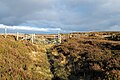 Gate in fence line along path - geograph.org.uk - 5587963.jpg 1,500 × 1,002; 1.57 MB
-
 Gate in fence on Bolt's Law - geograph.org.uk - 4750894.jpg 1,500 × 963; 1.21 MB
-
 Gate on boundary of Buckshott Fell - geograph.org.uk - 4209575.jpg 1,024 × 768; 325 KB
-
 Gibraltar (2) - geograph.org.uk - 3478473.jpg 640 × 480; 81 KB
-
 Gibraltar - door to barn - geograph.org.uk - 3478490.jpg 480 × 640; 119 KB

_pele_tower_in_the_grounds_of_St._James%27s_Church,_Hunstanworth_(2)_-_geograph.org.uk_-_3473666.jpg)
_pele_tower_in_the_grounds_of_St._James%27s_Church,_Hunstanworth_-_geograph.org.uk_-_2600905.jpg)
_the_Sikehead_lead_smelting_flue_(2)_-_geograph.org.uk_-_2864205.jpg)
_the_Sikehead_lead_smelting_flue_-_geograph.org.uk_-_2863997.jpg)
_a_Sikehead_lead_smelting_flue_-_geograph.org.uk_-_2863714.jpg)


_-_geograph.org.uk_-_2863971.jpg)


_-_geograph.org.uk_-_685010.jpg)


_-_geograph.org.uk_-_4438144.jpg)


_-_geograph.org.uk_-_511782.jpg)
_-_geograph.org.uk_-_510802.jpg)
_-_geograph.org.uk_-_511792.jpg)
_-_geograph.org.uk_-_511804.jpg)


_-_geograph.org.uk_-_1607582.jpg)
_-_geograph.org.uk_-_1607584.jpg)


_-_geograph.org.uk_-_1606175.jpg)
_-_geograph.org.uk_-_1606177.jpg)
_-_geograph.org.uk_-_1606178.jpg)
_-_geograph.org.uk_-_1606180.jpg)
_-_geograph.org.uk_-_1607590.jpg)
_-_geograph.org.uk_-_1607609.jpg)
_-_geograph.org.uk_-_1607616.jpg)
_-_geograph.org.uk_-_1607617.jpg)


_-_geograph.org.uk_-_1607581.jpg)
_-_geograph.org.uk_-_1607586.jpg)
_-_geograph.org.uk_-_1607603.jpg)

_-_geograph.org.uk_-_1606184.jpg)


_-_geograph.org.uk_-_4247652.jpg)
_-_geograph.org.uk_-_4247662.jpg)


_-_geograph.org.uk_-_2679129.jpg)
_-_geograph.org.uk_-_2679130.jpg)


_-_geograph.org.uk_-_2679615.jpg)
_-_geograph.org.uk_-_2679622.jpg)


_-_geograph.org.uk_-_1803701.jpg)


_-_geograph.org.uk_-_2864921.jpg)

_-_geograph.org.uk_-_3480644.jpg)
_-_geograph.org.uk_-_3480655.jpg)
_-_geograph.org.uk_-_3486689.jpg)

_-_geograph.org.uk_-_3480689.jpg)


_-_geograph.org.uk_-_1730713.jpg)
_-_geograph.org.uk_-_1730727.jpg)


_-_geograph.org.uk_-_2679626.jpg)
_-_geograph.org.uk_-_2679629.jpg)


_-_geograph.org.uk_-_3478473.jpg)
