Category:Hulver Street
Jump to navigation
Jump to search
hamlet in Suffolk, United Kingdom  | |||||
| Upload media | |||||
| Instance of | |||||
|---|---|---|---|---|---|
| Location | Henstead with Hulver Street, Waveney, Suffolk, East of England, England | ||||
 | |||||
English: Hulver Street is a hamlet in the civil parish of Henstead with Hulver Street, in the Waveney district, in the county of Suffolk, England.
Subcategories
This category has the following 2 subcategories, out of 2 total.
V
- Hulver Village Hall (3 F)
- Hulver Village Sign (4 F)
Media in category "Hulver Street"
The following 16 files are in this category, out of 16 total.
-
 B1127 The Street, Hulver Street - geograph.org.uk - 3510413.jpg 3,072 × 2,304; 1.15 MB
-
 B1127 The Street, Hulver Street - geograph.org.uk - 3510414.jpg 3,072 × 2,304; 1.24 MB
-
 B1127 The Street, Hulver Street - geograph.org.uk - 3510419.jpg 3,072 × 2,304; 1.31 MB
-
 B1127 The Street, Hulver Street - geograph.org.uk - 3510830.jpg 3,072 × 2,304; 1.26 MB
-
 Bad bend at the bottom of Hulver Street - geograph.org.uk - 2155496.jpg 640 × 480; 147 KB
-
 Disused Public House, Hulver - geograph.org.uk - 439884.jpg 640 × 480; 55 KB
-
 Farmland south of Goldings Farm - geograph.org.uk - 971318.jpg 640 × 427; 185 KB
-
 Fishing Lake near Hulver Street - geograph.org.uk - 2025516.jpg 640 × 480; 40 KB
-
 Golding's Farm - geograph.org.uk - 971326.jpg 640 × 427; 174 KB
-
 Hulver name sign - geograph.org.uk - 3508654.jpg 3,072 × 2,304; 1.55 MB
-
 Jay's Hill Road, Hulver Street - geograph.org.uk - 3510447.jpg 3,072 × 2,304; 1.5 MB
-
 Jay's Hill Road, Hulver Street - geograph.org.uk - 3510456.jpg 3,072 × 2,304; 1.4 MB
-
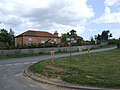
 Junction at Hulver Street - geograph.org.uk - 3509423.jpg 3,648 × 2,736; 4.37 MB
-

-
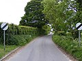
 The B1127 running through Hulver Street - geograph.org.uk - 2520885.jpg 768 × 1,024; 219 KB
-
 Track to Woodrow Farm, Hulver Street - geograph.org.uk - 3621953.jpg 3,264 × 2,448; 2.47 MB


