Category:Hulcote and Salford
Jump to navigation
Jump to search
English: Hulcote and Salford is a civil parish in the district of Central Bedfordshire in the county of Bedfordshire.

civil parish in Central Bedfordshire, England  | |||||
| Upload media | |||||
| Instance of | |||||
|---|---|---|---|---|---|
| Location | Central Bedfordshire, Bedfordshire, East of England, England | ||||
| Population |
| ||||
 | |||||
Subcategories
This category has the following 2 subcategories, out of 2 total.
H
S
Media in category "Hulcote and Salford"
The following 68 files are in this category, out of 68 total.
-
 A rest on Bunyan's Way - geograph.org.uk - 3115953.jpg 1,600 × 1,068; 835 KB
-
 A tributary of the Ouzel from Salford bridge - geograph.org.uk - 3014727.jpg 1,600 × 1,068; 657 KB
-
 Approaching Broughton Road, Salford - geograph.org.uk - 5309449.jpg 2,048 × 1,536; 1.47 MB
-
 Bench in the centre of Reynold's woods - geograph.org.uk - 3115950.jpg 1,600 × 1,068; 740 KB
-
 Borough of Milton Keynes , Grassy Field - geograph.org.uk - 5979096.jpg 6,000 × 4,000; 6.92 MB
-
 Bridleway by business unit - geograph.org.uk - 3115939.jpg 1,600 × 1,068; 515 KB
-
 Broughton Road goes over the M1 - geograph.org.uk - 3007460.jpg 1,600 × 1,069; 385 KB
-
 Central Bedfordshire , Field - geograph.org.uk - 5979108.jpg 6,000 × 4,000; 6.94 MB
-
 Central Bedfordshire , M1 Motorway - geograph.org.uk - 5979100.jpg 6,000 × 4,000; 6.99 MB
-
 Central Bedfordshire , M1 Motorway - geograph.org.uk - 5979103.jpg 6,000 × 4,000; 6 MB
-
 Central Bedfordshire , M1 Motorway - geograph.org.uk - 5979105.jpg 6,000 × 4,000; 6.08 MB
-
 Central Bedfordshire , M1 Motorway - geograph.org.uk - 5979109.jpg 6,000 × 4,000; 6.42 MB
-
 Central Bedfordshire , Ploughed Field - geograph.org.uk - 5979107.jpg 6,000 × 4,000; 5.8 MB
-
 Contraflow on the M1 southbound - geograph.org.uk - 4324950.jpg 640 × 424; 66 KB
-
 Copse across the cornfield - geograph.org.uk - 3007442.jpg 1,600 × 1,067; 417 KB
-
 Cranfield Airport from the air - geograph.org.uk - 2966049.jpg 480 × 640; 126 KB
-
 Cranfield Road, Salford - geograph.org.uk - 5309451.jpg 1,990 × 1,454; 823 KB
-
 Cranfield Road, Salford - geograph.org.uk - 5309453.jpg 2,012 × 1,488; 772 KB
-
 Cranfield Road, Salford - geograph.org.uk - 5309455.jpg 2,048 × 1,536; 768 KB
-
 Drainage channel by a lost footpath - geograph.org.uk - 3113311.jpg 1,200 × 1,600; 608 KB
-
 Drive through Reynold's woods - geograph.org.uk - 3115954.jpg 1,600 × 1,072; 666 KB
-
 Driveway to Hulcote Manor - geograph.org.uk - 2181585.jpg 2,272 × 1,704; 739 KB
-
 Electricity supply lines - geograph.org.uk - 3112517.jpg 1,200 × 1,600; 498 KB
-
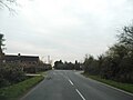
 Entering Hulcote - geograph.org.uk - 4628612.jpg 640 × 480; 68 KB
-
 Entering Salford - geograph.org.uk - 4729201.jpg 640 × 480; 95 KB
-
 Field by Cranfield Road - geograph.org.uk - 5309459.jpg 2,048 × 1,536; 942 KB
-

-
 Footbridge on the path across the fields - geograph.org.uk - 3115946.jpg 1,200 × 1,600; 436 KB
-
 Footbridge over the M1 - geograph.org.uk - 4699124.jpg 640 × 398; 32 KB
-
 Footbridge over the M1 - geograph.org.uk - 4699126.jpg 640 × 426; 28 KB
-
 Footbridge over the M1 - geograph.org.uk - 4730012.jpg 640 × 426; 50 KB
-
 Footbridge over the M1 - geograph.org.uk - 4730445.jpg 640 × 327; 33 KB
-
 Footpath off Salford Road - geograph.org.uk - 4628613.jpg 640 × 480; 84 KB
-
 Footpath towards Aspley Hall - geograph.org.uk - 3014711.jpg 1,600 × 1,068; 449 KB
-
 Former school, Salford and the Mary Agate village hall - geograph.org.uk - 3851779.jpg 4,320 × 3,240; 2.86 MB
-
 Gate on Bunyan's Way with Holcot Wood behind - geograph.org.uk - 3115957.jpg 1,600 × 1,068; 635 KB
-
 Gate on the path to the woods - geograph.org.uk - 3115942.jpg 1,200 × 1,600; 801 KB
-
 Gate onto overgrown path to the M1 - geograph.org.uk - 3113269.jpg 1,600 × 1,068; 608 KB
-
 Gated entrance to the former Salford quarry - geograph.org.uk - 2476109.jpg 1,024 × 768; 110 KB
-
 Grazing and hedgerow near Hulcote - geograph.org.uk - 4729207.jpg 640 × 480; 66 KB
-
 Grazing near Hulcote - geograph.org.uk - 4628601.jpg 640 × 480; 66 KB
-
 Grazing near Whitsundoles Farm - geograph.org.uk - 4729198.jpg 640 × 480; 72 KB
-
 Heading east from Salford - geograph.org.uk - 4729206.jpg 640 × 480; 64 KB
-
 Heading south east towards Salford - geograph.org.uk - 4729199.jpg 640 × 480; 81 KB
-
 M1 near Lower End - geograph.org.uk - 4325029.jpg 640 × 459; 67 KB
-
 M1, southbound - geograph.org.uk - 4730008.jpg 640 × 426; 44 KB
-

-
 Mobile phone mast by the bridleway - geograph.org.uk - 3115936.jpg 1,200 × 1,600; 511 KB
-
 Observatory - geograph.org.uk - 2181608.jpg 2,272 × 1,704; 679 KB
-
 Path over the M1 - geograph.org.uk - 3014838.jpg 1,200 × 1,600; 770 KB
-
 Path through Reynold's Woods - geograph.org.uk - 3115955.jpg 1,200 × 1,600; 843 KB
-
 Public Footpath - geograph.org.uk - 2181629.jpg 1,704 × 2,272; 670 KB
-
 Ramp up to the footbridge over the M1 - geograph.org.uk - 3113290.jpg 1,600 × 1,068; 601 KB
-
 Road Junction - geograph.org.uk - 2336892.jpg 2,272 × 1,704; 1.66 MB
-
 Roadside tree near the M1 motorway - geograph.org.uk - 2476111.jpg 1,600 × 1,200; 191 KB
-
 Rural warehouse and pallets - geograph.org.uk - 3112883.jpg 1,600 × 1,068; 474 KB
-
 Salford Road - geograph.org.uk - 4729209.jpg 640 × 480; 67 KB
-
 Salford Road - geograph.org.uk - 4729213.jpg 640 × 480; 55 KB
-
 Stile and path to Aspley Hall - geograph.org.uk - 3112871.jpg 1,600 × 1,068; 622 KB
-
 The old Salford Road now a bridleway - geograph.org.uk - 3113317.jpg 1,600 × 1,067; 376 KB
-
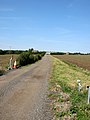
 Track by the field edge - geograph.org.uk - 3007455.jpg 1,600 × 1,067; 494 KB
-
 Track to Corr's Farm business park - geograph.org.uk - 3112515.jpg 1,200 × 1,600; 474 KB
-
 Track to Holcotmoors Farm - geograph.org.uk - 3112520.jpg 1,200 × 1,600; 502 KB
-
 Track to Hulcote Farm - geograph.org.uk - 4729212.jpg 640 × 480; 70 KB
-
 Track to Mill Farm - geograph.org.uk - 4729200.jpg 640 × 480; 87 KB
-
 Vestige of the original road to Cranfield - geograph.org.uk - 3112510.jpg 1,600 × 1,068; 608 KB
-
 Way marker but the way is hard to find - geograph.org.uk - 3113283.jpg 1,600 × 1,068; 768 KB
-
 Yard Entrance - geograph.org.uk - 2181632.jpg 2,272 × 1,704; 712 KB


