Category:Huis Den Treek
Jump to navigation
Jump to search
| Object location | | View all coordinates using: OpenStreetMap |
|---|
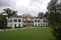
building in Leusden, Netherlands  | |||||
| Upload media | |||||
| Instance of | |||||
|---|---|---|---|---|---|
| Part of | |||||
| Location | Leusden, Utrecht, Netherlands | ||||
| Street address |
| ||||
| Located on street |
| ||||
| Heritage designation |
| ||||
 | |||||
|
This is a category about rijksmonument number 512201
|
| Address |
|
Media in category "Huis Den Treek"
The following 11 files are in this category, out of 11 total.
-
 Achterzijde - Leusden-Zuid - 20139193 - RCE.jpg 1,200 × 804; 180 KB
-

-
 Den Treek (Treekerweg, Leusden).jpg 1,280 × 960; 485 KB
-
 Dentreek 2742.png 4,290 × 2,856; 16.85 MB
-
 Exterieur OVERZICHT ACHTERGEVEL - Leusden-Zuid - 20340020 - RCE.jpg 1,200 × 1,134; 447 KB
-
 Exterieur OVERZICHT VOORGEVEL - Leusden-Zuid - 20314162 - RCE.jpg 1,183 × 1,200; 391 KB
-
 HUA-107483-Gezicht op het huis Den Treek bij Leusden.jpg 3,927 × 3,040; 2.64 MB
-
 RM25800 Den Treek.JPG 4,320 × 3,240; 2.15 MB
-
 Voor- en zijgevel - Leusden-Zuid - 20139191 - RCE.jpg 1,200 × 812; 307 KB
-
 Voorzijde - Leusden-Zuid - 20139190 - RCE.jpg 1,200 × 806; 371 KB
-
 Zij- en vooraanzicht - Leusden-Zuid - 20139192 - RCE.jpg 1,200 × 804; 240 KB


.jpg)


