Category:Hucclecote
Jump to navigation
Jump to search
village in Gloucester, Gloucestershire, England, United Kingdom  | |||||
| Upload media | |||||
| Instance of | |||||
|---|---|---|---|---|---|
| Location | Gloucester, Gloucestershire, South West England, England | ||||
 | |||||
English: Hucclecote is an area of Gloucester in Gloucestershire, England situated on the old Roman road connecting Gloucester with Barnwood, Brockworth, Cirencester and Cheltenham
Español: Hucclecote es una localidad del condado de Gloucestershire en Inglaterra, situada a los márgenes de una antigua calzada romana que unía la ciudad de Gloucester (entonces Glevum) con Barnwood, Brockworth y Cirencester.
Media in category "Hucclecote"
The following 16 files are in this category, out of 16 total.
-
 Children's corner in Hucclecote library (31456499617).jpg 1,024 × 768; 668 KB
-
 Farmland near Barnwood - geograph.org.uk - 1069976.jpg 640 × 480; 125 KB
-
 Folland Avenue, Hucclecote, Gloucester - geograph.org.uk - 1300140.jpg 640 × 479; 154 KB
-

-
 Hucclecote Court - geograph.org.uk - 77872.jpg 640 × 480; 92 KB
-
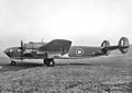 IWM-ATP10779D Albemarle 205126600.jpg 800 × 566; 192 KB
-
 Post Office, Hucclecote, Gloucester. (2630643415).jpg 1,280 × 960; 225 KB
-
 STAGECOACH WEST - Flickr - secret coach park (16).jpg 2,679 × 1,784; 2.05 MB
-
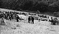 The Battle of Britain HU69164.jpg 2,480 × 1,431; 1.12 MB
-
 Trig point on Churchdown Hill - geograph.org.uk - 1608165.jpg 640 × 426; 95 KB
-
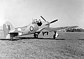 Typhoonnew.jpg 1,000 × 700; 230 KB
-
 Abbeymead Primary School - geograph.org.uk - 115653.jpg 640 × 480; 94 KB
-
 Hucclecote Millennium Garden - geograph.org.uk - 77864.jpg 640 × 480; 115 KB
-
 Kingscroft Road, Hucclecote - geograph.org.uk - 60390.jpg 640 × 480; 68 KB
-
 Kingscroft Road, Hucclecote - geograph.org.uk - 61961.jpg 640 × 480; 82 KB
-
 The Turmut Hoer Abbeymead - geograph.org.uk - 115651.jpg 640 × 480; 98 KB
.jpg)


.jpg)
.jpg)


