Category:Hoxne
Jump to navigation
Jump to search

village and civil parish in Suffolk, England, UK  | |||||
| Upload media | |||||
| Instance of | |||||
|---|---|---|---|---|---|
| Location | Mid Suffolk, Suffolk, East of England, England | ||||
| Population |
| ||||
 | |||||
Deutsch: Hoxne ist eine Gemeinde (parish) und ein Bezirk (ward) im Norden der englischen Grafschaft Suffolk im District Mid Suffolk. Der Ort Hoxne liegt etwa einen Kilometer südlich des Flusses Waveney, der die Grenze zu Norfolk bildet. Bei der Volkszählung 2001 wurden 813 Einwohner für die Gemeinde und 1.932 für den Bezirk Hoxne ermittelt.
English: Hoxne (pronounced Hoxen) is an anciently established village in the Mid Suffolk district of Suffolk, England. The parish is irregularly shaped, covering the villages of Hoxne, Cross Street and Heckfield Green, with a 'tongue' extending southwards to take in part of the former RAF Horham airfield. Hoxne features as Lymston village in the Agatha Christie's Miss Marple episode "The Moving Finger" (1985).
Subcategories
This category has the following 16 subcategories, out of 16 total.
2
A
- Abbey Farm, Hoxne (1 F)
C
- Chickering (38 F)
- Cross Street, Hoxne (11 F)
E
- Elm House, Hoxne (5 F)
H
- Heckfield Green (2 F)
- Hoxne War Memorial Board (2 F)
- Hoxne Water Mill (2 F)
M
- Maps of Hoxne (7 F)
P
R
S
- South Green, Suffolk (7 F)
- St Edmund's Memorial, Hoxne (9 F)
- The Swan, Hoxne (8 F)
V
- Hoxne Village Hall (11 F)
Pages in category "Hoxne"
This category contains only the following page.
Media in category "Hoxne"
The following 200 files are in this category, out of 429 total.
(previous page) (next page)-
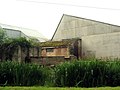 Derelict buildings and pond. - geograph.org.uk - 472407.jpg 640 × 480; 54 KB
-
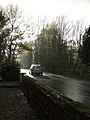 Heavy rain - geograph.org.uk - 610826.jpg 480 × 640; 94 KB
-
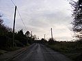
 Hoxne village - geograph.org.uk - 611565.jpg 640 × 480; 80 KB
-
 Hoxne Village-geograph-2765707.jpg 1,024 × 768; 244 KB
-
 Low Street, Hoxne - geograph.org.uk - 324124.jpg 640 × 427; 123 KB
-
 Low Street, Hoxne-geograph-3277093.jpg 3,648 × 2,736; 2.29 MB
-
 The Old Police House, Hoxne-geograph-2235460.jpg 640 × 480; 154 KB
-
 Utility building with radio mast. - geograph.org.uk - 472402.jpg 640 × 480; 45 KB
-
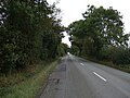
 30 mph signs into Denham - geograph.org.uk - 3911611.jpg 640 × 480; 79 KB
-
 41 Low Street, Hoxne (geograph 7557609).jpg 1,600 × 900; 640 KB
-
 53 and 54 Low Street, Hoxne (geograph 7557605).jpg 1,600 × 900; 707 KB
-
 A Packet for every Pocket - geograph.org.uk - 4524019.jpg 508 × 640; 454 KB
-

-
 Abbey Hill, Hoxne - geograph.org.uk - 2705443.jpg 3,072 × 2,304; 1.47 MB
-
 Abbey Hill, Hoxne - geograph.org.uk - 2705780.jpg 3,072 × 2,304; 1.24 MB
-
 Air raid shelter at Denham Corner - geograph.org.uk - 4521248.jpg 640 × 507; 568 KB
-
 Alpacas at Town Farm, Denham - geograph.org.uk - 3911633.jpg 640 × 480; 84 KB
-
 Alpacas at Town Farm, Denham - geograph.org.uk - 3911635.jpg 640 × 480; 65 KB
-
 Ancient oak tree, Hoxne - geograph.org.uk - 3277568.jpg 3,648 × 2,736; 3.36 MB
-
 Approaching Red Bridge on the B1118 - geograph.org.uk - 4179765.jpg 1,227 × 2,013; 393 KB
-
 Avenue and roadway to Park Farm - geograph.org.uk - 3911246.jpg 640 × 480; 114 KB
-
 B1117 Leaving Horham towards Eye - geograph.org.uk - 3911234.jpg 640 × 480; 89 KB
-
 B1118 at Red Bridge entering Norfolk - geograph.org.uk - 4233625.jpg 3,072 × 2,268; 3.03 MB
-
 B1118 Chickering Road - geograph.org.uk - 2759290.jpg 3,072 × 2,304; 1.46 MB
-
 B1118 Chickering Road at Green Street - geograph.org.uk - 2759307.jpg 3,072 × 2,304; 1.46 MB
-
 B1118 Chickering Road at Green Street - geograph.org.uk - 2759308.jpg 3,072 × 2,304; 1.38 MB
-
 B1118 Chickering Road, Hoxne - geograph.org.uk - 2673173.jpg 3,072 × 2,304; 1.46 MB
-
 B1118 Green Street at Chickering Corner - geograph.org.uk - 2673495.jpg 3,072 × 2,304; 1.4 MB
-
 B1118 Green Street ^ footpath - geograph.org.uk - 3992540.jpg 3,072 × 2,157; 1.65 MB
-
 B1118 Green Street, Hoxne - geograph.org.uk - 4382541.jpg 2,784 × 2,086; 2.44 MB
-
 B1118 Green Street, Hoxne - geograph.org.uk - 4382551.jpg 3,072 × 2,107; 2.55 MB
-
 B1118 Green Street, Hoxne - geograph.org.uk - 4382606.jpg 3,072 × 2,304; 1.74 MB
-
 B1118 Green Street, Hoxne - geograph.org.uk - 4382608.jpg 3,072 × 2,304; 1.72 MB
-
 B1118 junction with Low Street, Hoxne - geograph.org.uk - 2672995.jpg 3,072 × 2,304; 1.41 MB
-
 B1118 towards Hoxne - geograph.org.uk - 5169170.jpg 640 × 480; 67 KB
-
 B1118 towards Hoxne - geograph.org.uk - 5169177.jpg 640 × 480; 87 KB
-
 B1118 towards Oakley - geograph.org.uk - 5169196.jpg 640 × 480; 47 KB
-
 Banham's brickworks (disused) - geograph.org.uk - 4552327.jpg 640 × 453; 292 KB
-
 Banham's brickworks (disused) - geograph.org.uk - 4552334.jpg 640 × 564; 422 KB
-
 Banham's brickworks, Hoxne - geograph.org.uk - 3277571.jpg 3,648 × 2,736; 2.7 MB
-
 Birch Farm Hoxne - geograph.org.uk - 3277107.jpg 3,648 × 2,736; 3.7 MB
-
 Brakey Wood Hoxne Suffolk - geograph.org.uk - 5465814.jpg 2,592 × 3,872; 2.76 MB
-
 Brian Huggins Accident Repair Centre - geograph.org.uk - 2698526.jpg 3,072 × 2,304; 1.49 MB
-
 Bridge House and Bridge Cottage, Hoxne (geograph 7557558).jpg 1,600 × 900; 574 KB
-
 Bridge in Wittons Lane - geograph.org.uk - 2759318.jpg 3,072 × 2,304; 1.5 MB
-
 Broken Footpath Sign - geograph.org.uk - 3145802.jpg 1,024 × 768; 231 KB
-
 Broom Farm, Reading Green - geograph.org.uk - 4346507.jpg 640 × 480; 141 KB
-
 Building on the Technical site - geograph.org.uk - 4524009.jpg 640 × 480; 358 KB
-
 Building on the Technical site - geograph.org.uk - 4524015.jpg 640 × 480; 276 KB
-
 Bungalow Farm near Hoxne, Suffolk - geograph.org.uk - 2934083.jpg 1,600 × 851; 269 KB
-
 Byway to Gissing Farm - geograph.org.uk - 2705158.jpg 3,072 × 2,304; 1.33 MB
-
 Byway to Gissing Farm - geograph.org.uk - 2705163.jpg 3,072 × 2,304; 1.3 MB
-
 Car park and gate into Brakey Wood - geograph.org.uk - 6073683.jpg 3,264 × 2,448; 2.62 MB
-
 Car Park of St.Peter ^ St.Paul Church, Hoxne - geograph.org.uk - 3993378.jpg 3,072 × 2,304; 1.7 MB
-
 Cat's Lane - geograph.org.uk - 3147403.jpg 768 × 1,024; 353 KB
-
 Cats Lane Bridleway - geograph.org.uk - 2699348.jpg 2,304 × 3,072; 1.69 MB
-
 Cats Lane Bridleway - geograph.org.uk - 2699352.jpg 2,304 × 3,072; 1.68 MB
-
 Chestnut Tree Farm - geograph.org.uk - 3147454.jpg 1,024 × 768; 290 KB
-
 Chickering Bridge on Chickering Road - geograph.org.uk - 2709763.jpg 3,072 × 2,304; 1.37 MB
-
 Chickering Road (B1118) - geograph.org.uk - 5169179.jpg 640 × 480; 83 KB
-
 Chickering Road (B1118) - geograph.org.uk - 5169185.jpg 640 × 480; 77 KB
-
 Chickering Road - geograph.org.uk - 2709734.jpg 3,072 × 2,304; 1.38 MB
-
 Chickering Road - geograph.org.uk - 2709746.jpg 3,072 × 2,304; 1.32 MB
-
 Chickering Road - geograph.org.uk - 2709761.jpg 3,072 × 2,304; 1.45 MB
-
 Chickering Road, Chickering - geograph.org.uk - 5223690.jpg 4,608 × 3,456; 2.08 MB
-
 Chickering Road, Chickering - geograph.org.uk - 5223695.jpg 4,608 × 3,456; 2.04 MB
-
 Chickering, The Depperhaugh - geograph.org.uk - 6466714.jpg 7,239 × 4,826; 5.16 MB
-
 Chickering, The Depperhaugh - geograph.org.uk - 6466715.jpg 4,184 × 2,790; 1.93 MB
-
 Church Road - geograph.org.uk - 3147444.jpg 1,024 × 768; 223 KB
-
 Clink Hill - geograph.org.uk - 2705174.jpg 2,640 × 1,980; 789 KB
-
 Clink Hill - geograph.org.uk - 2705182.jpg 3,072 × 2,304; 1.4 MB
-
 Clink Hill - geograph.org.uk - 3145768.jpg 1,024 × 768; 219 KB
-
 Clink Hill looking towards Heckfield Green - geograph.org.uk - 2705161.jpg 3,072 × 2,304; 1.42 MB
-
 Clink Hill ^ the footpath to Cross Street - geograph.org.uk - 2705169.jpg 3,072 × 2,304; 1.52 MB
-
 Cottage at Cross Street - geograph.org.uk - 4552322.jpg 640 × 539; 451 KB
-
 Country Lane - geograph.org.uk - 1546848.jpg 640 × 480; 116 KB
-
 Country Road - geograph.org.uk - 3852288.jpg 1,024 × 768; 302 KB
-

-
 Crop field, Nuttery - geograph.org.uk - 5169198.jpg 640 × 480; 81 KB
-
 Crop fields as seen from Clink Hill - geograph.org.uk - 4552308.jpg 640 × 480; 275 KB
-
 Crop fields by Denham Corner - geograph.org.uk - 4520543.jpg 640 × 480; 412 KB
-
 Crop fields, Hoxne - geograph.org.uk - 4552343.jpg 640 × 480; 462 KB
-
 Cut Mark Hoxne Goldbrook Bridge - geograph.org.uk - 4994423.jpg 1,015 × 860; 216 KB
-
 Cut Mark Hoxne St Peter's and St Paul's Church - geograph.org.uk - 4994437.jpg 1,466 × 1,600; 1.15 MB
-
 Cut Mark Hoxne Swan Inn PH - geograph.org.uk - 5462036.jpg 2,783 × 3,085; 4.84 MB
-
 Denham Road - geograph.org.uk - 2709675.jpg 3,072 × 2,304; 1.4 MB
-
 Denham Road - geograph.org.uk - 2709678.jpg 3,072 × 2,304; 1.39 MB
-
 Denham Road - geograph.org.uk - 2709679.jpg 3,072 × 2,304; 1.4 MB
-
 Denham Road - geograph.org.uk - 2709681.jpg 3,072 × 2,304; 1.52 MB
-
 Denham Road - geograph.org.uk - 2709682.jpg 3,072 × 2,304; 1.45 MB
-
 Denham Road - geograph.org.uk - 2709690.jpg 3,072 × 2,304; 1.28 MB
-
 Denham Road - geograph.org.uk - 2709720.jpg 3,072 × 2,304; 1.5 MB
-
 Denham Road Telephone Box - geograph.org.uk - 2706197.jpg 2,304 × 3,072; 1.48 MB
-
 Denham Road ^ the footpath to Cat's Lane - geograph.org.uk - 2709698.jpg 3,072 × 2,304; 1.51 MB
-
 Denham Road ^ the footpath to Chickering Road - geograph.org.uk - 2709685.jpg 2,640 × 1,980; 1.27 MB
-
 Denham Road ^ the footpath to Chickering Road - geograph.org.uk - 2709714.jpg 3,072 × 2,304; 1.44 MB
-

-
 Denham Road, Cross Street - geograph.org.uk - 2706192.jpg 2,304 × 3,072; 1.28 MB
-
 Denham Road, Denham - geograph.org.uk - 3911637.jpg 640 × 480; 55 KB
-
 Denham Road, Hoxne - geograph.org.uk - 2706147.jpg 2,304 × 3,072; 1.29 MB
-

-

-
 Denham Street, Airfield - geograph.org.uk - 6540963.jpg 6,380 × 4,253; 4.9 MB
-
 Denham Street, Airfield - geograph.org.uk - 6540965.jpg 6,849 × 4,565; 5.43 MB
-
 Denham Street, Small Industrial Estate - geograph.org.uk - 6540952.jpg 6,343 × 4,229; 5.3 MB
-
 Denham Street, Small Industrial Estate - geograph.org.uk - 6540957.jpg 7,210 × 4,806; 6.45 MB
-
 Denham village hall (interior) - geograph.org.uk - 4543952.jpg 640 × 491; 393 KB
-
 Denham village hall - geograph.org.uk - 4521266.jpg 640 × 480; 375 KB
-
 Denham Village Name sign - geograph.org.uk - 4442297.jpg 2,192 × 2,914; 4.75 MB
-
 Denham, 'South House' - geograph.org.uk - 6540805.jpg 6,792 × 4,528; 6.04 MB
-
 Denham, Cereal crop - geograph.org.uk - 6540802.jpg 6,961 × 4,641; 5.66 MB
-
 Denham, Church Road where it joins Denham Road - geograph.org.uk - 6540807.jpg 6,685 × 4,456; 6.83 MB
-
 Denham, Semi detached cottages in Denham Road - geograph.org.uk - 6540800.jpg 5,887 × 3,925; 5.64 MB
-
 Depperhaugh Wood - geograph.org.uk - 3147413.jpg 1,024 × 768; 184 KB
-
 Disused Telephone Box - geograph.org.uk - 3145800.jpg 769 × 1,024; 364 KB
-
 End of Water Mill Lane - geograph.org.uk - 4382582.jpg 3,072 × 2,304; 2.07 MB
-
 Entering Denham on Denham Road - geograph.org.uk - 2709693.jpg 2,640 × 1,980; 1.34 MB
-
 Entering Denham on the B1117 Denham Road - geograph.org.uk - 4442292.jpg 3,072 × 2,304; 3.32 MB
-
 Entering Hoxne - geograph.org.uk - 5169188.jpg 640 × 480; 89 KB
-
 Entering Hoxne from Clink Hill - geograph.org.uk - 4552313.jpg 640 × 480; 521 KB
-
 Entering Hoxne on Denham Road - geograph.org.uk - 2709727.jpg 3,072 × 2,304; 1.4 MB
-
 Entering Hoxne on the B1118 Green Street - geograph.org.uk - 3600304.jpg 3,072 × 2,304; 1.24 MB
-
 Entering Hoxne on the B1118 Green Street - geograph.org.uk - 4382533.jpg 3,072 × 2,050; 2.45 MB
-
 Entrance into an air raid shelter - geograph.org.uk - 4521253.jpg 640 × 480; 358 KB
-
 Entrance of St.Peter ^ St.Paul Church, Hoxne - geograph.org.uk - 3993419.jpg 2,304 × 3,072; 1.79 MB
-
 Entrance to Depper Dip Cottage - geograph.org.uk - 5223677.jpg 4,000 × 3,000; 5.96 MB
-
 Entrance to St.Peter ^ St.Paul Church ^ The Old Vicarage - geograph.org.uk - 3993431.jpg 2,289 × 3,056; 1.49 MB
-
 Evelyn Close sign - geograph.org.uk - 2708907.jpg 3,072 × 2,304; 1.63 MB
-
 Evelyn Close, Hoxne - geograph.org.uk - 2708902.jpg 1,980 × 2,640; 1.05 MB
-
 Ex-RAF office buildings - geograph.org.uk - 3911226.jpg 640 × 480; 67 KB
-
 Ex-RAF underground bunker - geograph.org.uk - 3911219.jpg 640 × 480; 97 KB
-
 Eye Road - geograph.org.uk - 2708530.jpg 3,072 × 2,304; 1.52 MB
-
 Eye Road - geograph.org.uk - 2708531.jpg 3,072 × 2,304; 1.32 MB
-
 Eye Road - geograph.org.uk - 2708540.jpg 3,072 × 2,304; 1.38 MB
-
 Eye Road - geograph.org.uk - 2708675.jpg 3,072 × 2,304; 1.38 MB
-
 Eye Road - geograph.org.uk - 2708678.jpg 3,072 × 2,304; 1.36 MB
-
 Eye Road - geograph.org.uk - 2708686.jpg 3,072 × 2,304; 1.37 MB
-
 Eye Road - geograph.org.uk - 2708813.jpg 3,072 × 2,304; 1.41 MB
-
 Eye Road, Hoxne - geograph.org.uk - 4367527.jpg 3,072 × 2,304; 1.82 MB
-
 Eye Road, Hoxne - geograph.org.uk - 4367530.jpg 3,072 × 2,304; 1.75 MB
-
 Fairstead Farm, Hoxne - geograph.org.uk - 3277561.jpg 3,648 × 2,736; 3.94 MB
-

-
 Farm Buildings - geograph.org.uk - 3147400.jpg 1,024 × 768; 267 KB
-
 Farm Track - geograph.org.uk - 3147411.jpg 1,024 × 768; 227 KB
-
 Farm Track - geograph.org.uk - 3147415.jpg 1,024 × 768; 315 KB
-
 Farmer's Footpath Sign - geograph.org.uk - 3147428.jpg 768 × 1,024; 201 KB
-
 Farmland north of Doggett, Stradbroke - geograph.org.uk - 2592329.jpg 640 × 480; 198 KB
-
 Farmland off Chickering Road - geograph.org.uk - 5223622.jpg 4,000 × 3,000; 6.08 MB
-
 Farmland off Chickering Road - geograph.org.uk - 5223645.jpg 4,608 × 3,456; 2.03 MB
-
 Field entrance off the B1118 - geograph.org.uk - 5169193.jpg 640 × 480; 102 KB
-
 Field of rape near Hoxne - geograph.org.uk - 2934082.jpg 1,600 × 808; 269 KB
-
 Fields off Watering Road - geograph.org.uk - 2699366.jpg 3,072 × 2,304; 1.21 MB
-
 Fishpond at Hoxne Priory (geograph 7557699).jpg 1,600 × 900; 957 KB
-

-
 Footbridge To Denham - geograph.org.uk - 3147417.jpg 1,024 × 768; 236 KB
-
 Footpath along the field boundary - geograph.org.uk - 2235434.jpg 640 × 480; 140 KB
-
 Footpath Junction - geograph.org.uk - 3147408.jpg 1,024 × 768; 188 KB
-
 Footpath off the B1118 Green Street - geograph.org.uk - 3992546.jpg 3,072 × 2,304; 1.63 MB
-
 Footpath Route Slightly Changed - geograph.org.uk - 3147422.jpg 1,024 × 768; 293 KB
-
 Footpath to Cat's Lane - geograph.org.uk - 2709704.jpg 3,072 × 2,304; 1.39 MB
-
 Footpath to Cat's Lane - geograph.org.uk - 2709706.jpg 3,072 × 2,304; 1.63 MB
-
 Footpath to Cats Lane Bridleway - geograph.org.uk - 2699247.jpg 2,304 × 3,072; 1.65 MB
-
 Footpath to Chickering Road - geograph.org.uk - 2709686.jpg 2,640 × 1,980; 2.46 MB
-
 Footpath to Chickering Road - geograph.org.uk - 2709687.jpg 1,980 × 2,640; 2.14 MB
-
 Footpath to Chickering Road - geograph.org.uk - 2709688.jpg 1,980 × 2,640; 2.45 MB
-
 Footpath to Cross Street - geograph.org.uk - 2705177.jpg 3,072 × 2,304; 1.53 MB
-
 Footpath to Cross Street - geograph.org.uk - 2705179.jpg 3,072 × 2,304; 1.42 MB
-
 Footpath to Cross Street ^ Eye Road - geograph.org.uk - 2708821.jpg 2,304 × 3,072; 1.47 MB
-
 Footpath to Cross Street ^ Eye Road - geograph.org.uk - 2708824.jpg 2,304 × 3,072; 1.41 MB
-
 Footpath to Cross Street ^ Eye Road - geograph.org.uk - 2708828.jpg 2,304 × 3,072; 1.49 MB
-

-
 Footpath to Eye Road - geograph.org.uk - 2705356.jpg 3,072 × 2,304; 1.23 MB
-
 Footpath to Eye Road - geograph.org.uk - 2705357.jpg 3,072 × 2,304; 1.37 MB
-
 Footpath to Goldbrook Bridge - geograph.org.uk - 2705349.jpg 3,072 × 2,304; 1.64 MB
-
 Footpath to Hoxne Place - geograph.org.uk - 2698597.jpg 3,072 × 2,304; 1.27 MB
-
 Footpath to Hoxne Place ^ The Street, Horham - geograph.org.uk - 2706273.jpg 3,072 × 2,304; 1.53 MB
-
 Footpath to Hoxne Road ^ The Street, Horham - geograph.org.uk - 2699364.jpg 3,072 × 2,304; 1.27 MB
-
 Footpath to Hoxne Road ^ The Street, Horham - geograph.org.uk - 2699367.jpg 3,072 × 2,304; 1.24 MB
-
 Footpath to Hoxne Road, Denham Green - geograph.org.uk - 2699359.jpg 3,072 × 2,304; 1.3 MB
-
 Footpath to Hoxne Road, Denham Green - geograph.org.uk - 2699360.jpg 3,072 × 2,304; 1.24 MB
-
 Footpath to Low Street, Hoxne - geograph.org.uk - 2705777.jpg 3,072 × 2,304; 1.33 MB
-
 Footpath to South Green ^ Denham Low Road - geograph.org.uk - 2708669.jpg 2,640 × 1,980; 1.12 MB
-
 Footpath to the B1117 - geograph.org.uk - 2698047.jpg 3,072 × 2,304; 1.67 MB
-
 Footpath to the B1118 - geograph.org.uk - 4252898.jpg 3,072 × 2,304; 1.93 MB
-
 Footpath to the B1118 - geograph.org.uk - 4252900.jpg 3,072 × 2,304; 1.87 MB
-
 Footpath to Wittons Lane - geograph.org.uk - 2705368.jpg 3,072 × 2,304; 1.43 MB
-
 Ford at Reading Green - geograph.org.uk - 5185360.jpg 3,000 × 2,000; 7.14 MB
-
 Ford on Watering Road, Denham - geograph.org.uk - 4346497.jpg 640 × 480; 192 KB
-
 Former Runway - geograph.org.uk - 3145827.jpg 1,024 × 768; 214 KB
-
 Funny Looking Sheep - geograph.org.uk - 3147443.jpg 1,024 × 768; 216 KB
-
 Gold Brook at Swan Bridge - geograph.org.uk - 4367546.jpg 3,072 × 2,304; 1.88 MB
-
 Gold Brook at Swan Bridge - geograph.org.uk - 4367547.jpg 3,072 × 2,304; 1.91 MB
-
 Gold Brook Cottage, Hollydean and Old Thatch House, Hoxne (geograph 7557661).jpg 1,600 × 900; 775 KB
-
 Goldbrook Bridge - geograph.org.uk - 611572.jpg 640 × 480; 122 KB
-
 Goldbrook Bridge, Hoxne, Suffolk-geograph-2673027-by-Adrian-Cable.jpg 3,072 × 2,304; 1.57 MB
-
 Goldbrook Bridge, Hoxne, Suffolk-geograph-2673029-by-Adrian-Cable.jpg 3,072 × 2,304; 1.65 MB
-
 Goldbrook by Bungalow Farm, Hoxne - geograph.org.uk - 6073680.jpg 3,264 × 2,448; 1.67 MB
-
 Graffiti in the old guardroom - geograph.org.uk - 4543947.jpg 640 × 524; 451 KB
-
 Grazing, Hoxne - geograph.org.uk - 5169189.jpg 640 × 480; 44 KB
-
 Green Fields - geograph.org.uk - 3852290.jpg 1,024 × 768; 296 KB


.jpg)
.jpg)


_-_geograph.org.uk_-_4552327.jpg)
_-_geograph.org.uk_-_4552334.jpg)


.jpg)


_-_geograph.org.uk_-_5169179.jpg)
_-_geograph.org.uk_-_5169185.jpg)


_-_geograph.org.uk_-_5169178.jpg)


_-_geograph.org.uk_-_4543952.jpg)


.jpg)


.jpg)


