Category:Houtzagerij (Wouwse Plantage)
Jump to navigation
Jump to search
| Object location | | View all coordinates using: OpenStreetMap |
|---|
building in Roosendaal, Netherlands  | |||||
| Upload media | |||||
| Instance of | |||||
|---|---|---|---|---|---|
| Part of | |||||
| Location | Wouwse Plantage, Roosendaal, North Brabant, Netherlands | ||||
| Street address |
| ||||
| Heritage designation |
| ||||
 | |||||
|
This is a category about rijksmonument number 519684
|
| Address |
|
Media in category "Houtzagerij (Wouwse Plantage)"
The following 2 files are in this category, out of 2 total.
-
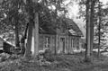 West, houtzagerij - Wouwse Plantage - 20218620 - RCE.jpg 1,200 × 788; 300 KB
-
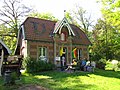 Wouwse Plantage 080.JPG 3,648 × 2,736; 3.76 MB
