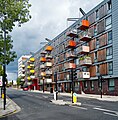
Category:Housing in the London Borough of Hackney
Jump to navigation
Jump to search
Subcategories
This category has the following 3 subcategories, out of 3 total.
A
E
H
Media in category "Housing in the London Borough of Hackney"
The following 43 files are in this category, out of 43 total.
-
Adelaide Wharf, Haggerston - geograph.org.uk - 5563327.jpg 1,578 × 1,600; 790 KB
-
Bryant Court, Haggerston - geograph.org.uk - 5967329.jpg 1,024 × 768; 243 KB
-
Buckland Court, Mintern St, N1 - geograph.org.uk - 171439.jpg 640 × 480; 118 KB
-
Buxton Court, Hoxton - geograph.org.uk - 613405.jpg 639 × 480; 127 KB
-
Cassland Road, Hackney 01.jpg 4,608 × 3,456; 3.57 MB
-
Cassland Road, Hackney 02.jpg 4,608 × 3,456; 3.98 MB
-
Cassland Road, Hackney 03.jpg 4,608 × 3,456; 3.71 MB
-
Cassland Road, Hackney 04.jpg 4,608 × 3,456; 3.79 MB
-
Cassland Road, Hackney 05.jpg 4,608 × 3,456; 3.51 MB
-
Cassland Road, Hackney 06.jpg 4,608 × 3,456; 3.52 MB
-
Dalston, Hindle House - geograph.org.uk - 2925765.jpg 4,218 × 3,157; 7.64 MB
-
Debenham Court - geograph.org.uk - 6219708.jpg 1,024 × 678; 671 KB
-
Bulgarian car , Лондон E5.jpg 1,200 × 1,600; 512 KB
-
Farleigh Hotel, Stoke Newington, N16 (3625852283).jpg 2,843 × 2,133; 2.4 MB
-
Finsbury Park - geograph.org.uk - 680285.jpg 640 × 480; 124 KB
-
Flats on Cassland Road, Homerton - geograph.org.uk - 3034315.jpg 1,600 × 1,200; 627 KB
-
Hackney Homes Information Point. Lower Clapton Road, E5, may 2009.jpg 864 × 1,152; 172 KB
-
Hackney housing project in Homerton - geograph.org.uk - 4943409.jpg 6,000 × 4,000; 4.46 MB
-
Haggerston, Samuel House, Dunston Road - geograph.org.uk - 1728707.jpg 3,264 × 2,448; 7.54 MB
-
Macbeth House flats on Purcell Street - geograph.org.uk - 820595.jpg 640 × 480; 73 KB
-
Mansfield Court on Queensbridge Road, Haggerston - geograph.org.uk - 6280192.jpg 1,832 × 1,132; 1.27 MB
-
Matchmakers Wharf, Homerton - geograph.org.uk - 3402363.jpg 4,288 × 3,216; 5.96 MB
-
New Traveller Site, Millfields E5 Jan 2009.jpg 1,152 × 864; 183 KB
-
NichollHouseWoodberryDown.JPG 5,184 × 3,456; 6.9 MB
-
Orwell Court - geograph.org.uk - 2904233.jpg 640 × 430; 108 KB
-
Orwell House on Regent's Row, Haggerston - geograph.org.uk - 6381850.jpg 5,456 × 3,632; 2.98 MB
-
Pitcairn House, Mare Street, Hackney - geograph.org.uk - 667068.jpg 640 × 427; 64 KB
-
Pitcairn House, off Mare Street - geograph.org.uk - 402496.jpg 640 × 480; 156 KB
-
Regent's Canal from Bridport Place - geograph.org.uk - 1054525.jpg 640 × 480; 79 KB
-
Small parade of shops - geograph.org.uk - 820610.jpg 640 × 480; 67 KB
-
Stoke newington the beckers 1.jpg 640 × 484; 213 KB
-
Tiffin under the Linden Tree - geograph.org.uk - 287152.jpg 568 × 467; 66 KB
-
Tornay House, Shore Place.JPG 3,488 × 2,616; 1.22 MB
-
Tower block in Shoreditch - geograph.org.uk - 3855924.jpg 640 × 430; 65 KB
-
Tradescant House, Hackney - geograph.org.uk - 6265974.jpg 3,264 × 2,448; 2.1 MB
-
Welshpool House, Welshpool Street, E8 - geograph.org.uk - 395539.jpg 480 × 640; 98 KB
-
Windsor House, Hoxton - geograph.org.uk - 1298665.jpg 640 × 480; 151 KB
-
Windsor Wharf, Hackney Wick - geograph.org.uk - 664372.jpg 640 × 480; 93 KB


