Category:Houses in the London Borough of Southwark
Jump to navigation
Jump to search
Wikimedia category | |||||
| Upload media | |||||
| Instance of | |||||
|---|---|---|---|---|---|
| Category combines topics | |||||
| London | |||||
capital and largest city of England and the United Kingdom | |||||
| Pronunciation audio | |||||
| Instance of |
| ||||
| Location |
| ||||
| Located in or next to body of water | |||||
| Official language | |||||
| Head of government |
| ||||
| Inception |
| ||||
| Significant event |
| ||||
| Highest point |
| ||||
| Population |
| ||||
| Area |
| ||||
| Elevation above sea level |
| ||||
| IATA airport code |
| ||||
| Different from | |||||
| official website | |||||
 | |||||
Subcategories
This category has the following 7 subcategories, out of 7 total.
Media in category "Houses in the London Borough of Southwark"
The following 131 files are in this category, out of 131 total.
-
105-145 St George's Road - geograph.org.uk - 4826524.jpg 640 × 388; 174 KB
-
110-116 St George's Road - geograph.org.uk - 4826500.jpg 640 × 491; 204 KB
-
124-130 Jamaica Road - geograph.org.uk - 4982026.jpg 640 × 530; 208 KB
-
13-15 College Road - geograph.org.uk - 4763224.jpg 640 × 481; 248 KB
-
159-163 Havil Street - geograph.org.uk - 3658547.jpg 640 × 380; 168 KB
-
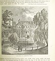
Image taken from page 885 of 'Old and New London, etc' (11187095415).jpg 1,892 × 2,071; 1.42 MB
-
2, 3 And 4, County Grove 2.jpg 6,000 × 4,000; 3.94 MB
-
2, 3 And 4, County Grove.jpg 6,000 × 4,000; 3.59 MB
-
20-26 Park Street - geograph.org.uk - 4806602.jpg 598 × 640; 230 KB
-
20-54 Surrey Square - geograph.org.uk - 4831843.jpg 640 × 526; 276 KB
-
25-28 West Square - geograph.org.uk - 4826441.jpg 470 × 640; 215 KB
-
30-45 West Square - geograph.org.uk - 4826450.jpg 640 × 543; 240 KB
-
33, Penrose Street.jpg 4,032 × 3,024; 3.73 MB
-
4 And 5, Lyndhurst Square.jpg 4,032 × 3,024; 4.5 MB
-
43-44 West Square - geograph.org.uk - 4828923.jpg 534 × 640; 281 KB
-
44-48 Surrey Square - geograph.org.uk - 4831850.jpg 640 × 516; 219 KB
-
50 - 52, Dulwich Village - geograph.org.uk - 5823792.jpg 1,024 × 681; 155 KB
-
6 And 7, Lyndhurst Square.jpg 4,032 × 3,024; 5.55 MB
-
62 And 64, Camberwell Road.jpg 4,032 × 3,024; 4.76 MB
-
63-83 St George's Road - geograph.org.uk - 4826767.jpg 640 × 346; 192 KB
-
74-86 Blackfriars Road - geograph.org.uk - 4990142.jpg 640 × 514; 261 KB
-
ANNIE BESANT - 39 Colby Road Gipsy Hill London SE19 1HA.jpg 1,500 × 2,000; 693 KB
-
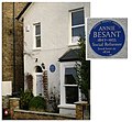
Annie Besant plaque.JPG 604 × 558; 61 KB
-
Bankside Terrace (8290287069).jpg 3,956 × 2,980; 6.39 MB
-
Bodeney House - geograph.org.uk - 5757832.jpg 640 × 426; 106 KB
-
Browning Street, Walworth - geograph.org.uk - 4359664.jpg 2,272 × 1,704; 690 KB
-
C. S. FORESTER - 58 Underhill Road East Dulwich London SE22 0QT.jpg 1,500 × 2,000; 719 KB
-
Caroline Gardens Back of Back Section.jpg 1,200 × 1,600; 391 KB
-
Caroline Gardens Peckham - geograph.org.uk - 1329974.jpg 640 × 480; 68 KB
-
Champion Cottage.jpg 4,032 × 3,024; 4.06 MB
-
Chumleigh Gardens almshouses - geograph.org.uk - 1741999.jpg 640 × 480; 94 KB
-
Corner of Heber Road, Dulwich - geograph.org.uk - 3360648.jpg 1,024 × 764; 187 KB
-
Cottages in Red Cross Garden - geograph.org.uk - 932552.jpg 640 × 480; 85 KB
-
Cottages in Warner Road, Camberwell - geograph.org.uk - 2244516.jpg 4,000 × 3,000; 2.87 MB
-
Dante Road, London SE11 - geograph.org.uk - 676011.jpg 640 × 480; 79 KB
-
DR HAROLD MOODY - 164 Queens Road Peckham London SE15 2HP.jpg 2,000 × 1,500; 1.26 MB
-
Dulwich Village houses - geograph.org.uk - 5583714.jpg 640 × 491; 154 KB
-
Dulwich village houses modern.jpg 1,200 × 901; 153 KB
-
Dulwich village houses old.jpg 1,200 × 900; 223 KB
-
Falmouth Road, Southwark - geograph.org.uk - 1766012.jpg 640 × 480; 95 KB
-
Fielding Street, Walworth - geograph.org.uk - 4359639.jpg 2,272 × 1,704; 853 KB
-
Fine town houses - Trinity Street - geograph.org.uk - 4259535.jpg 1,600 × 1,063; 445 KB
-
Forest Hill Road - geograph.org.uk - 731934.jpg 640 × 480; 104 KB
-
GEORGE MYERS - 131 St George's Road Southwark London SE1 6HY.jpg 1,500 × 2,000; 984 KB
-
Georgian houses in Dulwich Village - geograph.org.uk - 2609405.jpg 4,000 × 3,000; 3.94 MB
-
Georgian Terrace, St. Thomas St - geograph.org.uk - 3828941.jpg 640 × 430; 95 KB
-
Gladstone Street, Southwark - geograph.org.uk - 2312839.jpg 2,560 × 1,920; 1.77 MB
-
Glengall Road, Peckham - geograph.org.uk - 4368616.jpg 2,272 × 1,704; 1,005 KB
-
Glengall Terrace, Peckham - geograph.org.uk - 4368620.jpg 2,272 × 1,704; 889 KB
-
Globe Street, Southwark - geograph.org.uk - 1766005.jpg 640 × 480; 162 KB
-
Grange Walk, London SE1 - geograph.org.uk - 4380337.jpg 1,238 × 929; 1,003 KB
-
Grange Walk, London SE1 - geograph.org.uk - 4380339.jpg 580 × 987; 483 KB
-
Grange Walk, London SE1 - geograph.org.uk - 4380345.jpg 634 × 987; 401 KB
-
Grange Walk, London SE1 - geograph.org.uk - 4380347.jpg 625 × 987; 392 KB
-
Hidden little mews, Montague Close SE1 - geograph.org.uk - 1293804.jpg 640 × 479; 120 KB
-
House in Dulwich Village - geograph.org.uk - 1270842.jpg 640 × 480; 98 KB
-
House, Grange Road, London SE1 - geograph.org.uk - 4379809.jpg 740 × 987; 567 KB
-
Houses in Dulwich Village - geograph.org.uk - 1182793.jpg 640 × 360; 70 KB
-
Houses in King Edward Walk - geograph.org.uk - 1225705.jpg 640 × 480; 95 KB
-
Houses on Boxall Road, Dulwich - geograph.org.uk - 2399507.jpg 544 × 640; 101 KB
-
Houses on Clements Road, Bermondsey - geograph.org.uk - 3996671.jpg 640 × 480; 158 KB
-
Houses on Dulwich Village - geograph.org.uk - 3311712.jpg 4,608 × 3,456; 6.72 MB
-
Houses on Pageant Crescent, Rotherhithe, London.jpg 945 × 663; 153 KB
-
Houses on Turney Road, SE21 - geograph.org.uk - 2399524.jpg 640 × 480; 98 KB
-
Houses on Turney Road, SE21 - geograph.org.uk - 2399536.jpg 640 × 480; 101 KB
-
Houses, St Asaph Rd - geograph.org.uk - 3181652.jpg 640 × 430; 87 KB
-
Housing on Borland Road, Nunhead - geograph.org.uk - 2396885.jpg 640 × 480; 70 KB
-
Housing on Portland Street, Walworth - geograph.org.uk - 4214274.jpg 1,024 × 768; 264 KB
-
Housing on Webster Road, Bermondsey - geograph.org.uk - 4385882.jpg 1,024 × 768; 97 KB
-
Ilife Yard Crampton Street entrance - geograph.org.uk - 1599610.jpg 640 × 438; 86 KB
-
J.A.R. Newlands - house.JPG 1,944 × 2,592; 699 KB
-
JOHN LOGIE BAIRD - 3 Crescent Wood Road Sydenham London SE26 6RT.jpg 2,000 × 1,500; 1.03 MB
-
Keats House, St Thomas St - geograph.org.uk - 1126096.jpg 640 × 430; 102 KB
-
Kelmore Grove, SE22 - geograph.org.uk - 223221.jpg 640 × 480; 121 KB
-
Lambeth Road - geograph.org.uk - 1137641.jpg 640 × 625; 108 KB
-
Large House in College Lane Dulwich - geograph.org.uk - 1270904.jpg 640 × 480; 84 KB
-
London - Brunel Road - geograph.org.uk - 2976744.jpg 800 × 531; 125 KB
-
London MMB »0F6 River Thames.jpg 4,722 × 2,916; 3.63 MB
-
Merrick Square, off Trinity Street (2) - geograph.org.uk - 1765998.jpg 640 × 480; 157 KB
-
Millpond Cottages, Dulwich - geograph.org.uk - 1182526.jpg 640 × 360; 94 KB
-
New riverside development, docklands - geograph.org.uk - 771065.jpg 640 × 480; 89 KB
-
Old houses formerly at Bankside. Wellcome L0010185.jpg 1,617 × 1,140; 844 KB
-
Old Kent Road, Peckham - geograph.org.uk - 4368608.jpg 2,272 × 1,704; 912 KB
-
On Camberwell Church Rd - geograph.org.uk - 5758384.jpg 640 × 425; 77 KB
-
Pageant Crescent - geograph.org.uk - 2966460.jpg 640 × 430; 61 KB
-
Pageant Crescent - geograph.org.uk - 3703490.jpg 640 × 430; 78 KB
-
Peckham, Belfort Road, SE15 - geograph.org.uk - 499985.jpg 640 × 480; 117 KB
-
Peckham, Kirkwood Road, SE15 - geograph.org.uk - 500005.jpg 640 × 480; 101 KB
-
Peckham, terraced houses - geograph.org.uk - 1445944.jpg 640 × 480; 91 KB
-
PERCY LANE OLIVER - 5 Colyton Road Peckham Rye London SE22 0NE.jpg 1,500 × 1,559; 757 KB
-
Post war Prefab Costa Street Peckham - geograph.org.uk - 1318546.jpg 640 × 480; 120 KB
-
Randolph Schwabe - Schwabe-98147 - Bermondsey, Bridge House, 64 George Row - 1934.jpg 1,335 × 1,950; 732 KB
-
Renovating Cabrini House - geograph.org.uk - 731933.jpg 640 × 480; 107 KB
-
Ringmore Rise, SE23 - geograph.org.uk - 437095.jpg 640 × 480; 105 KB
-
Rupack Street - geograph.org.uk - 2428954.jpg 1,024 × 768; 316 KB
-
SCIPIO AFRICANUS MUSSABINI - 84 Burbage Road Herne Hill London SE24 9HE.jpg 1,500 × 2,000; 959 KB
-
Sir ALAN COBHAM - 78 Denman Road Peckham London SE15 5NR.jpg 1,500 × 2,000; 796 KB
-
Skip House in Bermondsey.jpg 4,032 × 3,024; 4.22 MB
-
St Thomas's St - geograph.org.uk - 4358849.jpg 640 × 430; 89 KB
-
Telephone box on St Thomas St - geograph.org.uk - 1271797.jpg 640 × 430; 93 KB
-
Terrace, St Thomas's Street - geograph.org.uk - 5739221.jpg 640 × 426; 97 KB
-
Terraced houses, Athenlay Road - geograph.org.uk - 4316153.jpg 1,024 × 768; 148 KB
-
Terraced houses, Loncroft Road, Peckham - geograph.org.uk - 3898925.jpg 640 × 480; 113 KB
-
The Old House on the Green, Camberwell, London.png 791 × 808; 1.29 MB
-
The Strata Tower (3) - geograph.org.uk - 1505238.jpg 640 × 480; 229 KB
-
Trinity Street Regency terraces.jpg 3,900 × 2,600; 5.63 MB
-
Turney Road, Dulwich - panoramio.jpg 3,968 × 2,976; 2.96 MB
-
TwoSemiDetachedCouncilHouses.jpg 4,896 × 3,672; 1.46 MB
-
Victorian housing in Calton Avenue - geograph.org.uk - 2609372.jpg 4,000 × 3,000; 4.24 MB
-
Victorian terrace, Honor Oak Rise - geograph.org.uk - 731938.jpg 640 × 480; 101 KB
-
Vintage House in a City (Unsplash).jpg 5,166 × 3,696; 10.13 MB
-
West Square (7327539120).jpg 3,648 × 2,736; 4.3 MB
-
West Square (7327540534).jpg 3,648 × 2,736; 4.39 MB
-
West Square (7327541062).jpg 3,648 × 2,736; 4.5 MB
-
White Cottage.jpg 6,720 × 4,480; 17.63 MB
-
Wilson Grove, Bermondsey - geograph.org.uk - 507447.jpg 640 × 480; 127 KB


