Category:Houses in Wrexham County Borough
Jump to navigation
Jump to search
Subcategories
This category has the following 10 subcategories, out of 10 total.
B
- Brynkinallt (1 F)
C
- Croesnewydd Hall (2 F)
F
G
- The Gelli (1 F)
H
- Halghton Hall (1 F)
I
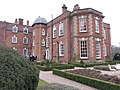
- Iscoyd Park (4 F)
T
- Trevor Hall, Llangollen (5 F)
Media in category "Houses in Wrexham County Borough"
The following 59 files are in this category, out of 59 total.
-
 ActonHall01.jpg 1,021 × 527; 89 KB
-
 Althrey Woodhouse near Bangor-is-y-coed - geograph.org.uk - 65935.jpg 640 × 480; 139 KB
-
 Another sympathetic conversion. - geograph.org.uk - 672419.jpg 640 × 436; 94 KB
-
 Borras Hall - geograph.org.uk - 77472.jpg 640 × 480; 75 KB
-
 Bryn Awel at Tyn-y-celyn - geograph.org.uk - 269060.jpg 640 × 480; 69 KB
-
 Caia Park, Wrexham - geograph.org.uk - 981216.jpg 640 × 425; 48 KB
-
 Country House and Barn - geograph.org.uk - 225070.jpg 640 × 457; 122 KB
-
 Croesiolyn by Tower Wood - geograph.org.uk - 72165.jpg 640 × 480; 105 KB
-
 Former Smithy - geograph.org.uk - 226821.jpg 640 × 457; 93 KB
-
 Fron Isaf from the Chirk castle road - geograph.org.uk - 69281.jpg 640 × 480; 87 KB
-

-
 Hoseley Bank House and farm buildings - geograph.org.uk - 77477.jpg 640 × 480; 112 KB
-

-
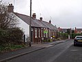
 Houses at Bedwell, near Cock Bank - geograph.org.uk - 54580.jpg 640 × 480; 100 KB
-
 Houses in Graig - geograph.org.uk - 227030.jpg 640 × 480; 123 KB
-
 Iscoyd Park (geograph 4893188).jpg 4,000 × 3,000; 3.46 MB
-
 Johnstown from the Hafod colliery bing - geograph.org.uk - 51431.jpg 640 × 480; 133 KB
-

-
 Mount Pleasant at Fron-deg - geograph.org.uk - 203103.jpg 640 × 480; 69 KB
-
 Newer housing at Cross lanes - geograph.org.uk - 66994.jpg 640 × 480; 97 KB
-
 Plas Grono Elihu Yale's house near Wrexham Wales.jpg 768 × 587; 224 KB
-
 Terraced housing, Rhosnesni - geograph.org.uk - 981214.jpg 640 × 480; 69 KB
-
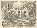
 The centre of Worthenbury - geograph.org.uk - 1129556.jpg 640 × 480; 129 KB
-
 The Elms Gresford Bank - geograph.org.uk - 77476.jpg 640 × 480; 83 KB
-
 The Old Vicarage, Worthenbury - geograph.org.uk - 353327.jpg 629 × 496; 81 KB
-
 Tin Chapel at Halton - geograph.org.uk - 68809.jpg 640 × 480; 95 KB
-
 Ty'n y Gerddi - geograph.org.uk - 568316.jpg 640 × 480; 124 KB
-
 Unusual sight this - geograph.org.uk - 72162.jpg 640 × 480; 121 KB
-

-
 Yr Hen Lythyrdy - Old Post Office - geograph.org.uk - 568304.jpg 640 × 480; 85 KB
-
 Abandoned Apartments - geograph.org.uk - 1147524.jpg 427 × 640; 69 KB
-
 Across the Ceiriog. - geograph.org.uk - 417472.jpg 640 × 480; 63 KB
-
 Bryn Offa, Wrexham - geograph.org.uk - 622605.jpg 640 × 480; 62 KB
-
 Bungalows in Pen-y-Graig - geograph.org.uk - 611573.jpg 640 × 480; 74 KB
-
 Burton Tower - geograph.org.uk - 342290.jpg 510 × 640; 71 KB
-

-
 Ffordd Nant-y-Gaer - geograph.org.uk - 328566.jpg 640 × 427; 60 KB
-
 Ffordd y Fynwent, Rhosllannerchrugog - geograph.org.uk - 254724.jpg 640 × 480; 85 KB
-
-
 Houses at Bryn-yr-Eos - geograph.org.uk - 637591.jpg 640 × 480; 62 KB
-
 Houses in Worthenbury - geograph.org.uk - 353314.jpg 640 × 427; 139 KB
-
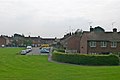
 Houses on Herbert Jennings Avenue - geograph.org.uk - 160910.jpg 640 × 480; 105 KB
-
 Houses on Rhodfa'r Poplys - geograph.org.uk - 616646.jpg 640 × 480; 97 KB
-
 Houses on Stryt Cynlas - geograph.org.uk - 616711.jpg 640 × 480; 80 KB
-
 Houses on Stryt y Brenin - geograph.org.uk - 616680.jpg 640 × 480; 81 KB
-
 Jeffreys Road, Borras Park, Wrecsam - geograph.org.uk - 160905.jpg 640 × 480; 72 KB
-
 Mill House, Pandy - geograph.org.uk - 568299.jpg 640 × 480; 137 KB
-
 Mulsford Hall - geograph.org.uk - 488811.jpg 640 × 415; 41 KB
-
 Nant Gwryd - geograph.org.uk - 325739.jpg 640 × 480; 83 KB
-
 New Housing on green field site - geograph.org.uk - 160551.jpg 640 × 480; 86 KB
-
 New Housing on Holt Road - geograph.org.uk - 160805.jpg 640 × 480; 71 KB
-
 Relatively new houses on Pen-y-Graig - geograph.org.uk - 610984.jpg 640 × 480; 82 KB
-
 Row of terraces, Tudor Street, Coedpoeth - geograph.org.uk - 606234.jpg 640 × 480; 102 KB
-

-
 Storm Brewing - geograph.org.uk - 488818.jpg 486 × 640; 35 KB
-
 Terrace houses in Stryt Fictoria - geograph.org.uk - 610980.jpg 640 × 480; 108 KB
-
 Terrace houses on Stryt yr Allt - geograph.org.uk - 615734.jpg 640 × 480; 77 KB
-
 The Mount, Chirk - geograph.org.uk - 583084.jpg 640 × 480; 112 KB
-
 Up Singret Hill - geograph.org.uk - 328904.jpg 640 × 426; 109 KB


.jpg)


