Category:Houses in Withernsea
Jump to navigation
Jump to search
Media in category "Houses in Withernsea"
The following 200 files are in this category, out of 309 total.
(previous page) (next page)-
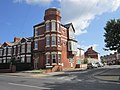
 231 Queen Street, Withernsea - geograph.org.uk - 683781.jpg 504 × 640; 73 KB
-
 38 Hull Road, Withernsea - geograph.org.uk - 190824.jpg 640 × 480; 152 KB
-
 A building on Queen street, Withernsea (geograph 3611510).jpg 1,024 × 768; 161 KB
-
 A camp site fishing pond at Withernsea (geograph 2097597).jpg 800 × 600; 208 KB
-
 A clear space on the Holiday Chalet site - geograph.org.uk - 1047968.jpg 640 × 427; 309 KB
-
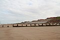
 A Defence Against the Sea - geograph.org.uk - 537971.jpg 640 × 480; 110 KB
-

-
 A footpath to Hollym (geograph 2257204).jpg 800 × 600; 346 KB
-
 A model of the pier (geograph 1992519).jpg 800 × 600; 276 KB
-
 A model pier - geograph.org.uk - 1049816.jpg 640 × 427; 289 KB
-
 A path leading to Ryecroft Drive, Withernsea (geograph 2259119).jpg 800 × 600; 234 KB
-

-
 A turning circle on Seacroft Road, Withernsea (geograph 2097583).jpg 800 × 600; 208 KB
-
 A Withernsea Footpath - geograph.org.uk - 876777.jpg 640 × 480; 122 KB
-
 Allotment Gardens, Withernsea - geograph.org.uk - 215568.jpg 640 × 468; 172 KB
-
 Allotment Gardens, Withernsea - geograph.org.uk - 290680.jpg 640 × 451; 99 KB
-
 Allotments - off Hull Road (geograph 4595308).jpg 640 × 480; 93 KB
-
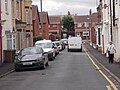
 Alma Street off Arthur Street, Withernsea (geograph 3611135).jpg 1,024 × 768; 186 KB
-
 Arthur Street (B1242), Withernsea (geograph 6375110).jpg 800 × 619; 106 KB
-
 Arthur Street - Hull Road (geograph 4595302).jpg 640 × 480; 69 KB
-
 Arthur Street towards Hull Road, Withernsea (geograph 3611194).jpg 1,024 × 768; 181 KB
-
 Arthur Street, Owthorne (geograph 4583471).jpg 640 × 427; 50 KB
-
 Arthur Street, Withernsea (geograph 2096154).jpg 800 × 600; 300 KB
-
 Arthur Street, Withernsea (geograph 3611117).jpg 1,024 × 768; 189 KB
-
 Arthur Street, Withernsea (geograph 3611121).jpg 1,024 × 768; 160 KB
-
 Arthur Street, Withernsea (geograph 3611131).jpg 1,024 × 768; 181 KB
-
 Arthur Street, Withernsea (geograph 3611179).jpg 1,024 × 768; 193 KB
-
 Arthur Street, Withernsea (geograph 3611188).jpg 768 × 1,024; 152 KB
-
 Arthur Street, Withernsea - geograph.org.uk - 1743249.jpg 800 × 600; 114 KB
-
 Bannister Street - Seaside Road (geograph 4595293).jpg 640 × 480; 65 KB
-
 Bannister Street at Dusk (geograph 3519943).jpg 3,192 × 2,700; 1.69 MB
-
 Bannister Street, Withernsea (geograph 6421656).jpg 5,472 × 2,928; 1.54 MB
-
 Beach's Café on Seaside Road, Withernsea (geograph 5083240).jpg 1,200 × 799; 274 KB
-
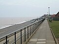
 Benches on Withernsea's Promenade - geograph.org.uk - 1412916.jpg 640 × 480; 100 KB
-
 British Isles rural and coastal (4452303640).jpg 2,048 × 1,371; 863 KB
-
 Bungalows on South Promenade, Withernsea (geograph 2097570).jpg 800 × 600; 178 KB
-
 Bus Depot (geograph 4101986).jpg 1,024 × 683; 113 KB
-
 Cammidge Street off Arthur Street, Withernsea (geograph 3611128).jpg 1,024 × 768; 150 KB
-
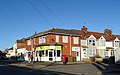
 Captain Williams restaurant, Withernsea (geograph 6382370).jpg 800 × 549; 78 KB
-

-
 Central Promenade, Withernsea (geograph 5082701).jpg 1,200 × 799; 285 KB
-
 Chestnut Avenue - geograph.org.uk - 234154.jpg 640 × 480; 73 KB
-
 Cheverton Avenue - Queen Street (geograph 4595387).jpg 640 × 480; 65 KB
-
 Cliff at Owthorne (geograph 4330390).jpg 1,024 × 768; 134 KB
-
 Cliff Top Path, Withernsea South - geograph.org.uk - 1743454.jpg 800 × 600; 104 KB
-
 Clifftop Path south of Withernsea - geograph.org.uk - 758547.jpg 640 × 348; 160 KB
-
 Clifftop, Withernsea (geograph 6054884).jpg 1,600 × 1,200; 338 KB
-

-
 Coastline South of Withernsea - geograph.org.uk - 274145.jpg 640 × 480; 106 KB
-
 Concrete sea defences in Withernsea (geograph 4583985).jpg 640 × 427; 35 KB
-
 Deserted beach at Withernsea - geograph.org.uk - 190827.jpg 640 × 480; 61 KB
-
 Diamond jubilee lamp post.jpg 3,120 × 4,160; 6.49 MB
-

-
 Edward Street off Arthur Street, Withernsea (geograph 3611183).jpg 1,024 × 768; 186 KB
-
 Egroms Lane, Withernsea (geograph 2257196).jpg 800 × 600; 237 KB
-
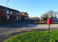
 Elizabeth II postbox on Hull Road, Withernsea (geograph 6373500).jpg 351 × 640; 63 KB
-

-
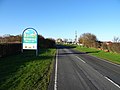 Entering Withernsea (geograph 6374809).jpg 640 × 480; 65 KB
-
 Everyday is like Sunday - geograph.org.uk - 293371.jpg 477 × 640; 53 KB
-
 EYMS buses at the Withernsea Garage (geograph 3607200).jpg 1,024 × 768; 217 KB
-
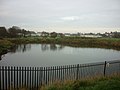
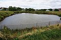 Fishing Lake at South Promenade, Withernsea (geograph 5065446).jpg 1,200 × 799; 396 KB
-
 Flood gate in place (geograph 4330384).jpg 1,024 × 768; 134 KB
-
 Footpath, North Promenade, Withernsea (geograph 3390636).jpg 1,024 × 682; 183 KB
-
 Footpath, Owthorne - geograph.org.uk - 1743391.jpg 800 × 600; 72 KB
-

-
 George VI postbox on North Road, Withernsea (geograph 6373520).jpg 305 × 640; 50 KB
-

-
 Golden Sands Holiday Park - geograph.org.uk - 293372.jpg 640 × 384; 72 KB
-
 Grocers shop next to Withernsea Lighthouse (geograph 4583324).jpg 640 × 427; 67 KB
-
 H.M. Coastguard Station - Central Promenade (geograph 4595234).jpg 640 × 465; 49 KB
-
 Hairdressers on Queen Street, Withernsea (geograph 6372854).jpg 4,629 × 2,900; 2.37 MB
-
 Heading towards Park Avenue, Withernsea (geograph 3611470).jpg 1,024 × 768; 197 KB
-
 High Brighton Street - Queen Street (geograph 4595380).jpg 640 × 480; 64 KB
-
 Holiday chalets south of Withernsea (geograph 6054974).jpg 1,600 × 1,200; 150 KB
-
 Holiday chalets, Withernsea (geograph 6374812).jpg 800 × 600; 106 KB
-
 Holiday chalets, Withernsea (geograph 6374813).jpg 640 × 384; 52 KB
-
 Hollym Road Withernsea (geograph 2406998).jpg 640 × 480; 44 KB
-
 Hollym Road, Withernsea (geograph 2096114).jpg 800 × 600; 214 KB
-
 Hollym Road, Withernsea (geograph 6424396).jpg 1,600 × 1,045; 334 KB
-
 Hollym Road, Withernsea - geograph.org.uk - 294436.jpg 640 × 480; 99 KB
-
 Holmpton Road - geograph.org.uk - 234159.jpg 480 × 640; 75 KB
-
 Holmpton Road, Withernsea (geograph 2096121).jpg 800 × 600; 186 KB
-
 Holmpton Road, Withernsea (geograph 5295995).jpg 640 × 480; 417 KB
-
 Holmpton Road, Withernsea (geograph 6373549).jpg 640 × 480; 106 KB
-
 Holmpton Road, Withernsea (geograph 6373550).jpg 4,644 × 3,397; 4.55 MB
-
 House on Holmpton Road, Withernsea (geograph 6373548).jpg 4,797 × 3,022; 2.51 MB
-
 House on Queen Street North, Withernsea (geograph 6372889).jpg 4,262 × 2,976; 1.86 MB
-
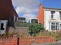
 Houses on Hull Road, Withernsea (geograph 6373502).jpg 3,971 × 2,808; 1.97 MB
-
 Houses on North Promenade, Withernsea (geograph 6382375).jpg 640 × 431; 63 KB
-
 Houses on Queen Street North, Withernsea (geograph 6373540).jpg 4,753 × 3,318; 2.59 MB
-
 Houses on Queen Street, Withernsea (geograph 6372901).jpg 4,705 × 2,821; 2.53 MB
-
 Houses on Queen Street, Withernsea (geograph 6374818).jpg 800 × 594; 99 KB
-
 Houses on Queen Street, Withernsea (geograph 6375105).jpg 800 × 562; 77 KB
-
 Hull Road (B1362), Withernsea (geograph 6373505).jpg 800 × 615; 86 KB
-
 Hull Road (B1362), Withernsea (geograph 6373506).jpg 4,091 × 2,945; 1.94 MB
-
 Hull Road (geograph 4101966).jpg 683 × 1,024; 82 KB
-
 Hull Road - geograph.org.uk - 234202.jpg 480 × 640; 73 KB
-
 Hull Road - Queen Street (geograph 4595297).jpg 640 × 480; 40 KB
-
 Hull Road from Withernsea - geograph.org.uk - 538863.jpg 640 × 480; 115 KB
-
 Hull Road, Withernsea (geograph 2407452).jpg 640 × 480; 49 KB
-
 Hull Road, Withernsea (geograph 3110190).jpg 1,024 × 719; 100 KB
-
 Hull Road, Withernsea (geograph 3611197).jpg 1,024 × 768; 152 KB
-
 Hull Road, Withernsea (geograph 6121623).jpg 4,312 × 2,897; 1.35 MB
-
 Inshore Rescue Boat (IRB) Station, Withernsea (geograph 3727388).jpg 1,600 × 1,200; 485 KB
-
 IRB Station - geograph.org.uk - 1047940.jpg 640 × 427; 242 KB
-
 Italian Gardens and Boatyard - geograph.org.uk - 234144.jpg 640 × 480; 45 KB
-
 Kirkfield Road off Queen Street, Withernsea (geograph 3611570).jpg 1,024 × 768; 144 KB
-
 Lascelles Avenue - Hull Road (geograph 4595299).jpg 640 × 480; 56 KB
-

-
 Lighthouse Garden - Hull Road (geograph 4595357).jpg 640 × 480; 96 KB
-

-
 Looking towards Queen Street North, Withernsea (geograph 3609415).jpg 1,024 × 768; 165 KB
-
 Louville Avenue, Withernsea (geograph 2096137).jpg 800 × 600; 160 KB
-
 Louville Avenue, Withernsea (geograph 2201422).jpg 800 × 600; 243 KB
-
 Louville Avenue, Withernsea (geograph 5065350).jpg 1,200 × 799; 273 KB
-
 Louville Avenue, Withernsea (geograph 5065354).jpg 1,200 × 799; 262 KB
-
 Memorial Gardens, Withernsea (geograph 6382384).jpg 800 × 600; 76 KB
-
 Methodist Church, Withernsea (geograph 4022440).jpg 3,072 × 2,304; 1.73 MB
-
 Methodist Church, Withernsea - geograph.org.uk - 1743241.jpg 600 × 800; 96 KB
-
 Methodist Church, Withernsea - geograph.org.uk - 713738.jpg 640 × 428; 132 KB
-
 Millennium Beacon, Withernsea (geograph 6457027).jpg 5,472 × 3,648; 1.95 MB
-
 Model of Withernsea Pier - geograph.org.uk - 1743100.jpg 800 × 600; 115 KB
-
 Newsham Gardens - geograph.org.uk - 1047974.jpg 640 × 427; 284 KB
-
 North Gate from North Promenade, Withernsea (geograph 3609377).jpg 1,024 × 768; 156 KB
-

-
 North Promenade (geograph 2295498).jpg 640 × 427; 75 KB
-
 North Promenade in Withernsea (geograph 4584011).jpg 640 × 427; 65 KB
-
 North Promenade, Withernsea (geograph 3607187).jpg 1,024 × 768; 140 KB
-
 North Promenade, Withernsea (geograph 3607191).jpg 1,024 × 768; 163 KB
-
 North Promenade, Withernsea (geograph 3607209).jpg 1,024 × 768; 175 KB
-
 North Promenade, Withernsea (geograph 3607268).jpg 1,024 × 768; 165 KB
-
 North Promenade, Withernsea (geograph 3607803).jpg 1,024 × 768; 159 KB
-
 North Promenade, Withernsea (geograph 3607805).jpg 1,024 × 768; 173 KB
-
 North Promenade, Withernsea (geograph 3609244).jpg 1,024 × 768; 120 KB
-
 North Promenade, Withernsea (geograph 3609247).jpg 1,024 × 768; 159 KB
-
 North Promenade, Withernsea (geograph 3609378).jpg 1,024 × 768; 129 KB
-
 North Promenade, Withernsea (geograph 3609406).jpg 1,024 × 768; 114 KB
-
 North Promenade, Withernsea (geograph 3609411).jpg 640 × 480; 59 KB
-
 North Promenade, Withernsea (geograph 3609754).jpg 1,024 × 768; 131 KB
-
 North Promenade, Withernsea (geograph 4584022).jpg 640 × 427; 65 KB
-
 North Promenade, Withernsea (geograph 6365690).jpg 1,024 × 768; 103 KB
-
 North Road (B1242), Withernsea (geograph 6373524).jpg 4,699 × 3,190; 2.52 MB
-
 North Road (B1242), Withernsea (geograph 6373525).jpg 5,184 × 3,888; 4.63 MB
-
 North Road (B1242), Withernsea (geograph 6375109).jpg 800 × 600; 88 KB
-
 North Road - geograph.org.uk - 234697.jpg 480 × 640; 75 KB
-
 North Road, Withernsea (geograph 3611072).jpg 1,024 × 768; 185 KB
-
 North Road, Withernsea (geograph 3611076).jpg 1,024 × 768; 160 KB
-
 North Road, Withernsea (geograph 3611105).jpg 1,024 × 768; 175 KB
-
 North Road, Withernsea (geograph 3611113).jpg 1,024 × 768; 193 KB
-
 Northfield (road) off North Road, Withernsea (geograph 3611102).jpg 1,024 × 768; 181 KB
-
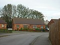
 Northfield, Withernsea (geograph 2097619).jpg 800 × 600; 205 KB
-
 Oak Avenue, Withernsea (geograph 2096133).jpg 800 × 600; 192 KB
-
 Oak Avenue, Withernsea (geograph 5065360).jpg 1,200 × 799; 318 KB
-
 St Matthew's C of E, Owthorne, Withernsea - geograph.org.uk - 713735.jpg 640 × 427; 111 KB
-
 Owthorne Walk off North Road, Withernsea (geograph 3611109).jpg 1,024 × 768; 141 KB
-
 Park Avenue - Queen Street (geograph 4595384).jpg 640 × 480; 63 KB
-
 Park Avenue, Withernsea (geograph 3611505).jpg 1,024 × 768; 155 KB
-
 Park Avenue, Withernsea (geograph 3611508).jpg 1,024 × 768; 165 KB
-
 Path above the beach, Withernsea (geograph 6382366).jpg 800 × 600; 70 KB
-
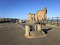 Pier Towers x 2 (geograph 4330361).jpg 1,024 × 768; 182 KB
-
 Piggy Lane Market, Withernsea (geograph 3611305).jpg 1,024 × 768; 139 KB
-
 Piggy Lane off Queen Street, Withernsea (geograph 3611289).jpg 1,024 × 768; 191 KB
-
 Piggy Lane, Withernsea - geograph.org.uk - 215579.jpg 640 × 418; 89 KB
-
 Playing Fields - off Hull Road (geograph 4595304).jpg 640 × 480; 46 KB
-
 Pond, Withernsea - geograph.org.uk - 1743184.jpg 800 × 600; 102 KB
-
 Princes Avenue off Queen Street, Withernsea (geograph 3612801).jpg 1,024 × 768; 157 KB
-
 Princes Avenue, Withernsea (geograph 6372856).jpg 640 × 407; 69 KB
-
 Queen Street North - viewed from Hull Road (geograph 4595362).jpg 640 × 480; 62 KB
-
 Queen Street North, Withernsea (geograph 6372890).jpg 4,487 × 3,342; 2.93 MB
-
 Queen Street North, Withernsea (geograph 6373541).jpg 5,184 × 3,888; 3.44 MB
-
 Queen Street North, Withernsea (geograph 6373542).jpg 4,002 × 2,778; 2.41 MB
-
 Queen Street, Withernsea (geograph 3390626).jpg 1,024 × 682; 200 KB
-
 Queen Street, Withernsea (geograph 3611369).jpg 1,024 × 768; 156 KB
-
 Queen Street, Withernsea (geograph 3612782).jpg 1,024 × 768; 172 KB
-
 Queen Street, Withernsea (geograph 3612785).jpg 1,024 × 768; 149 KB
-
 Queen Street, Withernsea (geograph 3612797).jpg 1,024 × 768; 138 KB
-
 Queen Street, Withernsea (geograph 5065347).jpg 1,200 × 799; 307 KB
-
 Queen Street, Withernsea (geograph 6372904).jpg 480 × 640; 57 KB
-
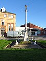
 Queen Victoria Jubilee Lamp, Withernsea (geograph 6374819).jpg 800 × 600; 109 KB
-
 Queen Victoria Jubilee Lamp, Withernsea (geograph 6374820).jpg 600 × 800; 104 KB
-
 Railway Crescent - Queen Street (geograph 4595368).jpg 640 × 480; 77 KB
-
 Road junction in Withernsea (geograph 4986196).jpg 4,892 × 3,671; 3.15 MB
-
 Rocks, Beach and Sea Wall (geograph 6530416).jpg 5,397 × 3,076; 2.46 MB
-
 Saffron Court, Withernsea - geograph.org.uk - 689012.jpg 447 × 640; 83 KB
-
 Scott Gardens, Withernsea (geograph 2097614).jpg 800 × 600; 271 KB
-
 Seacroft Road (geograph 1990795).jpg 800 × 600; 226 KB
-
 Seafront at Withernsea. (geograph 3957724).jpg 640 × 480; 41 KB
-
 Seafront, Withernsea - geograph.org.uk - 51712.jpg 640 × 480; 111 KB
-
 Seathorne (road), Withernsea (geograph 3611067).jpg 1,024 × 768; 153 KB
-
 Service station on Hollym Road, Withernsea (geograph 6372907).jpg 5,166 × 3,021; 2.76 MB
-
 Son of Poseidon - geograph.org.uk - 751615.jpg 640 × 480; 88 KB
-
 South beach, Withernsea - geograph.org.uk - 1515585.jpg 640 × 480; 54 KB
-
 South Cliff Road Withernsea (geograph 2406798).jpg 3,648 × 2,736; 1.95 MB
-
 South Promenade, Withernsea (geograph 5065423).jpg 1,200 × 799; 299 KB
-
 South Promenade, Withernsea (geograph 6054897).jpg 1,600 × 1,200; 159 KB
-
 Southcliff Road, Withernsea - geograph.org.uk - 1743192.jpg 800 × 600; 93 KB
-

-

-
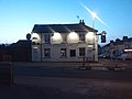 Spread Eagle Pub (geograph 4328417).jpg 1,600 × 1,200; 279 KB
-
 Spread Eagle, Queen Street, Withernsea (geograph 5083257).jpg 1,200 × 799; 261 KB


.jpg)
.jpg)


.jpg)
.jpg)

.jpg)
.jpg)
.jpg)


.jpg)
.jpg)
,_Withernsea_(geograph_6375110).jpg)
.jpg)
.jpg)
.jpg)
.jpg)
.jpg)
.jpg)
.jpg)
.jpg)
.jpg)

.jpg)
.jpg)
.jpg)
.jpg)

.jpg)
.jpg)
.jpg)
.jpg)
.jpg)
_(34854491581).jpg)
.jpg)

.jpg)
.jpg)


.jpg)
.jpg)

.jpg)


.jpg)
.jpg)
.jpg)
.jpg)
.jpg)
.jpg)

.jpg)
.jpg)
.jpg)
.jpg)

.jpg)
.jpg)
.jpg)

.jpg)
.jpg)
.jpg)
.jpg)
.jpg)
.jpg)
.jpg)
.jpg)
.jpg)
.jpg)
.jpg)


.jpg)
.jpg)
.jpg)
.jpg)
.jpg)
.jpg)
.jpg)
.jpg)
.jpg)
.jpg)
.jpg)
.jpg)
,_Withernsea_(geograph_6373505).jpg)
,_Withernsea_(geograph_6373506).jpg)
.jpg)

.jpg)

.jpg)
.jpg)
.jpg)
.jpg)
_Station,_Withernsea_(geograph_3727388).jpg)


.jpg)
.jpg)
.jpg)
.jpg)

.jpg)
.jpg)
.jpg)
.jpg)
.jpg)
.jpg)
.jpg)


.jpg)
_(34854490341).jpg)
.jpg)
.jpg)
.jpg)
.jpg)
.jpg)
.jpg)
.jpg)
.jpg)
.jpg)
.jpg)
.jpg)
.jpg)
.jpg)
.jpg)
.jpg)
.jpg)
,_Withernsea_(geograph_6373524).jpg)
,_Withernsea_(geograph_6373525).jpg)
,_Withernsea_(geograph_6375109).jpg)

.jpg)
.jpg)
.jpg)
.jpg)
_off_North_Road,_Withernsea_(geograph_3611102).jpg)
.jpg)
.jpg)
.jpg)

.jpg)
.jpg)
.jpg)
.jpg)
.jpg)
.jpg)
.jpg)
.jpg)

.jpg)

.jpg)
.jpg)
.jpg)
.jpg)
.jpg)
.jpg)
.jpg)
.jpg)
.jpg)
.jpg)
.jpg)
.jpg)
.jpg)
.jpg)
.jpg)
.jpg)
.jpg)
.jpg)

.jpg)
.jpg)
.jpg)

,_Withernsea_(geograph_3611067).jpg)
.jpg)


.jpg)
.jpg)
.jpg)


.jpg)
.jpg)
.jpg)
.jpg)