Category:Houses in East Dunbartonshire
Jump to navigation
Jump to search
Council areas (municipalities) of Scotland: Aberdeen · Aberdeenshire · Angus · Argyll and Bute · Clackmannanshire · Dumfries and Galloway · Dundee · East Ayrshire · East Dunbartonshire · East Lothian · East Renfrewshire · Edinburgh · Falkirk · Fife · Glasgow · Highland · Inverclyde · Midlothian · Moray · North Ayrshire · North Lanarkshire · Outer Hebrides · Orkney Islands · Perth and Kinross · Renfrewshire · Scottish Borders · Shetland Islands · South Ayrshire · South Lanarkshire · Stirling · West Dunbartonshire · West Lothian
Wikimedia category | |||||
| Upload media | |||||
| Instance of | |||||
|---|---|---|---|---|---|
| |||||
Subcategories
This category has the following 6 subcategories, out of 6 total.
Media in category "Houses in East Dunbartonshire"
The following 40 files are in this category, out of 40 total.
-
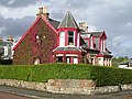
 Acredyke and Storen, Balmore Road - geograph.org.uk - 62182.jpg 640 × 480; 175 KB
-
 Adamslie Crescent, Hayston - geograph.org.uk - 1479306.jpg 640 × 480; 117 KB
-
 Auchinairn-1.JPG 1,600 × 1,200; 432 KB
-

-
 Balmore Village - geograph.org.uk - 556164.jpg 640 × 480; 109 KB
-
 Bardowie - geograph.org.uk - 1410416.jpg 640 × 480; 121 KB
-
 Brackenbrae House, Bishopbriggs - geograph.org.uk - 125172.jpg 640 × 480; 176 KB
-

-
 Cadder Stables - geograph.org.uk - 842907.jpg 640 × 480; 116 KB
-
 Cadder View, Balmore Road - geograph.org.uk - 556158.jpg 640 × 480; 87 KB
-
 Campsie Village (geograph 2830660).jpg 640 × 480; 98 KB
-
 Canniesburn Drive (geograph 4517510).jpg 3,504 × 2,336; 3.76 MB
-
 Castle Circle (geograph 4175596).jpg 800 × 441; 89 KB
-
 Castle Circle (geograph 5983878).jpg 1,024 × 768; 139 KB
-
 Clachan of Campsie - geograph.org.uk - 40319.jpg 640 × 480; 101 KB
-
 Cottages on Crosshill Street, Lennoxtown (geograph 5983762).jpg 1,024 × 768; 132 KB
-
 Crawford Road, Cloberfield, Milngavie - geograph.org.uk - 79403.jpg 640 × 479; 137 KB
-
 Holyknowe Road (geograph 2973274).jpg 640 × 480; 242 KB
-
 House at Boghead - geograph.org.uk - 57742.jpg 640 × 480; 136 KB
-
 House by Mugdock Reservoir - geograph.org.uk - 702094.jpg 640 × 480; 107 KB
-
 House on a Hill - geograph.org.uk - 729025.jpg 640 × 480; 24 KB
-
 Houses in Westerton - geograph.org.uk - 519922.jpg 640 × 480; 63 KB
-
 Houses on Canniesburn Road, Bearsden - geograph.org.uk - 515060.jpg 640 × 480; 92 KB
-
 Houses on Maxwell Avenue - geograph.org.uk - 1131573.jpg 640 × 480; 164 KB
-
 Inveraray Vs Inverary - geograph.org.uk - 309511.jpg 640 × 427; 81 KB
-
 Junction of Switchback Road and Braemar Crescent (geograph 4910098).jpg 3,436 × 2,293; 3.25 MB
-
 Leitchbank House - geograph.org.uk - 116533.jpg 640 × 480; 100 KB
-
 Lenzie Townhouse - geograph.org.uk - 57754.jpg 640 × 480; 157 KB
-

-
 Mains Estate, Milngavie - geograph.org.uk - 514094.jpg 640 × 480; 93 KB
-
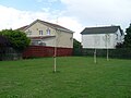
 Mains housing estate - geograph.org.uk - 49194.jpg 640 × 480; 121 KB
-
 Maxwell Mews - geograph.org.uk - 1131568.jpg 640 × 480; 134 KB
-
 Mugdock Road housing - geograph.org.uk - 694267.jpg 640 × 480; 62 KB
-
 Netherhouses near Lenzie - geograph.org.uk - 128751.jpg 640 × 448; 56 KB
-
 North Bardowie - geograph.org.uk - 1466603.jpg 640 × 480; 37 KB
-
 Station Road, Bardowie - geograph.org.uk - 62180.jpg 640 × 480; 108 KB
-
 Suburbs of Kirkintilloch from the Canal - geograph.org.uk - 1462769.jpg 640 × 480; 111 KB
-
 The Mill House, Baldernock - geograph.org.uk - 1407853.jpg 640 × 480; 133 KB
-
 Torrance housing - geograph.org.uk - 1410446.jpg 640 × 480; 116 KB
-
 Trig point and Mains Estate - geograph.org.uk - 762170.jpg 640 × 480; 273 KB


.jpg)
.jpg)
.jpg)
.jpg)

.jpg)

.jpg)


.jpg)


