Category:Houses in County Londonderry
Jump to navigation
Jump to search
Subcategories
This category has the following 3 subcategories, out of 3 total.
Media in category "Houses in County Londonderry"
The following 40 files are in this category, out of 40 total.
-
 'Top of the Hill', Gobnascale - geograph.org.uk - 1438260.jpg 360 × 640; 56 KB
-
 Ballinderry old school - geograph.org.uk - 267327.jpg 640 × 479; 55 KB
-

-
 Derelict house at Ranaghan - geograph.org.uk - 585402.jpg 640 × 426; 124 KB
-
 Westlake on a rainy day.JPG 2,560 × 1,920; 1.23 MB
-
 House at Churchtown Road, Brockagh - geograph.org.uk - 741780.jpg 640 × 299; 47 KB
-
 House at Kiltcaltan - geograph.org.uk - 420540.jpg 640 × 479; 83 KB
-
 Houses at Lough Enagh Eastern - geograph.org.uk - 430350.jpg 640 × 480; 134 KB
-
 Kilhoyle - geograph.org.uk - 454743.jpg 640 × 318; 57 KB
-
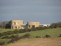 Modern House in rural setting - geograph.org.uk - 821003.jpg 640 × 480; 58 KB
-
 Near Garvagh - geograph.org.uk - 830388.jpg 640 × 479; 62 KB
-
 Old and new - geograph.org.uk - 433841.jpg 640 × 480; 85 KB
-
 Residential home - geograph.org.uk - 812520.jpg 640 × 360; 65 KB
-
 Rushie Park, Drumsurn - geograph.org.uk - 730901.jpg 640 × 285; 32 KB
-
 Sleepy Tullyverry - geograph.org.uk - 2989816.jpg 4,000 × 3,000; 3.84 MB
-

-
 Mill worker's houses, Upperlands - geograph.org.uk - 573646.jpg 640 × 479; 44 KB
-
 Ye Olde Worlde Cottage^ - geograph.org.uk - 492285.jpg 640 × 424; 116 KB
-
 Ard na Mara - geograph.org.uk - 503840.jpg 640 × 426; 89 KB
-
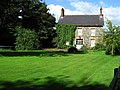
 Brook Hall - geograph.org.uk - 516765.jpg 640 × 480; 79 KB
-
 Bungalows off Chapel Road, Dungiven - geograph.org.uk - 1518284.jpg 640 × 481; 41 KB
-
 Farmhouse at Balloughry - geograph.org.uk - 108216.jpg 640 × 479; 96 KB
-
 Freehall Road - geograph.org.uk - 496366.jpg 640 × 268; 85 KB
-
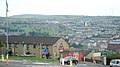 Gobnascale or 'Top of the Hill' - geograph.org.uk - 1438246.jpg 640 × 360; 62 KB
-
 House at Balloughry Hill - geograph.org.uk - 142046.jpg 640 × 479; 150 KB
-
 House at Carnet - geograph.org.uk - 730814.jpg 640 × 479; 95 KB
-
 House at Kilcreen - geograph.org.uk - 480189.jpg 640 × 479; 57 KB
-
 House at Longfield - geograph.org.uk - 539460.jpg 640 × 479; 59 KB
-
 House at Mullaghmenan - geograph.org.uk - 108217.jpg 640 × 478; 128 KB
-
 House at Quilly - geograph.org.uk - 519964.jpg 640 × 479; 73 KB
-
 House for sale, Letterlogher - geograph.org.uk - 435125.jpg 640 × 291; 33 KB
-
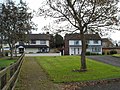
 House near Magherafelt - geograph.org.uk - 519930.jpg 640 × 479; 88 KB
-
 Houses at Beechwood Strathfoyle - geograph.org.uk - 637290.jpg 640 × 480; 119 KB
-
 Houses at Scriggan - geograph.org.uk - 716704.jpg 640 × 334; 39 KB
-
 New house at Toneragh - geograph.org.uk - 435560.jpg 640 × 480; 79 KB
-
 New housing in Strathfoyle - geograph.org.uk - 611993.jpg 640 × 480; 76 KB
-
 Newly built housing at Strathfoyle - geograph.org.uk - 612014.jpg 640 × 480; 88 KB
-
 Summer House, The Shepherd's Rest - geograph.org.uk - 561157.jpg 640 × 480; 60 KB
-
 The Fountain Estate - geograph.org.uk - 309897.jpg 640 × 437; 50 KB
-
 Westlake - geograph.org.uk - 414755.jpg 640 × 281; 32 KB


