Category:Housatonic Rail Trail
Jump to navigation
Jump to search

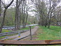
English: The Housatonic Rail Trail is a recreational trail for hikers, runners, and cyclists built along the former mainline of the Housatonic Railroad in four towns in southeastern Fairfield County, Connecticut, United States. Each town uses a slightly different name for the trail. For example, Monroe calls it the "Housatonic Valley Rail Trail", Trumbull calls it the "Housatonic Railway Rails to Trails Pequonnock Valley Greenway", etc. It runs from Bridgeport station in Bridgeport to the site of the former Botsford station along the active Housatonic line in Newtown. It opened as a rail line in February 1840 then closed some time later and was converted to a rail trail after that.
Media in category "Housatonic Rail Trail"
The following 16 files are in this category, out of 16 total.
-
 Botsford station platform 054.JPG 2,048 × 1,536; 1.34 MB
-
 D'Addario silos 135.JPG 2,048 × 1,536; 834 KB
-
 Housatonic rail trail 046.JPG 1,536 × 2,048; 700 KB
-
 Housatonic Rail Trail Bridgeport 047.JPG 1,536 × 2,048; 904 KB
-
 Housatonic rail trail head 072.JPG 2,048 × 1,536; 1.97 MB
-
 Housatonic rail trail head 073.JPG 2,048 × 1,536; 1.77 MB
-
 Housatonic Rail Trail near Botsford 100.JPG 480 × 640; 114 KB
-
 Housatonic Rail Trail, Trumbull 071.JPG 2,048 × 1,536; 2.28 MB
-
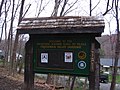
 Monroe Housatonic sign 052.JPG 2,048 × 1,536; 1.41 MB
-
 Parlor Rock Park 104.JPG 640 × 480; 72 KB
-
 Pepper Crossing 053.JPG 2,048 × 1,536; 1.48 MB
-
 Stepney station 101.JPG 640 × 480; 70 KB
-
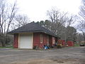 Stepney station 102.JPG 640 × 480; 65 KB
-
 Trumbull south of Whitney Avenue 161.JPG 2,048 × 1,536; 1.38 MB
-
 Trumbull Whitney Avenue station site 159.JPG 2,048 × 1,536; 1.22 MB
-
 Whitney Avenue station site 160.JPG 2,048 × 1,536; 1.3 MB


