Category:Hound, Hampshire
Jump to navigation
Jump to search
village and civil parish in Hampshire, United Kingdom  | |||||
| Upload media | |||||
| Instance of | |||||
|---|---|---|---|---|---|
| Location | Eastleigh, Hampshire, South East England, England | ||||
| official website | |||||
 | |||||
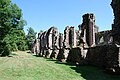
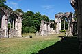
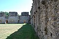
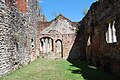
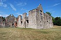
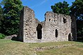
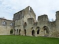
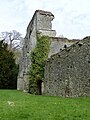
English: Hound is a village and civil parish in the borough of Eastleigh in Hampshire, England. The parish includes the village of Netley, Netley Castle and Netley Abbey.
Subcategories
This category has the following 3 subcategories, out of 3 total.
Media in category "Hound, Hampshire"
The following 200 files are in this category, out of 276 total.
(previous page) (next page)-
 A buoy in Southampton Water - geograph.org.uk - 2654227.jpg 800 × 600; 234 KB
-

-
 A rough ride^ - geograph.org.uk - 1987324.jpg 1,280 × 960; 481 KB
-

-
 Abbey Hill - geograph.org.uk - 6265456.jpg 4,000 × 3,000; 1.32 MB
-
 After Barn Starboard Channel Buoy - geograph.org.uk - 1937661.jpg 2,048 × 1,536; 1.44 MB
-

-

-

-
 Beach in front of Netley Castle - geograph.org.uk - 4501850.jpg 1,600 × 1,066; 207 KB
-
 Beach Lane - geograph.org.uk - 5254504.jpg 640 × 426; 75 KB
-
 Beach Rd - geograph.org.uk - 5254505.jpg 640 × 426; 57 KB
-
 Beacon, Southampton Water - geograph.org.uk - 5250293.jpg 640 × 426; 29 KB
-
 Boat club - geograph.org.uk - 5254517.jpg 640 × 426; 85 KB
-
 Boat park - geograph.org.uk - 5250278.jpg 640 × 396; 82 KB
-

-
 Bushes by the railway, Netley - geograph.org.uk - 5232744.jpg 640 × 426; 88 KB
-
 Business premises opposite Hound Manor - geograph.org.uk - 1464578.jpg 640 × 480; 121 KB
-
 By the West Coastway Line - geograph.org.uk - 5232738.jpg 640 × 426; 57 KB
-
-
 Chapel Road Station, Royal Victoria Railway - geograph.org.uk - 1986896.jpg 1,280 × 960; 476 KB
-
 Corner of Station Rd - geograph.org.uk - 5254498.jpg 640 × 426; 82 KB
-

-
-

-

-

-
 Field north of Hamble Station - geograph.org.uk - 5244275.jpg 640 × 426; 42 KB
-
 First house in Hound reached - geograph.org.uk - 1464053.jpg 480 × 640; 140 KB
-

-

-
-
 Footpath in Westwood Woodland Park - geograph.org.uk - 2426032.jpg 640 × 480; 221 KB
-
 Former Red Lion pub - geograph.org.uk - 5254503.jpg 640 × 426; 56 KB
-

-
 Grange Road - geograph.org.uk - 3284895.jpg 640 × 480; 73 KB
-

-
 Grange Road looking south - geograph.org.uk - 3333285.jpg 800 × 600; 139 KB
-

-
 Grange Road, Old Netley - geograph.org.uk - 1986915.jpg 1,280 × 960; 464 KB
-
 Green Channel Marker Buoy, After Barn - geograph.org.uk - 5050851.jpg 640 × 427; 332 KB
-

-
 Gymnasium in the trees - geograph.org.uk - 3159662.jpg 4,000 × 3,000; 3.74 MB
-
 Halfway between the B3397 and Hound - geograph.org.uk - 1464042.jpg 640 × 480; 86 KB
-

-
 Hamble Cliff Stables seen across field - geograph.org.uk - 2846539.jpg 1,024 × 768; 290 KB
-
 Hamble Rail Trail - geograph.org.uk - 3159635.jpg 4,000 × 3,000; 4.59 MB
-
 Hamble Rail Trail - geograph.org.uk - 3159645.jpg 640 × 480; 134 KB
-
 Hamble railway station, Hamble-le-Rice - geograph.org.uk - 3750250.jpg 800 × 515; 134 KB
-
 Hamble Station - geograph.org.uk - 5232780.jpg 640 × 569; 125 KB
-
 Hamble Station - geograph.org.uk - 5244271.jpg 640 × 426; 50 KB
-
 Hamble Station - geograph.org.uk - 5244289.jpg 640 × 426; 70 KB
-
 Hamble Station - geograph.org.uk - 5244294.jpg 640 × 426; 71 KB
-
 Heading towards Netley - geograph.org.uk - 3284915.jpg 640 × 480; 88 KB
-
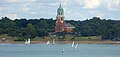
 Hospital Chapel in Royal Victoria Country Park - geograph.org.uk - 2375663.jpg 4,288 × 3,216; 1.81 MB
-
 Hound Nature Trail - geograph.org.uk - 1464074.jpg 480 × 640; 127 KB
-
 Hound Road - geograph.org.uk - 2847251.jpg 1,024 × 768; 328 KB
-
 House, Moore Crescent - geograph.org.uk - 5232741.jpg 640 × 426; 65 KB
-
 Lake north of Hound - geograph.org.uk - 2847266.jpg 1,024 × 768; 246 KB
-
 Level Crossing on the Royal Victoria Railway - geograph.org.uk - 1986900.jpg 1,280 × 960; 488 KB
-
 Line of trees in Royal Victoria Country Park - geograph.org.uk - 6334766.jpg 1,024 × 683; 217 KB
-
 Lodge, Royal Victoria Country Park - geograph.org.uk - 5254488.jpg 640 × 412; 70 KB
-
 Manchester Rd - geograph.org.uk - 5254499.jpg 640 × 426; 88 KB
-
 Miniature train vanishing into the trees - geograph.org.uk - 1986965.jpg 1,280 × 960; 489 KB
-
 MV Red Eagle on Southampton Water - geograph.org.uk - 6259481.jpg 3,365 × 2,369; 1.55 MB
-
 Netley Abbey (1) - geograph.org.uk - 5502921.jpg 3,872 × 2,592; 4.62 MB
-
 Netley Abbey (10) - geograph.org.uk - 5506971.jpg 3,872 × 2,592; 4.39 MB
-
 Netley Abbey (11) - geograph.org.uk - 5506978.jpg 3,872 × 2,592; 4.79 MB
-
 Netley Abbey (12) - geograph.org.uk - 5506982.jpg 3,872 × 2,592; 4.66 MB
-
 Netley Abbey (13) - geograph.org.uk - 5506987.jpg 3,872 × 2,592; 4.73 MB
-
 Netley Abbey (14) - geograph.org.uk - 5506989.jpg 3,872 × 2,592; 4.63 MB
-
 Netley Abbey (15) - geograph.org.uk - 5506995.jpg 3,872 × 2,592; 4.85 MB
-
 Netley Abbey (16) - geograph.org.uk - 5506999.jpg 3,872 × 2,592; 4.83 MB
-
 Netley Abbey (17) - geograph.org.uk - 5507002.jpg 3,872 × 2,592; 4.81 MB
-
 Netley Abbey (18) - geograph.org.uk - 5507004.jpg 3,872 × 2,592; 4.7 MB
-
 Netley Abbey (19) - geograph.org.uk - 5508760.jpg 3,872 × 2,592; 4.78 MB
-
 Netley Abbey (2) - geograph.org.uk - 5503824.jpg 3,872 × 2,592; 4.75 MB
-
 Netley Abbey (20) - geograph.org.uk - 5508767.jpg 3,872 × 2,592; 4.65 MB
-
 Netley Abbey (21) - geograph.org.uk - 5508774.jpg 3,872 × 2,592; 4.63 MB
-
 Netley Abbey (22) - geograph.org.uk - 5509632.jpg 3,872 × 2,592; 4.81 MB
-
 Netley Abbey (23) - geograph.org.uk - 5509638.jpg 3,872 × 2,592; 4.87 MB
-
 Netley Abbey (24) - geograph.org.uk - 5509647.jpg 3,872 × 2,592; 4.75 MB
-
 Netley Abbey (25) - geograph.org.uk - 5509656.jpg 3,872 × 2,592; 4.77 MB
-
 Netley Abbey (26) - geograph.org.uk - 5509667.jpg 3,872 × 2,592; 4.88 MB
-
 Netley Abbey (27) - geograph.org.uk - 5509676.jpg 3,872 × 2,592; 4.75 MB
-
 Netley Abbey (28) - geograph.org.uk - 5512126.jpg 3,872 × 2,592; 4.75 MB
-
 Netley Abbey (29) - geograph.org.uk - 5512130.jpg 3,872 × 2,592; 4.84 MB
-
 Netley Abbey (3) - geograph.org.uk - 5503830.jpg 3,872 × 2,592; 4.68 MB
-
 Netley Abbey (30) - geograph.org.uk - 5513727.jpg 3,872 × 2,592; 4.66 MB
-
 Netley Abbey (4) - geograph.org.uk - 5503841.jpg 3,872 × 2,592; 4.86 MB
-
 Netley Abbey (5) - geograph.org.uk - 5503847.jpg 3,872 × 2,592; 4.72 MB
-
 Netley Abbey (6) - geograph.org.uk - 5503853.jpg 3,872 × 2,592; 4.84 MB
-
 Netley Abbey (7) - geograph.org.uk - 5503861.jpg 3,872 × 2,592; 4.75 MB
-
 Netley Abbey (8) - geograph.org.uk - 5503868.jpg 3,872 × 2,592; 4.27 MB
-
 Netley Abbey (9) - geograph.org.uk - 5506964.jpg 3,872 × 2,592; 4.23 MB
-
 Netley Abbey - East Window of former church - geograph.org.uk - 4493559.jpg 1,000 × 1,376; 1.19 MB
-
 Netley Abbey - Fireplace in Infirmary - geograph.org.uk - 4493584.jpg 1,000 × 1,333; 1.13 MB
-
 Netley Abbey - Former Infirmary - geograph.org.uk - 4493579.jpg 1,333 × 1,000; 1.05 MB
-
 Netley Abbey - geograph.org.uk - 5254510.jpg 640 × 426; 85 KB
-
 Netley Abbey - geograph.org.uk - 5254511.jpg 640 × 426; 101 KB
-
 Netley Abbey - geograph.org.uk - 6359754.jpg 640 × 480; 129 KB
-
 Netley Abbey - geograph.org.uk - 6359851.jpg 640 × 480; 85 KB
-
 Netley Abbey - geograph.org.uk - 6372339.jpg 1,024 × 666; 130 KB
-
 Netley Abbey - Ivy-mantled walls - geograph.org.uk - 4493549.jpg 1,000 × 1,348; 1.17 MB
-
 Netley Abbey - Stream formerly a drain - geograph.org.uk - 4493574.jpg 1,333 × 1,000; 1.32 MB
-
 Netley Abbey - The nave of the abbey church - geograph.org.uk - 4493555.jpg 1,333 × 1,000; 1.16 MB
-
 Netley Abbey - View from Car Park - geograph.org.uk - 4493541.jpg 1,333 × 1,000; 1.14 MB
-
 Netley Abbey - Western flank wall - geograph.org.uk - 4493547.jpg 1,000 × 1,333; 1.27 MB
-
 Netley Abbey, abbot's lodging - geograph.org.uk - 6371133.jpg 1,024 × 760; 247 KB
-
 Netley Abbey, church ruins - geograph.org.uk - 6371123.jpg 1,024 × 768; 208 KB
-
 Netley Beach - geograph.org.uk - 6265460.jpg 5,184 × 3,456; 2.02 MB
-
 Netley Beach - geograph.org.uk - 6265461.jpg 5,184 × 3,456; 2.2 MB
-
 Netley Castle - geograph.org.uk - 6371931.jpg 1,024 × 768; 238 KB
-
 Netley Court - geograph.org.uk - 5257833.jpg 640 × 426; 61 KB
-
 Netley from Isle of Wight Ferry - geograph.org.uk - 3323265.jpg 640 × 480; 49 KB
-
 Netley Hospital Chapel - geograph.org.uk - 4891088.jpg 751 × 1,024; 139 KB
-
 Netley Hospital Chapel - geograph.org.uk - 5335099.jpg 640 × 302; 169 KB
-
 Netley Library - geograph.org.uk - 6372310.jpg 1,024 × 768; 171 KB
-
 Netley Marsh, United Kingdom (Unsplash).jpg 5,184 × 3,456; 752 KB
-
 Netley Military Cemetery - geograph.org.uk - 3159690.jpg 4,000 × 3,000; 3.89 MB
-
 Netley railway station, Hampshire - geograph.org.uk - 4305882.jpg 1,600 × 1,200; 477 KB
-
 Netley Sailing Club - geograph.org.uk - 5254493.jpg 640 × 426; 57 KB
-
 Netley Sailing Club - geograph.org.uk - 5254494.jpg 640 × 426; 78 KB
-
 Netley Sailing Club - geograph.org.uk - 5254495.jpg 640 × 426; 83 KB
-
 Netley Sailing Club - geograph.org.uk - 6334779.jpg 1,024 × 683; 234 KB
-
 Netley Starboard Channel Buoy and foreshore - geograph.org.uk - 1933975.jpg 1,881 × 1,411; 916 KB
-
 Netley Station - geograph.org.uk - 5232752.jpg 640 × 426; 102 KB
-
 Netley Station - geograph.org.uk - 5232758.jpg 640 × 426; 105 KB
-
 Netley Station - geograph.org.uk - 5232765.jpg 640 × 438; 57 KB
-
 Netley Station - geograph.org.uk - 5232767.jpg 640 × 426; 82 KB
-
 Netley Station - geograph.org.uk - 6371094.jpg 1,024 × 768; 126 KB
-
 Netley Victoria Club - geograph.org.uk - 5254500.jpg 640 × 424; 65 KB
-
 Netley Victoria Club - geograph.org.uk - 6372007.jpg 1,024 × 768; 148 KB
-
 Netley Waterside House - geograph.org.uk - 5254508.jpg 640 × 426; 94 KB
-
 Netley, Dancing Goose - geograph.org.uk - 6371117.jpg 1,024 × 769; 196 KB
-
 Netley, footpath - geograph.org.uk - 6371099.jpg 1,024 × 769; 310 KB
-
 Netley, footpath - geograph.org.uk - 6371106.jpg 1,024 × 768; 295 KB
-
 Netley, footpath - geograph.org.uk - 6372330.jpg 1,024 × 768; 349 KB
-
 Netley, former Red Lion - geograph.org.uk - 6372003.jpg 1,024 × 768; 149 KB
-
 Netley, Prince Consort - geograph.org.uk - 6372317.jpg 1,024 × 768; 196 KB
-
 Netley, pump - geograph.org.uk - 6372327.jpg 1,024 × 768; 257 KB
-
 Netley, railway lines - geograph.org.uk - 6371114.jpg 1,024 × 769; 222 KB
-
 Netley, sea wall - geograph.org.uk - 6371142.jpg 1,024 × 768; 241 KB
-
 Netley, seat - geograph.org.uk - 6372324.jpg 1,024 × 768; 246 KB
-
 Netley, shingle beach - geograph.org.uk - 6371144.jpg 1,024 × 731; 216 KB
-
 Netley, shingle beach - geograph.org.uk - 6371155.jpg 1,024 × 750; 223 KB
-
 Netley, shingle beach - geograph.org.uk - 6371950.jpg 1,024 × 768; 295 KB
-
 Netley, St. Edward's - geograph.org.uk - 6371206.jpg 1,024 × 761; 199 KB
-
 Netley, tower - geograph.org.uk - 6371153.jpg 1,024 × 761; 183 KB
-
 New junction, Royal Victoria Railway - geograph.org.uk - 2324810.jpg 2,048 × 1,536; 2.77 MB
-
 New terminus station Royal Victoria Railway - geograph.org.uk - 2324807.jpg 2,048 × 1,536; 2.07 MB
-
 Oil Refinery Chimneys - geograph.org.uk - 5837466.jpg 1,600 × 1,421; 471 KB
-
 Path beside buildings at police training centre - geograph.org.uk - 2847242.jpg 1,024 × 768; 262 KB
-
 Path to the Church - geograph.org.uk - 3179022.jpg 851 × 1,280; 1.31 MB
-
 Path west from Hamble Cliff Stables - geograph.org.uk - 2846533.jpg 768 × 1,024; 227 KB
-
 Paths in recreation ground - geograph.org.uk - 5237669.jpg 640 × 427; 131 KB
-

-
 Pickwell Farm - geograph.org.uk - 1984088.jpg 1,280 × 960; 463 KB
-
 Prince Consort - geograph.org.uk - 5257828.jpg 426 × 640; 76 KB
-

-
-

-

-
-

-

-
-

-

-
 Railway line to Hamble - geograph.org.uk - 2847248.jpg 1,024 × 768; 228 KB
-
 Railway line to Netley - geograph.org.uk - 2847247.jpg 1,024 × 768; 221 KB
-
 Rear of locomotive shed, Royal Victoria Railway - geograph.org.uk - 2324809.jpg 2,048 × 1,536; 2.5 MB
-
 Red Falcon en route from East Cowes to Southampton - 1 - geograph.org.uk - 3837476.jpg 4,608 × 3,072; 2.93 MB
-
 Red Falcon en route from East Cowes to Southampton - 2 - geograph.org.uk - 3837524.jpg 4,608 × 3,072; 2.52 MB
-
 Red Falcon's Red Funnel Logo, near Soutrhampton - geograph.org.uk - 3837528.jpg 4,608 × 3,072; 3.07 MB
-
 Road, Royal Victoria Country Park - geograph.org.uk - 5250449.jpg 640 × 426; 87 KB
-
 Royal Victoria Chapel - geograph.org.uk - 6334770.jpg 683 × 1,024; 151 KB
-
 Royal Victoria Chapel - geograph.org.uk - 6334774.jpg 1,024 × 683; 116 KB
-
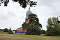
 Royal Victoria Country Park - geograph.org.uk - 2201871.jpg 640 × 344; 145 KB
-
 Royal Victoria Country Park - geograph.org.uk - 4501867.jpg 1,600 × 1,066; 299 KB
-
 Royal Victoria Country Park - geograph.org.uk - 4891092.jpg 593 × 800; 139 KB
-
 Royal Victoria Country Park - geograph.org.uk - 5250299.jpg 640 × 426; 52 KB
-
 Royal Victoria Country Park - geograph.org.uk - 5250306.jpg 640 × 426; 81 KB
-
 Royal Victoria Country Park - geograph.org.uk - 5250417.jpg 640 × 426; 90 KB
-
 Royal Victoria Country Park - geograph.org.uk - 5250422.jpg 640 × 400; 59 KB
-
 Royal Victoria Country Park - geograph.org.uk - 5250447.jpg 640 × 406; 67 KB
-
 Royal Victoria Country Park - geograph.org.uk - 5250448.jpg 640 × 426; 56 KB
-
 Royal Victoria Country Park - geograph.org.uk - 5250450.jpg 640 × 403; 61 KB
-
 Royal Victoria Country Park - geograph.org.uk - 5254489.jpg 640 × 426; 88 KB
-
 Royal Victoria Country Park - geograph.org.uk - 5636325.jpg 640 × 480; 100 KB
-

-

-

-
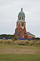
 Royal Victoria Hospital Chapel - geograph.org.uk - 5250297.jpg 640 × 426; 47 KB
-
 Royal Victoria Hospital Chapel - geograph.org.uk - 5250300.jpg 640 × 426; 54 KB
-
 Royal Victoria Hospital Chapel - geograph.org.uk - 5250303.jpg 426 × 640; 48 KB
-
 Royal Victoria Hospital Chapel - geograph.org.uk - 5250304.jpg 640 × 426; 50 KB
-
 Royal Victoria Hospital Chapel - geograph.org.uk - 5250418.jpg 640 × 426; 98 KB
-
 Royal Victoria Hospital Chapel - geograph.org.uk - 5250419.jpg 640 × 426; 65 KB
-
 Royal Victoria Hospital Chapel, Netley - geograph.org.uk - 5050817.jpg 640 × 427; 294 KB


_-_geograph.org.uk_-_5502921.jpg)
_-_geograph.org.uk_-_5506971.jpg)
_-_geograph.org.uk_-_5506978.jpg)
_-_geograph.org.uk_-_5506982.jpg)
_-_geograph.org.uk_-_5506987.jpg)
_-_geograph.org.uk_-_5506989.jpg)
_-_geograph.org.uk_-_5506995.jpg)
_-_geograph.org.uk_-_5506999.jpg)
_-_geograph.org.uk_-_5507002.jpg)
_-_geograph.org.uk_-_5507004.jpg)
_-_geograph.org.uk_-_5508760.jpg)
_-_geograph.org.uk_-_5503824.jpg)
_-_geograph.org.uk_-_5508767.jpg)
_-_geograph.org.uk_-_5508774.jpg)
_-_geograph.org.uk_-_5509632.jpg)
_-_geograph.org.uk_-_5509638.jpg)
_-_geograph.org.uk_-_5509647.jpg)
_-_geograph.org.uk_-_5509656.jpg)
_-_geograph.org.uk_-_5509667.jpg)
_-_geograph.org.uk_-_5509676.jpg)
_-_geograph.org.uk_-_5512126.jpg)
_-_geograph.org.uk_-_5512130.jpg)
_-_geograph.org.uk_-_5503830.jpg)
_-_geograph.org.uk_-_5513727.jpg)
_-_geograph.org.uk_-_5503841.jpg)
_-_geograph.org.uk_-_5503847.jpg)
_-_geograph.org.uk_-_5503853.jpg)
_-_geograph.org.uk_-_5503861.jpg)
_-_geograph.org.uk_-_5503868.jpg)
_-_geograph.org.uk_-_5506964.jpg)


.jpg)


