Category:Houghton Regis
Jump to navigation
Jump to search
town and civil parish in Bedfordshire, United Kingdom  | |||||
| Upload media | |||||
| Instance of | |||||
|---|---|---|---|---|---|
| Location | Central Bedfordshire, Bedfordshire, East of England, England | ||||
| Population |
| ||||
| official website | |||||
 | |||||
English: Houghton Regis is a town sandwiched between the major towns of Luton to the east and Dunstable to the west. The parish includes the ancient hamlets of Bidwell, Thorn and Sewell. Houghton Regis, along with its near neighbours of Dunstable and Luton form the Luton/Dunstable Urban Area, with a population over 230,000.
Italiano: Houghton Regis è una cittadina di 17.000 abitanti della contea del Bedfordshire, in Inghilterra.

Subcategories
This category has the following 7 subcategories, out of 7 total.
B
H
- Houghton Regis Marl Lakes (23 F)
S
- Sewell Cutting (5 F)
- Sewell, Bedfordshire (4 F)
T
- Thorn (Dunstable) (2 F)
Media in category "Houghton Regis"
The following 151 files are in this category, out of 151 total.
-
 0742 Dunstable and Kensworth Chalk Quarry - geograph.org.uk - 1832505.jpg 1,024 × 768; 118 KB
-
 A new stretch of the Chiltern Way - geograph.org.uk - 2365299.jpg 2,592 × 1,944; 2.32 MB
-
 A5 Dunstable Northern Bypass - geograph.org.uk - 6179401.jpg 1,024 × 684; 216 KB
-

-

-
 All Saints church, Houghton Regis - geograph.org.uk - 3799366.jpg 4,320 × 3,240; 4.53 MB
-
 Balancing pond by the warehouse - geograph.org.uk - 6718380.jpg 1,600 × 1,066; 503 KB
-
 Banking by the A5, Tithe Farm - geograph.org.uk - 5570245.jpg 2,048 × 1,536; 1.48 MB
-
 Bidwell Mews marketing suite - geograph.org.uk - 6854496.jpg 1,892 × 1,236; 1.14 MB
-
 Bidwell Mews, Houghton Regis - geograph.org.uk - 6854486.jpg 1,906 × 1,260; 1.6 MB
-
 Brunel Road - geograph.org.uk - 483661.jpg 640 × 480; 48 KB
-
 Bushes by Watling Street, North Dunstable - geograph.org.uk - 6711251.jpg 1,920 × 1,280; 1.52 MB
-
 Car wash on Mayer Way, Houghton Regis - geograph.org.uk - 6847488.jpg 1,838 × 1,142; 1.23 MB
-
 Central Bedfordshire , Dunstable Northern Bypass A5 - geograph.org.uk - 5733078.jpg 6,000 × 4,000; 5.64 MB
-
 Central Bedfordshire , Grassy Field ^ Pylons - geograph.org.uk - 5733076.jpg 5,801 × 3,867; 7.86 MB
-
 Central Bedfordshire , Grassy Field ^ Pylons - geograph.org.uk - 5733077.jpg 6,000 × 4,000; 7.78 MB
-
 Central Bedfordshire , The A505 - geograph.org.uk - 5733080.jpg 5,903 × 3,936; 5.81 MB
-
 Central Bedfordshire , The A505 - geograph.org.uk - 5733081.jpg 6,000 × 4,000; 7.87 MB
-
 Central Bedfordshire , The A505 - geograph.org.uk - 5733082.jpg 6,000 × 4,000; 7.02 MB
-
 Central Bedfordshire , Watling Street, A505 - geograph.org.uk - 5733084.jpg 6,000 × 4,000; 6.71 MB
-
 Central Bedfordshire , Watling Street, A505 - geograph.org.uk - 5733085.jpg 6,000 × 4,000; 6.14 MB
-
 Centre of grid square TL0123 looking West - geograph.org.uk - 388930.jpg 640 × 480; 186 KB
-
 Chalk pit at Dunstable - geograph.org.uk - 5461678.jpg 3,264 × 2,448; 3.17 MB
-
 Chiltern Way - geograph.org.uk - 2153807.jpg 640 × 480; 94 KB
-
 Chiltern Way - geograph.org.uk - 2153825.jpg 640 × 480; 80 KB
-
 Chiltern Way - geograph.org.uk - 2153865.jpg 640 × 480; 88 KB
-
 Chiltern Way - geograph.org.uk - 2153880.jpg 640 × 480; 99 KB
-
 Chiltern Way - geograph.org.uk - 2153891.jpg 640 × 480; 84 KB
-
 Chiltern Way - geograph.org.uk - 2153910.jpg 640 × 480; 153 KB
-
 Chiltern Way - geograph.org.uk - 2153955.jpg 640 × 480; 95 KB
-
 Chiltern Way Chalk Hill - geograph.org.uk - 2153851.jpg 640 × 480; 85 KB
-
 Cycle route heading for Leighton Buzzard - geograph.org.uk - 6710454.jpg 1,600 × 1,066; 450 KB
-
 Cycle route heading for Stanbridge - geograph.org.uk - 6718268.jpg 1,600 × 1,066; 710 KB
-
 Cycle route in the Sewell Cutting - geograph.org.uk - 6710427.jpg 1,600 × 1,066; 385 KB
-
 Dismantled railway at Sewell - geograph.org.uk - 2365233.jpg 2,592 × 1,944; 2.1 MB
-
 Disused Railway Bridge National Cycle Route - geograph.org.uk - 2633295.jpg 4,000 × 3,000; 4.97 MB
-
 Dunstable , Gulf Petrol Station - geograph.org.uk - 5733086.jpg 6,000 × 4,000; 6.56 MB
-
 Dunstable , Watling Street A505 - geograph.org.uk - 5733087.jpg 6,000 × 4,000; 5.62 MB
-
 Farmland below Chalk Hill - geograph.org.uk - 6718277.jpg 1,600 × 1,066; 308 KB
-
 Field near Sewell - geograph.org.uk - 2365248.jpg 2,592 × 1,944; 1.29 MB
-
 Fields and pylons by Bedford Road, Chalgrave - geograph.org.uk - 5053144.jpg 2,304 × 1,728; 858 KB
-
 Fields near Bidwell Farm - geograph.org.uk - 2365268.jpg 2,592 × 1,944; 1.58 MB
-
 Footbridge over A5 Dunstable Northern Bypass - geograph.org.uk - 6179389.jpg 1,024 × 684; 182 KB
-
 Footpath across the muddy field to Stanbridge - geograph.org.uk - 6718273.jpg 1,600 × 1,066; 452 KB
-
 Footpath behind Farriers Way - geograph.org.uk - 6710465.jpg 1,600 × 1,066; 479 KB
-
 Footpath by Lake View - geograph.org.uk - 6710467.jpg 1,600 × 1,066; 465 KB
-
 Footpath by the quarry - geograph.org.uk - 6710472.jpg 1,066 × 1,600; 568 KB
-
 Footpath down to Sewell Lane - geograph.org.uk - 6718279.jpg 1,600 × 1,200; 731 KB
-
 Footpath goes along the track to Grove Farm - geograph.org.uk - 3292285.jpg 1,600 × 1,067; 483 KB
-
 Footpath into Sewell - geograph.org.uk - 6718272.jpg 1,600 × 1,066; 634 KB
-
 Footpath to Suncote Avenue - geograph.org.uk - 6718276.jpg 1,600 × 1,066; 577 KB
-
 Footpath to Sundon Road - geograph.org.uk - 2153985.jpg 640 × 480; 71 KB
-
 Footpath towards Houghton Regis - geograph.org.uk - 6710474.jpg 1,600 × 1,066; 698 KB
-
 Frimatec (UK) limited - geograph.org.uk - 4138601.jpg 450 × 300; 32 KB
-
 Gatehouse and gate, Houghton Hall - geograph.org.uk - 5522517.jpg 640 × 427; 95 KB
-
 Grangeway - geograph.org.uk - 2691771.jpg 640 × 480; 57 KB
-
 Grove Road, Houghton Regis - geograph.org.uk - 5054982.jpg 2,304 × 1,728; 1.13 MB
-
 Haymarket Road - geograph.org.uk - 483628.jpg 640 × 480; 48 KB
-
 Hedge on top of the Sewell Cutting - geograph.org.uk - 6710422.jpg 1,600 × 1,066; 275 KB
-
 High Street Houghton Regis - geograph.org.uk - 5053139.jpg 2,104 × 1,547; 908 KB
-
 High-Tec Engineering, Houghton Regis - geograph.org.uk - 6847487.jpg 1,816 × 1,108; 1.42 MB
-
 Houghton Lodge - geograph.org.uk - 2468440.jpg 2,592 × 1,944; 2.52 MB
-
 Houghton Regis - All Saints - Chancel - geograph.org.uk - 4076215.jpg 1,000 × 1,333; 944 KB
-
 Houghton Regis - All Saints - Font detail - geograph.org.uk - 4024990.jpg 1,333 × 1,000; 969 KB
-
 Houghton Regis - geograph.org.uk - 2691821.jpg 640 × 480; 47 KB
-
 Houghton Regis - geograph.org.uk - 3180725.jpg 640 × 480; 68 KB
-
 Houghton Regis - geograph.org.uk - 3182070.jpg 640 × 480; 78 KB
-
 Houghton Regis - geograph.org.uk - 5463191.jpg 3,264 × 2,448; 3.24 MB
-
 Houghton Regis - Parish Map.jpg 1,109 × 876; 376 KB
-
 Houghton Regis Quarry - geograph.org.uk - 4508961.jpg 1,600 × 900; 513 KB
-
 Houghton Regis Town Council Offices.jpg 4,080 × 2,295; 2.37 MB
-
 Houghton Regis, Atlantic Cedar - geograph.org.uk - 3039067.jpg 640 × 480; 87 KB
-
 Houghton Regis, Chelsea Gardens - geograph.org.uk - 936104.jpg 640 × 480; 73 KB
-
 Houghton Regis, Churchfield Road - geograph.org.uk - 582624.jpg 640 × 480; 79 KB
-
 Houghton Regis, Holyrood Drive - geograph.org.uk - 3039098.jpg 640 × 480; 63 KB
-

-

-
 Houghton Regis, Richmond Drive - geograph.org.uk - 3039126.jpg 640 × 480; 65 KB
-
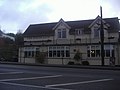
 Houghton Regis, The King's Arms - geograph.org.uk - 582636.jpg 640 × 480; 86 KB
-

-
 Houghton Road reservoir - geograph.org.uk - 6710461.jpg 1,600 × 1,066; 413 KB
-
 Houses on Clarkes Way - geograph.org.uk - 2468467.jpg 2,592 × 1,944; 3 MB
-
 Houses on Hillborough Crescent, Tithe Farm - geograph.org.uk - 5059940.jpg 2,304 × 1,728; 862 KB
-
 Houses on the B5120, Bidwell - geograph.org.uk - 6845563.jpg 1,890 × 1,234; 1.17 MB
-
 Houses on Watling Street, Chalk Hill - geograph.org.uk - 2882719.jpg 1,600 × 1,200; 660 KB
-

-
 Icknield Way behind Sewell Manor - geograph.org.uk - 6718275.jpg 1,600 × 1,066; 566 KB
-
 Icknield Way going south - geograph.org.uk - 6718445.jpg 1,600 × 1,066; 479 KB
-
 Icknield Way heading for Chalk Hill - geograph.org.uk - 6718395.jpg 1,600 × 1,066; 486 KB
-
 Kings Arms and All Saints' Church.jpg 2,499 × 1,874; 902 KB
-
 Kirton Way - geograph.org.uk - 2691793.jpg 640 × 480; 60 KB
-
 Lake View Play Area - geograph.org.uk - 6710462.jpg 1,600 × 1,066; 461 KB
-
 Longmeadow - geograph.org.uk - 3182098.jpg 640 × 480; 80 KB
-
 Looking at centre of grid square TL0123 - geograph.org.uk - 388924.jpg 640 × 480; 216 KB
-

-

-
 Looking SW along Sundon Road - geograph.org.uk - 395835.jpg 480 × 640; 50 KB
-
 LutonDunstableBUA.png 1,618 × 850; 92 KB
-
 New A5 roundabout - geograph.org.uk - 5646730.jpg 640 × 428; 88 KB
-
 New housing where the Icknield Way crosses Thorn Road - geograph.org.uk - 6718428.jpg 1,600 × 1,200; 320 KB
-
 New road construction by Bedford Road - geograph.org.uk - 5053145.jpg 2,238 × 1,636; 946 KB
-
 New roundabout on Bedford Road, Houghton Regis - geograph.org.uk - 6854492.jpg 1,850 × 1,164; 1.48 MB
-
 New roundabout on the A5, Houghton Regis - geograph.org.uk - 5279824.jpg 2,304 × 1,728; 980 KB
-
 New roundabout on the A5, Houghton Regis - geograph.org.uk - 5570248.jpg 2,048 × 1,536; 907 KB
-
 On the Chiltern Way - geograph.org.uk - 2365255.jpg 2,592 × 1,944; 1.78 MB
-
 Ouzel Brook by the sewage works - geograph.org.uk - 6718449.jpg 1,600 × 1,066; 463 KB
-
 Parking area on the new A5, Tithe Farm - geograph.org.uk - 5570246.jpg 1,960 × 1,412; 683 KB
-
 Play area - geograph.org.uk - 4189910.jpg 640 × 480; 58 KB
-
 Pond by a warehouse - geograph.org.uk - 6718392.jpg 1,600 × 1,066; 431 KB
-
 Power lines cross the A5120 near Chalgrave - geograph.org.uk - 3800541.jpg 4,320 × 3,240; 3.81 MB
-
 Public Footpath - Chiltern Way - geograph.org.uk - 2633301.jpg 4,000 × 3,000; 4.84 MB
-
 Public Footpath Bridge - geograph.org.uk - 2633298.jpg 4,000 × 3,000; 4.65 MB
-
 Pylons by the B5120, Houghton Regis - geograph.org.uk - 6845560.jpg 1,892 × 1,236; 1.32 MB
-
 Pylons take power across the farmland - geograph.org.uk - 3292280.jpg 1,600 × 1,067; 362 KB
-
 Rainbow over Tithe Farm Road - geograph.org.uk - 5055040.jpg 2,304 × 1,728; 849 KB
-
 Regent's Place, Houghton Regis - geograph.org.uk - 5078484.jpg 2,246 × 1,684; 1.42 MB
-
 Roundabout on Sundon Road, Houghton Regis - geograph.org.uk - 5059751.jpg 2,304 × 1,728; 835 KB
-
 Roundabout on the A5 and A505, Tilsworth - geograph.org.uk - 2882634.jpg 1,600 × 1,200; 584 KB
-
 Roundabout on the A5 and A505, Tilsworth - geograph.org.uk - 2882637.jpg 1,600 × 1,200; 684 KB
-
 Roundabout on the A5 and A505, Tilsworth - geograph.org.uk - 2882731.jpg 1,600 × 1,200; 474 KB
-
 Roundabout on the B5120, Houghton Regis - geograph.org.uk - 6845558.jpg 1,920 × 1,280; 856 KB
-
 Rowan tree on Tithe Farm Road - geograph.org.uk - 5055059.jpg 1,728 × 2,304; 834 KB
-
 Shops on Hillborough Crescent, Tithe Farm - geograph.org.uk - 5059797.jpg 2,238 × 1,636; 1.09 MB
-
 Shops on Tithe Farm Road, Houghton Regis - geograph.org.uk - 5055101.jpg 2,304 × 1,728; 841 KB
-
 Sodden building land by Thorn Road - geograph.org.uk - 6718459.jpg 1,600 × 1,200; 426 KB
-
 St Dominic Sq - geograph.org.uk - 483525.jpg 640 × 480; 66 KB
-
 St Thomas' Church Lowry Drive.jpg 3,648 × 2,736; 5.01 MB
-
 St Thomas' Meeting House - geograph.org.uk - 4189917.jpg 640 × 480; 77 KB
-
 Steep edge of the quarry nature reserve - geograph.org.uk - 6718270.jpg 1,600 × 1,200; 441 KB
-
 Stubbs Close - geograph.org.uk - 4189905.jpg 640 × 480; 69 KB
-
 Sundial Cottage, Sewell - geograph.org.uk - 2365221.jpg 2,592 × 1,944; 1.19 MB
-
 The A505 north of Totternhoe - geograph.org.uk - 5279842.jpg 2,200 × 1,578; 1.02 MB
-
 The B5120, Houghton Regis - geograph.org.uk - 6845561.jpg 1,888 × 1,230; 1.2 MB
-
 The edge of Beecroft, Dunstable - geograph.org.uk - 2365332.jpg 2,592 × 1,944; 1.63 MB
-
 The Green at Houghton Regis - geograph.org.uk - 2468464.jpg 2,592 × 1,944; 2.71 MB
-
 The Kings Arms, Houghton Regis - geograph.org.uk - 5053140.jpg 2,304 × 1,728; 852 KB
-
 The Kings Arms, Houghton Regis - geograph.org.uk - 6845557.jpg 1,916 × 1,276; 1.37 MB
-
 The new A5, Tithe Farm - geograph.org.uk - 5570243.jpg 2,048 × 1,536; 1.4 MB
-
 The White Lion pub, Chalk Hill - geograph.org.uk - 2882721.jpg 1,600 × 1,200; 635 KB
-
 The White Lion, Chalk Hill - geograph.org.uk - 6711431.jpg 1,856 × 1,176; 1.27 MB
-
 Tithe Farm Road, Houghton Regis - geograph.org.uk - 5055044.jpg 2,304 × 1,728; 830 KB
-
 Tithe Farm Road, Houghton Regis - geograph.org.uk - 5055065.jpg 2,304 × 1,728; 844 KB
-
 Tree by the B5120, Bidwell - geograph.org.uk - 6845564.jpg 1,892 × 1,236; 1.94 MB
-
 Woodside Link at the junction of Wheatfield Road - geograph.org.uk - 6613335.jpg 1,850 × 1,166; 1.17 MB
-

-
 Houghton Hall from Woodlands Avenue - geograph.org.uk - 204878.jpg 640 × 480; 100 KB
-
 Houghton Regis, Bedford Square - geograph.org.uk - 582631.jpg 640 × 480; 84 KB
-

-
 Recreation Ground, Tithe Farm - geograph.org.uk - 225642.jpg 640 × 480; 85 KB
-
 Road and scrubland at Parkside - geograph.org.uk - 395801.jpg 640 × 480; 39 KB
-
 Shell Petrol garage on Poynters Road - geograph.org.uk - 483622.jpg 640 × 480; 61 KB


_heading_north_-_geograph.org.uk_-_5646707.jpg)
_heading_north_-_geograph.org.uk_-_5646716.jpg)


_limited_-_geograph.org.uk_-_4138601.jpg)


