Category:Hotwells, Bristol
Jump to navigation
Jump to search
district of Bristol, England  | |||||
| Upload media | |||||
| Instance of | |||||
|---|---|---|---|---|---|
| Location | City of Bristol, South West England, England | ||||
| Area |
| ||||
 | |||||
Subcategories
This category has the following 12 subcategories, out of 12 total.
2
- 2–9 Albemarle Row (3 F)
C
- The Colonnade, Hotwells (6 F)
- Cornwallis Crescent, Bristol (6 F)
D
H
- Hope Chapel, Hotwells (4 F)
P
- Poole's Wharf (22 F)
S
- Sion Hill, Bristol (17 F)
Media in category "Hotwells, Bristol"
The following 200 files are in this category, out of 513 total.
(previous page) (next page)-
 'MV Glen Avon' entering Cumberland Basin Lock, Bristol - geograph.org.uk - 6423874.jpg 1,798 × 1,199; 336 KB
-
 'Sorry to bother you, but do you have any nuts^' - geograph.org.uk - 4432499.jpg 2,304 × 1,704; 1.6 MB
-
 1-10 Saville Place, Bristol - geograph.org.uk - 3771482.jpg 640 × 565; 216 KB
-
 1-16 York Place, Bristol - geograph.org.uk - 3771237.jpg 443 × 640; 180 KB
-
 1-19 Bellevue, Bristol - geograph.org.uk - 3771471.jpg 640 × 521; 191 KB
-
 14-34 West Mall, Bristol - geograph.org.uk - 3776488.jpg 640 × 552; 246 KB
-
 2 Royal York Crescent - geograph.org.uk - 5254728.jpg 680 × 1,024; 202 KB
-
 2-9 Sion Hill, Bristol - geograph.org.uk - 3773001.jpg 640 × 482; 185 KB
-
 262 Chapel Road, Bristol - geograph.org.uk - 3770416.jpg 521 × 640; 202 KB
-
 288-290 Hotwell Road, Bristol - geograph.org.uk - 3770424.jpg 520 × 640; 177 KB
-
 302-306 Hotwell Road, Bristol - geograph.org.uk - 3770421.jpg 640 × 480; 185 KB
-
 32-44 Caledonia Place, Bristol - geograph.org.uk - 3776477.jpg 640 × 556; 220 KB
-
 42 Regent Street, Bristol - geograph.org.uk - 3772924.jpg 491 × 640; 195 KB
-
 5 Albermarle Row, Bristol - geograph.org.uk - 3770432.jpg 422 × 640; 174 KB
-
 7-15 Clifton Vale, Bristol - geograph.org.uk - 3771195.jpg 640 × 482; 202 KB
-
 97 Princess Victoria Street, Bristol - geograph.org.uk - 3772955.jpg 640 × 455; 167 KB
-
 A broken circle - geograph.org.uk - 4432481.jpg 1,704 × 2,304; 1.71 MB
-
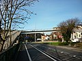 A footbridge over the A4 - geograph.org.uk - 2723771.jpg 800 × 600; 314 KB
-

-
 A wharf no more - geograph.org.uk - 5457578.jpg 4,320 × 3,240; 3.93 MB
-
 A4 Hotwells (750px).jpg 750 × 484; 48 KB
-
 Admiring the bridge - geograph.org.uk - 5455180.jpg 4,896 × 3,264; 5.2 MB
-
 Afternoon snooze - geograph.org.uk - 5353394.jpg 1,973 × 1,267; 985 KB
-
 Ambrose Rd, Bristol.jpg 4,272 × 2,403; 2 MB
-
 An old church and memorial - geograph.org.uk - 4430678.jpg 2,304 × 1,704; 1.67 MB
-
 Artist at work - geograph.org.uk - 4588914.jpg 1,899 × 1,195; 1.69 MB
-
 At the Clifton Suspension Bridge - geograph.org.uk - 4481764.jpg 640 × 480; 79 KB
-
 At the top of Hensmans Hill, Bristol - geograph.org.uk - 4481804.jpg 640 × 480; 105 KB
-
 Avon George Hotel, Sion Hill - geograph.org.uk - 4355557.jpg 2,048 × 1,536; 667 KB
-
 Avon Gorge Hotel - geograph.org.uk - 4583355.jpg 1,500 × 1,500; 246 KB
-
 Of the Hotwell waters near Bristol (IA b21440396).pdf 906 × 1,518, 108 pages; 3.88 MB
-
 Balloons over Bristol - geograph.org.uk - 5908013.jpg 971 × 1,024; 544 KB
-

-
 Beginning the Zig-zag path - geograph.org.uk - 6447637.jpg 3,068 × 3,977; 6.17 MB
-
 Behind Hope Chapel - geograph.org.uk - 6466741.jpg 4,779 × 3,186; 6.18 MB
-
 Below the Cabot Way flyover - geograph.org.uk - 4482768.jpg 800 × 451; 183 KB
-
 Bench on Clifton Hill - geograph.org.uk - 5455382.jpg 640 × 427; 280 KB
-
 Bennett Way, Hotwells - geograph.org.uk - 5450386.jpg 3,072 × 2,048; 1.23 MB
-
 Beside the Plimsoll Bridge, Bristol - geograph.org.uk - 5528841.jpg 1,802 × 2,172; 652 KB
-
 Bet tohorah at Jacob's Wells Road, Bristol.jpg 4,608 × 3,456; 3.16 MB
-
 Bicycle Bouquets - geograph.org.uk - 6444886.jpg 4,896 × 3,264; 5.7 MB
-
 Blue Ceanothus in Bristol - geograph.org.uk - 4481792.jpg 640 × 480; 149 KB
-
 Boyce's Buildings, Clifton - geograph.org.uk - 5445282.jpg 1,280 × 900; 279 KB
-
 Brandon Hill Nature Park - geograph.org.uk - 2473471.jpg 1,500 × 1,000; 250 KB
-
 Brandon Hill, Bristol (1) - geograph.org.uk - 3755534.jpg 640 × 418; 197 KB
-
 Brandon House on Jacob's Wells Road - geograph.org.uk - 2473470.jpg 1,500 × 1,000; 235 KB
-

-
 Bristol (2023-06-14) 18.jpg 5,568 × 3,712; 15.74 MB
-
 Bristol (2023-06-14) 19.jpg 3,712 × 5,568; 16.21 MB
-
 Bristol (2023-06-14) 20.jpg 3,712 × 5,568; 15.45 MB
-
 Bristol (2023-06-14) 21.jpg 5,568 × 3,712; 16.4 MB
-
 Bristol (2023-06-14) 22.jpg 3,712 × 5,568; 18.14 MB
-
 Bristol (2023-06-14) 23.jpg 3,712 × 5,568; 16.98 MB
-
 Bristol (2023-06-14) 24.jpg 3,712 × 5,568; 16.3 MB
-
 Bristol , Brunel Way View - geograph.org.uk - 2392354.jpg 3,176 × 2,326; 2.4 MB
-
 Bristol , Clifton Suspension Bridge - geograph.org.uk - 4615980.jpg 2,848 × 4,288; 7.3 MB
-
 Bristol , Clifton Suspension Bridge ^ River Avon - geograph.org.uk - 2392353.jpg 3,264 × 2,448; 3.21 MB
-
 Bristol , Hotwell Road A4 - geograph.org.uk - 4403260.jpg 4,288 × 2,848; 5.57 MB
-
 Bristol , Merchants Road - geograph.org.uk - 4403273.jpg 4,288 × 2,848; 5.39 MB
-
 Bristol , The Avon Gorge ^ Clifton Suspension Bridge - geograph.org.uk - 4615975.jpg 4,225 × 2,806; 5.99 MB
-
 Bristol - Clifton Road - geograph.org.uk - 5266424.jpg 2,560 × 1,920; 2.5 MB
-
 Bristol - Hotwell Road - geograph.org.uk - 5266368.jpg 2,560 × 1,920; 2.73 MB
-
 Bristol - Hotwells, BS8 - geograph.org.uk - 2897639.jpg 640 × 480; 104 KB
-

-
 Bristol Apartments (10) - geograph.org.uk - 6458211.jpg 3,264 × 3,869; 4.91 MB
-
 Bristol Apartments (3) - geograph.org.uk - 6458160.jpg 4,896 × 3,264; 6.67 MB
-
 Bristol Balloons 3 - geograph.org.uk - 4155514.jpg 4,385 × 2,993; 2.46 MB
-
 Bristol Harbour Pilot - geograph.org.uk - 4717508.jpg 5,600 × 3,504; 5.12 MB
-
 Bristol locks and former tobacco warehouses - geograph.org.uk - 5445897.jpg 1,280 × 960; 506 KB
-
 Bristol Marathon (1982) - Cumberland Basin - geograph.org.uk - 6437785.jpg 1,198 × 1,797; 446 KB
-
 Bristol MMB W2 Cumberland Basin.jpg 2,304 × 1,728; 1.22 MB
-
 Bristol MMB W5 Cumberland Basin.jpg 2,304 × 1,728; 1.68 MB
-
 Bristol Pubs (1) - geograph.org.uk - 6443602.jpg 4,896 × 3,264; 4.48 MB
-
 Bristol Pubs (24) - geograph.org.uk - 6469393.jpg 3,264 × 4,896; 6.48 MB
-
 Bristol Pubs (25) - geograph.org.uk - 6469400.jpg 4,279 × 3,194; 5.21 MB
-
 Bristol Pubs (3) - geograph.org.uk - 6449990.jpg 4,687 × 3,221; 4.58 MB
-
 Bristol Pubs (4) - geograph.org.uk - 6450000.jpg 4,110 × 2,887; 3.88 MB
-
 Bristol to Pill cyclepath - geograph.org.uk - 395875.jpg 480 × 640; 151 KB
-
 Bristol, Clifton, Zigzag Path - geograph.org.uk - 5661886.jpg 1,280 × 960; 599 KB
-
 Bristol, rooftops of Hotwells Road - geograph.org.uk - 854370.jpg 480 × 640; 92 KB
-
 Brunel's Lock - geograph.org.uk - 4717901.jpg 6,000 × 4,000; 6.44 MB
-
 Buildings in Clifton - geograph.org.uk - 5565420.jpg 6,000 × 4,000; 6.34 MB
-
 Buildings on The Mall, Clifton - geograph.org.uk - 4405793.jpg 1,920 × 2,380; 637 KB
-
 By Bristol Entrance Lock - geograph.org.uk - 5450261.jpg 3,072 × 2,048; 1.01 MB
-
 Caledonia Place - geograph.org.uk - 2311210.jpg 640 × 462; 81 KB
-
 Caledonia Place, Clifton - geograph.org.uk - 5014569.jpg 6,000 × 4,000; 4.65 MB
-
 Caledonia Place, Clifton - geograph.org.uk - 6392739.jpg 4,895 × 3,263; 3.56 MB
-
 Caledonia Place, Clifton, Bristol - geograph.org.uk - 3699908.jpg 800 × 680; 151 KB
-
 Cars overhead, runners below - geograph.org.uk - 6275409.jpg 3,296 × 2,472; 3.2 MB
-
 Caught by the sun - geograph.org.uk - 6444856.jpg 2,401 × 2,100; 2.87 MB
-
 Caught by the sun - geograph.org.uk - 6739029.jpg 4,514 × 2,916; 4.14 MB
-
 Cedar, The Polygon, Bristol - geograph.org.uk - 3770529.jpg 497 × 640; 263 KB
-
 Church Walk, or Birdcage Walk, Clifton - geograph.org.uk - 5445431.jpg 427 × 640; 131 KB
-
 Clifton - Bar Chocolat - geograph.org.uk - 5266397.jpg 2,560 × 1,920; 2.51 MB
-
 Clifton - BS8 (Bridge) - geograph.org.uk - 3069626.jpg 800 × 544; 152 KB
-
 Clifton - BS8 (Centre) - geograph.org.uk - 3069131.jpg 800 × 708; 162 KB
-
 Clifton - BS8 (Centre) - geograph.org.uk - 3069152.jpg 800 × 710; 225 KB
-
 Clifton - BS8 (Centre) - geograph.org.uk - 3069159.jpg 800 × 747; 212 KB
-
 Clifton - BS8 (Centre) - geograph.org.uk - 3069185.jpg 800 × 641; 149 KB
-
 Clifton - BS8 (Prince's Lane) - geograph.org.uk - 3069266.jpg 800 × 596; 136 KB
-
 Clifton - BS8 (Sion Hill) - geograph.org.uk - 3069237.jpg 601 × 800; 111 KB
-
 Clifton - BS8 (Sion Hill) - geograph.org.uk - 3069288.jpg 800 × 600; 137 KB
-
 Clifton - BS8 (Sion Hill) - geograph.org.uk - 3069316.jpg 800 × 682; 157 KB
-
 Clifton - BS8 (Sion Hill) - geograph.org.uk - 3069599.jpg 800 × 559; 148 KB
-
 Clifton - BS8 (Sion Hill) - geograph.org.uk - 3069607.jpg 800 × 483; 119 KB
-
 Clifton - Sion Hill - geograph.org.uk - 5266374.jpg 2,560 × 1,920; 2.67 MB
-
 Clifton - The Mall - geograph.org.uk - 5266389.jpg 2,560 × 1,920; 3.17 MB
-
 Clifton and Hot Wells 1833.jpg 4,272 × 2,098; 11.96 MB
-
 Clifton and Hotwells from the west bank of the Avon - geograph.org.uk - 1861383.jpg 3,442 × 2,174; 2.46 MB
-
 Clifton Bridge from the air - geograph.org.uk - 2613034.jpg 640 × 480; 147 KB
-
 Clifton from the Avon - geograph.org.uk - 4720252.jpg 5,938 × 3,958; 6.76 MB
-
 Clifton Hardware - geograph.org.uk - 5308147.jpg 640 × 480; 286 KB
-
 Clifton Hill - BS8 - geograph.org.uk - 3094521.jpg 800 × 520; 112 KB
-
 Clifton Hill - BS8 - geograph.org.uk - 3094538.jpg 800 × 578; 170 KB
-
 Clifton Hill Area - BS8 - geograph.org.uk - 3094830.jpg 600 × 800; 153 KB
-
 Clifton Hill Area - BS8 - geograph.org.uk - 3094861.jpg 800 × 562; 157 KB
-
 Clifton Hill House - geograph.org.uk - 2783563.jpg 2,048 × 1,536; 696 KB
-

-
 Clifton Road - geograph.org.uk - 6461067.jpg 1,024 × 683; 427 KB
-
 Clifton Rocks Railway, lower station - geograph.org.uk - 5446383.jpg 1,280 × 880; 527 KB
-
 Clifton Signpost - geograph.org.uk - 1942561.jpg 768 × 1,024; 252 KB
-
 Clifton Suspension Bridge - geograph.org.uk - 2085918.jpg 1,500 × 1,000; 161 KB
-
 Clifton Suspension Bridge - geograph.org.uk - 2991164.jpg 1,200 × 803; 956 KB
-
 Clifton Suspension Bridge - geograph.org.uk - 4274016.jpg 1,024 × 683; 117 KB
-
 Clifton Suspension Bridge - geograph.org.uk - 4583330.jpg 2,000 × 1,500; 272 KB
-
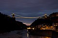 Clifton Suspension Bridge at dusk - geograph.org.uk - 3415820.jpg 1,631 × 1,080; 390 KB
-
 Clifton suspension bridge from hotwells 600.jpg 600 × 393; 44 KB
-

-
 Clifton Wood - geograph.org.uk - 5308159.jpg 640 × 480; 276 KB
-
 Clifton Wood - geograph.org.uk - 6743496.jpg 4,145 × 2,733; 3.04 MB
-
 Clifton Wood Crescent - Bristol - geograph.org.uk - 1866031.jpg 1,600 × 1,200; 379 KB
-
 Clifton Wood from Baltic Wharf, Bristol - geograph.org.uk - 4485983.jpg 1,024 × 768; 120 KB
-
 Clifton, Regent Street - BS8 - geograph.org.uk - 3093757.jpg 800 × 659; 167 KB
-
 Clifton, Royal York Cres - BS8 - geograph.org.uk - 3093542.jpg 600 × 800; 145 KB
-
 Clifton, Royal York Cres, BS8 - geograph.org.uk - 3093558.jpg 566 × 800; 149 KB
-
 Clifton, Royal York Crescent - BS8 - geograph.org.uk - 3093525.jpg 800 × 643; 170 KB
-
 Clifton, Royal York Crescent - BS8 - geograph.org.uk - 3093731.jpg 800 × 647; 187 KB
-
 Clifton, Sion Hill Area - BS8 - geograph.org.uk - 3093487.jpg 800 × 681; 172 KB
-
 Clifton, York Gdns - BS8 - geograph.org.uk - 3093702.jpg 800 × 620; 145 KB
-
 Cliftonwood - BS8 - geograph.org.uk - 3096991.jpg 800 × 703; 148 KB
-
 Cliftonwood - BS8 - geograph.org.uk - 3097030.jpg 800 × 673; 165 KB
-
 Cliftonwood - BS8 - geograph.org.uk - 3097067.jpg 600 × 800; 133 KB
-
 Cliftonwood - BS8 - geograph.org.uk - 3097074.jpg 800 × 600; 114 KB
-
 Cliftonwood Area - BS8 - geograph.org.uk - 3096634.jpg 600 × 800; 179 KB
-
 Cliftonwood Terrace - geograph.org.uk - 5353673.jpg 4,641 × 3,094; 5.92 MB
-
 Colonnade, Hotwells, Bristol.jpg 712 × 491; 104 KB
-
 Colourful Cliftonwood - geograph.org.uk - 4426712.jpg 2,304 × 1,704; 1.79 MB
-
 Colourful houses in Cliftonwood Crescent, Bristol - geograph.org.uk - 3757002.jpg 4,320 × 3,240; 5.29 MB
-
 Colourful Utilities Boxes - geograph.org.uk - 6444874.jpg 4,102 × 3,137; 6.98 MB
-
 Cornwallis Crescent - geograph.org.uk - 5444691.jpg 4,540 × 3,025; 4.93 MB
-

-
 Cumberland Basin - geograph.org.uk - 6461201.jpg 1,024 × 683; 343 KB
-
 Cumberland Basin Bridge - geograph.org.uk - 6466666.jpg 3,405 × 2,400; 2.22 MB
-
 Cumberland Basin Road - geograph.org.uk - 6443608.jpg 4,814 × 3,209; 6.16 MB
-
 Cumberland Basin Road - geograph.org.uk - 6444868.jpg 4,896 × 3,264; 5.5 MB
-
 Cumberland Basin Road, Bristol - geograph.org.uk - 3793557.jpg 640 × 457; 160 KB
-

-
 Decaying wharfs on River Avon - geograph.org.uk - 5443619.jpg 640 × 427; 101 KB
-
 Derelict jetties on Hotwell Road - geograph.org.uk - 6615799.jpg 4,000 × 3,000; 3.02 MB
-
 Derelict landing stage - geograph.org.uk - 4592395.jpg 5,962 × 3,975; 7.4 MB
-
 Derelict landing stage, Hotwells Rd, Clifton - geograph.org.uk - 4755264.jpg 1,024 × 768; 234 KB
-
 Derelict Piers - geograph.org.uk - 4140489.jpg 5,787 × 3,815; 6.95 MB
-
 Descending a path - geograph.org.uk - 5455460.jpg 640 × 427; 208 KB
-
 Detail of 2 Bellevue, Bristol - geograph.org.uk - 3771473.jpg 640 × 499; 271 KB
-

-
 Detail of Clifton Vale, Bristol - geograph.org.uk - 3771203.jpg 640 × 467; 155 KB
-
 Dining Room - geograph.org.uk - 5469966.jpg 4,896 × 3,264; 5.09 MB
-
 Doorway - geograph.org.uk - 2371522.jpg 768 × 1,024; 134 KB
-
 Down Goldney Lane - geograph.org.uk - 6445656.jpg 3,227 × 4,840; 4.71 MB
-
 Down the Zig-zag - geograph.org.uk - 6745666.jpg 4,684 × 3,123; 5.99 MB
-

-
 Dowry Square, Bristol - geograph.org.uk - 2998523.jpg 468 × 640; 75 KB
-
 Easter excursion - geograph.org.uk - 6126134.jpg 3,716 × 2,561; 3.1 MB
-

-
 Elegant facades - geograph.org.uk - 6741168.jpg 2,780 × 2,392; 1.71 MB
-
 Elegant house, Hotwells Road - geograph.org.uk - 4592645.jpg 4,798 × 3,315; 6.62 MB
-
 Entrance Lock - BS1 - geograph.org.uk - 3100869.jpg 800 × 600; 152 KB
-
 Entrance Lock - BS1 - geograph.org.uk - 3101001.jpg 623 × 800; 138 KB
-
 Entrance Lock - BS1 - geograph.org.uk - 3101105.jpg 800 × 638; 157 KB
-
 Entrance Lock - geograph.org.uk - 6477764.jpg 2,317 × 2,251; 1.96 MB
-
 Entrance Lock Gates - geograph.org.uk - 5353706.jpg 4,709 × 3,139; 4.11 MB
-
 Entrance to Cemetery near Clifton Wood, Bristol - geograph.org.uk - 2230490.jpg 3,071 × 2,282; 3.64 MB
-
 Eugenie de Montijo, Green Plaque - geograph.org.uk - 5254730.jpg 1,024 × 680; 128 KB
-
 Evening light on houses in Sion Hill - geograph.org.uk - 6080239.jpg 1,024 × 683; 188 KB
-
 Extreme Pruning - geograph.org.uk - 5443973.jpg 3,084 × 4,371; 5.64 MB
-
 Fairfold House, Clifton - geograph.org.uk - 1953860.jpg 640 × 480; 72 KB
-
 Fiesta, Gromit No. 54 - geograph.org.uk - 3791446.jpg 740 × 1,024; 174 KB
-
 Fine houses in Sion Hill - geograph.org.uk - 4816581.jpg 640 × 427; 89 KB
-
 Floating Gangway - geograph.org.uk - 4717639.jpg 4,109 × 2,976; 3.83 MB
-
 Flood debris - geograph.org.uk - 4141607.jpg 5,455 × 3,735; 7.26 MB
-
 Foot of the ZigZag - geograph.org.uk - 2166390.jpg 1,024 × 768; 281 KB
-
 Footbridge - geograph.org.uk - 5444828.jpg 3,849 × 2,902; 4.97 MB
-
 Footpath in Brandon Hill Nature Park - geograph.org.uk - 2473475.jpg 1,500 × 1,000; 299 KB
-
 Footpath signpost, Sion Hill, Clifton - geograph.org.uk - 5726960.jpg 2,848 × 4,288; 2.55 MB
-

-

-

-
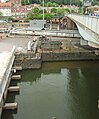
 Former Steamer Landing Places - BS8 - geograph.org.uk - 3102370.jpg 800 × 626; 173 KB
-

-


.jpg)

.jpg)


_-_geograph.org.uk_-_3755534.jpg)


_18.jpg)
_19.jpg)
_20.jpg)
_21.jpg)
_22.jpg)
_23.jpg)
_24.jpg)


_-_geograph.org.uk_-_6458211.jpg)
_-_geograph.org.uk_-_6458160.jpg)


_-_Cumberland_Basin_-_geograph.org.uk_-_6437785.jpg)


_-_geograph.org.uk_-_6443602.jpg)
_-_geograph.org.uk_-_6469393.jpg)
_-_geograph.org.uk_-_6469400.jpg)
_-_geograph.org.uk_-_6449990.jpg)
_-_geograph.org.uk_-_6450000.jpg)


_-_geograph.org.uk_-_3069626.jpg)
_-_geograph.org.uk_-_3069131.jpg)
_-_geograph.org.uk_-_3069152.jpg)
_-_geograph.org.uk_-_3069159.jpg)
_-_geograph.org.uk_-_3069185.jpg)
_-_geograph.org.uk_-_3069266.jpg)
_-_geograph.org.uk_-_3069237.jpg)
_-_geograph.org.uk_-_3069288.jpg)
_-_geograph.org.uk_-_3069316.jpg)
_-_geograph.org.uk_-_3069599.jpg)
_-_geograph.org.uk_-_3069607.jpg)


