Category:Hothersall
Jump to navigation
Jump to search
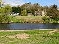
English: Hothersall is a civil parish in the Ribble Valley district, in Lancashire, England. The parish, which is on the north bank of the River Ribble, is rural and contains no major villages, and in the 2001 census had a population of 136. It is approximately north-east of Preston, and has boundaries with Longridge to the north and west, and Ribchester to the east.
hamlet and civil parish in Lancashire, UK | |||||
| Upload media | |||||
| Instance of | |||||
|---|---|---|---|---|---|
| Location | Ribble Valley, Lancashire, North West England, England | ||||
 | |||||
Media in category "Hothersall"
The following 97 files are in this category, out of 97 total.
-
 A choice of paths - geograph.org.uk - 4053230.jpg 4,000 × 3,000; 5.34 MB
-
 A field of mown hay - geograph.org.uk - 4053200.jpg 4,000 × 3,000; 7.15 MB
-
 A Ruin by Hothersall Hall - geograph.org.uk - 6093115.jpg 5,184 × 3,456; 7.13 MB
-
 A windblown tree - geograph.org.uk - 3918435.jpg 3,953 × 2,598; 4.85 MB
-
 A windblown tree with the River Ribble beyond - geograph.org.uk - 3917962.jpg 2,929 × 2,929; 5.15 MB
-
 An open gate with the River Ribble beyond - geograph.org.uk - 3917939.jpg 4,465 × 2,972; 7.82 MB
-
 Approaching Woodlands Farm - geograph.org.uk - 3444100.jpg 2,048 × 1,536; 716 KB
-
-
 B6245 from the end of Hothersall Lane - geograph.org.uk - 4490201.jpg 4,592 × 3,056; 7.03 MB
-
 Benchmark on a gatepost at Red Bank - geograph.org.uk - 3444846.jpg 2,048 × 1,536; 549 KB
-
 Bridleway above the Ribble Valley - geograph.org.uk - 2408360.jpg 2,592 × 1,944; 1.52 MB
-
 Bridleway between Longridge and Ribchester - geograph.org.uk - 2408365.jpg 2,592 × 1,944; 1.6 MB
-
 Bridleway West To Ox Hey - geograph.org.uk - 3286007.jpg 2,560 × 1,920; 3.16 MB
-
 Close up, Elizabeth II postbox on Blackburn Road - geograph.org.uk - 5134330.jpg 1,387 × 2,593; 463 KB
-
 Corporation Arms - geograph.org.uk - 4459940.jpg 4,945 × 2,385; 1.87 MB
-
 Corporation Arms, Longridge - geograph.org.uk - 3551690.jpg 1,600 × 1,200; 470 KB
-
 Eatoughs Farm - geograph.org.uk - 6098219.jpg 5,184 × 3,456; 7.55 MB
-
 Electricity pylon dominating the skyline - geograph.org.uk - 4962977.jpg 1,280 × 943; 1.17 MB
-
 Elizabeth II postbox and bus shelter on Blackburn Road - geograph.org.uk - 5134329.jpg 2,279 × 1,522; 779 KB
-
 Elizabeth II postbox and bus shelter on Blackburn Road - geograph.org.uk - 5134331.jpg 2,848 × 2,136; 1.4 MB
-
 Elm House - geograph.org.uk - 3551705.jpg 1,600 × 1,200; 592 KB
-
 Entrance to Lower College Farm - geograph.org.uk - 4868142.jpg 1,024 × 768; 289 KB
-
 Farm at Hothersall Hall - geograph.org.uk - 4868175.jpg 1,024 × 768; 210 KB
-
 Farmland at Longridge - geograph.org.uk - 5163159.jpg 1,280 × 960; 1.18 MB
-
 Farmland in the Ribble valley - geograph.org.uk - 4053212.jpg 4,000 × 3,000; 6.34 MB
-
 Farmland near Hothersall - geograph.org.uk - 1053996.jpg 640 × 480; 96 KB
-
 Field and trees near Longridge - geograph.org.uk - 5163145.jpg 1,280 × 959; 958 KB
-
 Field of mown hay - geograph.org.uk - 4053215.jpg 4,000 × 3,000; 7.35 MB
-
 Fisherman - geograph.org.uk - 597307.jpg 640 × 344; 145 KB
-
 Footpath heading towards Lord's Farm - geograph.org.uk - 6098213.jpg 5,184 × 3,456; 7.26 MB
-
 Footpath off Hothersall Lane to Meadow Head - geograph.org.uk - 3917996.jpg 3,892 × 2,442; 7.36 MB
-
 Footpath To Ribchester - geograph.org.uk - 3557022.jpg 2,560 × 1,920; 3.97 MB
-
 Grazing off Preston Road (B6245) - geograph.org.uk - 5132645.jpg 640 × 480; 56 KB
-
 Hothersall Hall (geograph 4053208).jpg 4,000 × 3,000; 4.22 MB
-
 Hothersall Hall - geograph.org.uk - 3285994.jpg 2,560 × 1,920; 2.21 MB
-
 Hothersall Hall - geograph.org.uk - 3917182.jpg 4,592 × 3,056; 6.2 MB
-
 Hothersall Hall - geograph.org.uk - 3938928.jpg 1,024 × 768; 668 KB
-
 Hothersall Hall - geograph.org.uk - 4868186.jpg 1,024 × 768; 209 KB
-
 Hothersall Hall Farm - geograph.org.uk - 3444836.jpg 2,048 × 1,215; 356 KB
-
 Hothersall Lane - geograph.org.uk - 3917131.jpg 4,592 × 2,996; 7.77 MB
-
 Hothersall Lane, near Longridge - geograph.org.uk - 5163148.jpg 1,280 × 1,071; 1.02 MB
-
 Hothersall Lane, near Longridge - geograph.org.uk - 5163149.jpg 1,280 × 960; 1,011 KB
-
 Hothersall, UK - panoramio (1).jpg 3,264 × 2,448; 2.2 MB
-
 Hothersall, UK - panoramio (2).jpg 3,264 × 2,448; 2.19 MB
-
 Hothersall, UK - panoramio (3).jpg 3,264 × 2,448; 2.2 MB
-
 Hothersall, UK - panoramio (4).jpg 3,264 × 2,448; 2.26 MB
-
 Hothersall, UK - panoramio (5).jpg 3,264 × 2,448; 2.22 MB
-
 Hothersall, UK - panoramio (6).jpg 3,264 × 2,448; 2.31 MB
-
 Hothersall, UK - panoramio (7).jpg 3,264 × 2,448; 2.26 MB
-
 In Leece's Wood - geograph.org.uk - 4053219.jpg 4,000 × 3,000; 6.29 MB
-
 Junction of paths at a pond near Ox Hey - geograph.org.uk - 4868165.jpg 1,024 × 768; 358 KB
-
 Leece's Wood - geograph.org.uk - 4053223.jpg 4,000 × 3,000; 6.36 MB
-
 Logs by a field boundary - geograph.org.uk - 3920025.jpg 4,592 × 3,056; 7.18 MB
-
 Lower Road by Spade Mill Reservoir - geograph.org.uk - 1976422.jpg 1,600 × 1,140; 171 KB
-
 Mature trees in a field north of the Ribble - geograph.org.uk - 2408354.jpg 2,592 × 1,944; 1.51 MB
-
 Narrow Road With Deep Ditches - geograph.org.uk - 3286015.jpg 2,560 × 1,920; 2.98 MB
-

-
 On the north bank of the Ribble - geograph.org.uk - 4053181.jpg 4,000 × 3,000; 5.08 MB
-
 Overlooking the Ribble - geograph.org.uk - 4053203.jpg 4,000 × 3,000; 4.66 MB
-
 Oxhey Barn - geograph.org.uk - 3444890.jpg 2,048 × 1,536; 543 KB
-
 Pasture near Butcher Fold - geograph.org.uk - 6097361.jpg 5,184 × 3,456; 6.4 MB
-
 Path from Butchers Fold Farm to Frances Green - geograph.org.uk - 6104714.jpg 1,600 × 1,200; 483 KB
-
 Path to Hothersall Lane Between Ox Hey and Butcher Fold - geograph.org.uk - 6104699.jpg 1,600 × 1,200; 718 KB
-
 Pilkington Bus on Preston Road - geograph.org.uk - 5132633.jpg 640 × 375; 81 KB
-
 Public Footpath by Lower College Farm - geograph.org.uk - 6097325.jpg 5,184 × 3,456; 4.1 MB
-
 Red Bank on the Ribble Way - geograph.org.uk - 4868197.jpg 1,024 × 768; 218 KB
-
 River Ribble - geograph.org.uk - 2408356.jpg 2,592 × 1,944; 1.55 MB
-
 River Ribble at Dobridding Wood - geograph.org.uk - 5714798.jpg 5,184 × 3,456; 6.5 MB
-
 Rivet benchmark on a rock near Red Bank - geograph.org.uk - 3444843.jpg 2,048 × 1,536; 519 KB
-

-
 Road Sign next to the Corporation Arms, Longridge - geograph.org.uk - 4501573.jpg 2,848 × 2,134; 1.05 MB
-
 Road to Higher College Farm - geograph.org.uk - 5131578.jpg 640 × 480; 38 KB
-
 Run down cottage on Preston Road - geograph.org.uk - 5132639.jpg 640 × 480; 79 KB
-
 Spade Mill Reservoir - geograph.org.uk - 4463987.jpg 5,102 × 2,677; 1.97 MB
-
 Stile near Butcher Fold - geograph.org.uk - 4053226.jpg 4,000 × 3,000; 3.63 MB
-
 Stile on the Ribble Way - geograph.org.uk - 4053190.jpg 4,000 × 3,000; 7.48 MB
-
 Stile on The Ribble Way at Red Bank - geograph.org.uk - 6104677.jpg 1,600 × 1,200; 787 KB
-
 Stubbins Nook Farm - geograph.org.uk - 6093242.jpg 5,149 × 3,455; 7.59 MB
-
 The Corporation Arms on Lower Road - geograph.org.uk - 4317573.jpg 1,500 × 999; 160 KB
-
 The Corporation Arms, Longridge - geograph.org.uk - 4501554.jpg 3,581 × 1,690; 1.04 MB
-
 The Corporation Arms, Longridge - geograph.org.uk - 5131580.jpg 640 × 414; 57 KB
-
 The entrance to Lower College Farm - geograph.org.uk - 4490089.jpg 4,058 × 2,900; 7.75 MB
-
 The Face in the Trees at Hothersall Hall - geograph.org.uk - 6104694.jpg 1,600 × 1,200; 550 KB
-
 The footpath to Butcher Fold - geograph.org.uk - 3916756.jpg 4,592 × 3,056; 6.96 MB
-
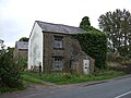
 The remains of a farm building - geograph.org.uk - 3917100.jpg 4,146 × 2,891; 6.35 MB
-
 The Ribble Valley - geograph.org.uk - 4053195.jpg 4,000 × 3,000; 6.49 MB
-
 The Ribble Way at Red Bank - geograph.org.uk - 5625565.jpg 1,024 × 768; 235 KB
-
 The River Ribble - geograph.org.uk - 3918387.jpg 640 × 375; 65 KB
-
 The River Ribble near Hothersall Hall - geograph.org.uk - 6104687.jpg 1,600 × 1,200; 340 KB
-
 The Wall at Hothersall - geograph.org.uk - 3444102.jpg 2,048 × 1,536; 520 KB
-
 Track (Roman Road^) at Red Bank on the Ribble Way - geograph.org.uk - 6104684.jpg 1,600 × 1,200; 470 KB
-
 Track between Butcher Fold Farm and Ox Hey - geograph.org.uk - 6104703.jpg 1,024 × 769; 245 KB
-
 Track near Haven Farm - geograph.org.uk - 6104721.jpg 1,600 × 1,200; 570 KB
-
 Ventilation Fan at Butcher Fold Farm - geograph.org.uk - 6104708.jpg 1,600 × 1,200; 783 KB
-
 View towards Hothersall from Red Bank - geograph.org.uk - 6093112.jpg 5,184 × 3,456; 6.85 MB
-
 Walking The Plank - geograph.org.uk - 3286032.jpg 2,560 × 1,920; 3.11 MB
-
 Butcher Fold - geograph.org.uk - 128192.jpg 640 × 426; 137 KB


_-_geograph.org.uk_-_5132645.jpg)
.jpg)


.jpg)
.jpg)
.jpg)
.jpg)
.jpg)
.jpg)
.jpg)


_-_geograph.org.uk_-_5132643.jpg)


_at_Red_Bank_on_the_Ribble_Way_-_geograph.org.uk_-_6104684.jpg)


