Category:Horseshoe Mesa
Jump to navigation
Jump to search
Landform in the Grand Canyon, Arizona | |||||
| Upload media | |||||
| Instance of | |||||
|---|---|---|---|---|---|
| Location | Arizona | ||||
 | |||||
.jpg)
(surrounded by canyons left & right, (west & east))
Subcategories
This category has the following 6 subcategories, out of 6 total.
C
- Canyon Copper Co. Mine (5 F)
G
H
- Horseshoe Mesa Copper Mine (8 F)
R
V
- Views from Horseshoe Mesa (6 F)
Media in category "Horseshoe Mesa"
The following 14 files are in this category, out of 14 total.
-
 AgaveUtahensis HorseshoeMesa 140430.JPG 2,448 × 3,264; 3.9 MB
-
 Arizona. LOC 99446126-11.jpg 4,883 × 6,157; 6.27 MB
-
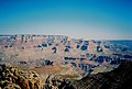
 Grand Canyon from Moran Point.jpeg 2,000 × 824; 231 KB
-
 Grand Canyon National Park Grandview Point Panorama 0177 (7572101006).jpg 8,000 × 3,449; 8.91 MB
-
 Grand Canyon Yavapai Point02.jpg 2,520 × 1,680; 3.08 MB
-
 GrandCanyonfromAbove.jpg 508 × 381; 71 KB
-
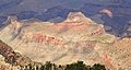
 Grandview-Phantom Monocline.jpg 1,013 × 587; 171 KB
-
 Harvey Butchart's hiking map - Flickr - brewbooks (8).jpg 3,264 × 2,448; 3.73 MB
-
 Horseshoe Mesa east (16330876855).jpg 3,264 × 2,448; 3.77 MB
-
 Horseshoe Mesa from Grandview Point, Grand Canyon.jpg 3,245 × 1,730; 1.64 MB
-
 Horseshoe Mesa.jpg 1,818 × 1,228; 740 KB
-
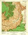
 NPS grand-canyon-south-rim-map.pdf 3,258 × 1,472; 13.71 MB
-
 Radiation area (16143292798).jpg 3,264 × 2,448; 3.65 MB
-
 Rainbow over Horseshoe Mesa.jpg 3,204 × 2,012; 2.2 MB


.jpg)
.jpg)


.jpg)
