Category:Horseshoe Bend National Military Park
Jump to navigation
Jump to search
2,040-acre park in Alabama (US) maintained by the National Park Service _side).JPG)  | |||||
| Upload media | |||||
| Instance of |
| ||||
|---|---|---|---|---|---|
| Commemorates | |||||
| Location | Tallapoosa County, Alabama | ||||
| Visitor center | |||||
| Operator | |||||
| Heritage designation | |||||
| IUCN protected areas category | |||||
| Inception |
| ||||
| Visitors per year |
| ||||
| official website | |||||
 | |||||
English: Horseshoe Bend National Military Park near Dadeville, Alabama, is listed on the National Register of Historic Places.
Subcategories
This category has the following 2 subcategories, out of 2 total.
M
- Miller Covered Bridge (25 F)
Media in category "Horseshoe Bend National Military Park"
The following 96 files are in this category, out of 96 total.
-
 Another view of the stockade line, Horseshoe Bend NMP.jpg 3,264 × 2,448; 1.64 MB
-
 Battlefield from woods, Horseshoe Bend NMP.jpg 3,264 × 2,448; 2.5 MB
-
 Battlefield overview, Horseshoe Bend NMP.jpg 3,264 × 2,448; 1.13 MB
-
 Bend in the Tallapoosa River, Horseshoe Bend NMP.jpg 3,264 × 2,448; 2.54 MB
-
 Cannon and memorial stone, Horseshoe Bend NMP.jpg 3,264 × 2,448; 2.92 MB
-
 Cannon at battlefield, Horseshoe Bend NMP.jpg 3,264 × 2,448; 2.61 MB
-
 Distant view of stockade line, Horseshoe Bend NMP.jpg 3,264 × 2,448; 1.9 MB
-
 Diving through Horseshoe Bend.jpg 1,478 × 2,229; 1.1 MB
-
 Driving loop 2, Horseshoe Bend NMP.jpg 3,264 × 2,448; 1.62 MB
-
 Driving loop, Horseshoe Bend NMP.jpg 3,264 × 2,448; 2.66 MB
-
 End of one-way driving loop, Horseshoe Bend NMP.jpg 3,264 × 2,448; 2.5 MB
-
 Entering the woods, Horseshoe Bend NMP.jpg 3,264 × 2,448; 2.87 MB
-
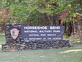 Entrance Sign P9230236.JPG 3,072 × 2,304; 1.49 MB
-
 Entrance sign, Horseshoe Bend NMP.jpg 2,560 × 1,920; 2.51 MB
-
 Entrance to visitors center, Horseshoe Bend NMP.jpg 3,264 × 2,448; 1.38 MB
-
 Fence along highway, Horseshoe Bend NMP.jpg 1,920 × 2,560; 2.42 MB
-
 Field, Horseshoe Bend NMP.jpg 3,264 × 2,448; 1.69 MB
-
 Firing Up The Cannon.jpg 2,048 × 1,492; 1.68 MB
-
 Forest, Horseshoe Bend NMP.jpg 3,264 × 2,448; 2.82 MB
-
 Grave of Major Lemuel Montgomery, Horseshoe Bend NMP.jpg 2,448 × 3,264; 2.55 MB
-
 Graves and battlefield, Horseshoe Bend NMP.jpg 3,264 × 2,448; 1.76 MB
-
 Graves and path, Horseshoe Bend NMP.jpg 3,264 × 2,448; 2.47 MB
-
 Horseshoe Bend National Military Park, Tallapoosa County, Alabama.jpg 3,872 × 2,592; 1.25 MB
-
 Horseshoe Bend National Military Park.jpg 5,472 × 912; 607 KB
-
 Horseshoe Bend NMP DSC 0246 (5586391902).jpg 3,872 × 2,592; 1.26 MB
-
 Horseshoe Bend NMP DSC 0252 (5586392306).jpg 3,872 × 2,592; 794 KB
-
 Horseshoe Bend NMP DSC 0259 (5585801025).jpg 3,872 × 2,592; 740 KB
-
 Horseshoe Bend NMP DSC 0265 (5586393272).jpg 3,872 × 2,592; 1.25 MB
-
 Horseshoe Bend NMP DSC 0270 (5585802897).jpg 2,592 × 3,872; 1.26 MB
-
 Horseshoe Bend NMP DSC 0271 (5586395108).jpg 2,592 × 3,872; 1.25 MB
-
 Horseshoe Bend NMP DSC 0273 (5586393954).jpg 3,872 × 2,592; 1.28 MB
-
 Horseshoe Bend NMP DSC 0277 (5586607274).jpg 2,592 × 3,872; 1.25 MB
-
 Horseshoe Bend NMP DSC 0278 (5586013209).jpg 3,872 × 2,592; 973 KB
-
 Horseshoe Bend NMP DSC 0283 (5586607842).jpg 3,872 × 2,592; 934 KB
-
 Horseshoe Bend NMP DSC 0291 (5586391290).jpg 2,592 × 3,872; 1.25 MB
-
 Horseshoe Bend NMP DSC 0298 (5586015035).jpg 2,592 × 3,872; 1.25 MB
-
 Horseshoe Bend NMP DSC 0300 (5586609036).jpg 2,592 × 3,872; 987 KB
-
 Horseshoe Bend NMP DSC 0303 (5586016151).jpg 3,872 × 2,592; 1.03 MB
-
 Horseshoe Bend NMP DSC 0318 (5586610932).jpg 2,592 × 3,872; 1.37 MB
-
 Horseshoe Bend NMP DSC 0328 (5586611604).jpg 3,872 × 2,592; 1.25 MB
-
 Horseshoe Bend NMP DSC 0329 (5586019299).jpg 3,872 × 2,592; 870 KB
-
 Horseshoe Bend NMP DSC 0330 (5586612260).jpg 2,592 × 3,872; 1.25 MB
-
 Horseshoe Bend NMP DSC 0337 (5586019691).jpg 3,872 × 2,592; 696 KB
-
 Horseshoe Bend NMP DSC 0343 (5586613766).jpg 3,872 × 2,592; 1.27 MB
-
 Horseshoe Bend NMP DSC 0356 (5586614364).jpg 3,872 × 2,592; 1.26 MB
-
 Horseshoe Bend NMP DSC 0361 (5586021351).jpg 2,592 × 3,872; 828 KB
-
 Horseshoe Bend Park Map.jpg 1,911 × 1,718; 454 KB
-
 Horseshoe Bend Re-enactment Day.jpg 2,048 × 1,418; 1.4 MB
-
 Horseshoe Bend Re-enactment.jpg 3,628 × 2,417; 2.27 MB
-
 Information boards, Horseshoe Bend NMP.jpg 3,264 × 2,448; 2.78 MB
-
 Jackson Trace terminus stone, Horseshoe Bend NMP.jpg 2,448 × 3,264; 3.13 MB
-
 Location of the Creek stockade, Horseshoe Bend NMP.jpg 3,264 × 2,448; 1.26 MB
-
 Marker for Gun Hill, Horseshoe Bend NMP.jpg 3,264 × 2,448; 2.91 MB
-
 Memorial stone up close, Horseshoe Bend NMP.jpg 3,264 × 2,448; 2.83 MB
-
 Memorial stone, Horseshoe Bend NMP.jpg 3,264 × 2,448; 2.59 MB
-
 NPS map of Horseshoe Bend NMP.jpg 961 × 838; 82 KB
-
 Overlook and battlefield, Horseshoe Bend NMP.jpg 3,264 × 2,448; 1.48 MB
-
 Overlook shelter up close, Horseshoe Bend NMP.jpg 3,264 × 2,448; 1.32 MB
-
 Overlook shelter, Horseshoe Bend NMP.jpg 3,264 × 2,448; 1.4 MB
-
 Plaque in honor of Major Lemuel Montgomery, Horseshoe Bend NMP.jpg 3,264 × 2,448; 2.59 MB
-
 Stop -1 P9230241 Tallapoosa River.JPG 3,072 × 2,304; 1.5 MB
-
 Stop -1 P9230242 Tallapoosa River.JPG 3,072 × 2,304; 1.43 MB
-
 Stop -2 P9230243 Stockade line.JPG 3,072 × 2,304; 1.44 MB
-
 Stop -2 P9230252 Stockade line from Creek (Red Sticks) side).JPG 3,072 × 2,304; 1.71 MB
-
 Stop -3 P9230244 Tallapoosa River-Cherokee Crossing.JPG 3,072 × 2,304; 1.64 MB
-
 Stop -3 P9230245.JPG 3,072 × 2,304; 1.5 MB
-
 Stop -3 P9230246.JPG 3,072 × 2,304; 1.61 MB
-
 Stop -3 P9230247.JPG 3,072 × 2,304; 1.69 MB
-
 Stop -3 P9230249 Tohopeka Village.JPG 3,072 × 2,304; 1.56 MB
-
 Stop -5 P9230250.JPG 3,072 × 2,304; 1.43 MB
-
 Stop -5 P9230251.JPG 3,072 × 2,304; 1.45 MB
-
 Sun-dappled drive, Horseshoe Bend NMP.jpg 3,264 × 2,448; 3.62 MB
-
 Tallapoosa County - Horseshoe Bend National Military Park - 20220711145800.jpg 3,024 × 4,032; 4.11 MB
-
 Tallapoosa County - Horseshoe Bend National Military Park - 20220711153003.jpg 4,032 × 3,024; 4.93 MB
-
 Tallapoosa County - Horseshoe Bend National Military Park - 20220711154406.jpg 4,032 × 3,024; 6.65 MB
-
 Tallapoosa River at Horseshoe Bend NMP.jpg 415 × 313; 171 KB
-
 Tallapoosa River, Horseshoe Bend NMP.jpg 3,264 × 2,448; 2.39 MB
-
 Terminus of Jackson Trace, Horseshoe Bend NMP.jpg 3,264 × 2,448; 3.24 MB
-

-
 The Horseshoe Bend itself, Horseshoe Bend NMP.jpg 3,264 × 2,448; 2.44 MB
-
 Tipi Re-enactment Day.jpg 3,074 × 2,411; 2.16 MB
-
 Trees and battlefield, Horseshoe Bend NMP.jpg 3,264 × 2,448; 2.86 MB
-
 Trees and clearing, Horseshoe Bend NMP.jpg 3,264 × 2,448; 2.2 MB
-
 Trees and driving loop, Horseshoe Bend NMP.jpg 3,264 × 2,448; 2.17 MB
-
 Trees at edge of woods, Horseshoe Bend NMP.jpg 2,448 × 3,264; 3.21 MB
-
 Trees of Horseshoe Bend.jpg 1,490 × 2,247; 1.39 MB
-
 Uphill path, Horseshoe Bend NMP.jpg 3,264 × 2,448; 2.97 MB
-
 Walking path in the woods, Horseshoe Bend NMP.jpg 2,448 × 3,264; 1.98 MB
-
 Walking path to memorials, Horseshoe Bend NMP.jpg 3,264 × 2,448; 2.82 MB
-

-
 White posts marking the Creek stockade, Horseshoe Bend NMP.jpg 3,264 × 2,448; 1.27 MB
-
 Wishbone Tree.jpg 1,161 × 1,752; 775 KB
-
 Woods and roadway, Horseshoe Bend NMP.jpg 3,264 × 2,448; 2.95 MB
-
 Woods and trees, Horseshoe Bend NMP.jpg 3,264 × 2,448; 1.44 MB
-
 Woods at Horseshoe Bend NMP.jpg 3,264 × 2,448; 2.94 MB
-
 Woods, Horseshoe Bend NMP.jpg 3,264 × 2,448; 2.84 MB


.jpg)
.jpg)
.jpg)
.jpg)
.jpg)
.jpg)
.jpg)
.jpg)
.jpg)
.jpg)
.jpg)
.jpg)
.jpg)
.jpg)
.jpg)
.jpg)
.jpg)
.jpg)
.jpg)
.jpg)
.jpg)
.jpg)


.JPG)


.jpg)


