Category:Horningsham
Jump to navigation
Jump to search
village and civil parish in Wiltshire, United Kingdom  | |||||
| Upload media | |||||
| Instance of | |||||
|---|---|---|---|---|---|
| Location | Wiltshire, South West England, England | ||||
 | |||||
English: Horningsham is a small Wiltshire village forming part of the Longleat Estate and lying on the Wiltshire/Somerset border between Warminster and Frome.
Nederlands: Horningsham is een dorp (village) en civil parish in de unitary authority Wiltshire, in het Engelse graafschap Wiltshire. De civil parish telt
Subcategories
This category has the following 3 subcategories, out of 3 total.
C
L
Media in category "Horningsham"
The following 200 files are in this category, out of 263 total.
(previous page) (next page)-
 '69 Lions - geograph.org.uk - 4796440.jpg 640 × 470; 43 KB
-

-

-

-

-

-

-

-
 2010 , Heaven's gate's gate - geograph.org.uk - 1996640.jpg 800 × 445; 142 KB
-
 2010 , Horningsham Trig Point - geograph.org.uk - 2010659.jpg 800 × 569; 232 KB
-

-

-
 2010 , North east from Cock Road - geograph.org.uk - 1938646.jpg 800 × 526; 131 KB
-

-
 2010 , Rye Hill Farm - geograph.org.uk - 1862066.jpg 1,024 × 377; 127 KB
-

-

-

-
 2010 , Track from Hitcombe Bottom - geograph.org.uk - 2010720.jpg 800 × 524; 130 KB
-

-
 Animatronic beasts at Longleat - geograph.org.uk - 5754312.jpg 4,032 × 3,024; 2.86 MB
-

-
 Approaching the B3092 - geograph.org.uk - 282230.jpg 640 × 480; 130 KB
-
 At the dead end of Pottle Street - geograph.org.uk - 1340737.jpg 640 × 521; 228 KB
-
 Autumn Gold at Little Bradley Wood - geograph.org.uk - 282226.jpg 480 × 640; 201 KB
-
 B3092 Frome Road - geograph.org.uk - 282233.jpg 640 × 480; 115 KB
-
 Beautiful trees and immaculate lawns at Longleat - geograph.org.uk - 4038997.jpg 1,500 × 1,125; 882 KB
-

-
 Bench Mark, Longleat - geograph.org.uk - 3659345.jpg 640 × 640; 267 KB
-
 Boat “Lady Bath”, Longleat Safari Park - geograph.org.uk - 6364437.jpg 1,024 × 768; 1.26 MB
-
 Bridleway and Mid Wilts Way - geograph.org.uk - 5603578.jpg 1,024 × 768; 343 KB
-
 Bridleway near Horningsham - geograph.org.uk - 1388266.jpg 640 × 480; 184 KB
-
 Bridleway near Horningsham - geograph.org.uk - 1388279.jpg 640 × 482; 216 KB
-
 Bridleway near Horningsham - geograph.org.uk - 2316793.jpg 640 × 480; 70 KB
-
 Bridleway near Horningsham - geograph.org.uk - 2316794.jpg 640 × 480; 84 KB
-
 Bunns Lane - geograph.org.uk - 136236.jpg 640 × 480; 47 KB
-
 Butterfly House at Longleat - geograph.org.uk - 5751385.jpg 4,032 × 3,024; 4.36 MB
-
 Californian Sea Lion, Longleat Safari Park - geograph.org.uk - 6363690.jpg 1,024 × 768; 1.01 MB
-
 Ceiling roundel, Longleat House - geograph.org.uk - 4039198.jpg 1,171 × 1,444; 341 KB
-
 Church Street Horningsham - geograph.org.uk - 1371586.jpg 640 × 516; 174 KB
-
 Cottages and meadow on Pottle Street - geograph.org.uk - 1371810.jpg 640 × 503; 158 KB
-
 Drawing room, Longleat House - geograph.org.uk - 4039183.jpg 1,972 × 1,462; 517 KB
-
 Dredging work on Half Mile Pond - geograph.org.uk - 5749062.jpg 3,948 × 2,457; 2.46 MB
-
 Dry valley near Baycliffe Farm - geograph.org.uk - 2316717.jpg 640 × 480; 68 KB
-
 Dry valley near Horningsham - geograph.org.uk - 2316722.jpg 640 × 480; 69 KB
-
 English Oak (Quercus robur) at Longleat House - geograph.org.uk - 4038950.jpg 1,192 × 1,600; 737 KB
-
 Entrance to Animal Adventure at Longleat - geograph.org.uk - 5751538.jpg 4,032 × 3,024; 5.77 MB
-
 Entrance to former stable block at Longleat - geograph.org.uk - 5755372.jpg 3,918 × 2,938; 3.79 MB
-
 Entrance to Hedge Maze at Longleat - geograph.org.uk - 5751557.jpg 4,032 × 3,024; 2.34 MB
-
 Entrance to Penguin Island - geograph.org.uk - 5751369.jpg 4,032 × 3,024; 2.8 MB
-
 Fallow deer, Longleat - geograph.org.uk - 3644624.jpg 640 × 505; 108 KB
-
 Family dining room, Longleat House, Wiltshire - geograph.org.uk - 4039163.jpg 1,975 × 1,466; 488 KB
-
 Farmland at Horningsham - geograph.org.uk - 5603537.jpg 1,024 × 768; 194 KB
-
 Farmland near Horningsham - geograph.org.uk - 4710878.jpg 1,600 × 1,069; 1.04 MB
-
 Farmland opposite Horningsham Church - geograph.org.uk - 5086491.jpg 640 × 480; 41 KB
-
 Feeding time at Penguin Island - geograph.org.uk - 5751376.jpg 4,032 × 3,024; 2.63 MB
-
 Festival of Light 2019 (1), Longleat House - geograph.org.uk - 6355011.jpg 1,024 × 768; 1.24 MB
-
 Festival of Light 2019 (2), Longleat House - geograph.org.uk - 6355020.jpg 1,024 × 768; 1.01 MB
-
 Field edge view from Horninghsam Triangulation Pillar - geograph.org.uk - 5343759.jpg 4,000 × 3,000; 2.93 MB
-
 Fire hydrant cover, Longleat - geograph.org.uk - 3659339.jpg 640 × 500; 160 KB
-
 Formal dining room, Longleat House - geograph.org.uk - 4039122.jpg 1,600 × 1,200; 486 KB
-
 Formal dining room, Longleat House - geograph.org.uk - 4039134.jpg 1,500 × 2,000; 404 KB
-
 Formal dining room, Longleat House - geograph.org.uk - 4039139.jpg 2,000 × 1,500; 649 KB
-
 Fountain at Longleat - geograph.org.uk - 4483334.jpg 800 × 531; 107 KB
-
 Fountain at Longleat House - geograph.org.uk - 2768735.jpg 430 × 709; 69 KB
-
 Fountain, Longleat House - geograph.org.uk - 4483329.jpg 531 × 800; 138 KB
-
 Garden at Longleat House - geograph.org.uk - 4483374.jpg 531 × 800; 180 KB
-

-
 Gate near Baycliffe Farm - geograph.org.uk - 2316709.jpg 640 × 480; 85 KB
-
 Giant animatronic cobra at Longleat - geograph.org.uk - 5751549.jpg 4,032 × 3,024; 2.57 MB
-
 Giant ants at Longleat - geograph.org.uk - 5754174.jpg 4,032 × 3,024; 3.19 MB
-
 Gorilla colony at Longleat - geograph.org.uk - 5749041.jpg 4,032 × 3,024; 3.9 MB
-
 Grass field near Horningsham - geograph.org.uk - 1398927.jpg 640 × 481; 155 KB
-
 Grass field near Horningsham - geograph.org.uk - 1451061.jpg 640 × 480; 139 KB
-
 High Wood, Longleat - geograph.org.uk - 16995.jpg 640 × 413; 40 KB
-
 Hiscombe Wood - geograph.org.uk - 456487.jpg 640 × 489; 106 KB
-
 Horningsham - Bristol 1257 DAE511K.JPG 1,024 × 768; 313 KB
-
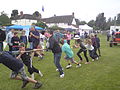 Horningsham Fete.jpg 2,592 × 1,944; 1.29 MB
-
 Horningsham, arable land - geograph.org.uk - 2680360.jpg 1,024 × 768; 260 KB
-
 Horningsham, autumn colour - geograph.org.uk - 2680368.jpg 1,024 × 768; 188 KB
-
 Horningsham, autumn colours - geograph.org.uk - 2680344.jpg 1,024 × 768; 308 KB
-
 Horningsham, autumn colours - geograph.org.uk - 2680372.jpg 1,024 × 768; 367 KB
-
 Horningsham, autumn colours - geograph.org.uk - 2680386.jpg 1,024 × 768; 236 KB
-
 Horningsham, clamp ^ barn - geograph.org.uk - 2680393.jpg 1,024 × 768; 141 KB
-
 Horningsham, Cock Road - geograph.org.uk - 2680365.jpg 1,024 × 768; 253 KB
-
 Horningsham, country road - geograph.org.uk - 2680380.jpg 1,024 × 768; 306 KB
-
 Horningsham, farm entrance - geograph.org.uk - 2680357.jpg 1,024 × 768; 225 KB
-
 Horningsham, gate - geograph.org.uk - 2680376.jpg 1,024 × 768; 317 KB
-
 Horningsham, haystack - geograph.org.uk - 2680383.jpg 1,024 × 768; 181 KB
-
 Horningsham, milestone - geograph.org.uk - 2680377.jpg 1,024 × 768; 301 KB
-
 Horningsham, milestone - geograph.org.uk - 2680389.jpg 1,024 × 768; 284 KB
-
 Horningsham, permissive footpath - geograph.org.uk - 2680351.jpg 1,024 × 768; 310 KB
-
 Inlet to Half Mile Pond - geograph.org.uk - 5751316.jpg 4,032 × 3,024; 5.22 MB
-
 Island in Half Mile Pond - geograph.org.uk - 5749025.jpg 4,032 × 3,024; 2.26 MB
-
 Island in Half Mile Pond - geograph.org.uk - 5749035.jpg 4,032 × 3,024; 1.57 MB
-
 Kissing gate, Horningsham - geograph.org.uk - 1451040.jpg 640 × 480; 148 KB
-
 Lady Lenka - geograph.org.uk - 5749007.jpg 4,032 × 3,024; 2.6 MB
-
 Lake outfall - geograph.org.uk - 2992907.jpg 1,024 × 769; 284 KB
-
 Lane to Round Hill Farm - geograph.org.uk - 1371920.jpg 640 × 539; 202 KB
-
 Lane, Horningsham - geograph.org.uk - 1451017.jpg 640 × 480; 149 KB
-
 Lane, Horningsham - geograph.org.uk - 1451031.jpg 480 × 640; 157 KB
-
 Lions, Longleat - geograph.org.uk - 3644616.jpg 640 × 444; 116 KB
-
 Lions, Longleat Safari Park - geograph.org.uk - 6354880.jpg 1,024 × 512; 982 KB
-
 Longbridge Deverill, cattle grazing - geograph.org.uk - 2680419.jpg 1,024 × 768; 112 KB
-
 Longbridge Deverill, country lane - geograph.org.uk - 2680417.jpg 1,024 × 768; 160 KB
-
 Longleat (1) - geograph.org.uk - 6383074.jpg 4,319 × 3,240; 2.6 MB
-
 Longleat (10) - geograph.org.uk - 6383086.jpg 4,320 × 3,240; 3.08 MB
-
 Longleat (11) - geograph.org.uk - 6383088.jpg 4,079 × 3,059; 2.72 MB
-
 Longleat (12) - geograph.org.uk - 6383090.jpg 3,240 × 4,320; 4.53 MB
-
 Longleat (13) - geograph.org.uk - 6383091.jpg 4,145 × 3,109; 3.39 MB
-
 Longleat (14) - geograph.org.uk - 6383093.jpg 4,320 × 3,240; 2.6 MB
-
 Longleat (15) - geograph.org.uk - 6383094.jpg 3,240 × 4,320; 2.2 MB
-
 Longleat (16) - geograph.org.uk - 6383097.jpg 4,320 × 3,240; 2.96 MB
-
 Longleat (17) - geograph.org.uk - 6383099.jpg 3,240 × 4,320; 2.87 MB
-
 Longleat (18) - geograph.org.uk - 6383109.jpg 4,320 × 3,240; 3.66 MB
-
 Longleat (19) - geograph.org.uk - 6383111.jpg 4,320 × 3,240; 2.95 MB
-
 Longleat (2) - geograph.org.uk - 6383077.jpg 4,223 × 3,167; 2.49 MB
-
 Longleat (20) - geograph.org.uk - 6383113.jpg 4,320 × 3,240; 3.01 MB
-
 Longleat (21) - geograph.org.uk - 6383115.jpg 4,320 × 3,240; 3.96 MB
-
 Longleat (22) - geograph.org.uk - 6383117.jpg 4,320 × 3,240; 2.48 MB
-
 Longleat (23) - geograph.org.uk - 6383820.jpg 4,211 × 3,159; 2.65 MB
-
 Longleat (24) - geograph.org.uk - 6383821.jpg 4,320 × 3,240; 3.15 MB
-
 Longleat (25) - geograph.org.uk - 6383822.jpg 4,320 × 3,240; 3.88 MB
-
 Longleat (26) - geograph.org.uk - 6383824.jpg 3,983 × 2,987; 1.81 MB
-
 Longleat (27) - geograph.org.uk - 6383825.jpg 4,320 × 3,240; 3.35 MB
-
 Longleat (28) - geograph.org.uk - 6383827.jpg 3,694 × 2,770; 1.89 MB
-
 Longleat (29) - geograph.org.uk - 6383828.jpg 4,320 × 3,240; 2.46 MB
-
 Longleat (3) - geograph.org.uk - 6383079.jpg 4,320 × 3,240; 2.42 MB
-
 Longleat (30) - geograph.org.uk - 6383830.jpg 4,320 × 3,240; 2.99 MB
-
 Longleat (4) - geograph.org.uk - 6383080.jpg 4,320 × 3,240; 2.07 MB
-
 Longleat (5) - geograph.org.uk - 6383081.jpg 4,223 × 3,167; 1.81 MB
-
 Longleat (6) (geograph 6383082).jpg 4,177 × 3,133; 3.66 MB
-
 Longleat (7) - geograph.org.uk - 6383083.jpg 4,320 × 3,240; 4.05 MB
-
 Longleat (8) - geograph.org.uk - 6383084.jpg 4,211 × 3,159; 3.21 MB
-
 Longleat (9) - geograph.org.uk - 6383085.jpg 4,079 × 3,059; 1.88 MB
-
 Longleat - Safari Park Lion - geograph.org.uk - 2768728.jpg 1,350 × 898; 187 KB
-
 Longleat Central - geograph.org.uk - 4772882.jpg 640 × 480; 97 KB
-
 Longleat Central Station - geograph.org.uk - 5386158.jpg 1,024 × 768; 217 KB
-
 Longleat estate, Wiltshire - geograph.org.uk - 4039583.jpg 1,600 × 1,200; 409 KB
-
 Longleat Gardens, Wiltshire - geograph.org.uk - 4038995.jpg 1,024 × 768; 201 KB
-
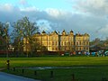
 Longleat House - geograph.org.uk - 1832742.jpg 640 × 480; 89 KB
-
 Longleat House - geograph.org.uk - 2526988.jpg 640 × 415; 79 KB
-
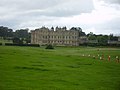 Longleat House - geograph.org.uk - 3151661.jpg 1,280 × 960; 313 KB
-
 Longleat House - geograph.org.uk - 4483311.jpg 1,024 × 680; 271 KB
-
 Longleat House - geograph.org.uk - 4483318.jpg 800 × 531; 100 KB
-
 Longleat House - geograph.org.uk - 4772900.jpg 640 × 480; 57 KB
-
 Longleat House - geograph.org.uk - 5386237.jpg 1,024 × 766; 134 KB
-
 Longleat House - geograph.org.uk - 5751293.jpg 3,850 × 2,888; 3.12 MB
-
 Longleat House - geograph.org.uk - 5754354.jpg 4,032 × 3,024; 2.16 MB
-
 Longleat House - geograph.org.uk - 5754361.jpg 4,032 × 3,024; 2.31 MB
-
 Longleat House - geograph.org.uk - 5755399.jpg 3,275 × 2,374; 1.93 MB
-
 Longleat House - geograph.org.uk - 6354985.jpg 1,024 × 768; 197 KB
-
 Longleat House and gardens - geograph.org.uk - 2515247.jpg 640 × 452; 125 KB
-
 Longleat House and gardens - geograph.org.uk - 3644636.jpg 640 × 435; 118 KB
-
 Longleat House viewed from the Orangery - geograph.org.uk - 6353289.jpg 1,024 × 768; 1.08 MB
-
 Longleat House, box garden - geograph.org.uk - 5386249.jpg 1,024 × 768; 248 KB
-
 Longleat House, courtyard - geograph.org.uk - 5386164.jpg 1,024 × 768; 139 KB
-
 Longleat House, South-west wing - geograph.org.uk - 5386132.jpg 1,024 × 768; 142 KB
-
 Longleat House, Wiltshire - geograph.org.uk - 4038956.jpg 1,500 × 1,117; 862 KB
-
 Longleat House, Wiltshire - geograph.org.uk - 4038982.jpg 1,600 × 1,161; 438 KB
-
 Longleat House, Wiltshire - geograph.org.uk - 4039114.jpg 1,992 × 1,489; 499 KB
-
 Longleat House, Wiltshire - geograph.org.uk - 4039156.jpg 2,000 × 1,500; 733 KB
-
 Longleat House, Wiltshire - geograph.org.uk - 4039570.jpg 1,600 × 1,200; 474 KB
-
 Longleat House, Wiltshire - geograph.org.uk - 4039701.jpg 1,600 × 1,196; 322 KB
-
 Longleat House, Wiltshire - geograph.org.uk - 4039706.jpg 1,600 × 1,191; 362 KB
-
 Longleat House, Wiltshire 1992 - geograph.org.uk - 6241783.jpg 1,500 × 2,139; 852 KB
-
 Longleat Maze - geograph.org.uk - 2768723.jpg 1,286 × 619; 236 KB
-
 Longleat Park - geograph.org.uk - 5748977.jpg 3,861 × 2,856; 4.61 MB
-
 Longleat Park, Flynn - geograph.org.uk - 5386160.jpg 1,024 × 768; 224 KB
-
 Longleat Park, fountains - geograph.org.uk - 5386245.jpg 1,024 × 768; 174 KB
-
 Longleat Park, peacocks - geograph.org.uk - 5386170.jpg 1,024 × 768; 150 KB
-
 Longleat Safari Park - Rhino - geograph.org.uk - 2768730.jpg 1,350 × 945; 197 KB
-
 Longleat Safari Park Camels - geograph.org.uk - 2515255.jpg 640 × 400; 89 KB
-
 Longleat Safari Park, camels - geograph.org.uk - 5386201.jpg 1,024 × 768; 132 KB
-
 Longleat Safari Park, deer - geograph.org.uk - 5386210.jpg 1,024 × 768; 165 KB
-
 Longleat Safari Park, lions - geograph.org.uk - 5386218.jpg 1,024 × 768; 275 KB
-
 Longleat, drive - geograph.org.uk - 5386241.jpg 1,024 × 754; 119 KB
-
 Longleat, landing stage - geograph.org.uk - 5386156.jpg 1,024 × 768; 201 KB
-
 Longleat, orangery - geograph.org.uk - 5386140.jpg 1,024 × 766; 209 KB
-
 Longleat, pet cemetery - geograph.org.uk - 5386096.jpg 1,024 × 745; 286 KB
-
 Longleat, Secret Garden - geograph.org.uk - 5386146.jpg 1,024 × 757; 307 KB
-
 Looking north near Round Hill Farm - geograph.org.uk - 1371827.jpg 640 × 533; 229 KB
-
 Maiden Bradley, country road - geograph.org.uk - 2679784.jpg 1,024 × 768; 272 KB
-
 Maiden Bradley, Forest Road - geograph.org.uk - 2680338.jpg 1,024 × 768; 297 KB
-
 Memorial to Joan Russell 1927-2003 - geograph.org.uk - 456499.jpg 640 × 480; 80 KB
-
 Milestone near Horningsham - geograph.org.uk - 2316795.jpg 640 × 481; 87 KB
-
 Milestone near Horningsham - geograph.org.uk - 2316796.jpg 640 × 480; 70 KB
-
 Mill Pond and Mill farm, Horningsham - geograph.org.uk - 5603522.jpg 1,024 × 768; 227 KB
-
 Miniature diesel locomotive, Longleat Safari Park - geograph.org.uk - 6364445.jpg 1,024 × 768; 1.15 MB
-
 Miniature diesel on the turntable at Longleat - geograph.org.uk - 5754258.jpg 4,032 × 3,024; 3.61 MB
-
 Miniature railway at Longleat - geograph.org.uk - 5751607.jpg 4,032 × 3,024; 4.3 MB
-
 Miniature railway at Longleat - geograph.org.uk - 5754195.jpg 2,944 × 4,006; 3.66 MB
-
 Miniature railway at Longleat - geograph.org.uk - 5754206.jpg 2,823 × 3,782; 3.99 MB
-
 Miniature railway at Longleat - geograph.org.uk - 5754223.jpg 3,024 × 3,895; 5.06 MB
-
 Miniature railway at Longleat - geograph.org.uk - 5754277.jpg 4,032 × 3,024; 5.17 MB
-
 Miniature train, Longleat Safari Park - geograph.org.uk - 6363762.jpg 1,024 × 521; 846 KB
-
 Mother Nature - geograph.org.uk - 207065.jpg 640 × 480; 131 KB
-
 Mute Swans on a pool at Longleat - geograph.org.uk - 5751623.jpg 4,032 × 3,024; 4.38 MB
-

-


_at_Longleat_House_-_geograph.org.uk_-_4038950.jpg)


,_Longleat_House_-_geograph.org.uk_-_6355011.jpg)
,_Longleat_House_-_geograph.org.uk_-_6355020.jpg)


_-_geograph.org.uk_-_6383074.jpg)
_-_geograph.org.uk_-_6383086.jpg)
_-_geograph.org.uk_-_6383088.jpg)
_-_geograph.org.uk_-_6383090.jpg)
_-_geograph.org.uk_-_6383091.jpg)
_-_geograph.org.uk_-_6383093.jpg)
_-_geograph.org.uk_-_6383094.jpg)
_-_geograph.org.uk_-_6383097.jpg)
_-_geograph.org.uk_-_6383099.jpg)
_-_geograph.org.uk_-_6383109.jpg)
_-_geograph.org.uk_-_6383111.jpg)
_-_geograph.org.uk_-_6383077.jpg)
_-_geograph.org.uk_-_6383113.jpg)
_-_geograph.org.uk_-_6383115.jpg)
_-_geograph.org.uk_-_6383117.jpg)
_-_geograph.org.uk_-_6383820.jpg)
_-_geograph.org.uk_-_6383821.jpg)
_-_geograph.org.uk_-_6383822.jpg)
_-_geograph.org.uk_-_6383824.jpg)
_-_geograph.org.uk_-_6383825.jpg)
_-_geograph.org.uk_-_6383827.jpg)
_-_geograph.org.uk_-_6383828.jpg)
_-_geograph.org.uk_-_6383079.jpg)
_-_geograph.org.uk_-_6383830.jpg)
_-_geograph.org.uk_-_6383080.jpg)
_-_geograph.org.uk_-_6383081.jpg)
_(geograph_6383082).jpg)
_-_geograph.org.uk_-_6383083.jpg)
_-_geograph.org.uk_-_6383084.jpg)
_-_geograph.org.uk_-_6383085.jpg)


