Category:Horninglow and Eton
Jump to navigation
Jump to search
English: Horninglow and Eton is a civil parish in the East Staffordshire district, in the county of Staffordshire, England.
civil parish in East Staffordshire, Staffordshire, England | |||||
| Upload media | |||||
| Instance of | |||||
|---|---|---|---|---|---|
| Location | East Staffordshire, Staffordshire, West Midlands, England | ||||
| Population |
| ||||
 | |||||
Subcategories
This category has the following 5 subcategories, out of 5 total.
B
H
R
Media in category "Horninglow and Eton"
The following 103 files are in this category, out of 103 total.
-

-

-
 A38 near Horninglow - geograph.org.uk - 4566399.jpg 640 × 356; 54 KB
-
 A38 towards Derby - geograph.org.uk - 3423172.jpg 800 × 600; 121 KB
-
 Barley Close, Burton-upon-Trent - geograph.org.uk - 5734815.jpg 5,067 × 3,659; 3.17 MB
-

-
 Benchmark on Dallow Bridge - geograph.org.uk - 3470662.jpg 1,024 × 683; 296 KB
-
 Benchmark on shop front of ^71 Horninglow Road - geograph.org.uk - 3541508.jpg 683 × 1,024; 149 KB
-
 Benchmark on side of ^226 Horninglow Road - geograph.org.uk - 3541473.jpg 683 × 1,024; 181 KB
-
 Benchmark on wall on SE side of Hunter Street - geograph.org.uk - 3541444.jpg 683 × 1,024; 307 KB
-
 Benchmark on ^143 Derby Street - geograph.org.uk - 3568512.jpg 652 × 1,024; 161 KB
-
 Benchmark on ^17 Sydney Street - geograph.org.uk - 3468827.jpg 683 × 1,024; 221 KB
-
 Benchmark on ^189 Stafford Street - geograph.org.uk - 3568176.jpg 683 × 1,024; 164 KB
-
 Benchmark on ^62 Stafford Street - geograph.org.uk - 3567860.jpg 667 × 1,024; 259 KB
-
 Benchmark on ^63 Derby Road - geograph.org.uk - 3568201.jpg 683 × 1,024; 220 KB
-
 Benchmark, Horninglow Road North - geograph.org.uk - 3987106.jpg 1,280 × 960; 407 KB
-
 Beresford Close, Burton - geograph.org.uk - 6404427.jpg 1,024 × 768; 110 KB
-
 Boarded up pub, Horninglow - geograph.org.uk - 3423207.jpg 640 × 480; 67 KB
-
 Bradmore Road Allotments - geograph.org.uk - 6194636.jpg 1,280 × 960; 688 KB
-
 Burton Amateur Boxing Club - geograph.org.uk - 6194628.jpg 1,280 × 960; 323 KB
-
 Burton Upon Trent Borough Boundary - geograph.org.uk - 4181144.jpg 826 × 1,280; 383 KB
-
 Canal beside the A38 at Horninglow - geograph.org.uk - 3960358.jpg 1,600 × 1,200; 536 KB
-
 Charnwood Road - geograph.org.uk - 5868227.jpg 2,000 × 1,333; 2.05 MB
-
 Charnwood Road, Outwoods - geograph.org.uk - 3423181.jpg 640 × 480; 62 KB
-
 Children's play area - geograph.org.uk - 5713537.jpg 2,000 × 1,333; 2.7 MB
-
 Church of St John the Divine, Horninglow - geograph.org.uk - 3987117.jpg 920 × 1,280; 347 KB
-
 Cycle Shop in former Star Inn - geograph.org.uk - 2192527.jpg 640 × 480; 68 KB
-
 Dallow Crescent, Burton Upon Trent - geograph.org.uk - 2192512.jpg 640 × 480; 116 KB
-
 Derby Road by the Pirelli Stadium roundabout - geograph.org.uk - 3653265.jpg 1,500 × 999; 172 KB
-
 Development site, Dallow Street - geograph.org.uk - 3453243.jpg 640 × 480; 82 KB
-
 DGM (Burton) Ltd, ^143 Derby Street - geograph.org.uk - 3568522.jpg 1,024 × 683; 150 KB
-
 Drainage ditch behind the Pirelli Stadium - geograph.org.uk - 3653263.jpg 1,500 × 999; 301 KB
-
 Eton Allotments - geograph.org.uk - 6004112.jpg 1,280 × 960; 497 KB
-
 Footpath to Farm Road - geograph.org.uk - 6245296.jpg 1,280 × 960; 459 KB
-
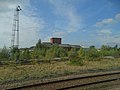
 Former Hydraulic Power House, Horninglow.jpg 640 × 324; 41 KB
-
 Former hydraulic power station - geograph.org.uk - 4897095.jpg 640 × 480; 59 KB
-
 Former Midland Railway Stores - geograph.org.uk - 3200852.jpg 800 × 500; 111 KB
-
 Former Midland Railway Warehouse, Horninglow.jpg 1,280 × 785; 132 KB
-
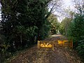
 Gates on the Kingfisher Trail - geograph.org.uk - 5114859.jpg 800 × 600; 177 KB
-
 Horninglow Basin - geograph.org.uk - 3572596.jpg 1,600 × 1,200; 436 KB
-
 Horninglow Basin - geograph.org.uk - 3960352.jpg 1,600 × 1,200; 540 KB
-
 Horninglow Basin in Burton upon Trent - geograph.org.uk - 4543729.jpg 1,024 × 788; 246 KB
-

-
 Horninglow Green - geograph.org.uk - 3987119.jpg 1,280 × 960; 412 KB
-
 Horninglow Green in the rain - geograph.org.uk - 4476177.jpg 1,600 × 1,200; 570 KB
-
 Horninglow Mural - geograph.org.uk - 2397991.jpg 640 × 480; 104 KB
-

-
 Horninglow Road North - geograph.org.uk - 3987108.jpg 1,280 × 960; 309 KB
-
 Horninglow Road, Burton upon Trent - geograph.org.uk - 3223190.jpg 4,000 × 3,000; 4.78 MB
-
 Horninglow Wharf - geograph.org.uk - 2397990.jpg 640 × 395; 78 KB
-

-
 Houses on Hunter Street - geograph.org.uk - 3541426.jpg 1,024 × 683; 168 KB
-
 In Horninglow Community Park - geograph.org.uk - 4181147.jpg 1,280 × 906; 164 KB
-
 Industrial premises off Derby Road, Burton-on-Trent - geograph.org.uk - 4178053.jpg 2,488 × 1,866; 1.05 MB
-
 Interesting parking on Hunter Street - geograph.org.uk - 3541461.jpg 1,024 × 683; 217 KB
-
 Midland Railway Grain Warehouse 4 - geograph.org.uk - 2149996.jpg 800 × 531; 90 KB
-

-
 Midland Railway No. 4 Grain Warehouse and Bonded Store - geograph.org.uk - 5430061.jpg 1,600 × 1,200; 273 KB
-

-
 Mural, Horninglow Wharf, Trent and Mersey Canal - geograph.org.uk - 3166717.jpg 2,052 × 1,397; 918 KB
-

-
 Narrowboat on the Trent ^ Mersey Canal - geograph.org.uk - 4621134.jpg 800 × 567; 170 KB
-
 Old railway warehouse - geograph.org.uk - 3200844.jpg 640 × 368; 81 KB
-
 Old warehouse, Wetmore - geograph.org.uk - 2982838.jpg 640 × 312; 42 KB
-
 Ordnance Survey Cut Mark - geograph.org.uk - 5054021.jpg 4,000 × 3,000; 4.97 MB
-
 Pettitts Newsagents, ^226 Horninglow Road - geograph.org.uk - 3541483.jpg 1,024 × 683; 157 KB
-
 Pickford's Bonded Warehouse, Burton - geograph.org.uk - 2983124.jpg 640 × 304; 38 KB
-
 Postbox at Horninglow Green ref DE13 1025 - geograph.org.uk - 3987122.jpg 960 × 1,280; 314 KB
-
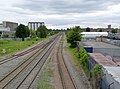
 Railway sidings in Burton - geograph.org.uk - 5713540.jpg 2,000 × 1,333; 2.72 MB
-

-

-
 Raised footpath alongside the Trent and Mersey Canal - geograph.org.uk - 3223170.jpg 4,000 × 3,000; 4.68 MB
-
 Residential close, Outwoods - geograph.org.uk - 3423186.jpg 640 × 480; 71 KB
-
 Road and footbridge - geograph.org.uk - 4916927.jpg 640 × 480; 54 KB
-
 Road works on Dallow Bridge - geograph.org.uk - 3470673.jpg 1,024 × 683; 141 KB
-
 Rolleston Road in Horninglow - geograph.org.uk - 5053993.jpg 4,000 × 3,000; 3.17 MB
-
 Shakespeare Road - geograph.org.uk - 5713535.jpg 2,000 × 1,333; 1.94 MB
-
 Shops on Horninglow Road - geograph.org.uk - 3541584.jpg 1,024 × 683; 130 KB
-
 Shops, Horninglow - geograph.org.uk - 3423211.jpg 640 × 480; 74 KB
-
 St John's Churchyard, Horninglow - geograph.org.uk - 3987104.jpg 1,280 × 960; 488 KB
-
 St. John's Church, Horninglow - geograph.org.uk - 3423199.jpg 768 × 1,024; 266 KB
-
 Tennyson Road - geograph.org.uk - 5713533.jpg 2,000 × 1,333; 1.85 MB
-
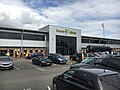
 The Coors Visitor Stand - geograph.org.uk - 3667022.jpg 1,500 × 999; 160 KB
-

-
 The New Inn, Horninglow - geograph.org.uk - 3987111.jpg 1,280 × 903; 275 KB
-
 The Pirelli Stadium - geograph.org.uk - 5512803.jpg 800 × 600; 94 KB
-
 The Pirelli Stadium - geograph.org.uk - 5713531.jpg 2,000 × 1,333; 1.71 MB
-

-
 The Rotala Home Stand - geograph.org.uk - 3667025.jpg 1,500 × 996; 158 KB
-
 The Victoria Inn on Horninglow Road - geograph.org.uk - 4622524.jpg 800 × 521; 97 KB
-
 Trent and Mersey Canal near Horninglow in Staffordshire - geograph.org.uk - 5050951.jpg 1,440 × 1,080; 2.09 MB
-
 Trent ^ Mersey Canal in Burton upon Trent - geograph.org.uk - 4543748.jpg 1,024 × 695; 272 KB
-

-
 Turnstiles to the Coors Visitor Stand - geograph.org.uk - 3653266.jpg 1,500 × 999; 178 KB
-
 Turnstiles to the nPower Family Stand - geograph.org.uk - 3653267.jpg 1,500 × 999; 200 KB
-
 Tutbury Road A511 Horninglow - geograph.org.uk - 5430072.jpg 1,600 × 1,200; 387 KB
-
 Tutbury Road at Forest Rdge Way - geograph.org.uk - 3987097.jpg 1,280 × 960; 304 KB
-
-
 View over Burton on Trent from the Outwood Hills - geograph.org.uk - 3373339.jpg 3,776 × 2,520; 4.12 MB
-
 Wyggeston Street, Outwoods - geograph.org.uk - 3423191.jpg 640 × 480; 55 KB
-
 ^189 Stafford Street - geograph.org.uk - 3568197.jpg 683 × 1,024; 159 KB
-
 ^62 Stafford Street - geograph.org.uk - 3567882.jpg 745 × 1,024; 171 KB
-
 ^63 Derby Road - geograph.org.uk - 3568208.jpg 1,024 × 683; 163 KB


_Ltd,_%5E143_Derby_Street_-_geograph.org.uk_-_3568522.jpg)


