Category:Horní Ves (Trstěnice)
Jump to navigation
Jump to search
| Object location | | View all coordinates using: OpenStreetMap |
|---|
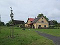
village in Cheb District of Karlovy Vary region  | |||||
| Upload media | |||||
| Instance of | |||||
|---|---|---|---|---|---|
| Location | Trstěnice, Cheb District, Karlovy Vary Region, Czechia | ||||
| Population |
| ||||
| Area |
| ||||
| Elevation above sea level |
| ||||
 | |||||
Media in category "Horní Ves (Trstěnice)"
The following 21 files are in this category, out of 21 total.
-
 Horní Ves (2016) 01.jpg 3,648 × 2,736; 2.54 MB
-
 Horní Ves (2016) 02.jpg 3,648 × 2,736; 1.66 MB
-
 Horní Ves (2016) 03.jpg 2,736 × 3,648; 1.59 MB
-
 Horní Ves (2016) 04.jpg 3,648 × 2,736; 2.06 MB
-
 Horní Ves (2016) 05.jpg 3,648 × 2,736; 2.49 MB
-
 Horní Ves (2016) 06.jpg 3,648 × 2,736; 3.06 MB
-
 Horní Ves (2016) 07.jpg 3,648 × 2,736; 3.53 MB
-
 Horní Ves (2016) 08.jpg 3,648 × 2,736; 3.71 MB
-
 Horní Ves (2016) 09.jpg 3,648 × 2,736; 2.81 MB
-
 Horní Ves (2016) 10.jpg 3,648 × 2,736; 2.41 MB
-
 Horní Ves (2016) 11.jpg 3,648 × 2,736; 2.27 MB
-
 Horní Ves (2016) 12.jpg 3,648 × 2,736; 2.71 MB
-
 Horní Ves (2016) 13.jpg 3,648 × 2,736; 2.65 MB
-
 Horní Ves (2016) 14.jpg 3,648 × 2,736; 3.32 MB
-
 Horní ves - 2016 01.jpg 4,928 × 3,264; 8.65 MB
-
 Horní Ves - 2016 01.jpg 4,928 × 3,264; 9.32 MB
-
 Horní ves - 2016 02.jpg 4,928 × 3,264; 11.76 MB
-
 Horní Ves - 2016 02.jpg 4,928 × 3,264; 10.73 MB
-
 Horní ves - 2016 03.jpg 4,928 × 3,264; 9.38 MB
-
 Horní Ves čp. 42 září 2020 (1).jpg 4,265 × 2,843; 6.72 MB
-
 Horní Ves čp. 42 září 2020 (2).jpg 4,592 × 3,058; 8.56 MB
_01.jpg)
_02.jpg)
_03.jpg)
_04.jpg)
_05.jpg)
_06.jpg)
_07.jpg)
_08.jpg)
_09.jpg)
_10.jpg)
_11.jpg)
_12.jpg)
_13.jpg)
_14.jpg)


.jpg)
.jpg)