Category:Hoofdstraat 72, 's Gravenmoer
Jump to navigation
Jump to search
| Object location | | View all coordinates using: OpenStreetMap |
|---|
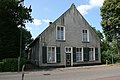
farmhouse in Dongen, Netherlands  | |||||
| Upload media | |||||
| Instance of | |||||
|---|---|---|---|---|---|
| Location | 's Gravenmoer, Dongen, North Brabant, Netherlands | ||||
| Street address |
| ||||
| Located on street |
| ||||
| Heritage designation |
| ||||
 | |||||
|
This is a category about rijksmonument number 18146
|
| Address |
|
Media in category "Hoofdstraat 72, 's Gravenmoer"
The following 6 files are in this category, out of 6 total.
-
 's-Gravenmoer - Hoofdstraat 72 - Boerderij.jpg 3,888 × 2,592; 8.68 MB
-
 Aanzicht - 's-Gravenmoer - 20091608 - RCE.jpg 3,300 × 2,208; 1.92 MB
-
 Achtergevel - 's-Gravenmoer - 20091612 - RCE.jpg 3,384 × 2,224; 1.57 MB
-
 Linker zijgevel - 's-Gravenmoer - 20091611 - RCE.jpg 1,200 × 799; 301 KB
-
 Voor- en rechter zijgevel - 's-Gravenmoer - 20091610 - RCE.jpg 1,200 × 788; 233 KB
-
 Voorgevel - 's-Gravenmoer - 20091609 - RCE.jpg 1,200 × 788; 219 KB


