Category:Hoofdstraat 63, De Lier
Jump to navigation
Jump to search
| Object location | | View all coordinates using: OpenStreetMap |
|---|
_OP_STAANDERS_-_De_Lier_-_20310457_-_RCE.jpg) | |||||
| Upload media | |||||
| Instance of |
| ||||
|---|---|---|---|---|---|
| Part of |
| ||||
| Location | De Lier, De Lier | ||||
| Street address |
| ||||
| Located on street |
| ||||
| Heritage designation |
| ||||
 | |||||
House:
|
This is a category about rijksmonument number 506289
|
Shed:
|
This is a category about rijksmonument number 507408
|
| Address |
|
Media in category "Hoofdstraat 63, De Lier"
The following 23 files are in this category, out of 23 total.
-

-

-
 Achtergevel en linker zijgevel - De Lier - 20340701 - RCE.jpg 3,043 × 3,073; 2.47 MB
-

-

-
 De Lier Timmerwerf.jpg 1,944 × 2,592; 2.09 MB
-

-
 Exterieur ACHTERGEVEL - De Lier - 20310456 - RCE.jpg 3,039 × 3,083; 4.57 MB
-
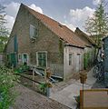
 Exterieur HOUTLOODS (XIX) OP STAANDERS - De Lier - 20310457 - RCE.jpg 3,046 × 3,083; 5.11 MB
-
 Exterieur LINKER ZIJGEVEL - De Lier - 20310455 - RCE.jpg 3,042 × 3,088; 4.17 MB
-
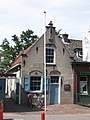
 Exterieur OVERZICHT VOORGEVEL (XVII) - De Lier - 20310454 - RCE.jpg 1,189 × 1,200; 298 KB
-
 INT. KAMER ACHTERZIJDE MET DOORGANG NAAR BIJKEUKEN - De Lier - 20310464 - RCE.jpg 1,186 × 1,200; 298 KB
-
 INT. KAMER MET DEUR EN DOORKIJKVENSTER NAAR WERKPLAATS - De Lier - 20310461 - RCE.jpg 1,192 × 1,200; 364 KB
-
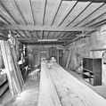
 INT. OVERZICHT KAPCONSTRUCTIE (BOVEN TIMMERWERKPLAATS) - De Lier - 20310465 - RCE.jpg 1,176 × 1,200; 284 KB
-
 INT. OVERZICHT WERKPLAATS MET WERKBANKEN - De Lier - 20310459 - RCE.jpg 1,195 × 1,200; 282 KB
-
 INT. OVERZICHT WERKPLAATS MET WERKBANKEN - De Lier - 20310460 - RCE.jpg 1,181 × 1,200; 262 KB
-
 INT. SCHOUW MET SCHILDERING - De Lier - 20310463 - RCE.jpg 1,185 × 1,200; 285 KB
-
 INT. WERKPLAATS, SPILTRAP (XVII) - De Lier - 20310458 - RCE.jpg 1,186 × 1,200; 229 KB
-
 INT. WOONKAMER MET SCHOUW EN BEDSTEDEN - De Lier - 20310462 - RCE.jpg 1,176 × 1,200; 331 KB
-
 Overzicht achtergevel houten loods met terrasje - De Lier - 20340712 - RCE.jpg 3,048 × 3,080; 2.67 MB
-
 Overzicht houten loods met terrasje - De Lier - 20340711 - RCE.jpg 3,059 × 3,086; 2.57 MB
-
 Overzicht voorgevel van de houten loods - De Lier - 20340710 - RCE.jpg 1,189 × 1,200; 424 KB
-
 Zijgevel van houten loods en afgemeerd klein vrachtscheepje - De Lier - 20340709 - RCE.jpg 3,046 × 3,082; 2.87 MB


_-_De_Lier_-_20310454_-_RCE.jpg)


_-_De_Lier_-_20310465_-_RCE.jpg)


_-_De_Lier_-_20310458_-_RCE.jpg)


