Category:Hoofdstraat 33, Leens
Jump to navigation
Jump to search
| Object location | | View all coordinates using: OpenStreetMap |
|---|
house in Het Hogeland, Netherlands  | |||||
| Upload media | |||||
| Instance of | |||||
|---|---|---|---|---|---|
| Location | Het Hogeland, Groningen, Netherlands | ||||
| Heritage designation | |||||
 | |||||
|
This is a category about rijksmonument number 509509
|
| Address |
|
Media in category "Hoofdstraat 33, Leens"
The following 3 files are in this category, out of 3 total.
-
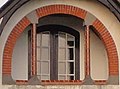 Hoofdstraat 33 Leens (detail).jpg 473 × 349; 30 KB
-
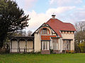 Hoofdstraat 33 Leens.jpg 3,567 × 2,675; 1.31 MB
-
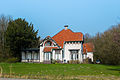 Leens - Hoofdstraat 33.jpg 3,287 × 2,191; 5.39 MB
.jpg)
