Category:Honeret
Jump to navigation
Jump to search
English: Forest and range of hills in Switzerland between Dietikon and Urdorf in the canton of Zürich
Deutsch: Waldgebiet und Hügelzug in der Schweiz zwischen Dietikon und Urdorf im Kanton Zürich
Subcategories
This category has the following 7 subcategories, out of 7 total.
A
- Aegertenbach (Reppisch) (7 F)
B
- Bachtobelgraben (Schäflibach) (10 F)
F
- Flora of Honeret (22 F)
H
- Honeret (Hill) (3 F)
R
- Ried am Honeret (3 F)
S
- Stoffelbach (32 F)
T
- Tobelbach (Dietikon) (19 F)
Media in category "Honeret"
The following 15 files are in this category, out of 15 total.
-
 Aegertenbach Quellgebiet.jpg 3,264 × 2,448; 12.39 MB
-
 Basistrasse nahe Cholgrueb.jpg 3,264 × 2,448; 12.52 MB
-
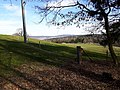
 Bergdietikon nach Honeret.jpg 3,264 × 2,448; 5.83 MB
-
 Blick auf Hohbüel.jpg 3,264 × 2,448; 11.27 MB
-
 Blick auf Hohbüel2.jpg 3,264 × 2,448; 13.58 MB
-

-
 Grenzstein Dietikon.jpg 2,448 × 3,264; 8 MB
-
 Hegi nach Honeret.jpg 4,608 × 3,456; 11.48 MB
-
 Hintere Honeretsrainstrasse.jpg 3,264 × 2,448; 15.5 MB
-
 Ibruch nach Honeret.jpg 4,608 × 3,456; 17.45 MB
-
 Pfad im Rain Honeret.jpg 3,264 × 2,448; 12.62 MB
-
 Römergrabstrasse Kreuzung Allmendlistrasse.jpg 3,264 × 2,448; 9.54 MB
-
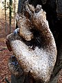
 Unbekannter Pilz1 Kanton Zürich.jpg 2,448 × 3,264; 5.95 MB
-
 Unbekannter Pilz1 Kanton Zürich2.jpg 2,448 × 3,264; 6.42 MB
-
 Waldstrasse Hochrüti Honeret.jpg 2,448 × 3,264; 12.05 MB


