Category:Holyhead Mountain
Jump to navigation
Jump to search
|
Holyhead Mountain has an entry on OpenStreetMap (show). |
hill (220m) on Anglesey  | |||||
| Upload media | |||||
| Instance of | |||||
|---|---|---|---|---|---|
| Location | Trearddur, Isle of Anglesey, Wales | ||||
| Topographic prominence |
| ||||
| Elevation above sea level |
| ||||
 | |||||
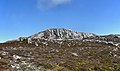
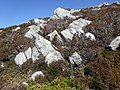
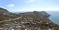
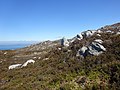
English: Holyhead Mountain (Mynydd Tŵr in Welsh: from (pen)twr, meaning "tower") is the highest hill on Holy Island, Anglesey, and the highest in the county of Anglesey, north Wales.
Media in category "Holyhead Mountain"
The following 158 files are in this category, out of 158 total.
-

-

-
 A top section of the quarry face - geograph.org.uk - 898678.jpg 640 × 480; 117 KB
-
 A walk from Ynys Lawd (South Stack) to Mynydd Twr (Holyhead Mountain) 01.jpg 7,747 × 4,024; 6.56 MB
-
 A walk from Ynys Lawd (South Stack) to Mynydd Twr (Holyhead Mountain) 02.jpg 4,896 × 3,672; 6.8 MB
-
 A walk from Ynys Lawd (South Stack) to Mynydd Twr (Holyhead Mountain) 03.jpg 4,896 × 3,672; 6.77 MB
-
 A walk from Ynys Lawd (South Stack) to Mynydd Twr (Holyhead Mountain) 04.jpg 5,672 × 3,341; 4.06 MB
-
 A walk from Ynys Lawd (South Stack) to Mynydd Twr (Holyhead Mountain) 05.jpg 4,896 × 3,672; 4.85 MB
-
 A walk from Ynys Lawd (South Stack) to Mynydd Twr (Holyhead Mountain) 06.jpg 4,896 × 3,672; 6.16 MB
-
 A walk from Ynys Lawd (South Stack) to Mynydd Twr (Holyhead Mountain) 07.jpg 6,075 × 3,162; 3.68 MB
-
 A walk from Ynys Lawd (South Stack) to Mynydd Twr (Holyhead Mountain) 08.jpg 4,896 × 3,672; 6.66 MB
-
 A walk from Ynys Lawd (South Stack) to Mynydd Twr (Holyhead Mountain) 09.jpg 6,454 × 3,739; 4.57 MB
-
 A walk from Ynys Lawd (South Stack) to Mynydd Twr (Holyhead Mountain) 10.jpg 6,969 × 3,317; 3.61 MB
-
 A walk from Ynys Lawd (South Stack) to Mynydd Twr (Holyhead Mountain) 11.jpg 4,896 × 3,672; 8.36 MB
-
 A walk from Ynys Lawd (South Stack) to Mynydd Twr (Holyhead Mountain) 13.jpg 7,416 × 3,773; 23.24 MB
-
 A walk from Ynys Lawd (South Stack) to Mynydd Twr (Holyhead Mountain) 14.jpg 4,896 × 3,672; 6.51 MB
-
 A walk from Ynys Lawd (South Stack) to Mynydd Twr (Holyhead Mountain) 15.jpg 4,422 × 3,316; 3.91 MB
-
 A walk from Ynys Lawd (South Stack) to Mynydd Twr (Holyhead Mountain) 16.jpg 5,891 × 3,654; 17.35 MB
-
 A walk from Ynys Lawd (South Stack) to Mynydd Twr (Holyhead Mountain) 17.jpg 4,788 × 3,590; 2.69 MB
-

-

-
 Anglesey-flag-holyhead-mountain.jpg 640 × 480; 40 KB
-
 Bottom of Holyhead Mountain - Mynydd Twr, not far from Holyheard itself in May 2021 09.jpg 4,896 × 3,672; 7.35 MB
-

-

-
 Breakwater Country Park - geograph.org.uk - 927551.jpg 640 × 480; 109 KB
-
 Breakwater Lighthouse - geograph.org.uk - 1553575.jpg 640 × 480; 50 KB
-

-
 Circular stone structure near Holyhead Mountain - geograph.org.uk - 5486638.jpg 4,184 × 2,789; 4.39 MB
-

-
 Climber on Mynydd Twr.jpg 2,592 × 3,888; 5.42 MB
-
 Coastal path near Holyhead Mountain - geograph.org.uk - 2601041.jpg 640 × 480; 101 KB
-
 Coastal View from Holyhead Mountain - geograph.org.uk - 3734438.jpg 800 × 531; 125 KB
-
 Crags on Holyhead Mountain - geograph.org.uk - 5072821.jpg 640 × 427; 107 KB
-
 Crags on Mynydd Twr - geograph.org.uk - 901564.jpg 640 × 480; 88 KB
-
-
 Forking of paths on Holyhead Mountain - geograph.org.uk - 6292681.jpg 1,600 × 1,200; 640 KB
-

-

-

-

-

-

-
 Holyhead breakwater.jpg 4,032 × 3,024; 1.4 MB
-
 Holyhead Mountain - geograph.org.uk - 3745458.jpg 800 × 530; 490 KB
-
 Holyhead Mountain - geograph.org.uk - 3745462.jpg 800 × 536; 426 KB
-
 Holyhead Mountain - geograph.org.uk - 3745468.jpg 800 × 530; 638 KB
-
 Holyhead Mountain - geograph.org.uk - 3745594.jpg 800 × 530; 614 KB
-
 Holyhead Mountain - geograph.org.uk - 3745595.jpg 800 × 530; 557 KB
-
 Holyhead Mountain - geograph.org.uk - 3745597.jpg 800 × 530; 463 KB
-
 Holyhead Mountain - geograph.org.uk - 3745605.jpg 800 × 530; 456 KB
-
 Holyhead Mountain - geograph.org.uk - 3745608.jpg 800 × 530; 460 KB
-
 Holyhead Mountain - geograph.org.uk - 3745609.jpg 800 × 530; 458 KB
-
 Holyhead Mountain - geograph.org.uk - 3746287.jpg 800 × 530; 640 KB
-
 Holyhead Mountain - geograph.org.uk - 3746346.jpg 800 × 530; 516 KB
-
 Holyhead Mountain - geograph.org.uk - 3747368.jpg 800 × 530; 399 KB
-
 Holyhead Mountain - geograph.org.uk - 4583340.jpg 640 × 480; 51 KB
-
 Holyhead Mountain - geograph.org.uk - 4583342.jpg 640 × 480; 88 KB
-
 Holyhead Mountain - geograph.org.uk - 5486700.jpg 3,184 × 2,123; 1.82 MB
-
 Holyhead Mountain - geograph.org.uk - 5524887.jpg 4,018 × 2,679; 1.4 MB
-
 Holyhead Mountain - Mynydd Twr - geograph.org.uk - 2013998.jpg 640 × 425; 191 KB
-
 Holyhead Mountain - Mynydd Twr, not far from Holyheard itself in May 2021 01.jpg 5,472 × 3,547; 5.22 MB
-
 Holyhead Mountain - Mynydd Twr, not far from Holyheard itself in May 2021 02.jpg 5,465 × 3,762; 4.58 MB
-
 Holyhead Mountain - Mynydd Twr, not far from Holyheard itself in May 2021 07.jpg 3,672 × 4,896; 7.94 MB
-
 Holyhead Mountain - Mynydd Twr, not far from Holyheard itself in May 2021 08.jpg 4,896 × 3,672; 6.39 MB
-
 Holyhead Mountain - Mynydd Twr, not far from Holyheard itself in May 2021 10.jpg 4,896 × 3,672; 7.26 MB
-
 Holyhead Mountain - Mynydd Twr, not far from Holyheard itself in May 2021 11.jpg 4,896 × 3,672; 8.2 MB
-
 Holyhead mountain and South Stack bridge. from the island.jpeg 900 × 668; 300 KB
-
 Holyhead Mountain and South Stack Road - geograph.org.uk - 5870688.jpg 1,024 × 683; 560 KB
-
 Holyhead Mountain at twilight - geograph.org.uk - 402263.jpg 640 × 480; 54 KB
-
 Holyhead Mountain crags - geograph.org.uk - 4583343.jpg 640 × 480; 106 KB
-
 Holyhead Mountain from the Anglesey Coastal Path - geograph.org.uk - 2606671.jpg 3,156 × 2,274; 2.63 MB
-

-
 Holyhead Mountain from the HSC Jonathan Swift - geograph.org.uk - 2076519.jpg 1,024 × 765; 144 KB
-
 Holyhead Mountain Radio Station - geograph.org.uk - 5484942.jpg 3,184 × 2,123; 1.54 MB
-
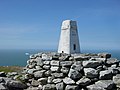 Holyhead Mountain Trig Point - geograph.org.uk - 10549.jpg 640 × 480; 82 KB
-
 Holyhead Mountain, Holy Island (507264) (32938403591).jpg 5,038 × 2,834; 3.38 MB
-

-
 Holyheadmountain.jpg 640 × 480; 56 KB
-

-
 Low cloud over Holyhead Mountain - geograph.org.uk - 2615963.jpg 2,799 × 1,952; 2.43 MB
-

-
 Minutes from Chester - geograph.org.uk - 898810.jpg 640 × 480; 81 KB
-
 Mynydd Twr a wal garreg ger y brif ffordd i Ynys Lawd, Ynys Mon, Cymru.jpg 6,534 × 2,576; 3.46 MB
-
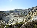
 Old Quarry Face - geograph.org.uk - 923923.jpg 640 × 480; 78 KB
-
 On Holyhead Mountain - geograph.org.uk - 4535432.jpg 640 × 480; 104 KB
-
 On Holyhead Mountain - geograph.org.uk - 4859566.jpg 640 × 471; 81 KB
-
 On the slopes of Holyhead Mountain - geograph.org.uk - 5072886.jpg 640 × 427; 136 KB
-

-
 Panorama from Holyhead Mountain - geograph.org.uk - 4860349.jpg 640 × 287; 54 KB
-
 Panorama from Holyhead Mountain - geograph.org.uk - 4860353.jpg 640 × 221; 41 KB
-

-
 Path heading for Holyhead Mountain - geograph.org.uk - 3918857.jpg 4,320 × 3,240; 4.03 MB
-

-

-
 Path up Holyhead Mountain - geograph.org.uk - 2601054.jpg 640 × 480; 75 KB
-
 Path, to the top of Holyhead Mountain - geograph.org.uk - 1412068.jpg 640 × 480; 103 KB
-

-
 Paths descending from Mynydd Twr - geograph.org.uk - 899355.jpg 640 × 480; 95 KB
-
 Paths towards Holyhead Mountain - geograph.org.uk - 5484931.jpg 3,184 × 2,123; 2.38 MB
-

-

-
 Porth Namarch - geograph.org.uk - 898762.jpg 640 × 405; 58 KB
-
 Porth Namarch cove - geograph.org.uk - 1416362.jpg 640 × 422; 53 KB
-

-
 Quarry Chimney across the Pond - geograph.org.uk - 923920.jpg 480 × 640; 92 KB
-
 Quarry on Holyhead Mountain - Mynydd Twr, not far from Holyheard itself in May 2021 03.jpg 4,810 × 3,607; 3.49 MB
-
 Quarry on Holyhead Mountain - Mynydd Twr, not far from Holyheard itself in May 2021 04.jpg 4,896 × 3,672; 4.94 MB
-
 Quarry on Holyhead Mountain - Mynydd Twr, not far from Holyheard itself in May 2021 05.jpg 4,896 × 3,672; 6.59 MB
-
 Quarry road above Porth Namarch - geograph.org.uk - 1416359.jpg 640 × 480; 103 KB
-

-
 Radio Station near Holyhead Mountain - geograph.org.uk - 5484918.jpg 2,123 × 3,184; 1.8 MB
-
 Radio station on Holyhead Mountain - geograph.org.uk - 5072827.jpg 640 × 427; 122 KB
-
 Ruined building at the Breakwater Quarry - geograph.org.uk - 1416352.jpg 480 × 640; 105 KB
-
 Seen from Holy Mountain - geograph.org.uk - 2591376.jpg 640 × 428; 124 KB
-

-
 Stone Rampart, Caer y Twr - geograph.org.uk - 4265795.jpg 1,600 × 1,200; 635 KB
-
 Summit of Holyhead Mountain - geograph.org.uk - 1412083.jpg 640 × 480; 88 KB
-
 Sunset on Holyhead mountain.jpg 1,400 × 1,050; 319 KB
-
 Telecommunications - geograph.org.uk - 3746389.jpg 800 × 530; 439 KB
-

-

-

-
 The Anglesey Coastal Path approaching Holyhead Mountain - geograph.org.uk - 5486672.jpg 3,184 × 2,123; 2.68 MB
-
 The Anglesey Coastal Path below Holyhead Mountain - geograph.org.uk - 5486684.jpg 3,184 × 2,123; 2.24 MB
-

-

-
 The former Breakwater brickworks - geograph.org.uk - 1416334.jpg 479 × 640; 97 KB
-

-

-
 The plateau area west of Mynydd Twr - geograph.org.uk - 898800.jpg 640 × 480; 62 KB
-
 The road to South Stack - geograph.org.uk - 898754.jpg 640 × 480; 54 KB
-
 The stepped path to "Spaghetti Junction" - geograph.org.uk - 899690.jpg 640 × 480; 147 KB
-
 The summit of Holyhead Mountain - geograph.org.uk - 2601074.jpg 640 × 480; 68 KB
-
 The trig point on Holyhead Mountain - geograph.org.uk - 2601068.jpg 640 × 480; 72 KB
-

-
 Tors on Holyhead Mountain - geograph.org.uk - 899214.jpg 640 × 480; 61 KB
-
 Towards Holyhead - geograph.org.uk - 3745601.jpg 800 × 530; 551 KB
-
 Towards Holyhead Mountain - geograph.org.uk - 3745441.jpg 800 × 530; 577 KB
-
 Towards Holyhead Mountain - geograph.org.uk - 3746387.jpg 800 × 530; 492 KB
-

-
 Trig Point, Mynydd Twr - geograph.org.uk - 4265789.jpg 1,600 × 1,200; 223 KB
-

-
 View eastwards towards Pwll Clai - geograph.org.uk - 1416365.jpg 640 × 464; 77 KB
-
 View from Holyhead Mountain - geograph.org.uk - 2453579.jpg 1,280 × 790; 446 KB
-
 View from the top of the quarry - geograph.org.uk - 896924.jpg 640 × 420; 135 KB
-
 View from the western crags of Mynydd Twr - geograph.org.uk - 899320.jpg 640 × 480; 103 KB
-

-
 View north, from Holyhead Mountain - geograph.org.uk - 1412073.jpg 640 × 480; 94 KB
-

-

-
 View towards the summit of Mynydd Twr - geograph.org.uk - 898779.jpg 640 × 480; 74 KB
-

-

-

-
 View, from Holyhead Mountain - geograph.org.uk - 1413527.jpg 640 × 480; 89 KB
-
 William Howard Yorke - American Ship Grandee off Holyhead.jpg 1,920 × 1,281; 362 KB
-
 North Stack island from Holyhead Mountain - geograph.org.uk - 468941.jpg 640 × 480; 135 KB


_to_Mynydd_Twr_(Holyhead_Mountain)_01.jpg)
_to_Mynydd_Twr_(Holyhead_Mountain)_02.jpg)
_to_Mynydd_Twr_(Holyhead_Mountain)_03.jpg)
_to_Mynydd_Twr_(Holyhead_Mountain)_04.jpg)
_to_Mynydd_Twr_(Holyhead_Mountain)_05.jpg)
_to_Mynydd_Twr_(Holyhead_Mountain)_06.jpg)
_to_Mynydd_Twr_(Holyhead_Mountain)_07.jpg)
_to_Mynydd_Twr_(Holyhead_Mountain)_08.jpg)
_to_Mynydd_Twr_(Holyhead_Mountain)_09.jpg)
_to_Mynydd_Twr_(Holyhead_Mountain)_10.jpg)
_to_Mynydd_Twr_(Holyhead_Mountain)_11.jpg)
_to_Mynydd_Twr_(Holyhead_Mountain)_13.jpg)
_to_Mynydd_Twr_(Holyhead_Mountain)_14.jpg)
_to_Mynydd_Twr_(Holyhead_Mountain)_15.jpg)
_to_Mynydd_Twr_(Holyhead_Mountain)_16.jpg)
_to_Mynydd_Twr_(Holyhead_Mountain)_17.jpg)


_(32938403591).jpg)


,_Wales,_where_lies_a_wonderful_Celtic_fort_14.jpg)


