Category:Holton le Clay
Jump to navigation
Jump to search
English: Holton le Clay is a village and civil parish in the extreme north of the district of East Lindsey, Lincolnshire, England that is situated south of Grimsby.
village and civil parish in Lincolnshire, United Kingdom  | |||||
| Upload media | |||||
| Instance of | |||||
|---|---|---|---|---|---|
| Location | East Lindsey, Lincolnshire, East Midlands, England | ||||
| Population |
| ||||
| Said to be the same as | Holton Le Clay (Wikimedia duplicated page, civil parish) | ||||
 | |||||
Subcategories
This category has the following 4 subcategories, out of 4 total.
H
- Holton le Clay War Memorial (4 F)
S
Media in category "Holton le Clay"
The following 146 files are in this category, out of 146 total.
-
 100 Squadron information board at RAF Waltham memorial site - geograph.org.uk - 6260744.jpg 4,608 × 3,072; 5.14 MB
-
 A16 Louth Road layby - geograph.org.uk - 3605258.jpg 1,024 × 768; 111 KB
-

-

-

-

-
 Autumn leaves and a concrete tunnel - geograph.org.uk - 3229095.jpg 640 × 427; 101 KB
-
 Beech Grove, Holton le Clay - geograph.org.uk - 5642221.jpg 1,600 × 1,065; 571 KB
-
 Beech Grove, Holton le Clay - geograph.org.uk - 5642225.jpg 1,600 × 1,065; 391 KB
-
 Brought down by a bomb^ - geograph.org.uk - 3229126.jpg 640 × 427; 75 KB
-
 Buildings at Eastfield, Holton le Clay - geograph.org.uk - 4154134.jpg 1,600 × 1,064; 466 KB
-
 Bungalows on Beaumonde (road) - geograph.org.uk - 4153429.jpg 1,600 × 1,064; 538 KB
-
 Bungalows on Beaumonde (road) - geograph.org.uk - 4153431.jpg 1,600 × 1,064; 574 KB
-
 Bungalows on Wold View, Holton le Clay - geograph.org.uk - 4153441.jpg 1,600 × 1,064; 541 KB
-
 Cable oddments - geograph.org.uk - 5667914.jpg 1,024 × 768; 157 KB
-
 Car Park at Jug and Bottle - geograph.org.uk - 2506957.jpg 640 × 480; 56 KB
-
 Cheapside heading west - geograph.org.uk - 3478760.jpg 640 × 480; 123 KB
-
 Church Lane, Holton le Clay - geograph.org.uk - 4153854.jpg 1,600 × 1,064; 484 KB
-
 Church Lane, Holton le Clay - geograph.org.uk - 4153858.jpg 1,600 × 1,064; 474 KB
-
 Church Lane, Holton le Clay - geograph.org.uk - 4154079.jpg 1,600 × 1,064; 405 KB
-
 Clay Lane, Holton le Clay - geograph.org.uk - 2202976.jpg 800 × 600; 320 KB
-

-
 Crop field north of Holton le Clay - geograph.org.uk - 4638550.jpg 640 × 480; 60 KB
-
 Crossroad of paths south of New Waltham - geograph.org.uk - 4154179.jpg 1,600 × 1,064; 592 KB
-
 Danger UXB^ - geograph.org.uk - 5286951.jpg 1,024 × 768; 120 KB
-
 Disused hall, Holton le Clay - geograph.org.uk - 5667948.jpg 1,024 × 768; 164 KB
-
 Eastfield Close, Church Lane, Holton le Clay - geograph.org.uk - 4153869.jpg 1,600 × 1,064; 455 KB
-
 Eastfield Farm, Holton le Clay - geograph.org.uk - 4154127.jpg 1,600 × 1,064; 554 KB
-
-
 Entering NE Lincs at Cheapside Farm - geograph.org.uk - 3012492.jpg 640 × 450; 106 KB
-
 Entrance to Holton le Clay Cemetery - geograph.org.uk - 4153864.jpg 1,600 × 1,064; 790 KB
-
 Entrance to Holton-le-Clay - geograph.org.uk - 2456472.jpg 640 × 480; 96 KB
-

-
 Farmland beside Louth Road - geograph.org.uk - 3478762.jpg 640 × 480; 97 KB
-
 Farmland off Louth Road - geograph.org.uk - 3478772.jpg 640 × 480; 108 KB
-
 Farmland off Station Road - geograph.org.uk - 4638541.jpg 640 × 480; 82 KB
-
 Farmland west of the A16 - geograph.org.uk - 3478754.jpg 640 × 480; 87 KB
-
 Footbridge on footpath to Station Road - geograph.org.uk - 4852654.jpg 2,000 × 1,596; 1.27 MB
-

-
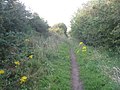
 Footpath from Holton le Clay - geograph.org.uk - 3321090.jpg 640 × 427; 58 KB
-

-
 Footpath leading to Eastfield Farm - geograph.org.uk - 4154083.jpg 1,600 × 1,064; 500 KB
-
 Footpath leading to Eastfield Farm - geograph.org.uk - 4154094.jpg 1,600 × 1,064; 413 KB
-
 Footpath leading to Eastfield Farm - geograph.org.uk - 4154097.jpg 1,600 × 1,064; 801 KB
-
 Footpath leading to Eastfield Farm - geograph.org.uk - 4154103.jpg 1,600 × 1,064; 508 KB
-
 Footpath leading to Eastfield Farm - geograph.org.uk - 4154106.jpg 1,600 × 1,064; 497 KB
-
 Footpath leading to Louth Road, Holton le Clay - geograph.org.uk - 4153600.jpg 1,600 × 1,064; 526 KB
-
 Footpath to Holton le Clay - geograph.org.uk - 4852599.jpg 2,000 × 1,333; 1.48 MB
-
 Footpath to Holton le Clay - geograph.org.uk - 4852641.jpg 2,000 × 1,334; 1.36 MB
-
 Footpath to Holton le Clay - geograph.org.uk - 4861584.jpg 2,000 × 1,333; 1.35 MB
-

-
 Former railway line at Holton le Clay - geograph.org.uk - 5633433.jpg 1,600 × 1,065; 936 KB
-
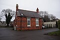 Former Village School - geograph.org.uk - 5642269.jpg 1,600 × 1,065; 428 KB
-
 From Tetney to the sea, aerial 2016 - geograph.org.uk - 5149589.jpg 427 × 640; 56 KB
-
 Garthway off Pinfold Lane, Holton le Clay - geograph.org.uk - 5642254.jpg 1,600 × 1,059; 556 KB
-
 Going around the bend in Holton le Clay - geograph.org.uk - 3523082.jpg 1,024 × 768; 146 KB
-
 Holton le Clay Cricket Club - geograph.org.uk - 3321085.jpg 640 × 427; 51 KB
-
 Holton le Clay cricket club - geograph.org.uk - 4817043.jpg 1,024 × 768; 142 KB
-
 Holton le Clay Garage - geograph.org.uk - 5642274.jpg 1,600 × 1,065; 378 KB
-

-
 Holton Lodge farmhouse 2022.jpg 4,032 × 3,024; 4.99 MB
-
 Holton Lodge on Station Road - geograph.org.uk - 3727574.jpg 1,024 × 681; 336 KB
-
 Home made replica of a bomb as a talking point - geograph.org.uk - 6260775.jpg 4,608 × 3,072; 5.11 MB
-

-
 Horse holiday camp^ - geograph.org.uk - 456575.jpg 640 × 480; 117 KB
-
 House dated 1912 - geograph.org.uk - 5667925.jpg 1,024 × 768; 167 KB
-
 House on Beaumonde (road) - geograph.org.uk - 4153437.jpg 1,600 × 1,064; 446 KB
-
 Houses on Church Close, Holton le Clay - geograph.org.uk - 4154090.jpg 1,600 × 1,064; 567 KB
-
 Houses on Worsley Drive, Holton le Clay - geograph.org.uk - 4153596.jpg 1,600 × 1,064; 623 KB
-
 Jug ^ Bottle, Holton le Clay - geograph.org.uk - 4852628.jpg 2,000 × 1,333; 1.45 MB
-
 Level Crossing gate - geograph.org.uk - 4861572.jpg 2,000 × 1,333; 1.26 MB
-
 Limagrain, Holton-le-Clay - geograph.org.uk - 3226425.jpg 640 × 427; 125 KB
-
 Louth Road (A16), heading north - geograph.org.uk - 3478757.jpg 640 × 480; 71 KB
-
 Louth Road (A16), heading north - geograph.org.uk - 3478767.jpg 640 × 480; 95 KB
-
 Louth Road (A16), heading north - geograph.org.uk - 3478773.jpg 640 × 480; 90 KB
-
 Louth Road Holton Le Clay - geograph.org.uk - 2506951.jpg 640 × 480; 80 KB
-
 Louth Road, Holton le Clay - geograph.org.uk - 5631393.jpg 1,600 × 1,064; 457 KB
-
 Louth Road, Holton le Clay - geograph.org.uk - 6214443.jpg 1,024 × 683; 240 KB
-
 Mammoth Savings, or a Trojan Elephant^ - geograph.org.uk - 3226412.jpg 640 × 427; 129 KB
-
 Millennium Farm, Holton le Clay - geograph.org.uk - 4154144.jpg 1,600 × 1,064; 564 KB
-
 Millennium Farm, Holton le Clay - geograph.org.uk - 4154149.jpg 1,600 × 1,064; 665 KB
-
 Old Fleet House, Pelham Road, Holton le Clay - geograph.org.uk - 4153591.jpg 1,600 × 1,064; 603 KB
-
 Paddocks behind Holton Grange - geograph.org.uk - 3227342.jpg 640 × 427; 102 KB
-
 Path leading to Holton le Clay - geograph.org.uk - 4153374.jpg 1,600 × 1,064; 588 KB
-
 Path leading to Magnolia Drive, Holton le Clay - geograph.org.uk - 5642153.jpg 1,600 × 1,065; 469 KB
-
 Path leading to Magnolia Drive, Holton le Clay - geograph.org.uk - 5642160.jpg 1,600 × 1,065; 788 KB
-
 Path leading to Magnolia Drive, Holton le Clay - geograph.org.uk - 5642216.jpg 1,600 × 1,065; 394 KB
-
 Path leading to New Waltham - geograph.org.uk - 4154187.jpg 1,600 × 1,064; 629 KB
-
 Path leading towards Humberston - geograph.org.uk - 4154153.jpg 1,600 × 1,064; 417 KB
-
 Path leading towards Humberston - geograph.org.uk - 4154157.jpg 1,600 × 1,064; 622 KB
-
 Path leading towards Humberston - geograph.org.uk - 4154163.jpg 1,600 × 1,064; 586 KB
-
 Path of Tetney Lane, Holton le Clay - geograph.org.uk - 5642145.jpg 1,600 × 1,065; 732 KB
-
 Pelham Road, Holton le Clay - geograph.org.uk - 4153587.jpg 1,600 × 1,064; 474 KB
-
 Picksley Crescent, Holton le Clay - geograph.org.uk - 2202988.jpg 800 × 600; 237 KB
-
 Pinfold Lane at St Peter's Close, Holton le Clay - geograph.org.uk - 5631392.jpg 1,600 × 1,064; 690 KB
-
 Pinfold Lane, Holton le Clay - geograph.org.uk - 5642227.jpg 1,600 × 1,065; 582 KB
-
 Poles apart - geograph.org.uk - 456586.jpg 640 × 480; 121 KB
-
 Power cable junction east of Waithe (1) - geograph.org.uk - 6533251.jpg 683 × 1,024; 150 KB
-
 Power cable junction east of Waithe (2) - geograph.org.uk - 6533255.jpg 1,024 × 683; 78 KB
-
 RAF Waltham memorial - geograph.org.uk - 6260739.jpg 4,608 × 3,072; 5.91 MB
-
 RAF Waltham memorials - geograph.org.uk - 6260722.jpg 4,608 × 3,072; 3.43 MB
-

-
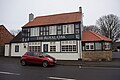
 Royal Oak Holton Le Clay - geograph.org.uk - 2506954.jpg 640 × 480; 69 KB
-
 Royal Oak Holton le Clay 2022 (cropped).jpg 3,951 × 2,179; 2.87 MB
-
 Royal Oak Holton le Clay 2022.jpg 4,030 × 2,319; 3.08 MB
-
 Site of new underground cable - geograph.org.uk - 5667652.jpg 1,024 × 768; 151 KB
-
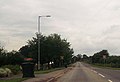
 South along the A16 Louth Road - geograph.org.uk - 2202992.jpg 800 × 600; 188 KB
-
 St. Peter's church, Holton le Clay - geograph.org.uk - 5667952.jpg 1,024 × 768; 234 KB
-

-

-
 Station Road - geograph.org.uk - 4638542.jpg 640 × 480; 65 KB
-
 Station road at Holton Lodge - geograph.org.uk - 3011872.jpg 640 × 442; 53 KB
-
 Station road at the old station - geograph.org.uk - 3011839.jpg 640 × 407; 55 KB
-
 Station Road, Holton le Clay - geograph.org.uk - 4852611.jpg 2,000 × 1,333; 1.11 MB
-
 Station Road, Holton-le-Clay - geograph.org.uk - 897196.jpg 640 × 480; 78 KB
-
 Street corner, Holton-le-Clay - geograph.org.uk - 3226431.jpg 640 × 427; 65 KB
-
 Tetney Lane - geograph.org.uk - 305431.jpg 640 × 480; 99 KB
-
 The Crescent, Holton le Clay - geograph.org.uk - 4153449.jpg 1,600 × 1,064; 520 KB
-
 The East Lincolnshire Railway - geograph.org.uk - 5055983.jpg 2,592 × 1,936; 1.36 MB
-
 The former East Lincolnshire Railway - geograph.org.uk - 3073538.jpg 1,024 × 768; 275 KB
-
 The Jug ^ Bottle Carvery - geograph.org.uk - 2456468.jpg 640 × 480; 77 KB
-
 The Old Railway Line to Grimsby - geograph.org.uk - 897205.jpg 640 × 480; 125 KB
-
 The Public Footpath to Holton-le-Clay - geograph.org.uk - 902140.jpg 640 × 480; 107 KB
-
 The Royal Oak - geograph.org.uk - 5642667.jpg 1,600 × 1,065; 422 KB
-
 The Royal Oak - geograph.org.uk - 5642671.jpg 1,420 × 1,600; 353 KB
-
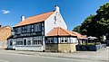
 The Royal Oak, Holton le Clay - geograph.org.uk - 2202979.jpg 800 × 600; 279 KB
-
 The Smooting, Holton le Clay - geograph.org.uk - 5667657.jpg 1,024 × 768; 134 KB
-
 Track (footpath) to Eastfield Farm - geograph.org.uk - 4638551.jpg 640 × 480; 53 KB
-
 Track leading to Eastfield Farm, Holton le Clay - geograph.org.uk - 4154121.jpg 1,600 × 1,064; 568 KB
-
 Track to Eastfield Farm - geograph.org.uk - 5667660.jpg 1,024 × 768; 190 KB
-
 Turning for Holton le Clay - geograph.org.uk - 4861564.jpg 2,000 × 1,333; 1.14 MB
-
 Village Hall, Holton le Clay - geograph.org.uk - 5642257.jpg 1,600 × 1,047; 465 KB
-
 Village Hall, Holton le Clay - geograph.org.uk - 5642260.jpg 1,030 × 1,600; 309 KB
-
 Waithe Mill - geograph.org.uk - 3073534.jpg 1,024 × 768; 140 KB
-
 Waithe mill - geograph.org.uk - 4686823.jpg 1,024 × 768; 247 KB
-
 Waithe Mill - geograph.org.uk - 6251195.jpg 4,608 × 3,072; 3.37 MB
-
 Waithe water mill 2022 (cropped).jpg 3,782 × 2,209; 3.73 MB
-
 Waithe water mill 2022.jpg 4,024 × 2,546; 4.64 MB
-
 Waithe Watermill (1) - geograph.org.uk - 6533269.jpg 640 × 427; 95 KB
-
 Waithe Watermill (2) - geograph.org.uk - 6533273.jpg 427 × 640; 81 KB
-

-
 Waithe Watermill (4) - geograph.org.uk - 6533283.jpg 427 × 640; 100 KB
-
 Waithe Watermill (5) - geograph.org.uk - 6533285.jpg 1,024 × 683; 227 KB
-

-
 Waltham Road, Holton le Clay - geograph.org.uk - 4153379.jpg 1,600 × 1,064; 592 KB
-
 WW2 memorial seat - geograph.org.uk - 6260765.jpg 4,608 × 3,072; 5.48 MB


_-_geograph.org.uk_-_4153429.jpg)
_-_geograph.org.uk_-_4153431.jpg)


_junction_near_Eastfield_Farm_-_geograph.org.uk_-_4817032.jpg)


_-_geograph.org.uk_-_4153437.jpg)


,_heading_north_-_geograph.org.uk_-_3478757.jpg)
,_heading_north_-_geograph.org.uk_-_3478767.jpg)
,_heading_north_-_geograph.org.uk_-_3478773.jpg)


_-_geograph.org.uk_-_6533251.jpg)
_-_geograph.org.uk_-_6533255.jpg)


.jpg)


_to_Eastfield_Farm_-_geograph.org.uk_-_4638551.jpg)


.jpg)

_-_geograph.org.uk_-_6533269.jpg)
_-_geograph.org.uk_-_6533273.jpg)
,_remains_of_the_water_wheel_-_geograph.org.uk_-_6533279.jpg)
_-_geograph.org.uk_-_6533283.jpg)
_-_geograph.org.uk_-_6533285.jpg)


