Category:Holme, Nottinghamshire
Jump to navigation
Jump to search
English: Holme is a village and civil parish in Nottinghamshire, England. The population of the civil parish (including Langford) at the 2011 Census was 165. It is located on the east of the River Trent, less than half a mile from the riverside and 4 miles north of Newark-on-Trent. (→Holme, Nottinghamshire)
Nederlands: Holme is een plaats en civil parish in het bestuurlijke gebied Newark and Sherwood, in het Engelse graafschap Nottinghamshire. (→Holme (Nottinghamshire))
Polski: Holme – wieś w Anglii, w hrabstwie Nottinghamshire, w dystrykcie Newark and Sherwood. Leży 30 km na północny wschód od miasta Nottingham i 185 km na północ od Londynu. (→Holme (Nottinghamshire))

village and civil parish in Nottinghamshire, UK  | |||||
| Upload media | |||||
| Instance of | |||||
|---|---|---|---|---|---|
| Location | Newark and Sherwood, Nottinghamshire, East Midlands, England | ||||
 | |||||
Subcategories
This category has only the following subcategory.
H
Media in category "Holme, Nottinghamshire"
The following 146 files are in this category, out of 146 total.
-
 Across the Trent - geograph.org.uk - 590638.jpg 640 × 427; 48 KB
-
 All our yesterdays - geograph.org.uk - 4813583.jpg 3,072 × 1,728; 1.52 MB
-
 Along the River Trent near North Muskham - geograph.org.uk - 5123763.jpg 800 × 600; 139 KB
-
 Barn, Holme - geograph.org.uk - 1876392.jpg 1,600 × 1,200; 520 KB
-
 Bend in Holme Lane - geograph.org.uk - 4375794.jpg 4,272 × 2,848; 6.98 MB
-
 Boat on the R Trent, N of Holme - geograph.org.uk - 4754319.jpg 1,024 × 768; 198 KB
-
 Boundary on the river bank - geograph.org.uk - 3161627.jpg 640 × 428; 164 KB
-
 Cattle grazing near Holme - geograph.org.uk - 3052005.jpg 640 × 427; 81 KB
-

-
 Cattle next to the River Trent - geograph.org.uk - 5123442.jpg 800 × 572; 141 KB
-
 Cattle watering by the River Trent - geograph.org.uk - 4094928.jpg 1,280 × 824; 287 KB
-
 Common Toadflax - geograph.org.uk - 2929288.jpg 480 × 640; 165 KB
-
 Common Toadflax - geograph.org.uk - 2929293.jpg 480 × 640; 121 KB
-
 Concrete barge - geograph.org.uk - 4303008.jpg 1,024 × 768; 184 KB
-
 Concrete barge at Winthorpe Lake - geograph.org.uk - 5123493.jpg 800 × 521; 172 KB
-
 Concrete barge at Winthorpe Lake - geograph.org.uk - 5123536.jpg 800 × 595; 139 KB
-
 Cottage next to Winthorpe Crossing - geograph.org.uk - 5120685.jpg 800 × 600; 117 KB
-
 Cows in Field off Holme Lane - geograph.org.uk - 2876903.jpg 1,280 × 853; 336 KB
-

-
 Crossing Lodge - geograph.org.uk - 937260.jpg 640 × 427; 73 KB
-
 Curious cattle - geograph.org.uk - 3052006.jpg 640 × 427; 117 KB
-
 Cycle Route 64 leaving Langford Lane - geograph.org.uk - 2333275.jpg 4,000 × 3,000; 2.91 MB
-
 Cycle Route 64 on the Trent floodplain - geograph.org.uk - 2333266.jpg 4,000 × 3,000; 2.91 MB
-
 Entering Holme from the Trent - geograph.org.uk - 1117721.jpg 640 × 480; 93 KB
-
 Farm track near Holme - geograph.org.uk - 2944299.jpg 640 × 480; 91 KB
-
 Farm track off Holme Lane - geograph.org.uk - 2796034.jpg 3,648 × 2,736; 2.63 MB
-
 Farm track off Holme Lane - geograph.org.uk - 2944281.jpg 640 × 480; 102 KB
-
 Farmland next to the River Trent - geograph.org.uk - 5120659.jpg 800 × 611; 170 KB
-
 Farmland off Holme Lane - geograph.org.uk - 2944283.jpg 640 × 480; 86 KB
-
 Farmland off Holme Lane - geograph.org.uk - 2944290.jpg 640 × 480; 117 KB
-
 Farmland off Holme Lane - geograph.org.uk - 2944295.jpg 640 × 480; 87 KB
-
 Farmland off Langford Lane - geograph.org.uk - 2944304.jpg 640 × 480; 85 KB
-
 Farms at Holme - geograph.org.uk - 3161606.jpg 640 × 426; 173 KB
-

-
 Fisherman's car park north of Holme - geograph.org.uk - 1120304.jpg 640 × 480; 59 KB
-
 Fishing in the River Trent - geograph.org.uk - 4847179.jpg 800 × 600; 142 KB
-
 Flood bank beside River Trent - geograph.org.uk - 4813564.jpg 3,072 × 1,728; 1.68 MB
-
 Flooding near Holme - geograph.org.uk - 6321225.jpg 1,024 × 768; 164 KB
-
 Floodwater at Holme - geograph.org.uk - 6321221.jpg 1,024 × 768; 136 KB
-
 Gothic House, Langford Lane - geograph.org.uk - 4847167.jpg 800 × 600; 82 KB
-
 Grazing off Langford Lane - geograph.org.uk - 2944309.jpg 640 × 480; 93 KB
-
 Heading north along Holme Lane - geograph.org.uk - 5120674.jpg 800 × 516; 101 KB
-
 Hedgerow beside Langford Lane - geograph.org.uk - 2944311.jpg 640 × 480; 81 KB
-
 Holme - a working village - geograph.org.uk - 4840541.jpg 1,024 × 768; 207 KB
-
 Holme church.jpg 2,213 × 1,601; 944 KB
-
 Holme Crossroads, Nottinghamshire - geograph.org.uk - 4754317.jpg 1,024 × 768; 109 KB
-
 Holme from across the Trent - geograph.org.uk - 3917982.jpg 1,024 × 768; 140 KB
-
 Holme Holme and Holme Church - geograph.org.uk - 4094949.jpg 1,280 × 960; 411 KB
-
 Holme Lane - geograph.org.uk - 2277344.jpg 640 × 427; 57 KB
-
 Holme Lane - geograph.org.uk - 2796023.jpg 3,648 × 2,736; 2.44 MB
-
 Holme Lane - geograph.org.uk - 2796285.jpg 3,518 × 2,627; 2.08 MB
-
 Holme Lane heading north - geograph.org.uk - 2944293.jpg 640 × 480; 61 KB
-
 Holme Lane heading north - geograph.org.uk - 2944297.jpg 640 × 480; 62 KB
-
 Holme Lane looking north - geograph.org.uk - 2876897.jpg 1,280 × 853; 262 KB
-
 Holme village looking towards St Giles' parish church - geograph.org.uk - 4813575.jpg 3,072 × 1,728; 1.31 MB
-
 Holme, looking south in February - geograph.org.uk - 1718022.jpg 640 × 375; 60 KB
-
 Horse next to the River Trent at Holme - geograph.org.uk - 5123829.jpg 800 × 710; 224 KB
-
 Lane to Holme - geograph.org.uk - 2795979.jpg 2,711 × 1,910; 1.3 MB
-
 Langford Crossing Gatehouse - geograph.org.uk - 3320672.jpg 640 × 427; 136 KB
-
 Langford Lane heading east - geograph.org.uk - 2944306.jpg 640 × 480; 59 KB
-
 Langford Lane towards Holme - geograph.org.uk - 2944301.jpg 640 × 480; 64 KB
-

-
 Leaving Holme - geograph.org.uk - 4813571.jpg 3,072 × 1,728; 1.92 MB
-
 Lodge Farm next to the River Trent - geograph.org.uk - 5123884.jpg 682 × 800; 116 KB
-
 Looking towards Holme - geograph.org.uk - 4813566.jpg 3,072 × 1,728; 1.47 MB
-
 Narrowboat "Muskham Lady" - geograph.org.uk - 4847176.jpg 800 × 600; 152 KB
-
 New housing at Holme - geograph.org.uk - 2715228.jpg 3,648 × 2,736; 2.82 MB
-
 North Muskham - view across River Trent - geograph.org.uk - 1955426.jpg 1,600 × 1,200; 399 KB
-
 North Muskham from the River Trent - geograph.org.uk - 2127619.jpg 1,600 × 1,061; 374 KB
-
 North Muskham near the River Trent - geograph.org.uk - 5123549.jpg 800 × 554; 122 KB
-
 North Muskham slipway - geograph.org.uk - 4094941.jpg 1,280 × 1,280; 563 KB
-
-
 Once upon a time there was a ferry here. - geograph.org.uk - 4813265.jpg 3,072 × 1,728; 1.85 MB
-
 Ordnance Survey Cut Mark - geograph.org.uk - 4982682.jpg 640 × 592; 157 KB
-
 Pasture land south of Holme village - geograph.org.uk - 5123465.jpg 800 × 607; 99 KB
-

-
 Rainbow over Holme - geograph.org.uk - 2796248.jpg 3,648 × 2,736; 2.59 MB
-
 Rainbow over the Trent floodplain - geograph.org.uk - 2796308.jpg 3,648 × 2,736; 2.4 MB
-
 Rainbow over Trent valley farmland - geograph.org.uk - 2796001.jpg 3,648 × 2,736; 3.06 MB
-
 River Trent - geograph.org.uk - 590650.jpg 640 × 427; 68 KB
-
 River Trent - geograph.org.uk - 590654.jpg 640 × 427; 63 KB
-
 River Trent and A1 road - geograph.org.uk - 4375803.jpg 4,272 × 2,848; 5.9 MB
-
 River Trent at Holme - geograph.org.uk - 4813230.jpg 3,072 × 1,728; 3.37 MB
-
 River Trent map (02).jpg 1,792 × 1,716; 453 KB
-
 River Trent near Winthorpe - geograph.org.uk - 4813562.jpg 3,072 × 1,728; 1.7 MB
-
 Route 64 over Slough Dyke - geograph.org.uk - 2714938.jpg 640 × 427; 111 KB
-
 Sluice on Slough Dyke - geograph.org.uk - 4812772.jpg 3,072 × 1,728; 1.47 MB
-
 Small meadow east of Holme - geograph.org.uk - 2796268.jpg 3,648 × 2,736; 3.05 MB
-
 St Giles' Church, Holme - geograph.org.uk - 4847169.jpg 800 × 600; 118 KB
-
 St Giles' Church, Holme - geograph.org.uk - 4847171.jpg 800 × 600; 100 KB
-
 St. Giles' Church, Holme - geograph.org.uk - 5171234.jpg 4,500 × 3,132; 3.48 MB
-

-
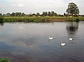 Swans on the Trent - geograph.org.uk - 2695816.jpg 3,450 × 2,548; 2.06 MB
-
 The Muskham Ferry - geograph.org.uk - 4847173.jpg 800 × 600; 101 KB
-
 The Muskham Ferry public house - geograph.org.uk - 5123842.jpg 800 × 671; 152 KB
-
 The Old Hall at Holme - geograph.org.uk - 4847164.jpg 800 × 600; 146 KB
-

-
 The River Trent at Holme - geograph.org.uk - 4847181.jpg 800 × 600; 102 KB
-
 The River Trent at Holme - geograph.org.uk - 5123853.jpg 800 × 600; 147 KB
-
 The River Trent at Winthorpe - geograph.org.uk - 4847161.jpg 800 × 600; 91 KB
-
 The River Trent near Holme - geograph.org.uk - 5123755.jpg 800 × 550; 73 KB
-
 The River Trent near North Muskham - geograph.org.uk - 5123759.jpg 800 × 725; 163 KB
-
 The River Trent near Winthorpe Lake - geograph.org.uk - 5123424.jpg 800 × 600; 117 KB
-
 The River Trent near Winthorpe Lake - geograph.org.uk - 5123543.jpg 800 × 600; 129 KB
-
 The swollen River Trent at Holme - geograph.org.uk - 6321220.jpg 1,024 × 768; 184 KB
-
 The Trent flood bank and Holme Lane - geograph.org.uk - 2009811.jpg 1,024 × 768; 176 KB
-
 The Trent north of Winthorpe - geograph.org.uk - 1117693.jpg 640 × 482; 70 KB
-
 Track next to Winthorpe Lake - geograph.org.uk - 5123532.jpg 800 × 600; 217 KB
-
 Track towards the railway near Holme - geograph.org.uk - 6321222.jpg 1,024 × 768; 224 KB
-
 Tree in the centre of Holme - geograph.org.uk - 4840603.jpg 1,024 × 740; 194 KB
-
 Tree on the Holme side - geograph.org.uk - 3161612.jpg 543 × 640; 275 KB
-
 Trees on the flood bank, Holme - geograph.org.uk - 1876420.jpg 1,200 × 1,600; 600 KB
-
 Trent Farm at North Muskham - geograph.org.uk - 4813257.jpg 3,072 × 1,728; 3.55 MB
-
 Trent Valley Way along the River Trent - geograph.org.uk - 5123382.jpg 800 × 496; 126 KB
-
 Trespassers beware - geograph.org.uk - 4847162.jpg 800 × 600; 134 KB
-
 View of Holme from the Trentside meadows - geograph.org.uk - 1876372.jpg 1,600 × 1,200; 471 KB
-
 View of North Muskham from Holme meadows - geograph.org.uk - 1876385.jpg 1,600 × 1,200; 485 KB
-
 View to Holme - geograph.org.uk - 1451682.jpg 640 × 426; 69 KB
-
 View to Holme - geograph.org.uk - 590661.jpg 640 × 427; 53 KB
-
 Where's my field gone^ - geograph.org.uk - 6321218.jpg 1,024 × 768; 199 KB
-
 Winthorpe cricket field - geograph.org.uk - 2795935.jpg 3,648 × 2,736; 2.82 MB
-
 Winthorpe Crossing - geograph.org.uk - 1117676.jpg 640 × 508; 61 KB
-
 Winthorpe crossing - geograph.org.uk - 2660186.jpg 640 × 427; 85 KB
-
 Winthorpe Crossing - geograph.org.uk - 2944287.jpg 640 × 480; 65 KB
-
 Winthorpe Crossing - geograph.org.uk - 4847155.jpg 800 × 366; 62 KB
-
 Winthorpe crossing lodge - geograph.org.uk - 3044495.jpg 640 × 427; 74 KB
-
 Winthorpe Crossing, near Newark, - geograph.org.uk - 4812777.jpg 3,072 × 1,728; 1.65 MB
-
 Winthorpe Lake concrete barge - geograph.org.uk - 4303004.jpg 1,024 × 768; 230 KB
-
 Winthorpe level crossing - geograph.org.uk - 4176906.jpg 1,024 × 683; 378 KB
-
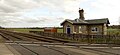
 Winthorpe level crossing - geograph.org.uk - 937254.jpg 640 × 427; 75 KB
-
 Winthorpe Level Crossing near Newark on Trent - geograph.org.uk - 4754313.jpg 1,024 × 768; 180 KB
-
 Winthorpe Rack - geograph.org.uk - 2929002.jpg 640 × 480; 85 KB
-
 Wintry scene by the Trent - geograph.org.uk - 2991327.jpg 3,648 × 2,736; 2.84 MB
-
 Wood near Langford - geograph.org.uk - 1876403.jpg 1,600 × 1,200; 499 KB
-
 Concrete barge - geograph.org.uk - 590736.jpg 640 × 427; 59 KB
-
 Concrete barge - geograph.org.uk - 590742.jpg 640 × 427; 79 KB
-
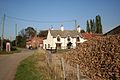
 Gothic Farmhouse and Holme village - geograph.org.uk - 152289.jpg 640 × 427; 97 KB
-
 Holme - geograph.org.uk - 236526.jpg 640 × 427; 72 KB
-
 Holme - geograph.org.uk - 590621.jpg 640 × 427; 74 KB
-
 Holme - geograph.org.uk - 590768.jpg 640 × 427; 57 KB
-
 Holme Lane - geograph.org.uk - 590592.jpg 640 × 427; 65 KB
-

-
 Langford Lane junction - geograph.org.uk - 590595.jpg 640 × 427; 67 KB
-
 Old Hall Farm, Holme - geograph.org.uk - 152281.jpg 640 × 427; 128 KB
-
 Trent Valley Way near Holme - geograph.org.uk - 152264.jpg 640 × 427; 84 KB
-
 Winthorpe Lake - geograph.org.uk - 152235.jpg 640 × 427; 108 KB


.jpg)


.jpg)


