Category:Hollyfort
Jump to navigation
Jump to search
 | |||||
| Upload media | |||||
| Instance of | |||||
|---|---|---|---|---|---|
| Location |
| ||||
 | |||||
English: Hollyfort (Ráth an Chuilinn in Irish) is a village in the valley of the River Bann in north County Wexford, Ireland, 5 km northwest of Gorey.
Media in category "Hollyfort"
The following 16 files are in this category, out of 16 total.
-
 IMG Hollyfort1639.jpg 3,888 × 2,039; 2.35 MB
-
 IMG HollyfortLane1640.jpg 3,888 × 2,592; 3.87 MB
-
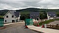 IMG HollyfortNewHousing1641.jpg 2,591 × 1,441; 1.12 MB
-
 IMG HollyfortSchool1638.jpg 2,592 × 3,888; 4.13 MB
-
 St. John's, Hollyfort - geograph.org.uk - 731022.jpg 640 × 480; 120 KB
-
 The River Bann - geograph.org.uk - 704205.jpg 640 × 480; 111 KB
-
 Animal pens at Ballintlea - geograph.org.uk - 704549.jpg 640 × 480; 81 KB
-
 Cottage at the fork - geograph.org.uk - 704548.jpg 640 × 412; 65 KB
-
 Countryside north-west of Gorey - geograph.org.uk - 704545.jpg 640 × 480; 71 KB
-
 Farm at Bolacreen - geograph.org.uk - 704546.jpg 640 × 480; 107 KB
-
 Farm land north-west of Kilmichael - geograph.org.uk - 704177.jpg 640 × 480; 90 KB
-
 Land ear-marked for building - geograph.org.uk - 704544.jpg 640 × 480; 95 KB
-
 Slievebaun Hill - geograph.org.uk - 705907.jpg 640 × 323; 53 KB
-
 View across the Bann valley - geograph.org.uk - 704189.jpg 640 × 480; 76 KB
-
 View north-west from Laraheenhill - geograph.org.uk - 704557.jpg 640 × 480; 82 KB
-
 Woodland on Laraheenhill - geograph.org.uk - 704556.jpg 640 × 480; 125 KB


