Category:Hollybush, East Ayrshire
Jump to navigation
Jump to search

A hamlet in East Ayrshire, Scotland
Subcategories
This category has the following 3 subcategories, out of 3 total.
Media in category "Hollybush, East Ayrshire"
The following 44 files are in this category, out of 44 total.
-
 A713-B742 Junction - geograph.org.uk - 184983.jpg 640 × 480; 57 KB
-
 Ayrshire Farmland View - geograph.org.uk - 3339362.jpg 640 × 480; 101 KB
-
 Benston Crescent - geograph.org.uk - 3337130.jpg 640 × 425; 93 KB
-
 Benston Crescent, Hollybush - geograph.org.uk - 3693355.jpg 1,920 × 1,280; 1.5 MB
-
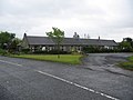 Boghall Cottages - geograph.org.uk - 184982.jpg 640 × 480; 68 KB
-
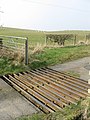 Cattle Grid - geograph.org.uk - 382035.jpg 480 × 640; 108 KB
-
 Craigs Road - geograph.org.uk - 182604.jpg 640 × 480; 67 KB
-
 Farm Road to High Woodston - geograph.org.uk - 382029.jpg 640 × 480; 67 KB
-
 Farmland View - geograph.org.uk - 3337148.jpg 640 × 454; 100 KB
-
 Farmland View - geograph.org.uk - 3337156.jpg 640 × 417; 68 KB
-
 Farmland View - geograph.org.uk - 3337164.jpg 640 × 425; 89 KB
-
 Farmland View - geograph.org.uk - 615279.jpg 640 × 480; 89 KB
-
 Farmland View at Martnaham Mains - geograph.org.uk - 3339411.jpg 640 × 480; 90 KB
-
 Farmland View at Martnaham Mains - geograph.org.uk - 3339423.jpg 640 × 480; 76 KB
-
 Glorious Mud - geograph.org.uk - 615295.jpg 450 × 600; 63 KB
-
 Going to Dalmellington - geograph.org.uk - 3337137.jpg 640 × 439; 104 KB
-
 Hollybush Estate Road - geograph.org.uk - 5338530.jpg 2,592 × 1,728; 2.46 MB
-
 Hollybush House - geograph.org.uk - 3339643.jpg 640 × 455; 122 KB
-
 Hollybush Junction - geograph.org.uk - 3693381.jpg 1,920 × 1,280; 1.98 MB
-
 Hollybush, East Ayrshire geograph-3400424-by-Ben-Brooksbank.jpg 2,395 × 1,453; 3.4 MB
-
 Laurieston - geograph.org.uk - 182607.jpg 640 × 480; 74 KB
-
 Purclewan View - geograph.org.uk - 3339353.jpg 640 × 448; 87 KB
-
 Railway bridge at Hollybush - geograph.org.uk - 184986.jpg 640 × 480; 64 KB
-
 Road into Hollybush Estate - geograph.org.uk - 3693365.jpg 1,920 × 1,280; 1.49 MB
-
 Road to Ayr at Hollybush - geograph.org.uk - 3693374.jpg 1,920 × 1,280; 1.66 MB
-
 Road to Dalmellington - geograph.org.uk - 5338534.jpg 2,592 × 1,728; 3.16 MB
-
 Road to Dalmellington at Hollybush - geograph.org.uk - 3693369.jpg 1,920 × 1,280; 1.91 MB
-
 Road to Dalrymple at Hollybush - geograph.org.uk - 3693377.jpg 1,920 × 1,280; 1.55 MB
-
 Road to the A713 at Hollybush - geograph.org.uk - 3693359.jpg 1,920 × 1,280; 1.59 MB
-
 Shankston Farm - geograph.org.uk - 548640.jpg 640 × 480; 65 KB
-
 Shankston Loch - geograph.org.uk - 528985.jpg 640 × 480; 69 KB
-
 Shelterbelt Edge - geograph.org.uk - 3339601.jpg 640 × 435; 119 KB
-
 Sinking Bridges - geograph.org.uk - 615275.jpg 450 × 600; 69 KB
-
 Skeldon Mill - geograph.org.uk - 1830826.jpg 1,600 × 1,200; 893 KB
-
 Skeldon Mill 1975 - geograph.org.uk - 3219689.jpg 899 × 599; 138 KB
-
 Stagecoach Bus, Hollybush - geograph.org.uk - 5338527.jpg 2,592 × 1,728; 2.34 MB
-
 Start of the Skeldon Mill Lade - geograph.org.uk - 3337671.jpg 640 × 448; 157 KB
-
 The A713 - geograph.org.uk - 615284.jpg 640 × 480; 68 KB
-
 The A713 at Hollybush - geograph.org.uk - 184985.jpg 640 × 480; 68 KB
-
 The Road to Ayr - geograph.org.uk - 5338539.jpg 2,592 × 1,728; 1.92 MB
-
 The Road To Boghall Cottages - geograph.org.uk - 615264.jpg 640 × 480; 73 KB
-
 The Weir at Skeldon Mills - geograph.org.uk - 3337664.jpg 640 × 480; 149 KB
-
 Towards Purclewan Mill - geograph.org.uk - 3339346.jpg 640 × 454; 153 KB
-
 Wind-Blown Trees - geograph.org.uk - 821971.jpg 640 × 419; 89 KB


