Category:Holdenby
Jump to navigation
Jump to search
English: Holdenby is a village in the West Northamptonshire district of the county of Northamptonshire in England. Holdenby House, with its associations with Sir Christopher Hatton, King James I, his son King Charles I and the Marlborough family, is its principal building.
village and civil parish in Northamptonshire, United Kingdom  | |||||
| Upload media | |||||
| Instance of | |||||
|---|---|---|---|---|---|
| Location | West Northamptonshire, Northamptonshire, East Midlands, England | ||||
| Population |
| ||||
| Area |
| ||||
 | |||||
Subcategories
This category has the following 3 subcategories, out of 3 total.
A
- All Saints' Church, Holdenby (6 F)
H
- Holdenby Education Centre (3 F)
- Holdenby House (28 F)
Media in category "Holdenby"
The following 43 files are in this category, out of 43 total.
-
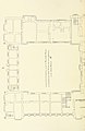 42 of 'Memorials of Holdenby' (11084632226).jpg 1,470 × 2,256; 468 KB
-
 43 of 'Memorials of Holdenby' (11086919204).jpg 1,364 × 2,280; 546 KB
-
 Althorp Cottages - geograph.org.uk - 2539054.jpg 640 × 480; 77 KB
-
 Arches at Holdenby House - geograph.org.uk - 446877.jpg 640 × 477; 77 KB
-
 Between Holdenby and Althorp - geograph.org.uk - 530749.jpg 640 × 480; 105 KB
-
 Cottage in Holdenby, Northants - geograph.org.uk - 2433406.jpg 1,600 × 1,085; 796 KB
-
 Cottages on Northampton Road, Althorp - geograph.org.uk - 5404884.jpg 2,266 × 1,676; 1.14 MB
-
 Delf Spinney - geograph.org.uk - 2236420.jpg 640 × 332; 62 KB
-
 Falconry at Holdenby - geograph.org.uk - 530659.jpg 640 × 480; 107 KB
-
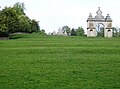
 Grass triangle at Holdenby - geograph.org.uk - 3570628.jpg 800 × 600; 121 KB
-
 Haddon Spinney - geograph.org.uk - 2571478.jpg 640 × 480; 88 KB
-
 Holdenby - geograph.org.uk - 249254.jpg 640 × 480; 142 KB
-
 Holdenby - geograph.org.uk - 249257.jpg 640 × 480; 133 KB
-
 Holdenby - geograph.org.uk - 251111.jpg 640 × 480; 142 KB
-
 Holdenby Bridleway - geograph.org.uk - 2560848.jpg 640 × 480; 55 KB
-
 Holdenby Bridleway - geograph.org.uk - 2563933.jpg 640 × 480; 91 KB
-
 Holdenby Farmland - geograph.org.uk - 2572445.jpg 640 × 480; 59 KB
-
 Holdenby Farmstead - geograph.org.uk - 2561875.jpg 640 × 480; 119 KB
-
 Holdenby Footpath - geograph.org.uk - 2567345.jpg 640 × 480; 83 KB
-
 Holdenby Mill - geograph.org.uk - 232180.jpg 640 × 480; 93 KB
-
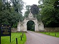
 Holdenby South Lodge - geograph.org.uk - 3570633.jpg 800 × 600; 123 KB
-
 Holdenby-All Saints Church - geograph.org.uk - 2561849.jpg 640 × 480; 75 KB
-
 Holdenby-All Saints Church - geograph.org.uk - 2561864.jpg 640 × 480; 124 KB
-
 Holdenby-Coneybury Hill - geograph.org.uk - 2572469.jpg 640 × 480; 93 KB
-
 Holdenby-Farmland - geograph.org.uk - 2572488.jpg 640 × 480; 86 KB
-
 Holdenby-Macmillan Way (geograph 2571453).jpg 640 × 480; 99 KB
-
 Holdenby-Macmillan Way - geograph.org.uk - 2572457.jpg 640 × 480; 83 KB
-
 Inquisitive lambs - geograph.org.uk - 446882.jpg 640 × 477; 92 KB
-
 Teeton Farmland - geograph.org.uk - 2563959.jpg 640 × 480; 74 KB
-
 Teeton-Macmillan Way - geograph.org.uk - 2572434.jpg 640 × 480; 87 KB
-
 The Green, Holdenby - geograph.org.uk - 446867.jpg 640 × 477; 142 KB
-
 View west to All Saints church, Holdenby - geograph.org.uk - 530662.jpg 640 × 480; 116 KB
-
 Warehouse and Storage - geograph.org.uk - 2539071.jpg 640 × 480; 60 KB
-
 Copse and open fields - geograph.org.uk - 530669.jpg 640 × 480; 107 KB
-
 Ditch at Holdenby - geograph.org.uk - 446863.jpg 640 × 477; 107 KB
-
 Estate houses, Holdenby - geograph.org.uk - 530653.jpg 640 × 480; 102 KB
-
 Hill near Holdenby - geograph.org.uk - 446891.jpg 640 × 477; 95 KB
-
 Holdenby Mill - geograph.org.uk - 232176.jpg 640 × 482; 103 KB
-
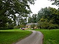
 Holdenby North Lodge - geograph.org.uk - 446860.jpg 640 × 477; 86 KB
-
 Horseriders near Holdenby - geograph.org.uk - 446886.jpg 640 × 477; 70 KB
-
 Paddocks at Holdenby - geograph.org.uk - 446875.jpg 640 × 477; 92 KB
-
 Part of Grange Farm, Holdenby - geograph.org.uk - 446873.jpg 640 × 477; 117 KB
-
 Stile at Holdenby North Lodge - geograph.org.uk - 446858.jpg 640 × 477; 81 KB
.jpg)
.jpg)


.jpg)


