Category:Hohkeppel
Jump to navigation
Jump to search
human settlement in Germany _(01).jpg)  | |||||
| Upload media | |||||
| Instance of |
| ||||
|---|---|---|---|---|---|
| Location | Lindlar, Oberbergischer Kreis, Cologne Government Region, North Rhine-Westphalia, Germany | ||||
| Area |
| ||||
| Elevation above sea level |
| ||||
 | |||||
Subcategories
This category has the following 2 subcategories, out of 2 total.
H
- Haus Weißen Pferdchen (10 F)
L
Media in category "Hohkeppel"
The following 40 files are in this category, out of 40 total.
-
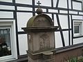
 AlterFriedhofHohkeppel.JPG 2,448 × 3,264; 1.77 MB
-
 Erntewagen in Hohkeppel-Leienhoeher Fruechtchen Foto Ivo Franz.jpg 1,476 × 1,108; 487 KB
-
 Friedhof Hohkeppel Frauenfigur 2.jpg 2,448 × 3,264; 4.76 MB
-
 Friedhof Hohkeppel Frauenfigur.jpg 2,448 × 3,264; 1.75 MB
-
 FriedhofHohkeppel (02).JPG 2,448 × 3,264; 1.74 MB
-
 FriedhofHohkeppel (05).JPG 2,448 × 3,264; 1.77 MB
-
 FriedhofHohkeppel.JPG 2,448 × 3,264; 1.62 MB
-
 Heidenstraße - Info-Tafel in Hohkeppel (Lindlar).jpg 3,160 × 2,288; 5.69 MB
-

-
 Hohkeppel Feuerwehr.jpg 3,448 × 3,000; 1.96 MB
-
 Hohkeppel Weihnachtsfenster.jpg 3,840 × 2,160; 2.7 MB
-
 Hohkeppel, Burghof 2.jpg 3,414 × 2,936; 2.92 MB
-
 Hohkeppel, Bushaltestelle Hengasch (1).jpg 4,032 × 3,024; 5.21 MB
-
 Hohkeppel, Bushaltestelle Hengasch (2).jpg 3,024 × 4,032; 4.16 MB
-
 Hohkeppel, Bushaltestelle Hengasch (3).jpg 3,024 × 4,032; 2.58 MB
-
 Hohkeppel, Wegekreuz.jpg 3,024 × 4,032; 4.53 MB
-
 Im weißen Pferd - Hohkeppel (Lindlar) (2).jpg 2,356 × 3,212; 3.85 MB
-
 Im weißen Pferd - Hohkeppel (Lindlar).jpg 2,448 × 2,601; 4.03 MB
-
 Jacobsweg, Hohkeppel.jpg 3,024 × 4,032; 6.79 MB
-
 Jaehrlich wird das Erntepaar gekuert Erntezug in Hohkeppel Foto Ivo Franz.jpg 2,688 × 1,520; 2.34 MB
-
 Knotenpunkt 85 im ueber 1000-jaehrigen Hohkeppel Bergisches Land Foto Ivo Franz.jpg 2,688 × 1,520; 2.05 MB
-
 Lindlar 2011 002.jpg 1,536 × 2,048; 1.19 MB
-
 Lindlar 2011 003.jpg 2,048 × 1,536; 1.11 MB
-
 Lindlar 2011 004.jpg 2,048 × 1,536; 1.07 MB
-
 Lindlar 2011 005.jpg 2,048 × 1,536; 1.13 MB
-
 Lindlar 2011 006.jpg 1,536 × 2,048; 1.2 MB
-
 Lindlar 2011 007.jpg 1,536 × 2,048; 1.04 MB
-
 Lindlar 2011 009.jpg 2,048 × 1,536; 1.23 MB
-
 Lindlar 2011 010.jpg 2,048 × 1,536; 1.08 MB
-
 Lindlar 2011 011.jpg 2,048 × 1,536; 1.22 MB
-
 Lindlar 2011 013.jpg 2,048 × 1,536; 1.1 MB
-
 Lindlar 2011 014.jpg 2,048 × 1,536; 1.05 MB
-
 Lindlar 2011 015.jpg 2,048 × 1,536; 1.21 MB
-
 Lindlar 2011 016.jpg 2,048 × 1,536; 1.28 MB
-
 Lindlar 2011 017.jpg 2,048 × 1,536; 1.15 MB
-
 Lindlar 2011 018.jpg 1,536 × 2,048; 1.09 MB
-
 Lindlar 2011 019.jpg 1,536 × 2,048; 1.13 MB
-
 Lindlar 2011 020.jpg 2,048 × 1,536; 1.25 MB
-
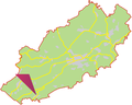 Pos hohkeppel.png 835 × 671; 73 KB
-
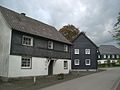
 Unterbergscheid im Jahr 2022 vorne Alteweyer-Hof, Mitte Eich-Hof, hinten Wohnhaeuser.jpg 2,823 × 2,117; 2.16 MB


.JPG)
.JPG)

.jpg)


.jpg)
.jpg)
.jpg)

_(2).jpg)
.jpg)


