Category:Hogewoerd 151, Leiden
Jump to navigation
Jump to search
| Object location | | View all coordinates using: OpenStreetMap |
|---|
 | |||||
| Upload media | |||||
| Instance of |
| ||||
|---|---|---|---|---|---|
| Location | Leiden, South Holland, Netherlands | ||||
| Heritage designation |
| ||||
 | |||||
|
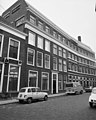
This is a category about rijksmonument number 24839
|
| Address |
|
Media in category "Hogewoerd 151, Leiden"
The following 5 files are in this category, out of 5 total.
-
 Fabrieksgebouw, overzicht hoektoren - Leiden - 20364408 - RCE.jpg 936 × 1,200; 217 KB
-
 Gevel - Leiden - 20136140 - RCE.jpg 1,200 × 802; 182 KB
-
 Leiden - Hogewoerd 151, 149, 147.JPG 3,056 × 4,592; 4.03 MB
-
 Voorgevel - Leiden - 20136136 - RCE.jpg 810 × 1,200; 228 KB
-
 Voorgevel - Leiden - 20136138 - RCE.jpg 960 × 1,200; 255 KB


