Category:Hofsingel 10, The Hague
Jump to navigation
Jump to search
| Object location | | View all coordinates using: OpenStreetMap |
|---|
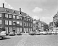
building in The Hague, Netherlands  | |||||
| Upload media | |||||
| Instance of | |||||
|---|---|---|---|---|---|
| Location | The Hague, South Holland, Netherlands | ||||
| Street address |
| ||||
| Located on street |
| ||||
| Heritage designation |
| ||||
 | |||||
|
This is a category about rijksmonument number 17531
|
| Address |
|
Media in category "Hofsingel 10, The Hague"
The following 6 files are in this category, out of 6 total.
-
 RM17529 Den Haag - Hofsingel 6-10.jpg 3,264 × 2,448; 1.77 MB
-
 Rm17531.JPG 2,736 × 3,648; 2.13 MB
-
 Voorgevel - 's-Gravenhage - 20088581 - RCE.jpg 947 × 1,200; 223 KB
-
 Voorgevel - 's-Gravenhage - 20088584 - RCE.jpg 957 × 1,200; 213 KB
-
 Voorgevels - 's-Gravenhage - 20088582 - RCE.jpg 1,183 × 1,200; 320 KB
-
 Voorgevels overzicht - 's-Gravenhage - 20088577 - RCE.jpg 1,200 × 960; 225 KB


