Category:Hofanlage Neuer Weg 64 (Rhauderfehn)
Jump to navigation
Jump to search
| Object location | | View all coordinates using: OpenStreetMap |
|---|
Subcategories
This category has the following 2 subcategories, out of 2 total.
N
Media in category "Hofanlage Neuer Weg 64 (Rhauderfehn)"
The following 2 files are in this category, out of 2 total.
-
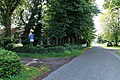 Rhauderfehn - Neuer Weg + Hofanlage 64 + Oll Wiek 01 ies.jpg 5,616 × 3,744; 29.35 MB
-
 Rhauderfehn - Neuer Weg + Hofanlage 64 01 ies.jpg 5,616 × 3,744; 22.98 MB

