Category:Hockley, Nottingham
Jump to navigation
Jump to search
neighbourhood in Nottingham, England, UK  | |||||
| Upload media | |||||
| Instance of | |||||
|---|---|---|---|---|---|
| Part of | |||||
| Location | City of Nottingham, Nottinghamshire, East Midlands, England | ||||
 | |||||
Media in category "Hockley, Nottingham"
The following 21 files are in this category, out of 21 total.
-
 20 Carrington Street, Nottingham - geograph.org.uk - 6485281.jpg 2,432 × 3,648; 3.64 MB
-
 22 Carrington Street, Nottingham - geograph.org.uk - 6485280.jpg 3,648 × 2,432; 3.22 MB
-
 6-12 Carrington Street, Nottingham - geograph.org.uk - 6485282.jpg 3,648 × 2,432; 3.35 MB
-
 A 90 degree turn in Nottingham Canal. - geograph.org.uk - 6296098.jpg 4,032 × 3,024; 4.76 MB
-
 Barley Twist, Nottingham - geograph.org.uk - 6290945.jpg 851 × 1,280; 425 KB
-
 Bridlesmith Gate - geograph.org.uk - 6343205.jpg 2,000 × 1,330; 1.97 MB
-
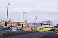 Broad Marsh Redevelopment - geograph.org.uk - 6291293.jpg 1,280 × 852; 268 KB
-

-
 Hockley - geograph.org.uk - 674452.jpg 640 × 480; 101 KB
-
 Hockley and Cranbrook Street - geograph.org.uk - 674455.jpg 640 × 427; 90 KB
-
 Hockley Nottingham - geograph.org.uk - 1066507.jpg 640 × 480; 121 KB
-
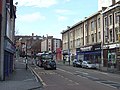
 Hockley Shops - geograph.org.uk - 1066514.jpg 640 × 480; 112 KB
-
 London train at Nottingham - geograph.org.uk - 6373927.jpg 1,024 × 768; 129 KB
-
 Looking down Low Pavement - geograph.org.uk - 6343202.jpg 2,000 × 1,330; 2.05 MB
-
 Nottingham Canal - geograph.org.uk - 6433013.jpg 2,000 × 1,500; 457 KB
-
 Nottingham Canal Museum - geograph.org.uk - 6373960.jpg 1,024 × 768; 265 KB
-
 Nottingham Central Mosque, Curzon Street - geograph.org.uk - 6376767.jpg 1,024 × 768; 159 KB
-
 Seventh Day Adventist church, Lamartine Street - geograph.org.uk - 6376765.jpg 1,024 × 768; 135 KB
-
 Station Street, Nottingham - geograph.org.uk - 6485277.jpg 3,648 × 2,432; 4.02 MB
-
 The Lacehouse, Nottingham - geograph.org.uk - 6456978.jpg 5,129 × 3,629; 3.47 MB
-
 The Old Angel as it used to be - geograph.org.uk - 6345153.jpg 819 × 1,024; 914 KB


